

-
 11417 Hits
-
 85.36% Score
-
 20 Votes
|
|
Route |
|---|---|
|
|
46.76430°N / 10.87995°E |
|
|
Mountaineering |
|
|
Spring, Summer, Fall, Winter |
|
|
Half a day |
|
|
F - easy glacier climb |
|
|
Overview
Similaun West Ridge (Normal route)
What's New on this Page?
* May 28, 2021 - Adopted the page from rgg
* May 29, 2021 - Overhaul of the page
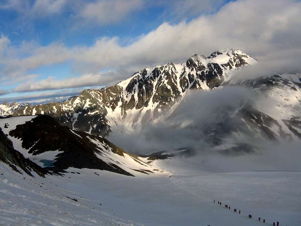
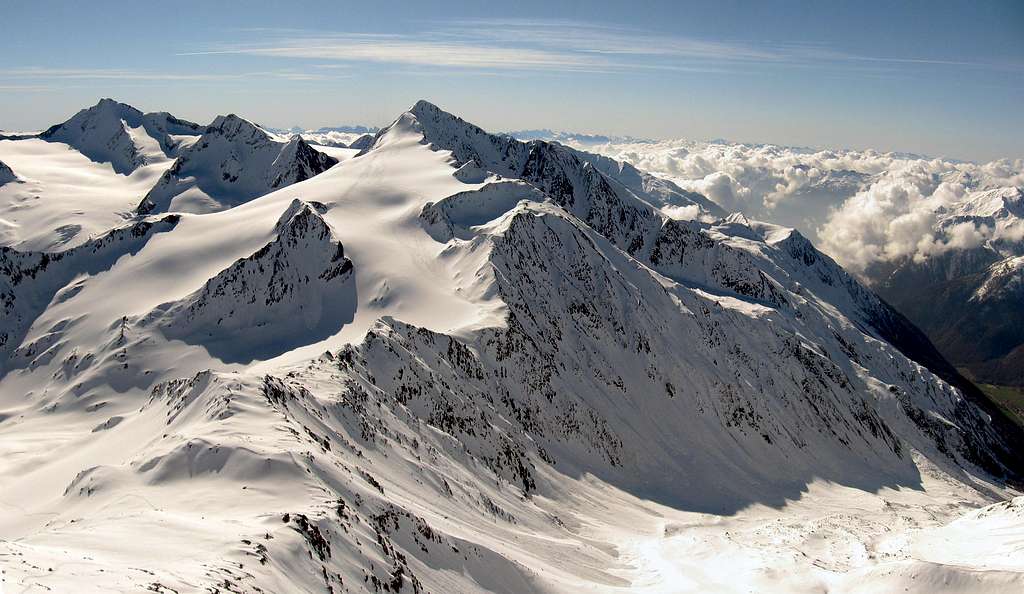
Similaun 3607 m is a mountain in the Alpi Venoste (Ötztal Alps, according to the Tyrolean idiom), located along the border line between the province of Bolzano Alto-Adige (Italy) and Tyrol (Austria), more precisely between the Val Senales and the municipality of Sölden.
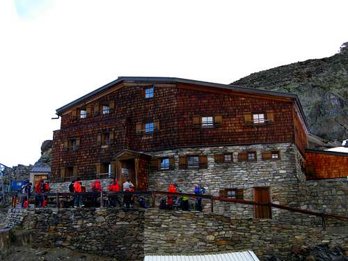
Similaun is the dominating mountain in this area and therefore it is a very popular destination, attracting many alpinists. The West ridge is the standard route to climb Similaun starting from the italian side. It's a rather easy glacier crossing with a nice little firn ridge at the end, perfect to introduce people with little experience to the thrills of glacier travel. It lies right at the edge of the big glaciers in the Southern side of the Ötztal group, and on a nice day the views are fantastic. The Rifugio Similaun 3019 m at Giogo Basso pass is an ideal basis. From there climbing Similaun is a rather short trip.
Similaun has become a very famous mountain even among non-mountaineers as the ice-mummy "Ötzi" has been found in its vicinity. Though the exact location where it was found is West of the Niederjoch, half way to Punta di Finale - Fineilspitze, it has been named "man of the Similaun", because Similaun just is the more popular name. Visiting the cairn that has been built at this location, has made the area even more popular.
Approach
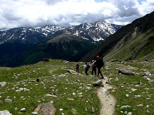
The route starts at the Similaun Hütte at the Niederjoch (3019m). This historically important high mountain pass can be reached from the north from the Austrian village of Vent (1900m), or from the south from the Vernagt Stausee (1690m), an artificial lake at the end of the Val Senales. The shortest approach is from Vernago. The approach from Vent is longer but a bit gentler.
It will be described the road approach and the ascent to the refuge from the South side (Italy).
Approach from the South side
From Merano take the Val Venosta and proceed towards Naturno, then entering the Val Senales up to Vernago. From Vernago near the homonymous lake take the path signposted "Rifugio Similaun", continuing north for about 20 minutes and climbing towards the Tisenhof farm 1822 m. Then proceed along the path n. 2 in the solitary Valle di Tisa, where it begins a long climb, first through a larch forest, then along grassy and rocky terrain, and then finally up a scree at the foot of an impervious rocky flank. From here, along an easy zig-zag path you head straight towards the Similaun Refuge at Giogo Basso, 4 hours from Vernago.
Route Description
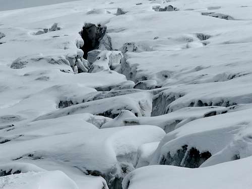
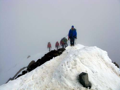
Snow makes it dangerous, as these partly hidden crevasses on the Niederjochferner show
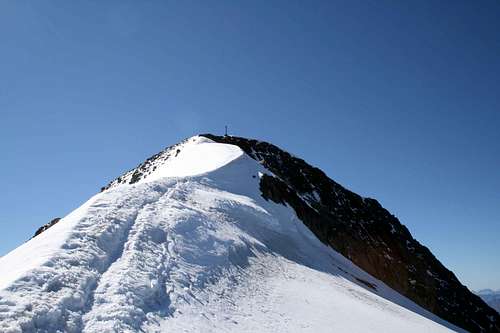
Last few meters to the summit
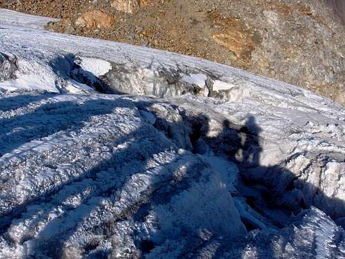
Without snow it's different, as the danger is easy to see now
- Similaun West ridge
Difficulty: Alpine F
Difference in level: 600 m. from Rifugio Similaun
Exposure: West
A fine route - entirely glacial - without particular technical difficulty, but pay attention to the crevasses
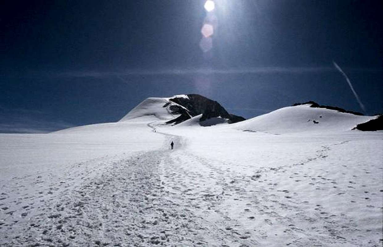
From the Similaun Hütte first head south to south east, towards a gentle ridge. Very soon the route turns towards the east and leaves the ridge. From here the route continues eastwards on the gentle slopes of the Niederferner glacier. A rocky outcrop lies south of the route, at around 3200m (46.7685°N / 10.8653°E). When just north of the outcrop, turn south, passing it close by on the eastern side. The Niederjochferner has some crevasses, especially in this area.
A variation on the normal route stays on the rocky ridge for much longer, and only goes on the glacier directly east of this outcrop - but I have no personal knowledge of this.
Either way, at this point you can see a rocky subsidiary, a few hundred meters to the southeast. That's the Kleiner Similaun (3363m)(46.7659°N / 10.8685°E). Head towards it, and pass it on the northern side. Continue to the southeast, and soon you are close to the crest of the Similaun west ridge. The route stays just north of the crest - the south face is rocky and steep. Only the final section of the route is a bit exposed.
From the refuge to the summit takes about 2 hours, the descent about 1,15 hour.
Essential Gear
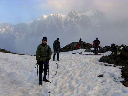
Basic glacier equipment: crampons, axe, rope.
Red Tape
No fees no permits required
Hut
The Similaun Refuge is located at 3019 m above sea level. It was built in 1898 by Serafin Gurschler.
The Similaun Refuge has 30 beds in shared rooms and 65 beds in dormitories.
Ownership and managment: Mountain guide Pirpamer Markus
"Ötzi", the Iceman

Similaun caught the attention of the media in the year 1991, on September 19th, because of a very singular event. Similaun in fact is located near the place, named Giogo di Tisa 3210 m, half way to Punta di Finale - Fineilspitze, where it was found the mummy of "Ötzi", the Iceman. The mummy is kept at the Archaeological Museum of Bolzano with a dedicated exhibition. A stone monument was erected in the place of the discovery and visiting the cairn has made the area even more popular.
The Giogo di Tisa can be reached in about 1 hour and a half on a marked path, equipped in some points with steel safety ropes, easy for trained hikers.
Map
DAV Alpenvereinskarte 30/1, Ötztaler Alpen, Gurgl. Scale 1:25 000.