
|
|
Route |
|---|---|
|
|
46.47735°N / 13.45382°E |
|
|
Hiking, Mountaineering, Scrambling |
|
|
Summer, Fall |
|
|
Most of a day |
|
|
Easy marked route. Some scrambling below the summit. |
|
|
Getting There
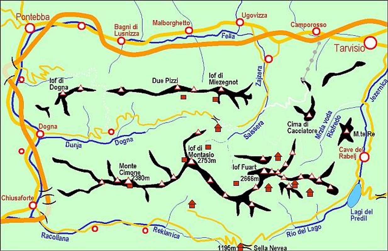
The overview map of the area.
The starting point is the pass Sella di Sompdogna (Sedlo Rudni vrh) (1389m) which is approachable from over the road from the valley Dogna (Dunja). We can also reach the pass from the end of the road in the valley Val Saisera (Zajzera).
Route Description
 On the south slopes below the summit.
From the pass Sella di Somdogna you continue first over the macadam road and then soon you come on the marked route with a number 609. You walk in the nice forest all the way over the good marked path. You cross some small brook and come on the other side of the small valley in forest. Now you ascent through the steep slope in forest in many switchbacks.
Soon the route comes out of the forest and you walk now over the grassy slopes. You see an old military road that goes in the direction to Monte Piper / Piparji. You cross some slopes just below the small ridges and you come to the bivouac Alpini Gemona, 1890m. A bit higher is a crossing where the left route goes to Monte Piper (route number 649). You turn on right marked route (number 609) and you reach the upper rocky slope. In some easy climbing you reach a summit. The view on whole Vis and Montaz group is really nice.
You descend by the same route.