
-
 2724 Hits
-
 0% Score
-
 1 Votes
|
|
Route |
|---|---|
|
|
39.91750°N / 105.6823°W |
|
|
Hiking, Skiing |
|
|
Spring, Summer, Fall, Winter |
|
|
Half a day |
|
|
I |
|
|
Approach
Park at Forest Lakes Trailhead (10990') on Rollins Pass Road. The road usually opens sometime in May. Depending on snow closures, you may not be able to make it to Forest Lakes Trailhead. If this is the case park at 10457' where the road crosses right over a creek.To get to Rollins Pass Road, take 119 south out of Nederland 5 miles from the traffic circle. Take a right onto a dirt road. Take a right onto Rollins Pass Road 7.6 miles from the start of the road.
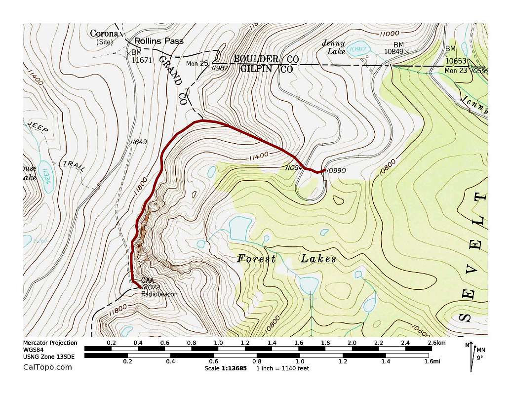
Radiobeacon's North Ridge Route. 1.2 miles with 1,240 feet of elevation gain. Click to enlarge.