
|
|
Route |
|---|---|
|
|
47.61687°N / 121.27163°W |
|
|
Hiking, Mountaineering, Scrambling |
|
|
Spring, Summer, Fall |
|
|
Most of a day |
|
|
Class 3 |
|
|
Overview
The north ridge route for Bald Eagle Peak, in the Alpine Lakes Wildernes, is the most common approach for the mountain. Although the route seems straightforward (i.e. "follow the ridgeline"), the reality is that the upper half of the route ( above 4400') involves a substantial amount of bushwhacking, steep forest-duff slopes (where a slip could have disasterous consequences), steep side-hilling, Class 2-3 scrambling, and necessary veggie belays.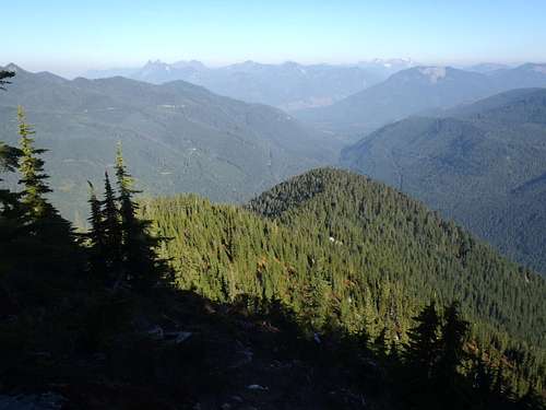 Lower Forested Section Of North Ridge
The route follows the north ridge southward towards the mountain, and then uses a series of gullies and ridge scrambles to reach the summit. From car-to-summit, the route has approximately 5000' elevation (including various ups and downs) in only 2.75 miles. Most summit parties take 7-11 hours roundtrip to complete the trek.
Due to the steep slopes traversed along the route, the optimum timeframe to attempt the peak via this route is during dry conditions between late Spring through early Autumn.
Getting There
STARTING AT SKYKOMISH, WA:
1) Drive east along Highway 2 from Skykomish turnoff.
2) After 1.8 miles, take a right turn onto Foss River Road.
NOTE: After 1.2 miles, Foss River Road becomes a gravel road, Forest Road 68.
3) After 4.7 miles from Highway 2, turn left onto Forest Road 6835.
4) After 0.5 miles, approximately 200' beyond a small concrete bridge, park off the side of the road. This is the across the road from the lower northern end of the north ridge.
Route Description
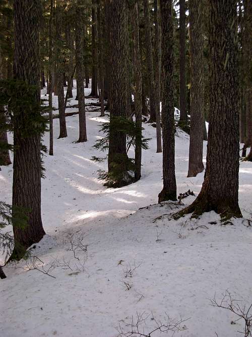
1) From the roadside parking area (1560' elevation), begin steeply ascending southward up the lower end of the north ridge. The lower half of the north ridge, until approximately 4500' elevation, is comprised of evergreen forests. The trees are thick near the road and then open-up further above 2700' elevation. Lower End Of North Ridge
 Lower Evergreen Forest On North Ridge
2) At approximately 4300' elevation, the north ridge slope becomes more gradual and nearly horizontal for a short time.
 At Approximately 4300' Elevation...
3) At approximately 4450' elevation, the steep slopes of the ridgeline return. From this point on until 5200' elevation, the north ridgeline weaves across terrain that is steeply forested and rock ribs. Several of the major rock ribs must be circumnavigated on the west (right) side and then steeply ascended.
4) At approximately 4500' elevation, the ridgeline because more defined, almost knife-edge-like. This elevation marks the beginning of what is nicknamed by some peakbaggers as "700 vertical feet of bushwhacking." This section of the route has many small, thick fir trees intermixed with slide alder. The bushwhacking is not as bad as it might sound, and is not completely throughout that 700' of gain.
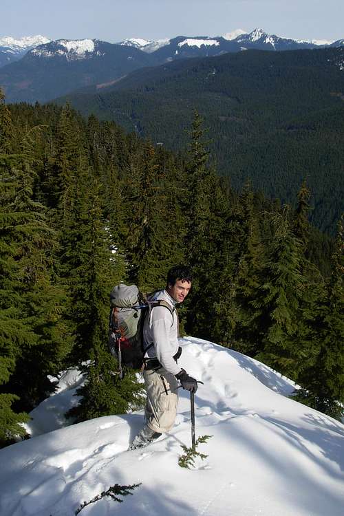
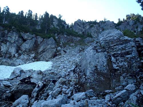
5) At approximately 5200' elevation, the ridgetop opens-up, giving way for rocks and small meadow shrubs in lieu of evergreen forests. Views of the summit ridge can be seen, although the true summit is still out of view. This open area of the ridgetop is a common location for mountain goats to rest.
 Ridgetop Opens-Up
6) At 5400', a steep rock cliff is encountered which prevents further hiking progress on the north ridge. Some people have opted to scramble (more like rock-climb) over it, but that is generally not advised. A workable steep hidden gully on its east side can allow safe passage to the top, but then there would still be a substantial amount of continued scrambling/rock climbing from that location. The standard route, which is recommended, skirts along the eastern base of the rock rib at approximately 5400', and eventually drops slightly in elevation. It is, at times, a little cumbersome and has some narrow steeply-slanted slopes, but manageable with caution.
 About To Leave North Ridge On East (Left) Side...
7) Once beyond corner on the east side of the rock rib, a brief meadow is encountered that leads to a boulder slope. Continue walking through those areas, between 5350'-5400' elevation, until beyond the boulder slope.
8) At the end of the boulder slope, a large hidden gully is now reached. One option is to continue to descend the hillside to the snow patch at the base of the gully and then ascend the gully from there. Another option is to steeply ascend along the right side of the gully for approximately 100' until finding an easy and safe way to enter the gully.
 Entering Large Hidden Gully...
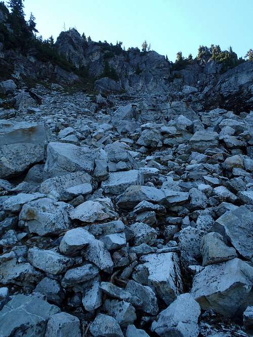 Ascending Large Gully...
9) Following the large gully is straightforward. It heads up boulder slopes, then angles upward left, and then at its top end (where another lower gully intersects on the leftside) a narrow hidden gully leads steeply up to the right. These gullies might be better with snow to kick-step (but that is only a guess, not verified). The bottom half of this upper gully is dirt and steep rock, and then it angles left where it becomes very steep meadow.
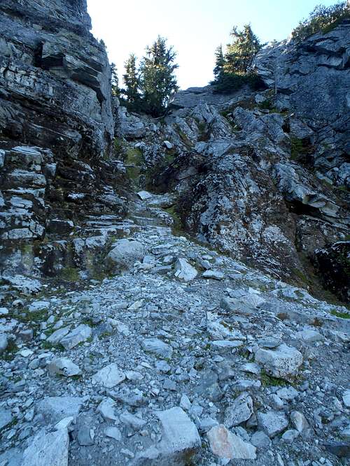 Entering Narrow Upper Gully...
 Ascending Upper Section Of Narrow Gully...
10) Once at the top of the upper gully, turn right and head up a steep forested hill. There is a large snow-filled gully slope on the left side which might be possible to drop down into and then ascended, but most people continue following the ridgeline. Once at the top of the hill, which has a lot of fir trees, summiters will *finally* get their first clear view of the summit. But stay away from the major cliff drop-off on the right!
 Summit Ridge
11) Follow the ridgetop around to the false summit, and then scramble around it on the right side. Drop down, and then steeply ascend up through fir trees to the true summit.
ADDITIONAL NOTES:
-> Bushwhacking is typically more difficult going uphill than downhill.
-> Following a forest ridge is typically easier going uphill than downhill. When descending the north ridge, multiple sub-ridges and sidehills are encountered which are probably not noticed during ascents. It could be very easy for somebody to get off-route during the descent. Use the GPS!
Essential Gear
Bring trekking poles, a GPS, and sturdy mountaineering boots. Helmet not required.Traction devices (such as microspikes or crampons) are strongly advised due to the steep forest-duff slopes and slanted meadow slopes. An inadvertent slip on one of the route's steep slopes could have potentially disasterous consequences.