Hazy Baird - August 25th, 2012
Pt. I
Pt. II
Pt. III
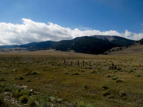
Once again, Idaho. For Saturday, anyway. Though not a P2K Mt. Baird is a county highpoint and, of even more importance to me, a range highpoint. It’s an odd duck too, the Snake River Range, which features two lower peaks with over 2000’ of Prominence (Baldy to the northwest and Observation Peak in Wyoming) separated from Baird by lower drainages, the actual highpoint of the range, due to a high saddle connecting it to the Tetons the peak barely has 1,700’ of prominence. Nevertheless, it was on both Greg and I’s lists, so we set off. I took the Wyoming route this time, driving up from Evanston through the circuitous highways taking you through the Wyoming outback up towards eventually the Tetons. After hours of driving through the open desert, the road then wound past a small mountain pass and I found myself in the beautiful, green and lush Swan Valley, a magical and instant from Great Basin to Northern Rockies environs.
It was an endless row of cool looking tourist towns up to Alpine and I noted the chilly morning air a week away from Labor Day weekend. Eventually I circled up Palisades Reservoir, where I had frequented only two weeks prior when hitting Big Elk Peak with Dean.
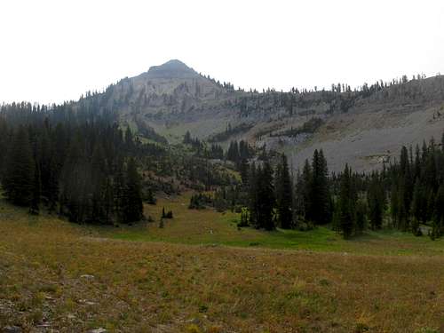
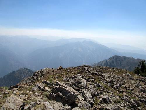
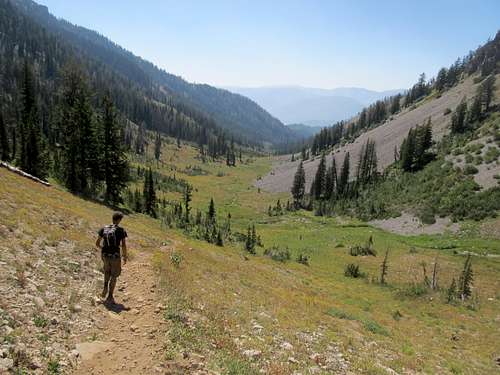
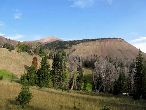
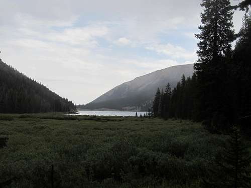
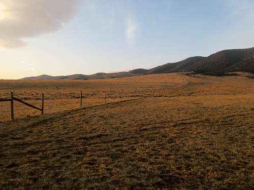
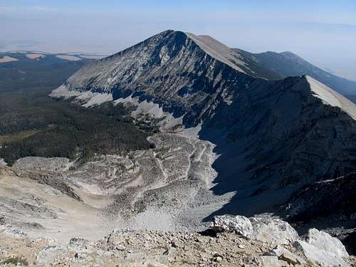
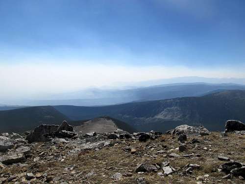
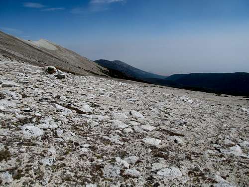
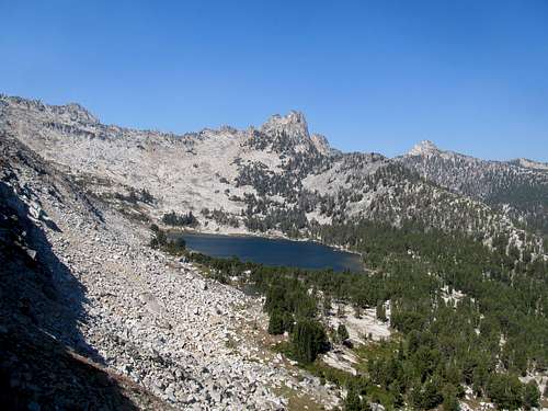
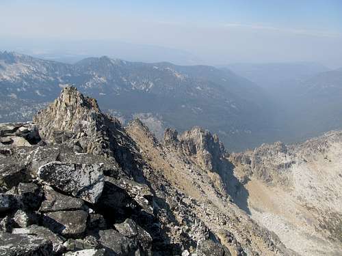
The problem once more with the day was the haze, which had been full on thick since the Swan Valley. It was under these hazy conditions when Greg and I started up the trail up Little Elk drainage, which gained elevation very gradually. The trail is also popular with horses, as we met and talked to a few riders along the way.
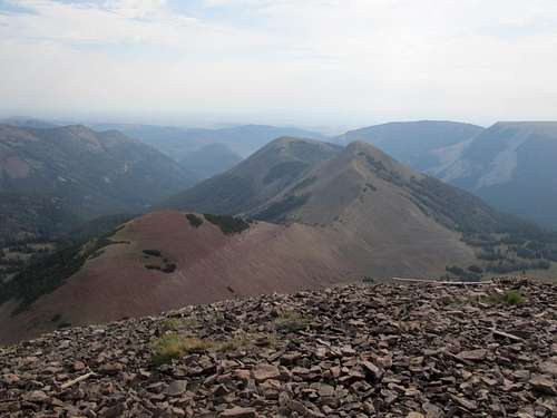
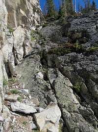
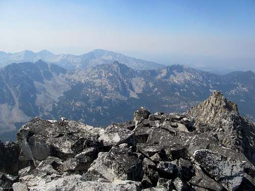
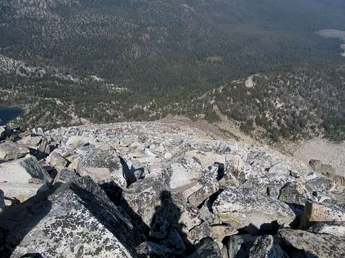
Eventually we reached the upper ramparts of the range, and cut to the right off the trail before hitting the highpoint of the Baird/Sheep Creek saddle. The traverse was easy, with some very minor scrambling and descent as we looped around the charming little basin sitting below the peak’s sharp northeast profile to hit the Baird’s Northeast Ridge. As promised, the area near the top saw the “class 2” dirt, or required a traverse through some scratchy shrubs to avoid it.
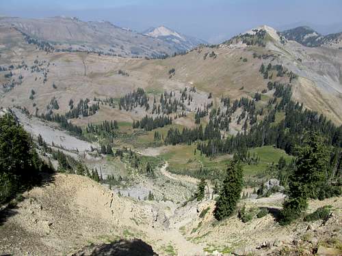
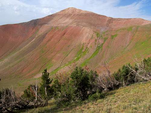
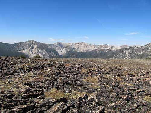
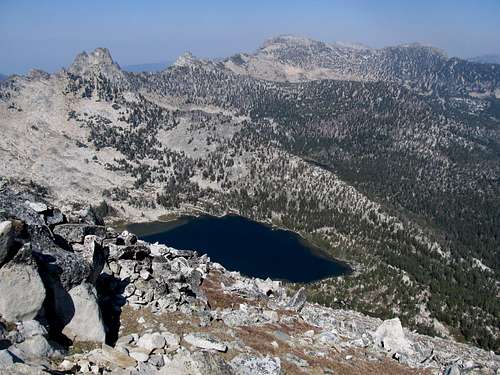
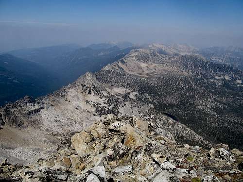
We were met at the summit by a family from nearby Rexford, a father and upwards or 4 or so kids. Apparently their favorite Saturday pastime is to roll large boulders off of steep faces, in this case, papa helping the kiddos roll the especially large table sized ones thousands of feet down to the drainage below. Both Greg and I gave disapproving looks of disbelief as we observed their reckless behavior. Neither one of us wanted to really make a scene though in front the young children, so we went to the highpoint as the morning haze gave way somewhat to some views of the surrounding mountains. Unfortunately the Tetons were still out of view, as were the northern peaks of the Salt River Ranges past Alpine, but we were both glad to have not been completely socked in.
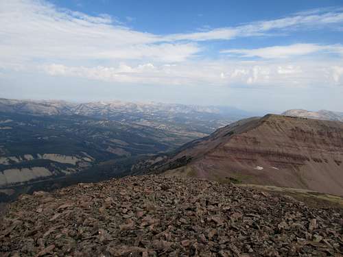
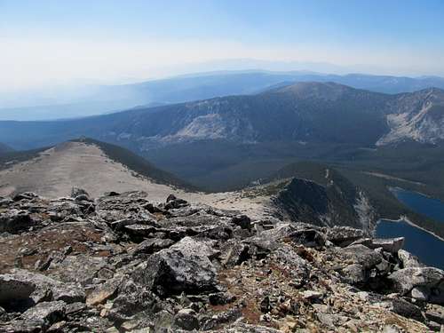
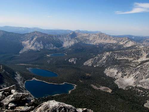
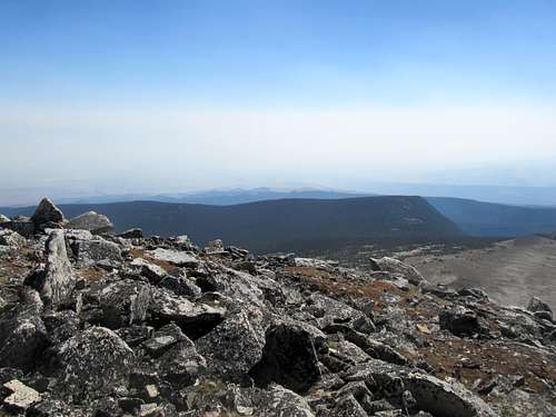
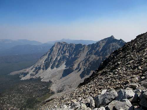
Eventually we started our descent, noting the new views of the surrounding ridges with the haze having cleared. The descent was uneventful, and we met up with Kadee at the reservoir where we all took a swim in the very chilly water.
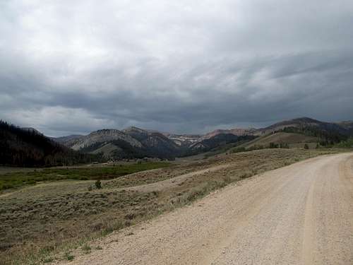
Greg and Kadee would continue on past Jackson Hole, where Greg found himself driven off Middle Teton by storms the next day. I had a more frantic agenda for Sunday though, and as a result a much longer drive around and across the Wyoming Ranges all the way to Big Piney. As I rounded Hoback Junction and got my first ever views of the Gros Ventre my thoughts filled with…pure rage, actually. The summer was too short, and I lamented all these great peaks that I would not be able to get to for at least another year. Speaking of which, there were the Wind Rivers in the distance and a fire raging near Roberts Mountain. At least I had gotten a taste of that range to start the summer.
Drafting Wyoming - August 26th, 2012
The reason I drove all the way to Big Piney Saturday night was because I was operating on a tight deadline Sunday. 3:15 MST was the start time for one of my fantasy football drafts, and I figured my best shot to get a banner peak and still draft live was to try and hit up Wyoming Peak in the early morn, then span the relatively short distance to Evanston in time to plug inonline at a motel lobby (I had called the Best Western on Friday to make sure I could mooch their wifi for a few). Big Piney itself was a…how do you say it…rustic town. But it wasn’t without its charms, and I spent a pleasant night in an interesting motel in the center of town, full on with cats in the lobby. Needing to get an early start, I didn’t have much time to enjoy the nightlife anyway.
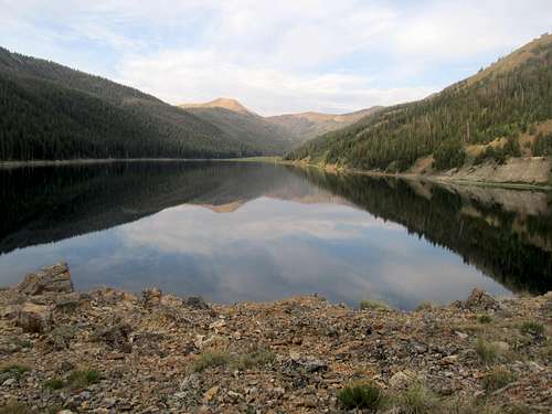
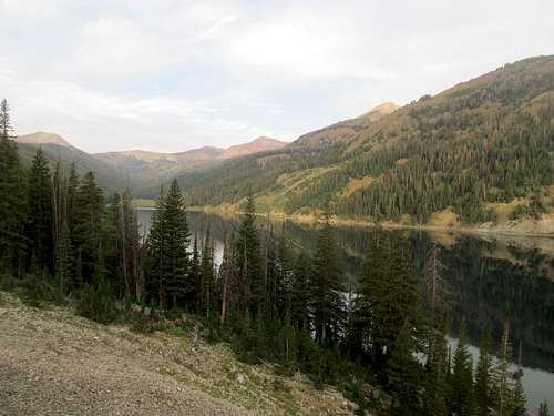
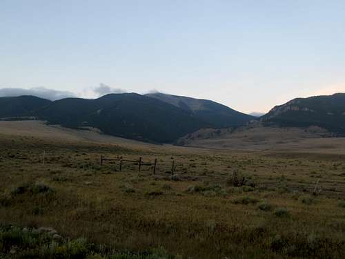
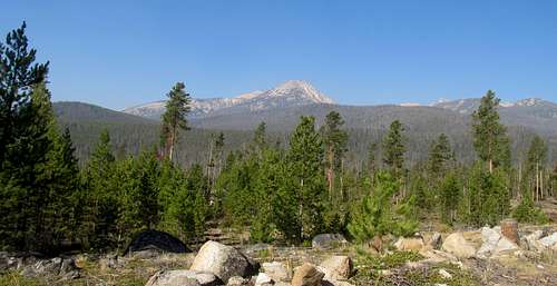
I pressed snooze a few times before getting up the next day and to my dismay found that the road to Middle Piney Lake took longer than I had anticipated (I had expected leave town, and arrive within a few minutes). The last bits of dirt road was a little rocky but I got my Camry to the lake without any problems. There had been a fire since late July in the area that had kept me away until now, and as I drove I observed rows and rows of recently burned trees standing like charred toothpicks where a lush forest had once been. There was a slight chance of t-storms but I knew I was good for the early morning.
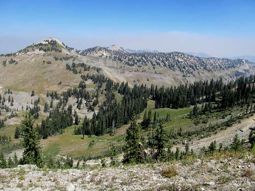
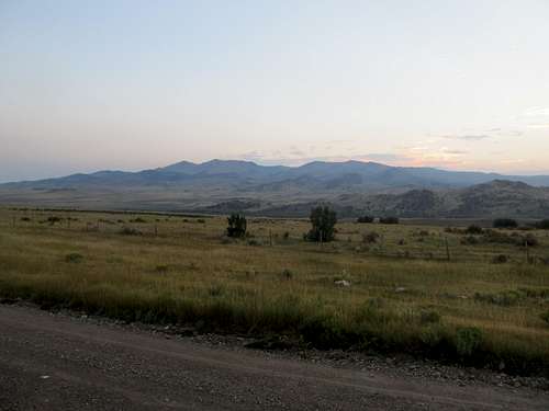
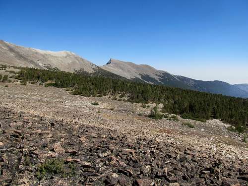
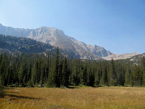
Hints of the high peaks beyond glinted at me as I rounded the trail lining the south side of the lake. It dragged a little with its minor ups and downs, and I suppose after all that it’s a little frustrating to find, after rounding the lake, that you’re still at the same elevation you started from. Nevertheless it was a nice cool morning, and I continued on through some marshy flatlands and up a slope as the trail finally began to gain elevation. It was here that the high peaks of the Wyoming Range finally revealed themselves to me.
Eventually the trail linked up with the north south running trail. I followed north a bit through the high meadows still lush, and it soon became apparent why as high up on the ridge south of Wyoming Peak I saw a thin band of snow still melting.
The immediate area around it was lush and green, even lined with small flowers seemingly, while further down the grass was already dry.
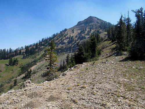
I intended to follow Dean’s beta to cut northwest from the main trail as a shortcut to the top, rather than taking the trail as it passed the east ridge of Wyoming and came up from the other end of the hill. I cut forth through a dry drainage to eventually arrive at the base of the southeast ridge. I sat in this tiny little basin, lovely, and mines and only mines for the moment, chewing a granola bar, contemplating the tranquility of the scene, the vast cosmos….and who I needed to draft in a few hours.
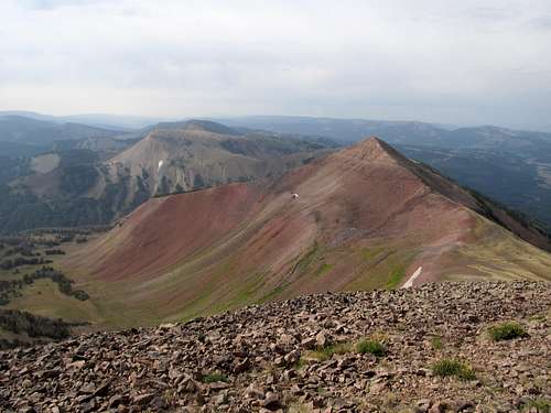
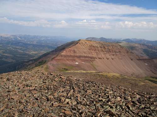
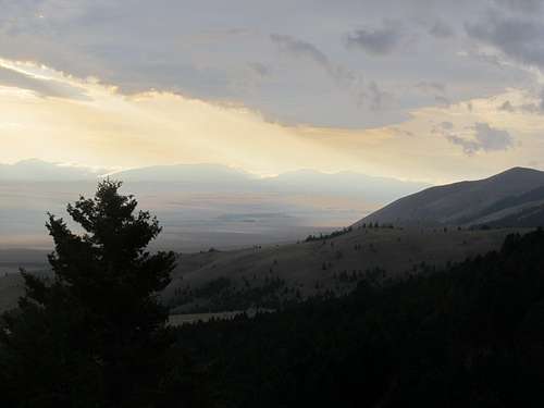
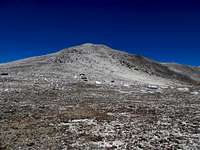
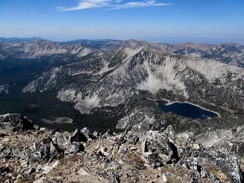
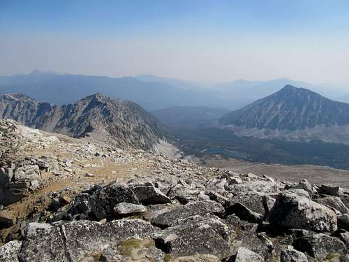
Then it was up. There was some brush, but soon I cleared the trees and ascended straightforward as the slopes became boulders. Higher and higher, and the rounded summit soon became apparent. I topped out and beheld a spectacular scene.
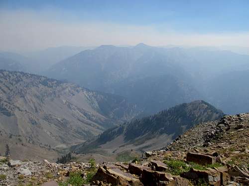
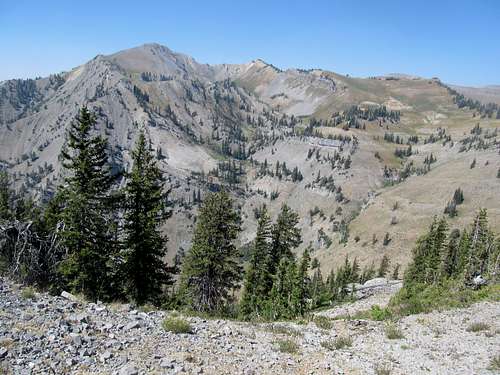
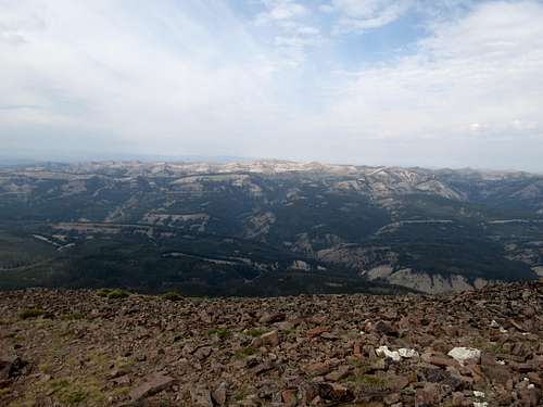
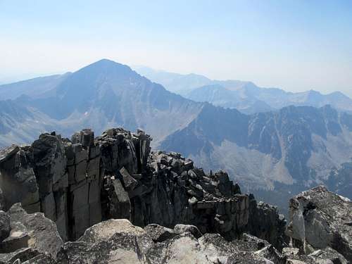
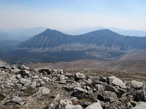
The haze had relented for the day, and my what views of the Greys River Valley, the Salt River Range, and north, the tilted oblong summits of the Wyoming Range crest. I stood, fascinated, amid the landscape Turiano’s book had painted in my head all those years ago, surrounded by peaks and ranges he had described that I had only dreamed of seeing. The scene before me was as real and as fleeting as the clock ticking down towards my fantasy football draft.
Well, it was chilly anyway. I lingered enough to have taken in the sights, and made my descent down. On the lower ramparts of the ridge before getting back into the drainage I ran into some brush.
The trail down was pleasant, though the skies turned dark momentarily as I grazed through the open meadows before Middle Piney Lake.
It rained on me a little, a light pleasant rain, then I was sheltered in the trees again as the trail lined the lake.
I made it back to my car a little less than four hours after leaving it, and rushed down the roads towards Evanston. It was a pleasant drive through a surprisingly lush desert scene as the highway wound next to the Green River on its way to Kemmerer. I arrived at the Best Western lobby well in time for the draft, and got myself a Jack & Diet in anticipation. I explained my situation to an understanding/indifferent clerk and huddled down below a stuffed grizzly bear, logging into my account…only to find that the draft had been postponed.
What. The. Hell.
I packed up, left, got an ice cream in town, and drove home wondering what I would do with the last summer weekend available to me.
Hightailing it up Blacktail - Sep. 1st, 2012
Labor Day weekend finally arrived with much in flux. The weather in Montana was iffy. Ideally we could head up to the Snowcrest Range and on a nice day get both Sunset and/or Hogsback, then head further north for Mt. Powell the next day. Greg, with a few more days off, would head for peaks further north while I’d try to get something on my way back on Monday. However, as Saturday approach the threat of rain and thunderstorms derailed our plans for the Snowcrest Range, especially considering the many miles of uncertain and untested dirt roads it would take for us to get to the “Notch” between the two peaks.
The backup plan was the Blacktail Mountains HP, an inconspicuous lower P2K southeast of Dillon. I had felt icky that week, with not a lot of sleep, and could barely get any on a rainy Friday night in Salt Lake, so I eventually gave up on it and coffee’d up for the long drive north to Dillon. The sun was just rising as I met up with them on a dirt road outside of town, and we surveyed the range in the dim morning light.
We drove ahead a bit to the starting point and set off cross country towards the northeastern slopes.
The route looked basic on paper (ie Google Earth), but after an extremely steep slope we ran into a line of cliffs. I spotted a gully and Greg went first with Oquirrh. It looked easy, so I was puzzled as to why it took them so long, Greg needing to lift his dog up and move him onto a higher ledge. I got there myself and contemplated the moves for quite awhile before backing away. I didn’t trust it enough. Though not really exposed, the holds were too wet, and the best hold spots were clogged with slick bushes. I was a little abashed at backing down but traversed further left (southeast) and eventually found a better opening through the cliffs that, while loose, got me through.
The weather had started to deteriorate ever since we started going uphill. Dark clouds moved in, we saw rain seemingly drench the valley further back towards Dillon, and felt swooshes of cold gusts that Greg thought were portents of precipitation ahead. We continued up a small ridge over the cirque to reach the flat, grassy summit plateau. Here, though it stayed dry, we were completely socked in by clouds and blasts of wind gusts up to probably 40-50 mph. Thank God for Greg’s GPS, as if it were just me I probably would have floundered around quite a bit without finding the true summit. We reached a spot closed to where he had marked the summit, and walked around it. It seemed to be the highpoint and, satisfied, we started our downward trek.
It started clearing up a little, as bits of blue sky appeared around us. Occasionally we could even see Southwest towards the valley that held I-15 in the stretch between Lima and Dillon. The odd geographic positioning of this ranged confused us both, and really screwed with my sense of direction. In one startling moment the clouds suddenly parted and a dark and ominous apparition appeared in the peripheries of our vision. Greg had noticed it too, and upon further examination, was merely nearby subpeak that had been hidden in the clouds until now.
I was starting to feel not just exhaustion from the drive and the lack of sleep, but sickness coming on too: cold-like symptoms that always began for me with a sore throat. Cold and battered by the wind, I felt like shit as we descended. Fortunately it got warmer after we left the summit plateau, and after finding a reasonable way through the cliffs and the steep descent afterwards, made our way back to the truck.
We returned through Dillon, which seemed like a charming little town. This was the prime rodeo weekend too, so the streets were crowded. I was tempted to stay, especially with cowgirls hitting on me (or the pizza I had in my hands) in the streets, but alas Mt. Powell was on the agenda for Sunday. I stocked up on coffee and checked into a motel on the outskirts of Butte and caught some of the college football action. The town apparently has a reputation for poverty, drunkenness, street fights, and polluted waters. And probably meth too, in addition to its unnaturally cold winters and inversion. I took a few minutes to drive through the town between, and despite its reputation Butte seemed to have its own kind of charm, especially the architecture. There’s potential perhaps, if it weren’t for the bitter winters there, for real estate investors to swoop in and yuppies to follow, to turn the town around into a new retro retreat, perhaps a new hipster haven, a western version of Williamburg in Brooklyn?
Wow'd by Powell - Sep. 2nd, 2012
I more than caught up on sleep and was running a little late meeting up with Greg at the Mt. Powell trailhead. In a hurry, I saw a large rock in the road and didn’t bother to remove it, and the bottom of my Camry suffered as a result. There were more than a few ways to get Powell; most of the beta we found saw a fairly unpleasant ascent from the Dempsey Lakes that involved a lot of mileage, scree, brush, and cliffs. Fortunately, Cedron Jones's Peakbagging Montana Guidebook offered up an alternative route that would cut down both on mileage and icky terrain.
We followed the 4WD road as it rounded the drainage south of Powell for 3.5 and located the turnoff fairly easily. The creek is big enough to notice, but Greg’s GPS certainly helps to add peace of mind in knowing the exact spot. We wandered north into the woods, and the brush wasn’t that bad. There were usually paths between brush. The goal was to stay midway between the gully bottom (deadfall) and ridge crest (cliffy) and find pleasant open terrain and game trails leading you up to a high plateau. We ended up traversing too high near the ridge crest and came upon some cliffs above some talus. I would’ve have contoured right around them myself and try to gain the midsection, but Greg was adamant about going straight up the rocks, so up he went and I followed. The scrambling wasn’t too bad, but some spots had brush blocking the ideal holds, and there was a little bit of minor exposure (at least for me) near the top of a chimney area.
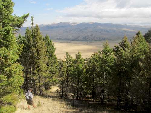
We ascended some steep dirt terrain past the cliffs, but eventually reached the high plateau after traversing beautiful open forest. It was in this section that Greg, a few steps ahead, glimpsed a large brown shape running down into woods. He didn’t get a good look at it, so I guess it could have been a bear, or moose, or anything. The high plateau tableland was a fascinating geographic feature, and Powell stuck out nonchalantly on the other end. Deer Lodge Mountain to the right cut a cool profile too.
The table is deceptively long and took us awhile to cross, though it was remarkably flat, easy, and pleasant walking across a smooth silky surface. We arrived at the base of Powell and huffed up the talus to reach the long summit ridge.
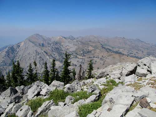
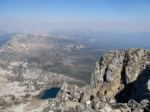
Views were amazing. Though it was hazy below, the slightly colder temperatures kept the smog in the valleys, and we stood, with neighboring summits, above the haze. On a crystal clear day the distant ranges I’m sure would be unbelievable to see, but at least we could still find glimpses of the Pintlers to the south and others ranges in various directions.
The immediate views though of the sharp cliffs lining the crater to the east, the talus piles below, and the Dempsey Lakes to the west were good enough, and we descended happy with the day’s summit.
Greg opted to descend the cliffs on the way down, while I found some easier terrain slightly to the left…though I’m sure even easier terrain could be found if you contoured further east, down towards the drainage.
We walked back down the trail then parted ways. Greg further north to Missoula then into the deep northern Idaho wilderness for three more days, while I headed south. I called ahead to see if there were any motel rooms left in Dillon; perhaps I could have a few drinks and partake in the festivities. Alas, no. Oh well. I was tired anyway, Anaconda was close, and perhaps a good night’s rest was good for me. I felt better, less sick today, but another full night of sleep couldn’t hurt.
Labouring up Tweedy - Sep. 3rd, 2012
Monday was destined to mark a return of the haze that we had bid a brief respite from on Powell. I drove down from Anaconda and the Pioneer Range beckoned menacingly on the right side of the highway, its high summits hidden in an already thick morning smoke. Cedron’s guidebook indicated that my Camry would make it to a reasonable 2WD trailhead, and it did, after many long miles of bottoming out and driving along one of the rougher, bumpier, and scarier supposedly sedan accessible dirt roads that I had driven. I started the first mile descending on foot the dirt road a few hundred feet down to the drainage dividing the ridge where I had parked and the drainage towards Gorge Lakes.
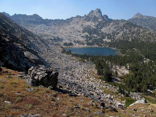
Some routefinding was required. I was used to desert routefinding on cross country jaunts, on terrain that is usually relatively open and slopes and canyons that can be spotted to the naked eye. This was my first time really doing a cross country hike in the Northern Rockies by myself. The route necessitated finding a lightly marked cairn marking the “Old Trail” to the southern Gorge Lakes. Most of the trail itself was very well groomed and maintained, and a breeze to walk. The forest, though beautiful, became somewhat monotonous after 3 or 4 miles of the same thing. I bumped into only one group of hikers along the way, a couple who had backpacked and camped at the lakes over the long weekend.
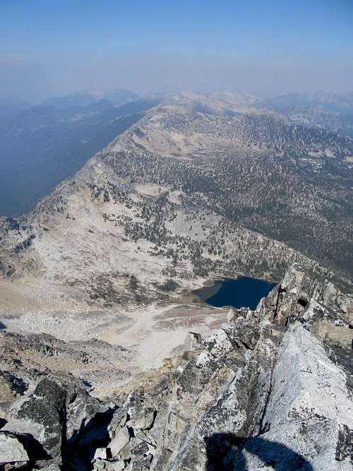
After a false alarm at every boulder I eventually spotted the large one marking the split for the “old trail” and followed it until it disappeared past the aforementioned meadow. Here, I contoured southwest through the open forest, crossed a small creek, and eventually found a green, open drainage with some slabby granite surfaces leading in a west southwest direction. This made for pleasant going to the top of the hill where just below me to the west was the largest and most southeasterly of the Gorge Lakes. Here, I was able to make a sharp left and ascend up another grassy ramp, this one a little steeper, in an east-southeasterly direction and thus contour around the line of cliffs that marked the northern edge of Tweedy’s north face coming down to the Gorge Lakes.
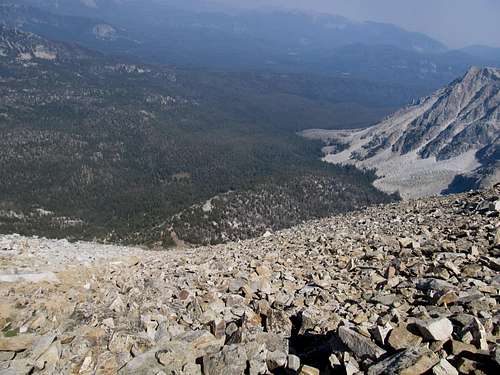
From here on out it was a long and tedious 2000 feet of ascent up Tweedy’s Northeast Ramp. The footing over grass was easy at first, though steep, but eventually marked a transition to boulder after endless boulder. The haze hid views afar, but the nearby rock spires rising over the Gorge Lakes was a treat for the eyes.
It was chilly, with an occasionally westerly wind. I was bundled up in my hoodie and though I felt good, I hoped that the breeze didn’t infect me with a second onset of the cold. The ascent took forever as the boulder higher got steeper and looser. I took a southwesterly course, always contouring towards the right on the way up. The bouldering was precarious at times and sometimes required large steps over giant gaps, but there were never any moves that were exposed or exceeded a hard class 2. Eventually I reached the summit ridge and saw the easy sandy terrain leading down to Barb Lake, another ascent option that I had avoided due to the prospect of more GPS-less route finding through trailless forest.
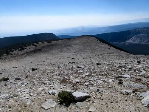
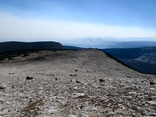
The summit ridge took forever as it led me on and over and around a few false summits. The haze engulfed even the moderately faraway peaks of the Pioneer Range, and I could really only make out the vague triangular shape of Torrey to the south. What views must there be here on a nice clear day.
The descent down was just as tedious, though I opted for the looser but smaller boulders near the center of the ramp for easier downwards progress.
Finally down at the two ramps, I made a careful course after bidding farewell to the gorge lakes, hoping to find the trail again without too much difficulty.
I crossed the stream on my return at a different spot, but I knew it was the same stream and had a good idea of where I was. I eventually reached the meadow and, letting my guard down, lost the “old” trail for a bit before refinding it. The walk back to the car was uneventful, and I made it door to door in around six hours. I was a little tired but not spent, though the last uphill section was not fun under the afternoon sun. Throughout my trailed descent I was more worried about the drive out, hoping my Camry would survive. It did, though not without a few more bruises, and I made a Starbucks stop at the Dillon Safeway. The drive back was long, and I wondered whether I had made the correct choice in peaks after driving by Garfield and the Beaverheads near Lima in a smogless evening.
I was spent by the time I arrived in Salt Lake late Monday night. My efforts to avoid the flu had been futile, and I spent the next week with a bad fever, cough, and sore throat. Not the worst price to pay to have sought the tidings of the North for one summer.
Comments
No comments posted yet.