
-
 3031 Hits
-
 75.81% Score
-
 6 Votes
|
|
Route |
|---|---|
|
|
46.06248°N / 9.07395°E |
|
|
Download GPX » View Route on Map |
|
|
Hiking, Skiing |
|
|
Spring, Summer, Fall, Winter |
|
|
Half a day |
|
|
Hike, ski tour |
|
|
Overview
 Capella and Passo San Lucio Capella and Passo San Lucio |
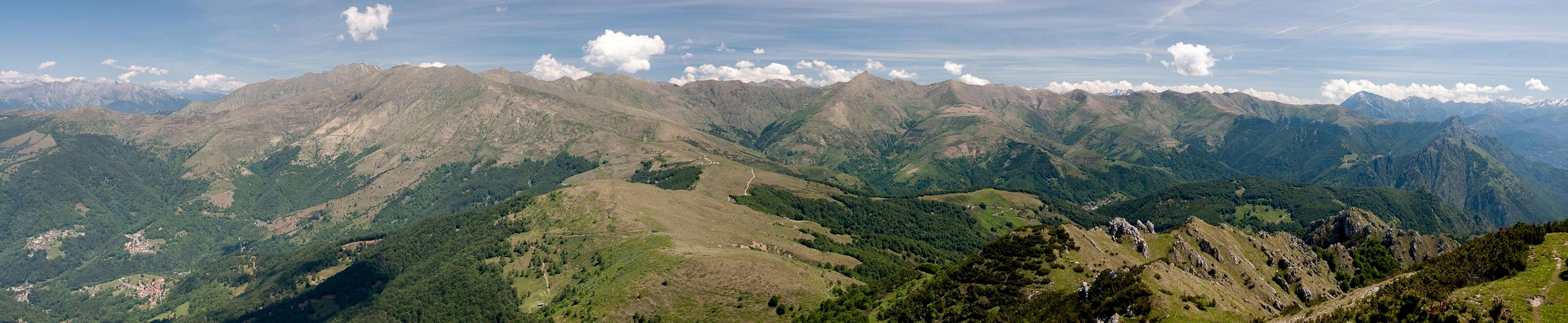
A wonderfully panoramic route, the north-western ascent to Cima di Fojorina from Bogno to Passo San Lucio, follows the border ridge between Italy and Switzerland for about half the way. Before it is a mix of hiking paths and dirt roads, depending on your starting point inside the village of Bogno.
The route is never difficult or exposed, however, it gets very steep in the final part between Bocchetta di San Bernado and the summit. This section reminded me of Pizzo Mirabella in Sicily, thanks to the limestone rocks and gendarmes, overgrown by bushes. The summit block, however, can be much more easily reached by a narrow hiking path winding between the rocks and bushes. The traverse to the southern summits of Cima di Fojorina is easy as well but here the last section gets rocky and exposed.
Getting There
Bogno is situated in the very end of Val Colla, east of Lugano. See the main page for the itinerary.Route Description
  |
- Start altitude: 950m
- Summit altitude: 1809m
- Prevailing exposure: N
- Type: Hike
nbsp; - Protection: None
Bogno, at the end of Val Colla is a mountain village, which stretches along a narrow, winding road. There is only little parking space available, a small lot in the centre of the village and an even smaller one near the very end of Bogno. All other parking space is owned privately. There is a mountain bike route, which follows a narrow dirt road to Passo San Lucio and which starts near the village centre but for hikers a more interesting route starts near the upper parking lot (200m to the south).
Follow the signs to Alpe Cottino and Passo San Luco the path crosses a small meadow before entering the forests in Val Giumello. It heads steeply upwards to an abandoned house, where the San Lucio Route turns off to the left (straight on you can either get to the dirt road or to the villages of Certara and Cimadera). A short steep section takes you to the slope above Val Giumello, which you'll have to follow until you reach the meadows around Alpe Cottino.
 |  |  |
The path leads to the farm buildings and I suspect you have to reach the road behind. Signs, however, lead you into and across a creek bed, where the paths vanish. we had to make an escape eastward until we came to the road. The remaining 100m of elevation are quickly gained following the road and finally you head out onto the pastures around Passo San Lucio. Ignore the sign to Capanna San Lucio and head to the little chapel instead. Here you'll have wonderful views eastward into the Italian Valleys and mountains beyond.
From The chapel follow a well trodden path, which follows the ridge (and border) directly. A few insignificant ups and downs lead you accross (or beside Monte Cucco to Bocchetta San Bernado, a small saddle just beneath Cima di Fojorina. There is a trail intersection and the obvious routes all lead in the wrong directions.
 Looking back from Bocchetta San Bernado
For Cima di Fojorina head up a very narrow path (no signs in the saddle) leading steeply upwards onto the north slopes of the mountain. After some 30m a sign leads westward so the path tuns right and now traverses the north slopes of Fojorina. It avoids the lower eastern parts of the mountains and instead heads for another small saddle, Bocchetta di Fojorina. Turn right here onto the west slopes of the main summit, where a path winds through the dwarf pines to reach the top. Shortly before you reach the top, another path leads south towards the south summit of Cima di Fojorina.
The route can also be done as a ski tour. Together with the west ridge route across Cima dell'Oress it is a nice full day round trip (winter and winter.