
|
|
Route |
|---|---|
|
|
39.27310°N / 114.1988°W |
|
|
Hiking |
|
|
Spring, Summer, Fall |
|
|
Half a day |
|
|
Class 2 |
|
|
Approach
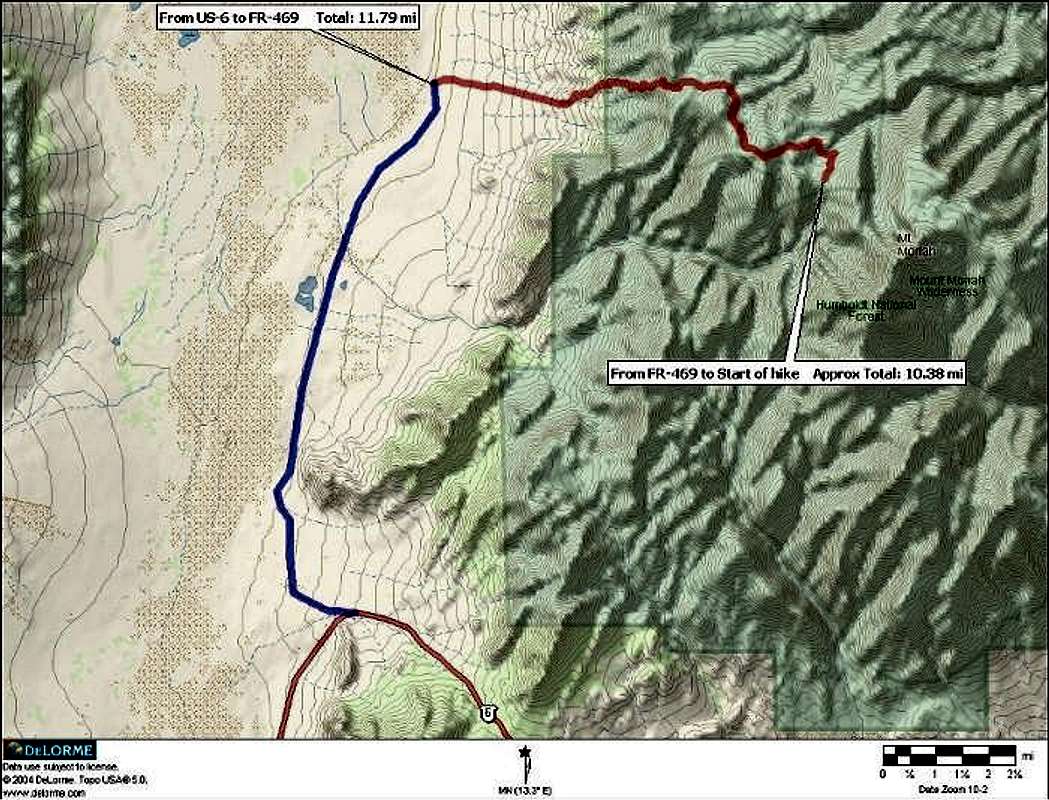
This approach is very scenic, taking you from the desert floor to alpine meadows. By far this is the easiest way to the top of Mount Moriah; cutting the elevation gain from 6000 ft to 2500 ft (compared to the Hendry’s route). The access for this route requires 4-Wheel Drive because of the steepness, other than that it is close to a well graded dirt road. The turnoff is at the tip of the large horseshoe bend of US-6 approximately halfway between Ely, NV and the Utah Nevada border.Getting There
Going West From UT/NV border on US-6
After crossing the Utah / Nevada border it is 21 miles to the turnoff road that heads north. Take a right on the turnoff road which heads east at first and then continues north. Go approximately 11.8 miles on the road to Forest Road 469. Take a right on FR-469 and start heading up the mountain. Continue on FR-469 for approximately 10.4 miles to a large bend in the road and a “no vehicles” sign.
Going East from Ely, NV on US-6
From Ely, NV head east on US-6 for approximately 42.5 miles to the turnoff road. Take a right on the turnoff road which heads east at first and then continues north. Go approximately 11.8 miles on the road to Forest Road 469. Take a right on FR-469 and start heading up the mountain. Continue on FR-469 for approximately 10.4 miles to a large bend in the road and a “no vehicles” sign.
Route Description
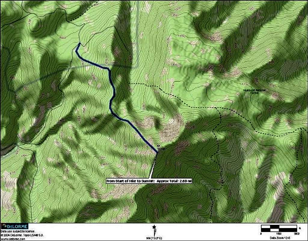
Round Trip Distance : 5.5 mi
Elevation Gain : 2500 ft
From the start of the hike head south a couple hundred yards and gain the small ridge seen in the previous picture. After intersecting the ridge follow the old truck route east to the ridge seen here. From the top of this ridge you will have a good view of the peak like this one. Make your way along the ridge on the bottom right of the previous photo to the base of the peak. From the base of the peak seen in the picture it is 1500 ft up. Once at the base of the peak head up it is steep but not as steep as it looks in the picture. The rocks are mostly small and not loose. Make your way up the ridge seen here to the summit.