|
|
Trailhead |
|---|---|
|
|
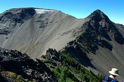
Jefferson |
|
|
6150 ft / 1875 m |
Getting There
Olympic National Park is located in the NW corner of Washington State on the Olympic Peninsula.From Seattle, either take a Washington State Ferry from the waterfront at Coleman Dock to Bremerton or Bainbridge Island. You may also choose to drive South to Tacoma on I-5. Take the Gig Harbor / Highway 16 exit and follow to the Hood Canal Bridge.
From Bremerton, make your way to Highway 3 heading northbound toward the Hood Canal Bridge.
From Bainbridge Island, make your way west on Highway 305 to Poulsbo. Take the on-ramp to Highway 3 toward the Hood Canal Bridge.
Cross the Hood Canal Bridge on Highway 104 and follow the signs to Port Angeles, Washington. Hwy 104 merges onto Hwy 101 prior to Port Angeles.
In Port Angeles, follow signs to the Olympic National Park. Take a turn towards the hills on S Race St. Follow the signs up to Hurricane Ridge, approximately 18 from the Port Angeles Ranger Station. As you reach Hurricane Ridge, just before the Parking lot is a dirt road to the south. If the gate is open, head on out another 8.4 miles to the end of the road at the Obstruction Point parking lot. This is the jumping off point for Badger Valley, Grand Valley, Deer Park, Lillian Ridge and beyond.
Red Tape
This is within the Olympic National Park, therefore one needs a Olympic National Park Annual Pass, Golden Age Passport, Golden Eagle Passport, 7 day pass or National Park Pass. Fees may change yearly.Overnight Passes are required for staying over night in the Olympic National Park.
Permits and Reservations are required when staying in Grand Valley.
When to Hike
The Obstruction Point Road is open from late Spring when snow melt has occurred, until the first road covering snow of the Fall. When the road is closed, Hurricane Ridge road is typically open on weekends when the road has been cleared and the Obstruction Point Road is an excellent place to snowshoe, cross country ski and explore.Trails
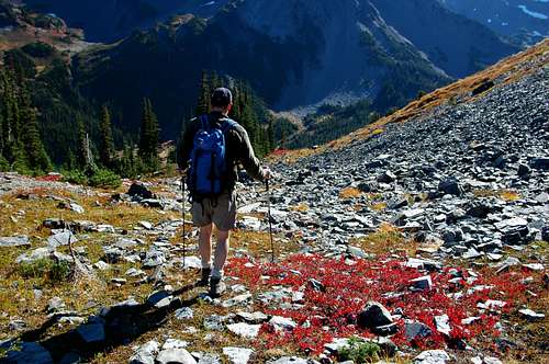
Obstruction Point to Deer Park. This is an excellent ridgeline trail to do in one day at 15.6 miles round trip or to split with another group or couple. They park at Deer Park, you park at Obstruction Peak. Meet in the middle and exchange keys.Obstruction Point to Badger Valley or Grand Valley and camp overnight at Grand Lake or Moose Lake.
Obstruction Point to Lillian Ridge and beyond. You can reach Peak 6753, Lake Lillian or Grand Pass easily.
Green Trails Map No. 134S: Hurricane Ridge/Elwha North
Images