Despite its large size, South Dakota’s Badlands National Park has few official hiking trails but it has an open hiking policy meaning that you could hike anywhere you desired. I wanted to explore the beauties of the park away from the crowded hiking trails and view points along the road. Before going on any hike, I usually use Google Earth to get a feel for the topography of the area. Unfortunately, Google Earth showed the badland mountains as rounded hills but I knew that they were impassable jagged mini peaks. To avoid obstacles, I had thought that my best bet was to hike the grassy plain at the base of the badland mountains where I could get good views and investigate any area that appeared appealing. I also wanted to go up at least one of the countless canyons that drained the badland mountains. From the grassy plain, I chose a spur path that took me up a nameless canyon to the upper end of it at the base of a big drop off below a view point on the park road known as White River Valley Overlook.
Turned out to be a fantastic day and I did not see any other person or even a boot print for that matter.
Trip Report
Hike length: 10.9 miles
Total Ascent: 750 ft
Minimum Elevation: 2430 ft
Maximum Elevation: 2610 ft
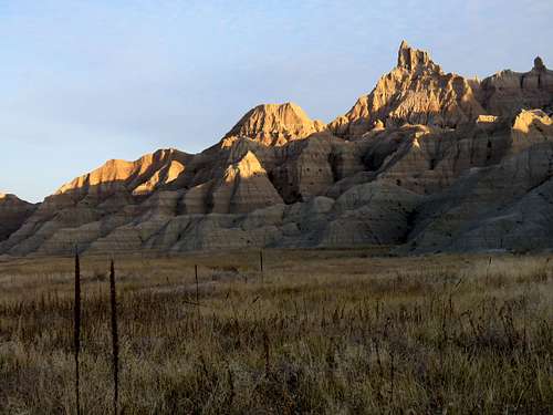
Left the Cedar Pass Cabins in Badlands National Park before sunrise (7:50 a.m.) and drove a few miles west on the park’s main road. The moon was visible in the western sky. I took a couple of pictures of it but they did not come out good. I had planned to start my hike at a spot where the road began to go uphill to reach Fossil Exhibit Trailhead. On Google Street Maps I had seen a place where I could park. That was where I started my hike at 7:10 a.m. It was 32 degrees F. I was in the shade but the tips of the very impressively jagged badland mountains were glowing in the rays of the rising sun.
Start of my hike
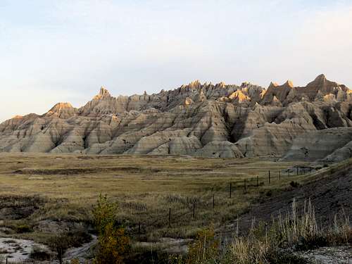
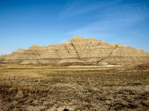
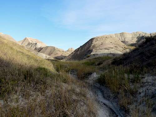
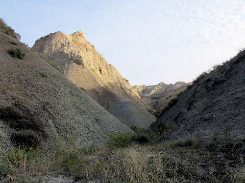
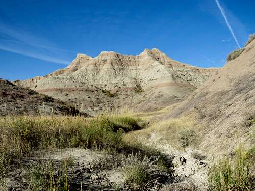
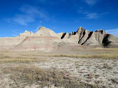
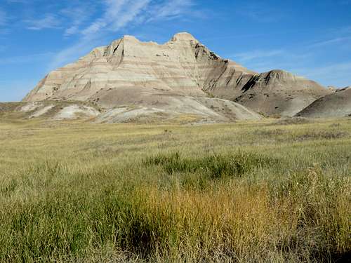
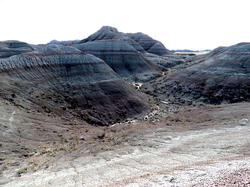
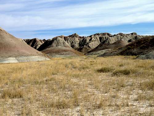
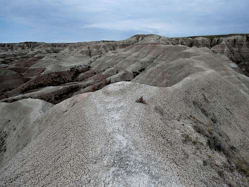
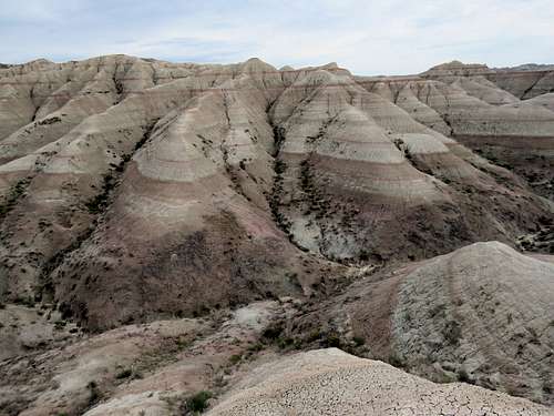
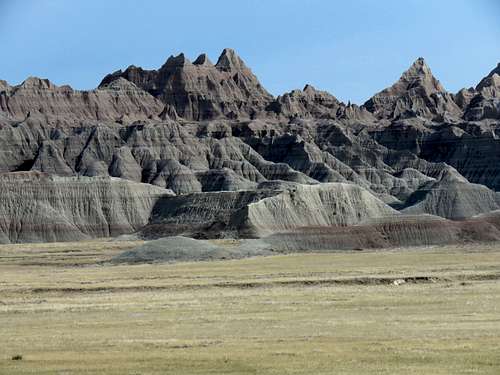
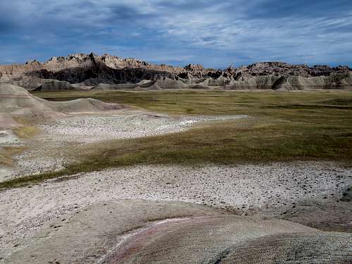
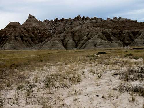
Headed west going down the road embankment to reach a wire fence that ran north-south at the eastern end of a grassy plain. A steep hill rose just to the south of me and the fence ended on the slopes of the hill. Climbed the slopes a little and went beyond the southern end of the fence to reach the grassy plain. Was hesitant to walk over the grass worrying that I might inadvertently step on a rattle snake but I guess it was too cold for snakes since I did not see any during the two and a half days that I was in the park. At first followed the bottom of a dry creek but the creek turned south so I left it going north to reach the base of the badland mountains that rose abruptly above the plain and followed the general path that I had entered into my GPS. The highest point of the mountains formed a big horn that was visible during most of my hike even when I was miles away from it giving me a sense of how far I was from the starting spot.
Horn
Horn
Was soon out of the shade.
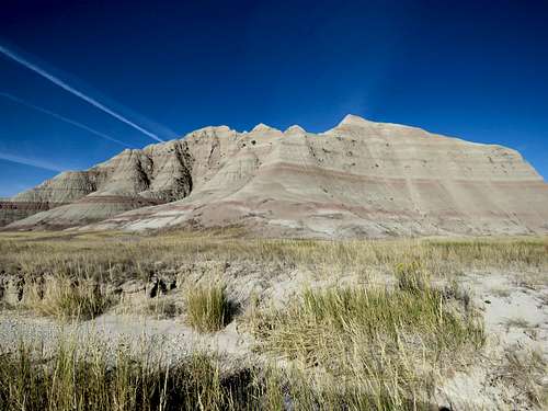
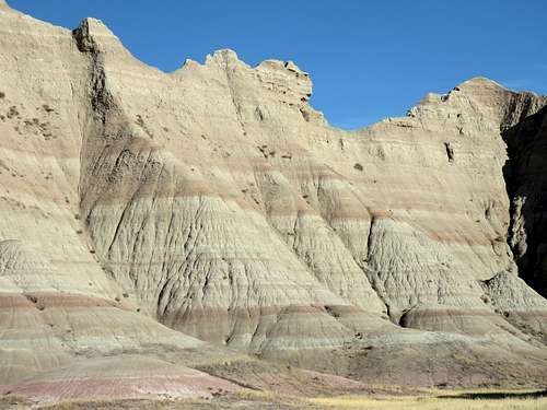
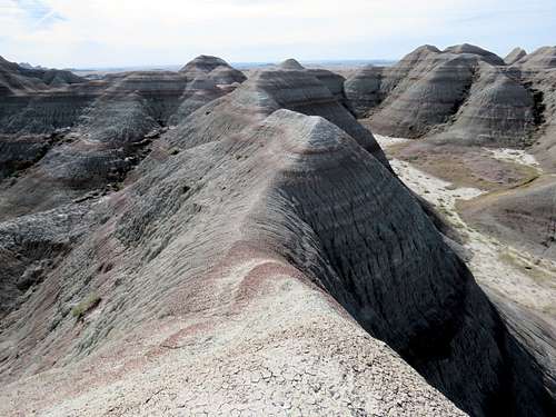
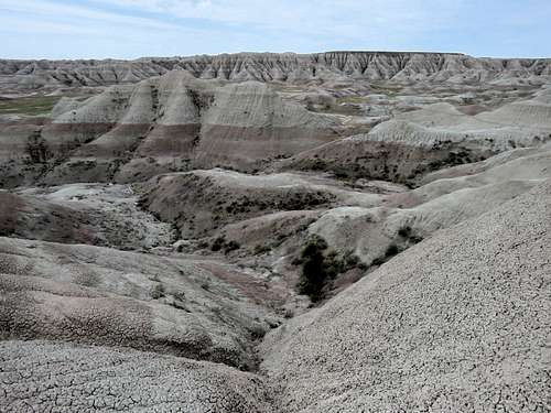
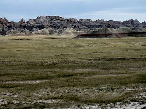
Badlands
Badlands
Badlands
Badlands
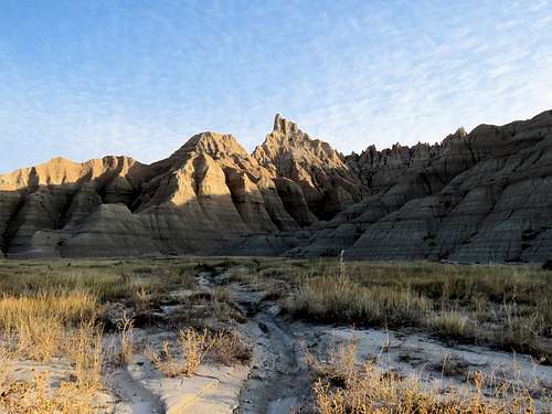
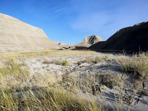
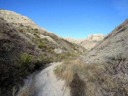
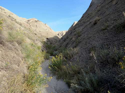
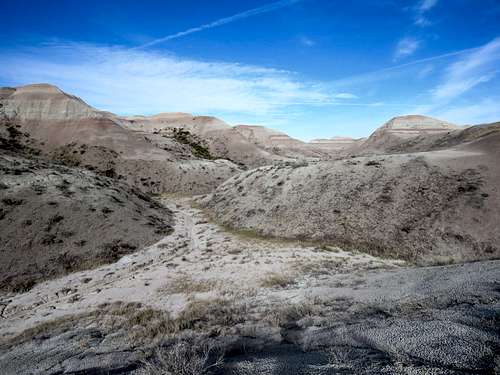
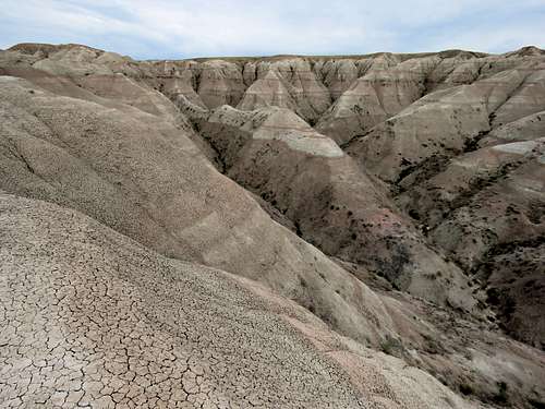
My GPS then showed that I was at the mouth of the canyon that I wanted to explore. Turned north and followed the dry canyon uphill.
Start of canyon
Start of canyon
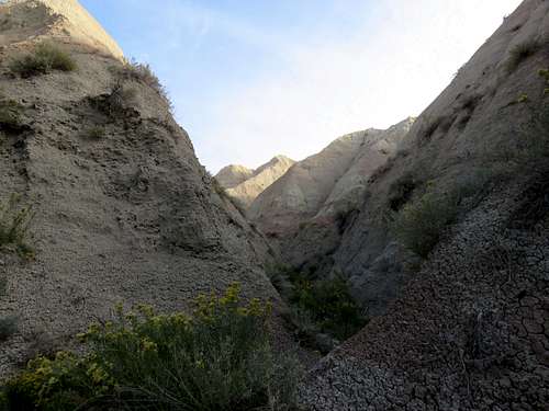
As I kept going, the canyon kept becoming narrower and I wondered if I would eventually be forced to turn back due to some obstacle. Soon pieces of garbage (soft drink cans, potato chip wrappers etc.) that were half buried began to appear here and there. I figured that they must have come down from the view point on the road at the head of the canyon since I did not even see another boot print to prove that anyone had ever been there.
Canyon
Canyon
Canyon
Canyon
Canyon
Canyon
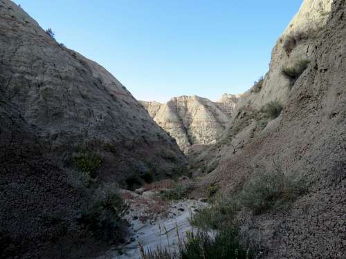
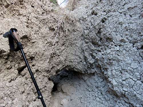
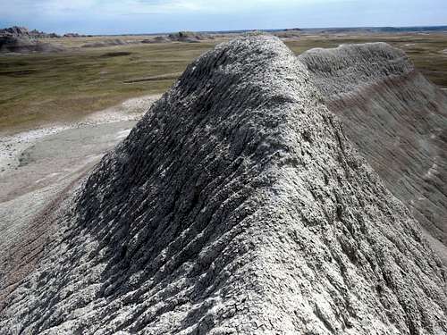
Eventual slot canyon.
Slot canyon
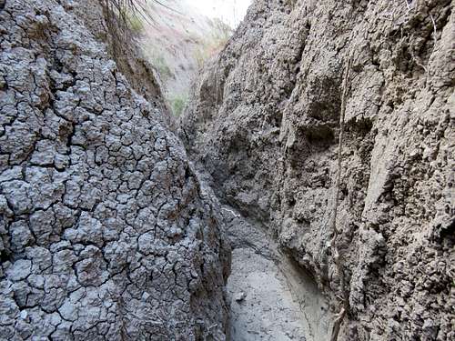
Going past a few minor obstacles, I reached a spot where the canyon was extremely tight and the bottom of it formed small dirt bridges just like snow bridges form over a running stream in spring as the snowpack begins to melt. I did not want to step over the bridges fearing that they might break getting me stuck in a tight squeeze. My GPS showed that I was only 200 feet away as the crow flies from the viewpoint on the road 100 vertical feet above. It was 8:35 a.m. and I had hiked 2.52 miles.
End of canyon
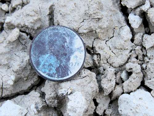
Turned back and began to retrace my path down the canyon. A metallic object caught my attention. Turned to be a 1971 penny half buried in the dirt. I picked it up as my lucky penny.
Penny I found
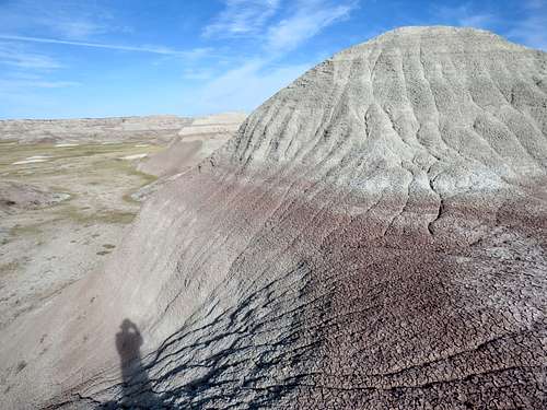
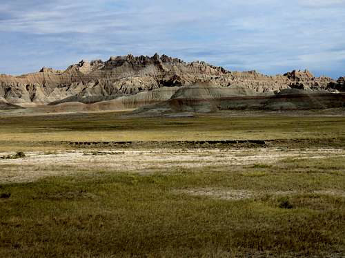
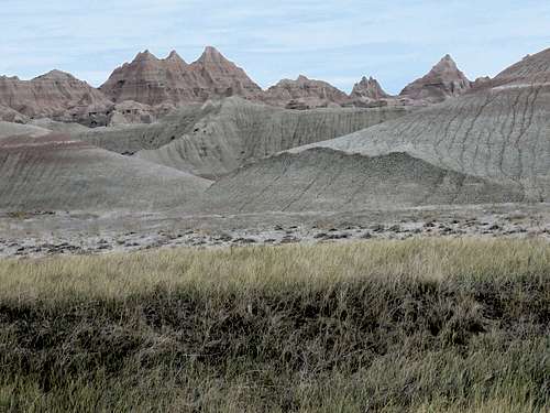
I was out of the canyon at 9:10 a.m. and 3.53 miles of hiking. Was actually glad to be out of the claustrophobic canyon and back on the beautiful open plain. Headed south and then west skirting the southern end of the badland mountains.
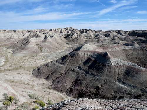
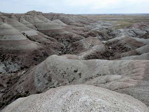
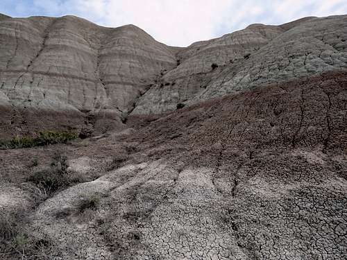
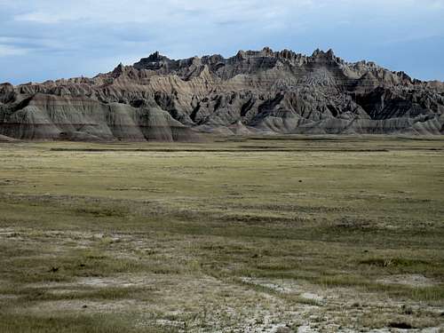
Badlands
Badlands
Badlands
Badlands
Badlands
Badlands
Badlands
Badlands
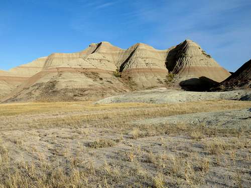
Looks like The Sphinx.
Looks like The Sphinx
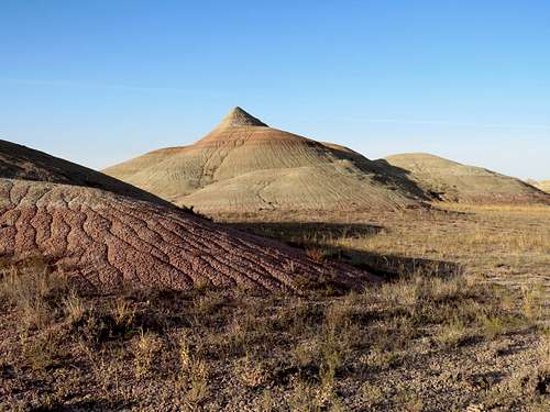
Two faces of a pretty peak.
Pretty Peak
Pretty Peak
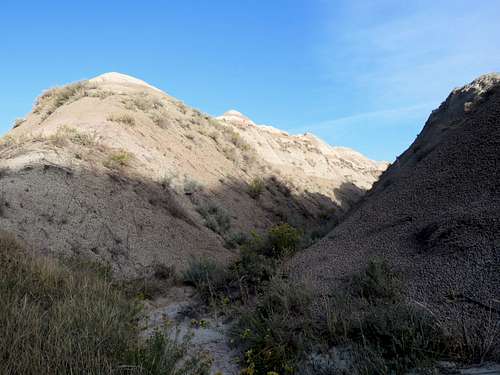
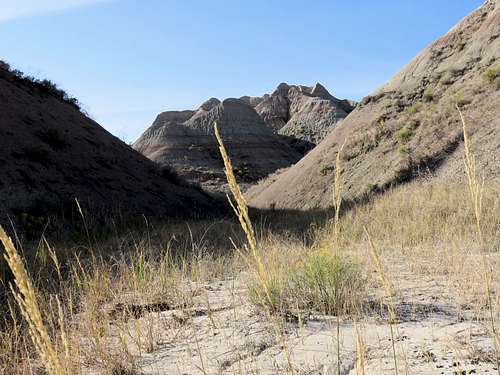
The path that I had entered into my GPS showed that I had to go south skirting the southern edge of the badland mountains and then go north on the plain behind the mountains. It now appeared that I could go up a wide canyon and climb the easy western slopes of it to reach the plain beyond.
Open canyon
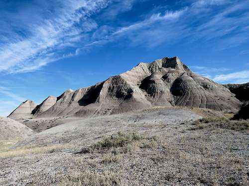
Hiked to the western end of the canyon and went up the slopes to reach the base of a summit. Left my backpack there and attempted to climb to the top but the slopes were too steep with nothing to hang on to. A fall would have meant tumbling down to the very bottom so I gave up.
Steep summit
Looking north from the base of the summit.
Looking north from below the summit
Found a taller and easier to climb peak to the south. Went all the way down and then climbed some 70 vertical feet going over a narrow ridgetop to reach the summit.
Narrow ridgetop before the summit
Looking southeast at the pretty peak and the canyon I had been in.
Pretty peak
Other views from the summit.
From the summit
From the summit
From the summit
From the summit
Sat there to eat and drink. There was barely enough room for me up there so did not dare to let go of my backpack or hiking poles.
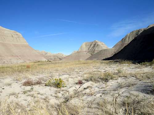
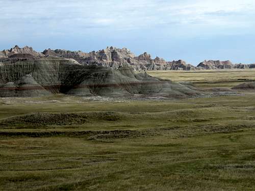
I then went down the slopes and reached the plain where I had planned to be.
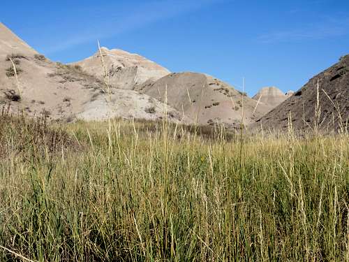
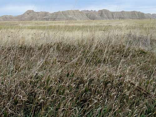
Grassy plain
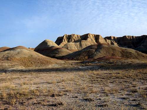
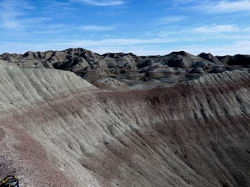
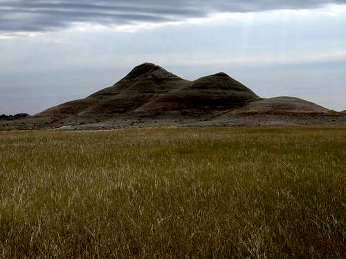
Went northwest for some time wondering where to go next. Saw a big mass of badland mountains to the distant southwest so turned direction and began to hike toward them on the grassy plain. After a while I realized that those mountains were just too far away. I found a hill that obviously used to be a mountain but had been eroded to a mound no more than 3 feet tall. Went to the top of it and sat to rest and figure what to do next. It was 10:45 a.m. and I had hiked 6.05 miles. Zoomed view of the mountains to the southwest.
Distant badlands
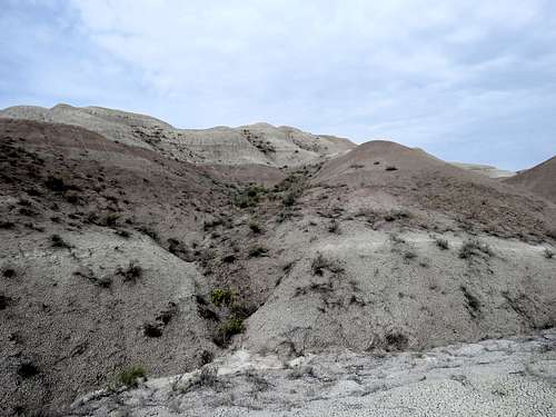
I was itching to go to the top of something again. The mountains to the northwest appeared closer. I left at 11:10 and began to hike northwest going beyond the path that I had originally planned (and left a copy for my wife in case a rescue was needed). It became cloudy. Entered a random canyon and began to look for an easy thing I could climb. Did not want to get myself engaged with a difficult slope in that place where in case of an accident, nobody could ever find me. Deep inside, however, I knew that all of those slopes eventually lead to difficult spots. Where I decided to climb.
The slope I climbed
Up some steep slopes with nothing to hang on to, I reached this narrow ridgetop.
Ridgetop
Followed the narrow ridgetop north for a short distance. Views from the top.
From the top
From the top
From the top
From the top
Decided to go down via a different route descending into another canyon on the other (west) side of the ridgetop. Found a slope that appeared do-able. As I went down, it became apparent that I could not walk down. Had to sit on my butt and put my feet into a groove where two slope faces reached each other. The groove had some of those “dirt bridges” that I had seen in the other canyon making me worry that a sink hole may open up swallowing me whole. Fortunately, After a few tens of vertical feet I was down to the bottom of the canyon. Looking back at the slope I descended.
Slope I descended
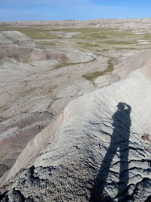
Out of the canyon and back on the grassy plain, I headed southeast and then east going back toward my car via a route different but parallel to the one I had come. A long and narrow line of badland mountains ran north-south creating an obstacle on my path east but I could see a very low and easy to climb saddle in the ridgeline.
Ridgeline on grassy plain
Went up to reach the saddle. Looking south at the line of peaks extending beyond the saddle.
Ridgeline extending south
Looking east from the saddle.
Badlands from the saddle
Badlands from the saddle
Went down the saddle and continued east on the grassy plain.
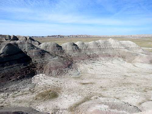
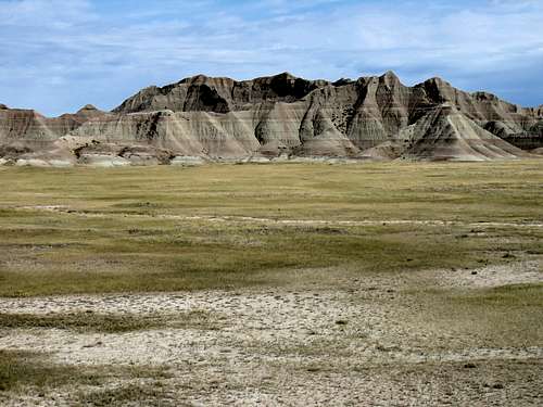
Badlands
Badlands
Zoomed view of what looked like most spectacular Himalayan giants.
Himalayan looking peaks
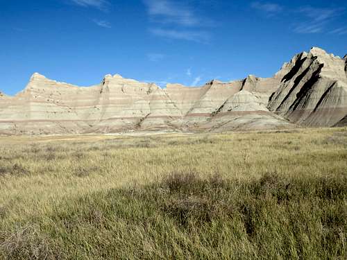
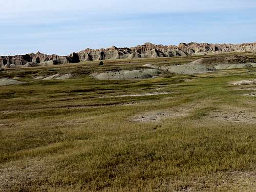
Continuing on the grassy plain.
Badlands
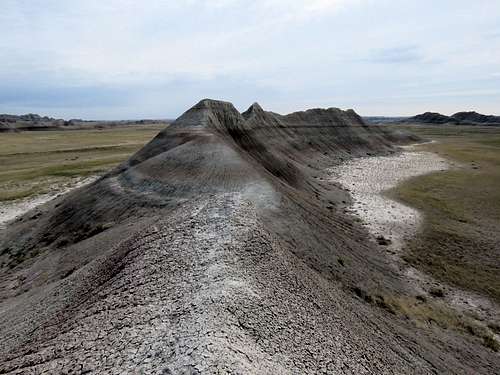
Could not resist attempting to climb this little peak.
The peak I decided to climb
Reaching its summit however, proved to be much more tricky than I thought. Did not dare walk the knife edge ridgetop just a few feet below the summit.
Knife edge ridge to summit
View from just below the summit.
From just below the summit
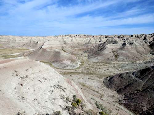
More wonderful views from the grassy plain.
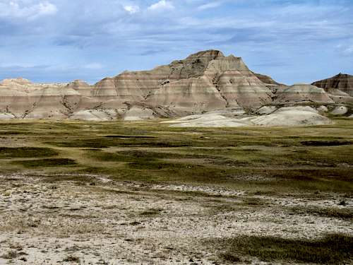
Badlands
Badlands
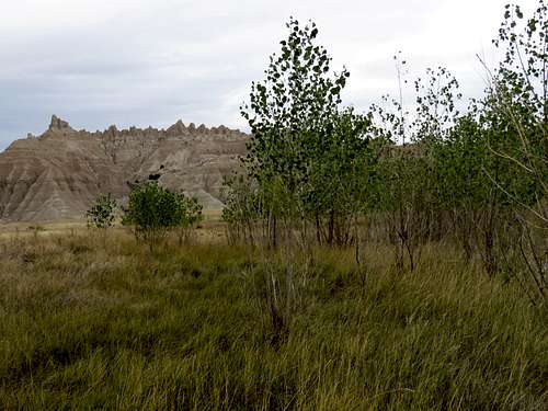
Was surprised to see a few small trees.
Trees
From far away, I could see a few people and cars where I had parked. They had probably seen my car and thought that there was a viewpoint there. I did not want them to see me having gone beyond the fence although I knew that I had not broken any rules. By the time I passed the fence and went up the embankment to reach my car, there was only one person there. He did not say anything. Ended my hike at 1:42 p.m.
I wouldn't have normally considered the Dakota badlands ripe terrain for peakbagging, but this was fascinating! Good to know about the open hiking policy as well.
Thank you for reading and commenting. I always wanted to make a small scale model of the mountain ranges that I like in my backyard. The badlands look like such a model but in much larger scale than what I would have made.
Parents refers to a larger category under which an object falls. For example, theAconcagua mountain page has the 'Aconcagua Group' and the 'Seven Summits' asparents and is a parent itself to many routes, photos, and Trip Reports.


Comments
Post a Comment