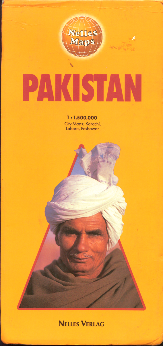
Maps on Pakistan

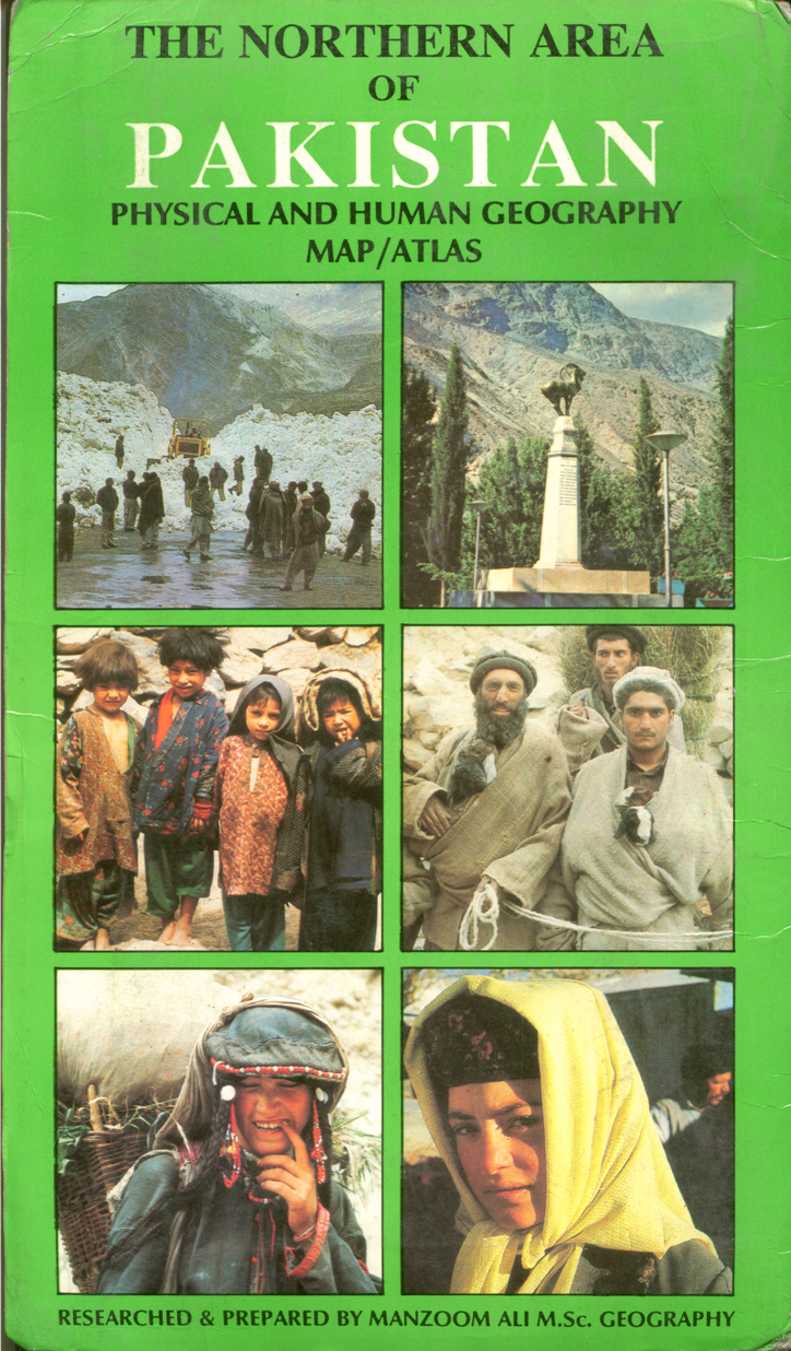
The Northern Area of Pakistan map

Gilgit Baltistan Pakistan physical and human geography map/atlas on scale !:500.000, researched and prepared by Manzoom Ali, head of geography department, government degree college, gilgit, Pakistan.
This map includes selected travel and tour operators, selected hotels, selected treks, some tourists spots, average rainfall and temperature, population, distance charts and its atlas section cover northern area before 1840-42, expanding frontiers 1840-92, the colonial period 1840-1947, the liberation of war of 1947-48, ethnic groups/tribes, languages, religion, propagation of Islam, some important wild life, gilgit town, skardu town, agro ecological zones, selected forest types.
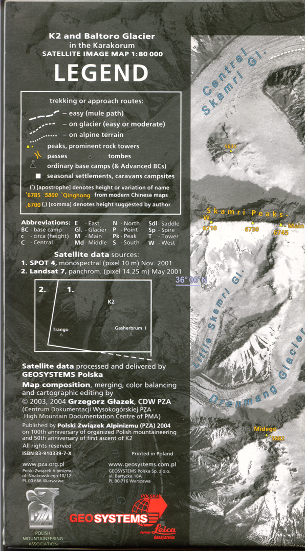
Baltoro Glacier Satellite map
Karakoram Maps - Leomann
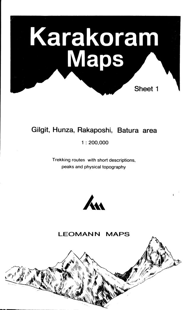
Sheet 1 cover Gilgit, Hunza, Rakaposhi, Batura Area with information on these area.
Sheet 2 cover Skardu, Hispar and Biafo area
Sheet 3 cover K2, Baltoro, Gasherbrum, Masherbrum, Saltoro groups
Sheet 4 cover Siachen, Rimo, Saser groups
Pakistan Nelles Maps

Trekking map on Pakistan elaborated by Jerzy Wala
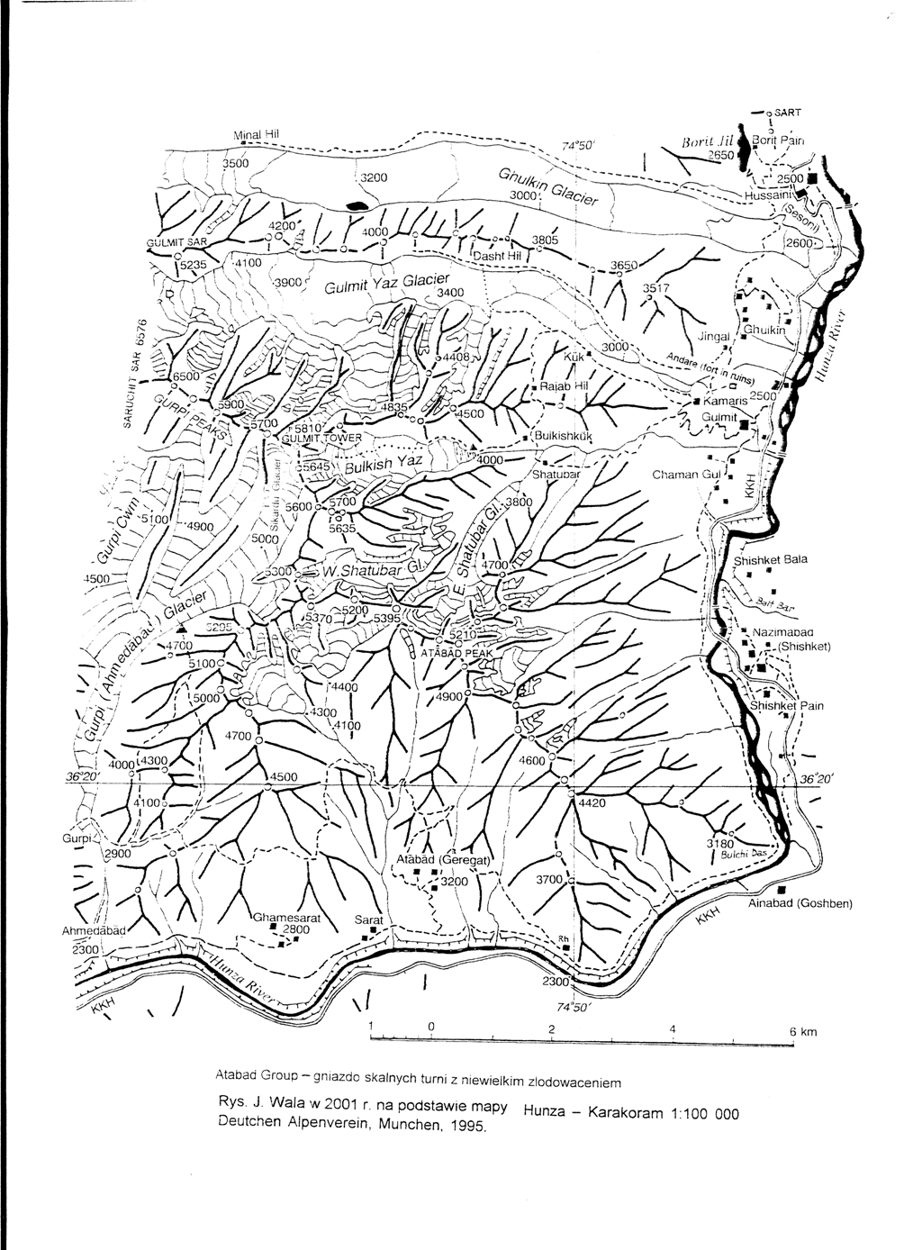
Note: The orographic maps presented below was created on the basis of the landsat images (supplied by Grzegorz Glazek CDW-PZA), N. W. Frontier Pakistan Satellite Image Map, Scale 1:500 000 (Lambert conformal conic projection, standart parallels: 26 and 34. N. Everest Spheroid, Virginia 1997 map I-2587-B) and pictures taken from the literature, Elaborated by Jerzy Wala 2005.1. Hunza - Karakorum; Rys. J. Wala w 2001 r. na podstawie mapy Hunza - Karakoraum 1:100 000 Deutchen Alpenverein, Munchen, 1995
2. Charakusa Glacier - K6 group.
3. Pakistan Western Karakoram - Batura Muztagh: Gulmit Tower
4. Hushe Region - Masherbrum Mountains (Masherbrum Ranges)
5. Nangmah Valley - Karakoram Masherbrum Mountains
6. Haramosh Mountains - Central Karakorum;
a. Haramosh Group
b. Kupultugh Kung Group (Paraber group)
c. Berginsho Group
d. Askot Group
e. Marshakala Group
6. Charakusa - Chogolisa Glacier - K6 group and Chogolisa Group
7. Batura Muztagh - yashkuk - Yaz Glacier
8. Hispar Muztagh
9. Rakaposhi - Malubiting Mountains
a. Rakaposhi Group
b. Sikiang Group
c. Diran Group
d. Bilchar Dobani Group
e. Phuparash Group
f. Koro Group
g. East Miar Glacier Group
h. Malubiting Group
i. Laila Group
10. Shani Glacier
11. Spantik - Sosbun Mountains
a. Barpu Group
b. Spantik Group
c. Makrong Group
d. Shingu Kuru Group
e. Balchhish Group (Balchhish Range, Hispar Wall)
f. Berelter Group
g. Sosbun Group
h. Ganchen Group
i. Gama Sokha-Lumbu Group
12. Gulmit Yaz Glacier
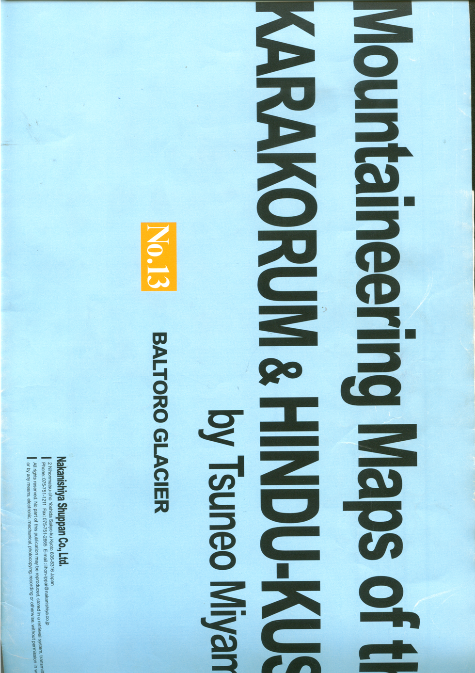
Mountaineering Maps of the Karakorum & Hindu-Kush by Tsuneo Miyamori
Mountain maps of the Karakorum & Hindu-Kush by Tsuneo Miyamori. publish in 2001 by Nakanishiya Shuppan Co., Ltd. With two main section there are total 13 sheets which includes. Sheet 1 to 12 on 1: 150, 000 scale. Sheet 13 on 1: 75, 000 scale. Now the English version of map is also publish.A. Hindu-Kush & Hindu Raj
1. Eastern Hindu-Kush & Tirich Mir (35 45 - 36 45 N, 71 - 72 E)
2. Southern Hindu-Raj & Chitral (35-36 N, 71 30 - 72 30 E)
3. Eastern Hindu-Kush & Mastuj (36 - 37 N, 72 - 73 E)
4. Eastern Hindu-Raj & Yasin (36 - 37 N, 73 - 74 E)
Karakorum
5. Batura Glacier & Hunza (36 - 37 N, 74 - 75 E)
6. Nanga Parbat & Gilgit 35 - 36 N, 74 - 75 E)
7. Hispar Glacier & Shimshal ( 36 - 37 N, 75 - 76 E)
8. Biafo Glacier & Skardu ( 35 - 36 N, 75 - 76 E)
9. Insgaiti Glacier (36 - 36 30 N, 76 - 76 45 E)
10. Baltoro Glacier & Khaplu (34 45 - 36 N, 76 - 77 E)
11. Siachen & Rimo Glacier (34 45 - 35 45 N, 77 - 78 15 E)
12. Nubra & Shyok River & Saser Kangri 33 45 - 34 45 N, 77 15 - 78 15 E)
13. Baltoro Glacier 35 35 - 35 55 N, 76 05 - 76 45 E)
Images
 |  |  |  |  |  |