
-
 10026 Hits
-
 79.04% Score
-
 10 Votes
|
|
Route |
|---|---|
|
|
34.38190°N / 118.0345°W |
|
|
Hiking |
|
|
Spring, Summer, Fall, Winter |
|
|
Half a day |
|
|
Class 1 |
|
|
Overview
This is a wonderful route on a section of the Pacific Crest Trail (“PCT”). At the northern-most part of the route, the trail opens up to magnificent and expansive views of the Mojave Desert and Antelope Valley in anticipation of what you will see on the summit of Pacifico Mountain. This peak, at 7,124 feet elevation, is situated on the northern part of the San Gabriel range. This route is about 12 miles roundtrip with 2200’ of gain.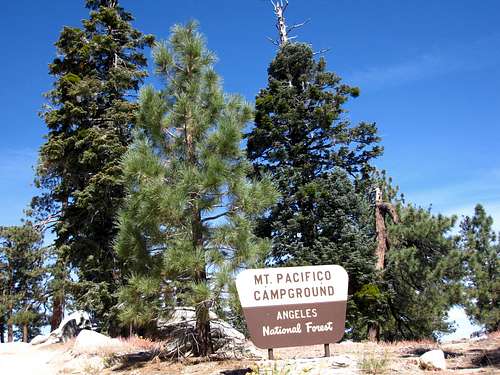 Your destination 6 miles from the trailhead. Note that peak is known as Pacifico Mountain.
Getting There
From the 210 Freeway, exit at Angeles Crest Highway (SR 2) and go north for 9.5 miles to Angeles Forest Highway. Turn left onto Angeles Forest Highway and drive 14.2 miles to Mill Creek Summit on the right. The first facility you will see is the signed Mill Creek Summit Picnic Area which has its own parking lot. Do not park here. Rather, turn right onto the paved road marked by a sign indicating hiking trail. This road will take you to the Mill Creek Summit Station on one side of the road and maintenance facilities on the other side. Just past the maintenance buildings, there is a large paved parking area on your right. Park here. Mill Creek Summit Picnic Area
 Parking is next to this station
Route Description
 Direction to the PCT from trailhead
 Mill Creek Summit trailhead
This area was hard hit by the 2009 "Station" fire and was then hit again by the so-called "Sand" fire of 2016. The area was closed as of August 2016, reopening again in March 2017. The ravages of these events are still visible.
![PCT at Mill Creek Summit]() Beginning of PCT route to Pacifico Mtn.
The trail to Pacifico Mountain roughly parallels 3N17 which road is to the south. During the first couple of miles you will have awesome views of Tie Canyon to your left.
After heading generally east for about 3 miles, the trail turns north through a forest of big cone spruce and live oak. Further up, you will emerge onto less shaded chapparal-laden slopes.
Beginning of PCT route to Pacifico Mtn.
The trail to Pacifico Mountain roughly parallels 3N17 which road is to the south. During the first couple of miles you will have awesome views of Tie Canyon to your left.
After heading generally east for about 3 miles, the trail turns north through a forest of big cone spruce and live oak. Further up, you will emerge onto less shaded chapparal-laden slopes.
![Mt. Pacifico (8332 ) from PCT]() Pacifico Mtn. from PCT
As you reach a ridgecrest, which you will round, you will be able to soak in expansive views of the Antelope Valley and Mojave Desert. These views are always good, but can attain the quality of stunning if the skies are particularly clear. After rounding the ridge, the trail turns south and intersects a dirt road. The PCT follows this road for about ½ mile. The trail then turns left and climbs east again, then southeast under Jeffrey pines and oaks.
Pacifico Mtn. from PCT
As you reach a ridgecrest, which you will round, you will be able to soak in expansive views of the Antelope Valley and Mojave Desert. These views are always good, but can attain the quality of stunning if the skies are particularly clear. After rounding the ridge, the trail turns south and intersects a dirt road. The PCT follows this road for about ½ mile. The trail then turns left and climbs east again, then southeast under Jeffrey pines and oaks.
![Saddle below Mt. Pacifico]() Big sign at saddle below Pacifico's summit
Big sign at saddle below Pacifico's summit ![Saddle below Mt. Pacifico]() Begin ridge ascent here
Finally, in a little over 5 miles from the start, you will reach a large saddle signed for the Pacifico Mtn. Campground and the PCT. If you wanted to stay on road all the way to the summit, you could follow the “Pacifico Road” another 1.25 miles to the top.
Begin ridge ascent here
Finally, in a little over 5 miles from the start, you will reach a large saddle signed for the Pacifico Mtn. Campground and the PCT. If you wanted to stay on road all the way to the summit, you could follow the “Pacifico Road” another 1.25 miles to the top.
![Roundtop Mtn (L) and Granite Mtn (R)]() Roundtop Mtn (L) and Granite Mtn (R) from Pacifico's west ridge
Roundtop Mtn (L) and Granite Mtn (R) from Pacifico's west ridge ![Pines below Mt. Pacifico]() Pines below Pacifico's summit
For a more scenic, not to mention challenging alternative, leave the trail at the saddle and head east up Pacifico’s west ridge. The ridge is extremely steep at the beginning, but it gets more “manageable” as you ascend. You get great views of the Mt. Wilson crest from along this ridge. It is about ½ mile to the top.
Pines below Pacifico's summit
For a more scenic, not to mention challenging alternative, leave the trail at the saddle and head east up Pacifico’s west ridge. The ridge is extremely steep at the beginning, but it gets more “manageable” as you ascend. You get great views of the Mt. Wilson crest from along this ridge. It is about ½ mile to the top.
![View near summit of Mt. Pacifico]() Flora on Pacifico's west ridge
Flora on Pacifico's west ridge
 Beginning of PCT route to Pacifico Mtn.
 Pacifico Mtn. from PCT
 Big sign at saddle below Pacifico's summit
 Begin ridge ascent here
 Roundtop Mtn (L) and Granite Mtn (R) from Pacifico's west ridge
 Pines below Pacifico's summit
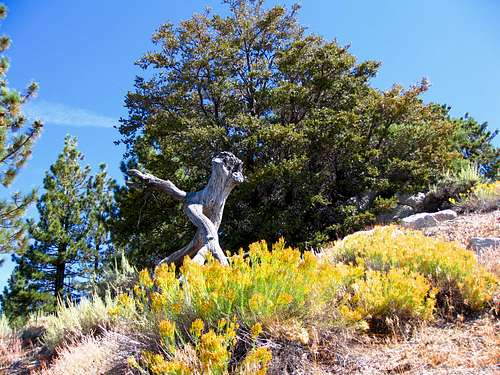 Flora on Pacifico's west ridge