An Idaho Smokeshow - July 6th, 2013
Two weeks prior I had twisted my left ankle. The injury wasn’t that bad and was now probably 90% healed. (Though for some reason 7 months later, as I write this now, it refused to heal fully fully and still remains around 94%). One week prior I had twisted my right ankle very badly. After a week of trying to nurse it I gauged it was only perhaps 60-70%, quite tender and visibly swollen, and still lacking the ability to fully support myself without a brace. Yet, Greg was thinking Idaho, and I couldn’t say no. Well, I could depending on the destination. He had batted around Baldy and Observation (latter in Wyoming) in the Snake River Range. I figured the former would be too much for my ankle, though for some reason I thought Observation would be easy…we both underestimated the peak and that came back to haunt us almost two months later. For now though, I said that I would forsake those two for some easier targets, perhaps Smoky Dome and Trinity Mountain further west, the former an easy ascent based on the stats and the latter a walk up a good dirt road. As it turned out, the weather for the Snake River Range turned to heavy rain by the end of the week, so Greg decided to forsake those peaks as well for my easier targets.
He and Kadee drove up Friday night as usual, and I left Saturday morning in the early AM, meeting them at their campsite at a beautiful meadow upon a saddle southwest of the peak. The roads were a maze near the end, the directions on SP somewhat vague, so I took quite a bit of false turns and starts before using the far from dependable GPS on my brand new iPhone to find the right trailhead. Luckily I had service, or else I would’ve been screwed, though I could take comfort in the fact that Greg had been just as lost the night before, the darkness adding an additional challenge to his navigation. That explained why he and Kadee were still sleeping as I pulled up around 9 AM ish.
Over the past week I had returned my new cheap boots and forked out the money a new pair of Asolos. I’m firmly on #teambigboots due to my easily twistable ankles, needing the high ankle support, and while my new Asolo’s were pretty solid they, like seemingly all the new boots out there these days on the market, were smaller in general and my ankles felt less secure in them. To make things better, the presence of a brace on each ankle would hopefully provide me some added insurance, and I took my time tightening things up while Greg and Kadee packed up their campsite.
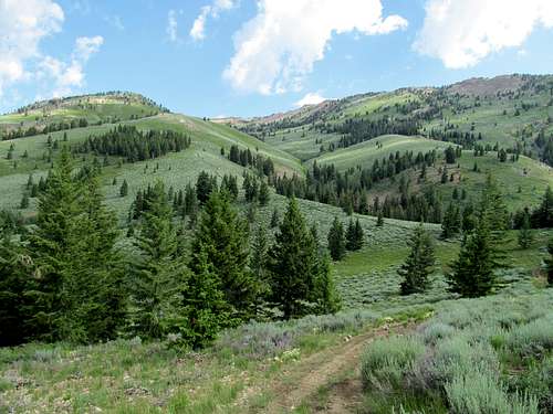
We had decided the day before to use the Rough Cut approach as outlined on SP; it offered slightly less elevation gain, and I figured the shorter the route the less chance of renewed disaster for my ankles.
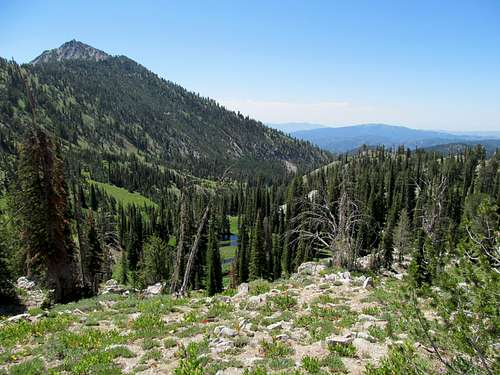
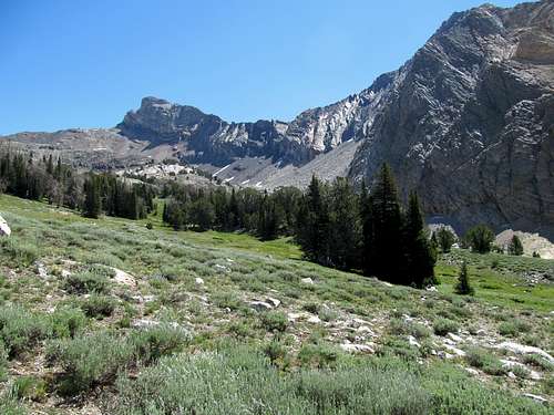
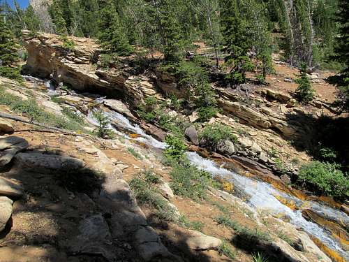
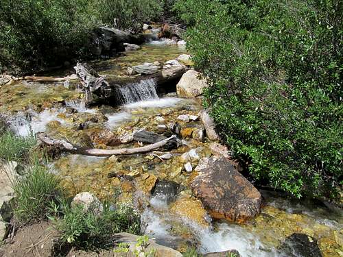
We started up the jeep track and followed as it turned into a trail and crossed Rough Creek near some charming cascades. Things got a little marshier as we waded through some trees, brush, and some swampy areas out of right field; I was fine in my new boots, shit ankles and all but Greg in his trail runners was not having it.
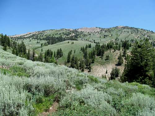
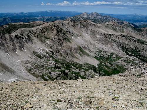
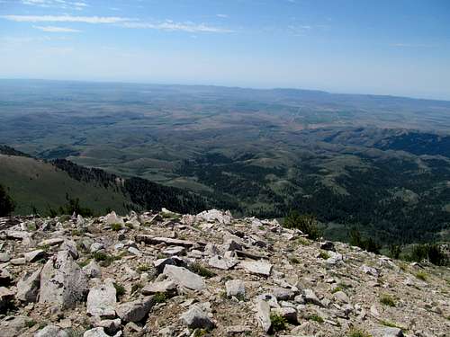
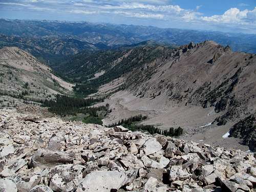
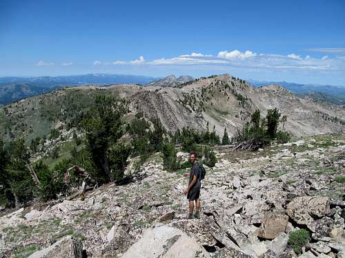
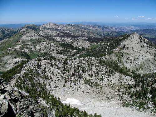
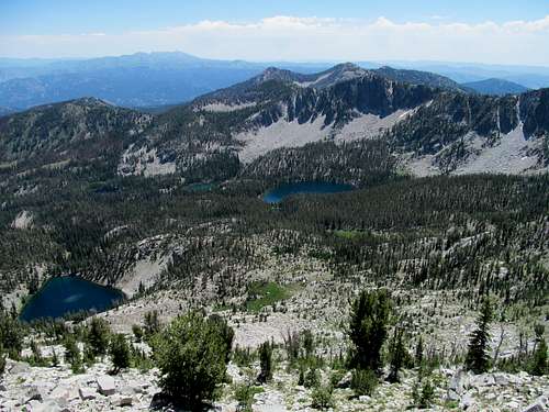
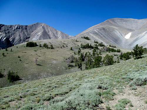
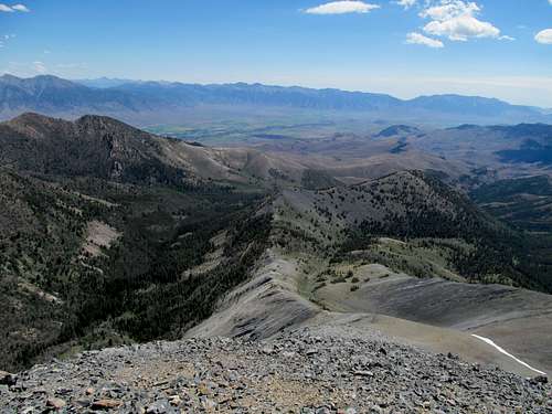
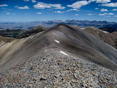
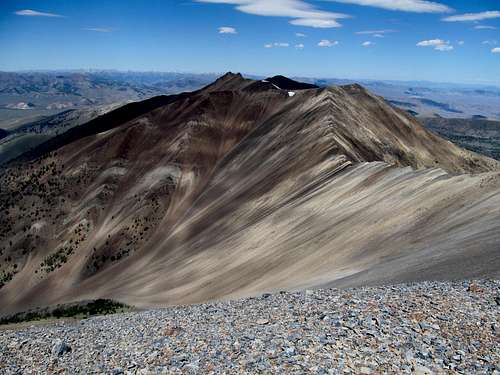
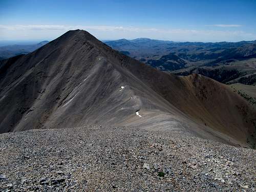
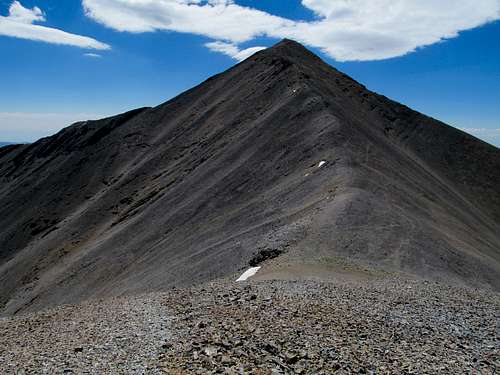
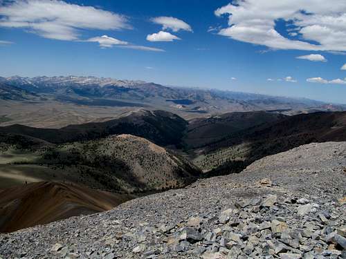
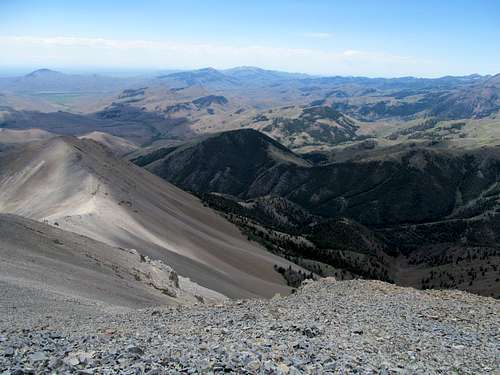
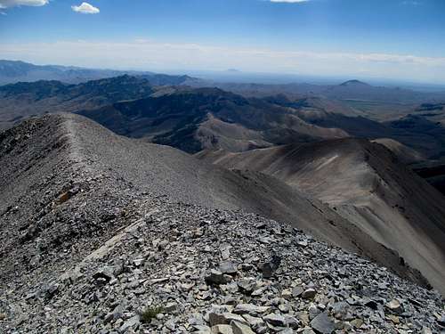
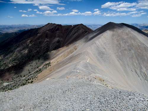
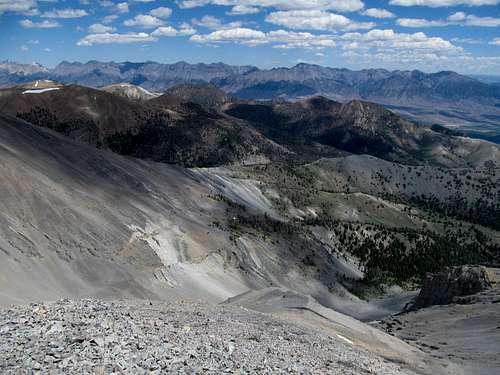
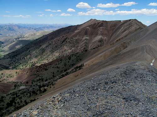
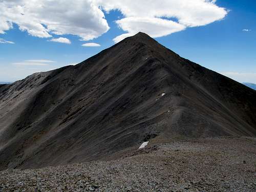
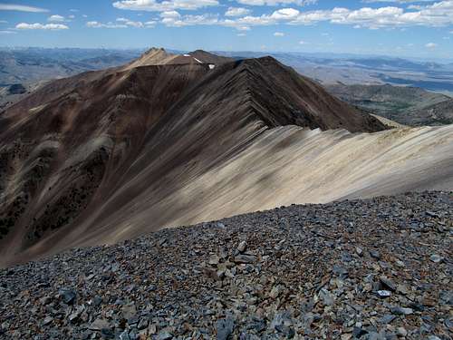
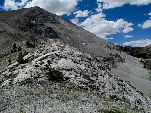
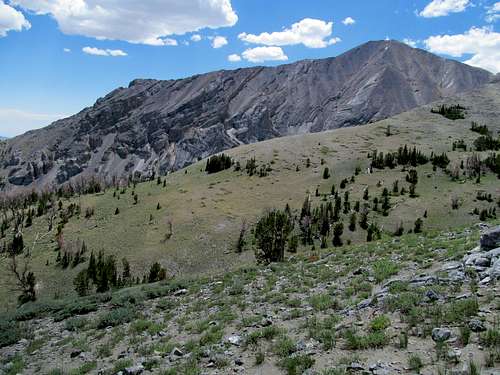
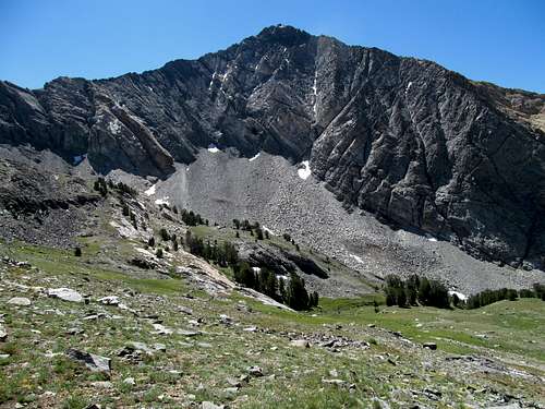
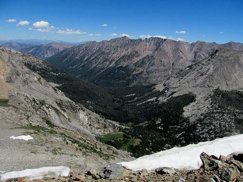
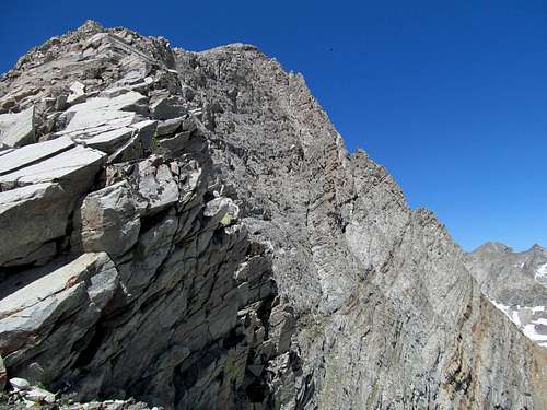
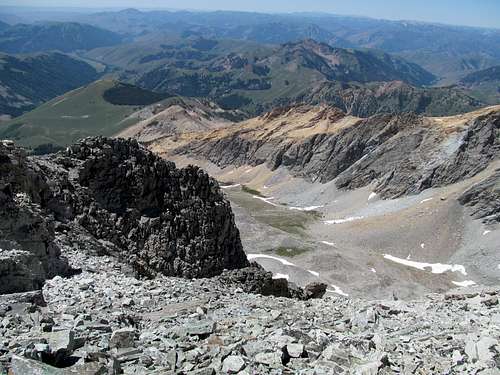
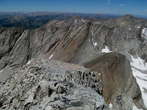
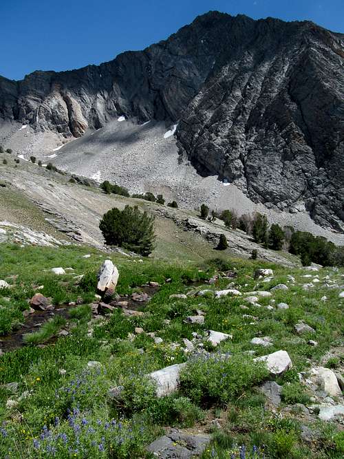
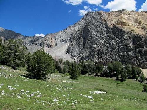
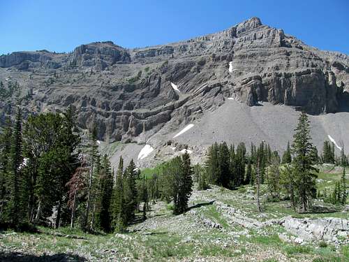
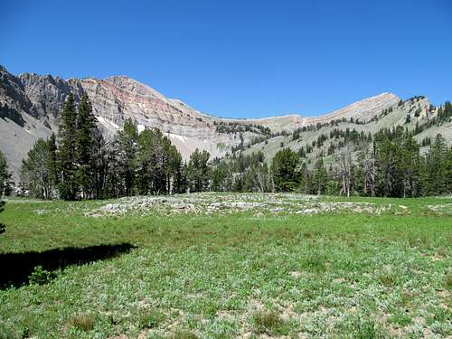
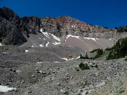
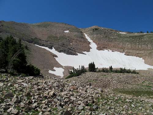
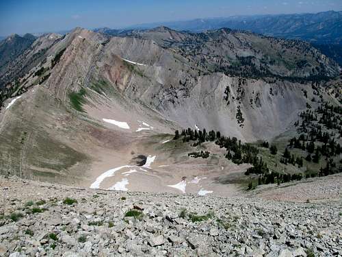
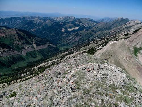
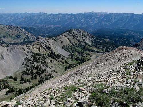
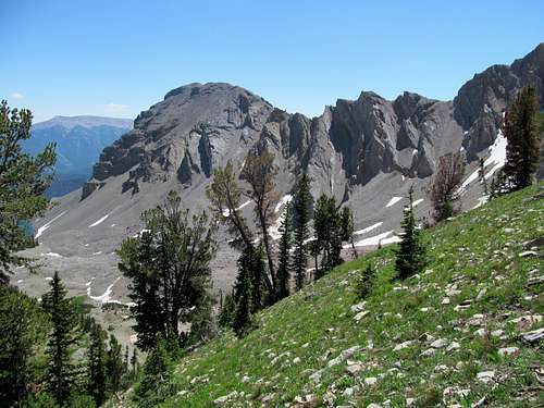
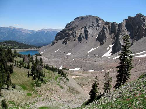
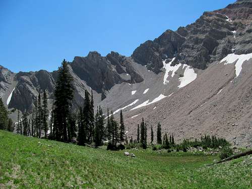
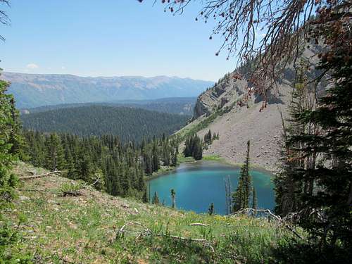
Eventually we reached the upper reaches of the ridge where the steep but grassy slopes with its decent footing turned to talus and eventually some pretty large boulders. As we ascended higher I noticed that these new boots, far from worn in, were drilling holes into the back of my ankles. It was painful but nothing major, so I soldiered on. Both of us were deceived by the terrain, thinking the summit would be close by, further down towards the left of the ridge, but as Greg crested first he told me to prepare for disappointment. The left led towards an anonymous bump ending nowhere, while the impressive hump of Smoky Dome stood towards the right and along a curved traverse along the ridge. I joked around trying to insist the little bump to the left was the true summit while prepping my ankle for its toughest challenge of the day, moving slowly and carefully across each boulder.
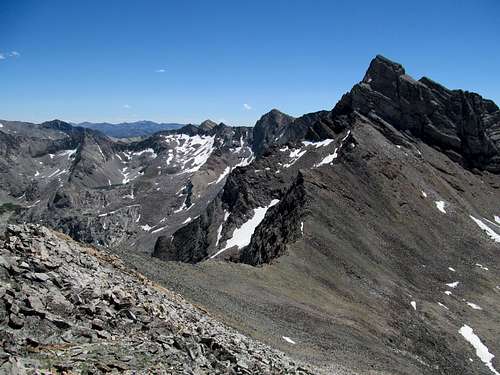
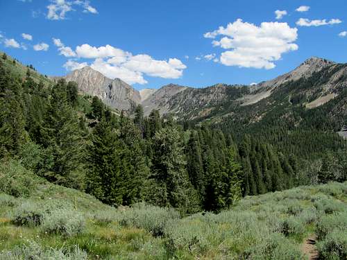
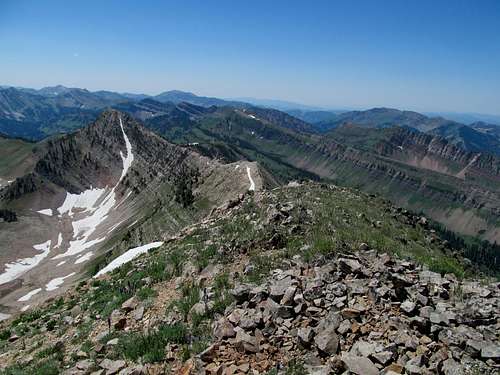
The terrain got better as we approached the summit, and the views from the top were some Billy Joel We Didn’t Start the FireFlames hot. I had climbed along the fringes of the Idaho heartland before, further east atop the Lost Rivers and beyond to the east and south, and west up the peaks north from Boise, but this was the first time I really had a good view into the heart of the rugged central Idaho landscape, the Boise Mountains, Sawtooths, Pioneers, Boulders, Smokies, and the majestic White Clouds. Castle, a peak that Greg had really wanted for a long time now and we had batted around the past summer, stood silent sentry above it all, not the highest peak in view for sure but surely the most formidable looking.
We enjoyed the views for quite awhile before we descended, a straight shot back towards where we started.
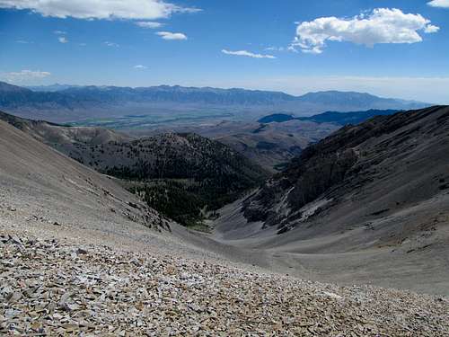
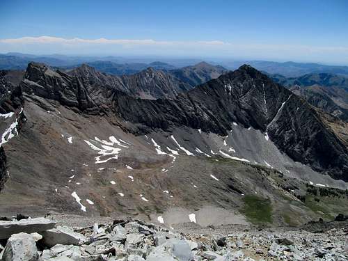
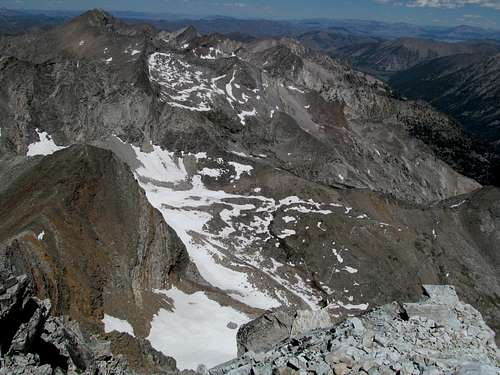
With the entire route in view we were able to pick out the optimal course pretty easily, avoiding the worst of the talus and the marshes. I took it easy on some steeper parts and wrenched my ankle in pain a couple times, but the brace prevented any serious damage.
There were some logistical problems as Greg and Kadee went into Fairfield to get groceries, and without cell reception further towards our rendezvous point near Anderson Ranch Reservoir we fumbled around before finally meeting back up. We enjoyed a swim on the beach, surprisingly crowded, and stopped at a saloon in Pine where I overpaid for a shitty grocery store pizza, dinner for the night, and obtained some liquor in preparation for the crux of this trip…camping. I had wanted to stay in a motel in Mountain Home, but Greg and Kadee persuaded me to camp, especially since I had never camped with the both of them before. I got suitably drunk off cheap brandy straight from the bottle (as well as a couple small sample things of wine), and we got a later start the next morning for Trinity.
Trinity Mountain - July 7th, 2013
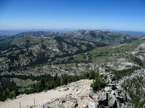
The plan was for me to take it easy on the ankles and walk the 4WD road up to the summit lookout. We first dropped Greg off north at the trailhead at Big Trinity Lake, where he’d take a more circuitous trail and cross country course to Trinity. I then drove back up the very rough roads to park at the junction to the Trinity Lookout Road. The ascent was non-eventful…pretty and nothing too exciting, and I tried frantically to get reception to catch up on the Red Sox score and everything else I had missed from being off the grid the night before.
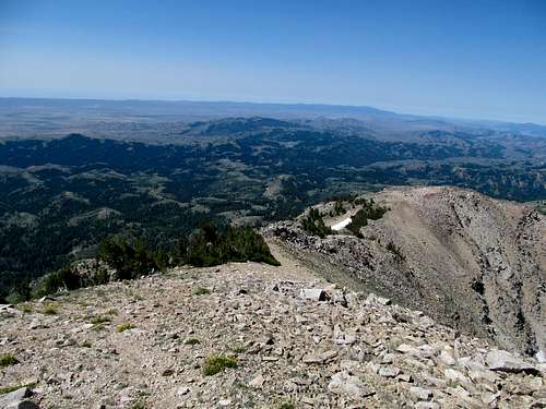
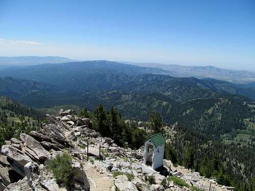
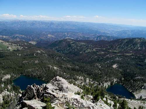
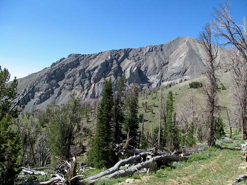
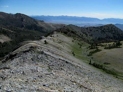
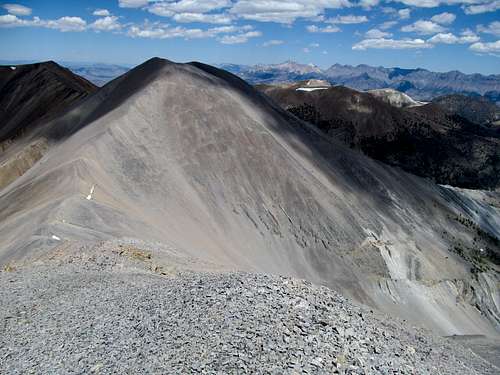
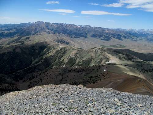
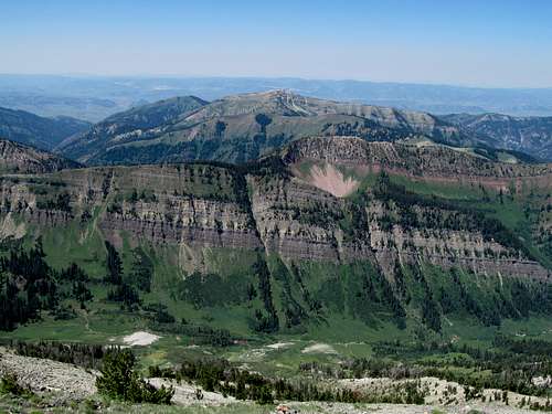
I waited quite awhile at the summit for Greg and Oquirrh to make it up, wondering if they were in trouble. Eventually, after encountering several parties coming and going off the summit, I saw the two coming up the ridge to the south. They ran the rest of the way up to the lookout, and Greg explained that the trail had disappeared and he had wandered awhile lost in the maze of (very pretty) lakes below. For a summit with a lookout tower, a road, and even an outhouse, the views were pristine, Smoky the Bear only you can prevent forest FireFlames hot, and to the east figured prominently the Soldier Range and Smoky Dome from the day before.
We walked back down the road and both made the drive separately past the long and endless roads lining the west side of Anderson Ranch Reservoir. A quick detour was made at Fall Creek Falls, a very pretty waterfall Greg had noticed on Google Earth earlier in the week, before we drove back to SLC.
Shelly & Redbird - July 13th, 2013
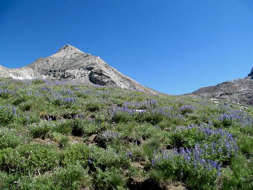
One week later and my right ankle was better, but probably stood at only 70-80% healed. I was concerned about it but still wanted to get some good peaks up north. The weather seemed the most optimal in central Idaho once more, but I was concerned about going up on these remote peaks with a loose ankle on my own. After consulting via text with Matt (Mtybumpo), discussing these peaks that used to be in his backyard, I decided on Shelly/Redbird in the White Knobs, then Hyndman Peak, a 12’er and the highest summit in the Pioneers. Both seemed reasonable, and Hyndman at least featured a trail all the way to the top.
First the White Knobs. I drove up past some stormy weather near Pocatello and Lava Springs on Saturday morning but as promised the skies cleared up by the time I set off on the dusty and barren road towards Arco. The access road into the White Knobs was winding and long winded but ultimately gravel and well graded…a passenger car could make it until the branchoff the last few miles towards the trailhead.
I parked at a junction and continued down the dirt road on foot as I ascended the drainage northeast of Redbird, a summit I would have to traverse over and back to get Shelly, the range highpoint. After a couple easy stream crossings along the dirt road I looked for a smaller dirt track branching left, which would take me up onto the east ridge of Redbird.
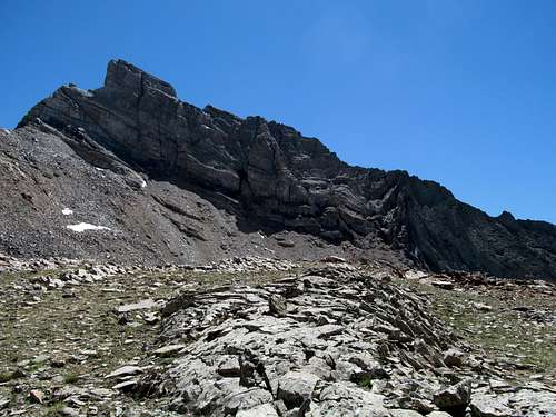
Unfortunately I spotted a faded track maybe half a mile or so before the proper junction, and found myself disoriented as the road disappeared shortly afterwards near a small mine shaft. I decided to just ascend the loose and steep slopes to hit the ridge, passing through some class 3 ledges and testing my ankle on some very uneven terrain.
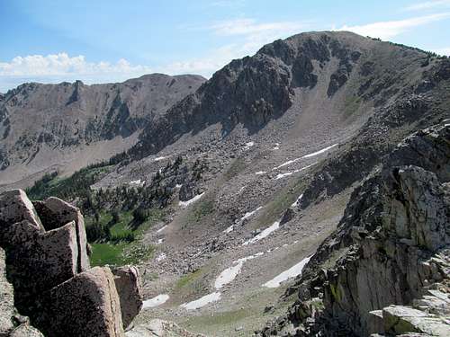
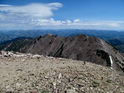
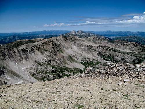
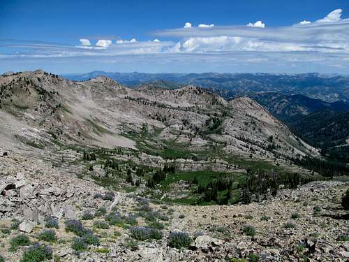
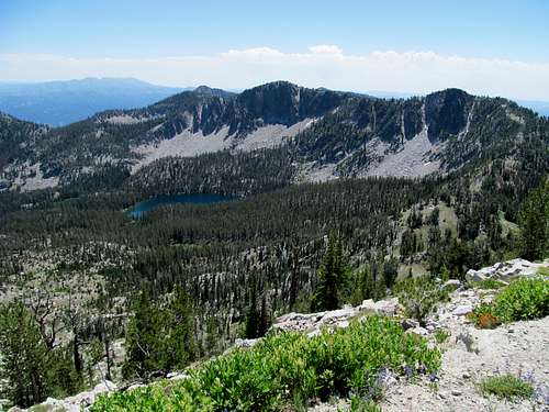
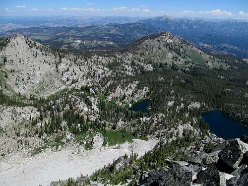
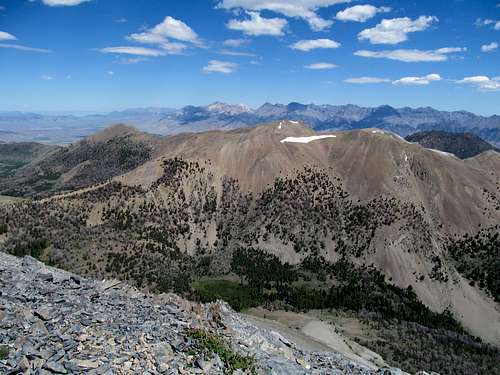
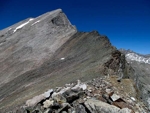
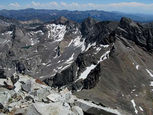
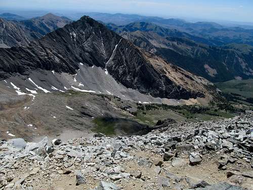
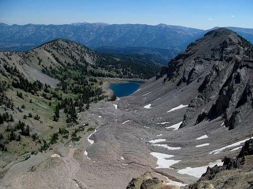
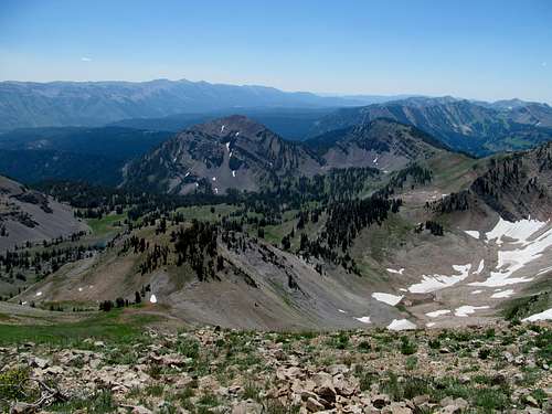
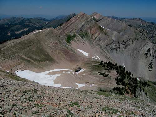
Eventually I made the ridge, which made for a surprisingly easy superhighway to the top of Redbird. To the south Shelly stood rugged with its terraced north face, probably the roughest aspect of the peak. Nearer to Redbird the endless scree along its east face was mesmerizing.
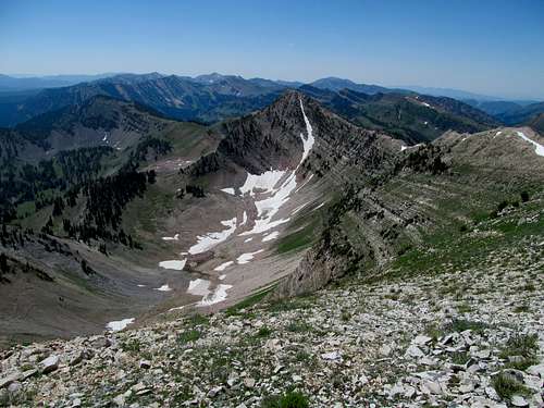
Despite a couple loose areas midway through the ridge the route up Redbird wasn’t too bad for the ankle. I admired the Mt. Saint Helens FireFlames hot views of the Lost Rivers and the Lemhi’s to the east and the Pioneers, Boulders and White Clouds to the west, Castle once more looming ominously in the distance.
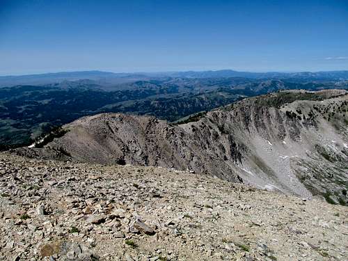
Then it was the tedious descent off Redbird and a quick but slightly rugged ascent up Shelly, which a couple rocky areas but nothing too complicated.
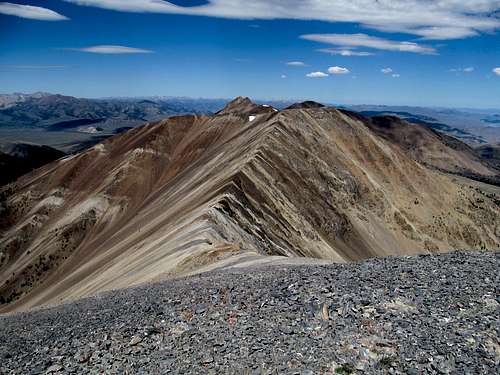
The views were some straight Barnum and Bailey’s Circus lions jumping through a ring of FireFlames hot, especially the colorful lines of shale covering the ridges of Lime and Cabin Peaks, the other two eleveners of the range.
The ascent back up Redbird was tedious, especially since the boots were once more wearing a hole into the back of my ankles, but the descent off Redbird was surprisingly nice.
I chose to straight shot it through the scree lining the east face rather than backtrack all the way back to the East Ridge, and the scree was surprisingly hard packed and solid.
The descent was heaven on my ankles and I found the right dirt road this time to descend back to the main road, where a longer than expected walk in the afternoon heat brought me back to the car. I continued down the dirt roads leading to Mackey which, again, were very well graded and smooth and passenger car appropriate. (If you only have a Sedan you should only have to do an extra few miles of walking each way, nothing too unreasonable).
Holy Hyndman - July 14th, 2013
I had a few drinks in Mackey and got up maybe an hour later than planned Sunday morning. Hyndman would be a long day, but before that was a long drive to the trailhead, as I had to traverse Trail Creek Road, a well graded but long gravel road running from the highway north of Mackey through the saddle between the Pioneers and Boulders, then dropping into Ketchum and Sun Valley.
I drove probably dangerously fast down the road as it wound precipitously down into Sun Valley, where the traffic and construction of the resort town slowed me down all the way to the trailhead.
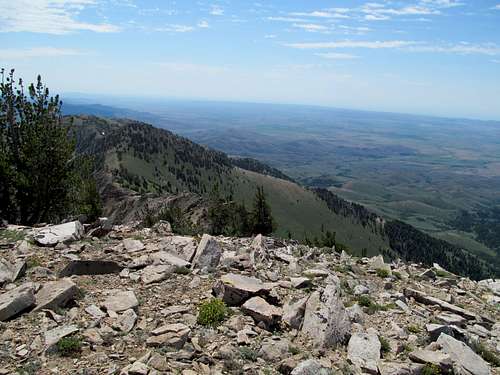
It was already muggy in the late morning as I started down the trail around 9 or 10 AM. The mosquitos were pretty bad in the first meadow past the trailhead but disappeared after a stream crossing shortly afterwards. The stats for the route are around 6 miles one way and five thousand feet of gain, but despite a trail most of the way up, the mountain feels a lot harder than its stats. Maybe it was due to my late start and the heat, but the trail seemed to drag despite the myriad of wildflowers lining the sides, all sorts of shapes, sizes and colors that I had never seen before, and I was sweating well before it started steeply uphill.
The trail continued through some woods which provided me with some much needed shade, and a steady stream of cascades accompanied me the rest of the way as I approached the high basin and the rocky upper ramparts of the range came into view.
The trail finally ascended into the upper basin, passing by the sheer slopes of Cobb Peak to the right and the long and flat saddle between Hyndman and Old Hyndman stood deceivingly close ahead.
And despite its perceived proximity the route through the basin took forever, ascending small rocky terrace after small rocky terrace until a steep huff through some loose rock to gain the saddle; it’s only when you’re higher and have the upper perspective relative to the basin before you see how large and wide the traverse through the basin is. The snow had melted probably fairly recently, maybe only weeks before, so the trail was hard to find at times…not a big deal if you’re used to cross country travel but unnerving when travelling on a bad ankle and the path of least resistance is your goal.
I noticed that for the entirety of the hike most of the people I encountered were on their way down. It seems like the popular way to do the peak among locals (and the Sun Valley tourists) is to backback up, camp at the basin for a night, hit the peak early morning and then descend in the late morning and early afternoon.
Traversing along the saddle towards the ridge was surprisingly a pain in the ass, and the last thousand plus feet from the saddle matched the theme of the day and took forever. The trail was tough to follow as it circumvents the boulders and cliffs.
Where it did exist it was annoyingly loose, you’re typical “climber’s trail”, and I was comforted only by the spectacular views of the rugged neighboring peaks of the Pioneers and the sheer cliffs of Hyndman’s north face.
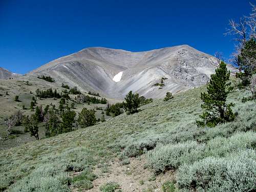
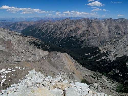
The views at the top were The Roof! The Roof is on Fire!Flames hot, the narrow summit narrow and precipitous, but despite my fear of heights I lingered, not wanting to leave this special and glorious vantage point.
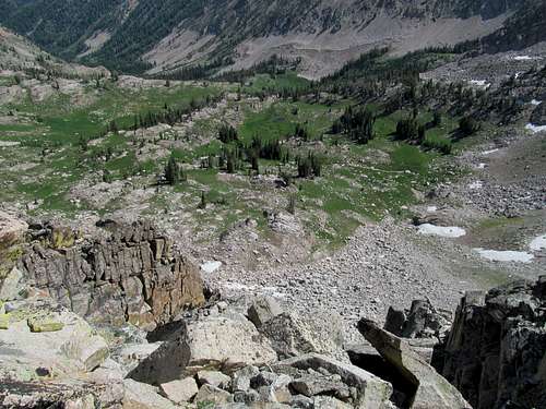
Eventually I descended, opting to boulder hop on a weak ankle two thousand feet down the southeast face of Hyndman rather than try to follow the loose and annoying climber’s trail. The rocks were mostly solid and I made it back to the basin unscathed, the worst damage to the ankle done when I banged it against a small piece of deadfall along the trail further down.
The ambiance was still just as grand on the way down.
I made it back to the car and into Hailey for a delicious crabmeat burrito and a refreshing beer at the Sun Valley Brewery, and refilled myself on coffee for the long drive back.
Fitzpatrick Hat Trick - July 20th, 2013
Yet another week later my ankle was mostly healed, maybe 90%, but the A/C at my apartment was broken, and I lay sleepless through the early hours of the morning frustrated that the uncomfortable nature of the room was hindering me from getting my rightful hours of sleep. Pissed, I finally gave up on the futile attempt to dream and drove furiously through the night, finding a parking area on the side of the highway between Cokeville and the Swan Valley in Wyoming to get a few hours of sleep. I was already in the foothills of the Salt River Range, and heat was no problem as I slept soundly in the back of the 4Runner. I woke in the chilly morning to find a bear paw imprinted on my rear window. Following Greg's directions on SP I found the long and windy Smith’s Fork Road and drove through the woods to reach the top of the Greys River Basin, an area that had long fascinated me ever since I read Bob Sihler’s SP page and dreamed about the wilderness out west while stuck in a cubicle back east.
Reality was a little hazier as wildfires from Idaho settled into the Grey’s River Valley. I found the trailhead without incident and started down the long trail towards Lower Crow Creek Lake, walking aimlessly listening to my audiobook while yelling out “Hey Bear!” periodically.
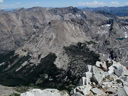
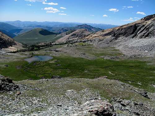
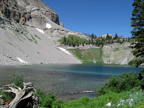
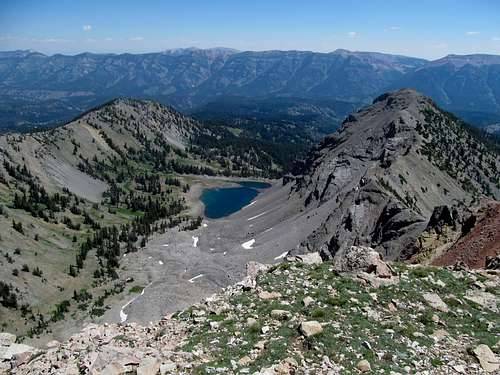
Despite its length the trail seemed shorter than its stats, and after a quick couple of switchbacks I was walking along the rim of a ridge towards the Lower Crow Creek Lake Basin. Even with the haze covering the valley and blocking clear views of the Wyoming Range to the east the views of the crystal clear lake juxtaposed against the rugged cliffs above were breathtaking. I had arrived in Wyoming, and ain’t there nothing like it.
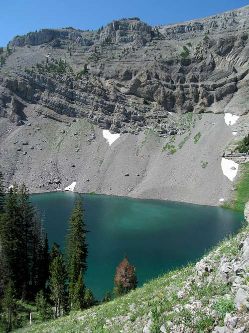
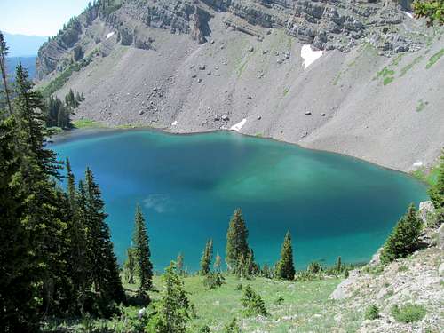
I found the trail to Upper Crow Creek Lake without incident, but past that the trail started to fade.
Some cross country travel brought me to the final northeast ridge, which formed the last 800 or so feet of the ascent.
It was a basic and honest uphill march, starting in grassy meadows and interspersed with a small looser cliff band, before ending on a false summit right next to the peak’s highpoint.
The views were Maggie Simpson sucking on a pacifierFlames hot despite the haze, with eyecatching views of the long and unique ridges of the Salt River Range. I could only imagine how amazing the experience would be if the view from atop the peak were as pristine as that of the tableau of the two lakes below.
The descent passed pretty quickly too, interrupted by a rough patch between the upper ridge and Upper Crow Creek Lake.
Unable to find the trail leading back down towards the lake, I ascended through a short but very steep hillside lined with some narrow and loose ridges. I survived and navigated through the steep and grassy slopes, refinding the trail and enjoying the presence of the two lakes before a long and somewhat boring trod back to the trailhead.
The drive down the Grey’s River Road towards Alpine was pretty but like the hike, encumbered by thoughts of what could have been had the day been less smoky. The river was surprisingly crowded, and I passed by lots of cars and fisherman and ATV’s, especially as I drove closer and closer to Alpine. I checked into a cheap motel in town and wished away the haze. My wishes weren’t granted, and the smog would prove to be the least of my problem the coming weeks ahead.
PS. All fireflames comments courtesy of the stool


Comments
Post a Comment