
-
 21820 Hits
-
 87.76% Score
-
 25 Votes
|
|
Mountain/Rock |
|---|---|
|
|
47.73465°N / 121.48454°W |
|
|
Download GPX » View Route on Map |
|
|
Hiking, Mountaineering, Scrambling |
|
|
Spring, Fall, Winter |
|
|
5043 ft / 1537 m |
|
|
Overview

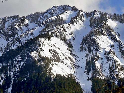
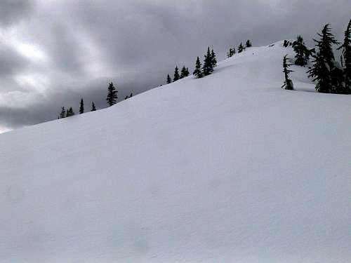
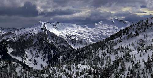
Palmer Mountain's Summit
Contrasting Light on Lennox : Taken March 21, 2011
 View through the Trees |  Cosby Peak |  The Quarry |  Tree Cone |  Pathway |
Getting There
From Seattle: Head east onto the Highway 520 bridge which goes over Lake Washington. Then take a left (North) onto I-405 until your at Bothell. Then take a right onto Highway 522 which goes to Monroe. In Monroe take a left (East) and follow along highway 2 for a while. After passing the straight away section in the city of Baring keep your eyes peeled for a sign that says Money Creek Camp Ground. Take a right from highway 2 onto NE Old Cascade Highway. After crossing the bridge look for FR 6030 which will be the first one on the right (I missed this turn easily thinking it was further). Soon you reach a fork in the road, stay on the main one which is to the right. This road turns into fs 6031 as you drive along. Go as far as you can comfortably go, (in my case there was a tree in the road) sometimes there is water that runs through the road which may make driving difficult. No matter what the conditions are, there is a washout at Lowe Creek which if lucky would be the current trail head.
From Everett: Pretty much the Same Directions As above except for access to Monroe which you would go right onto Highway 2 and then follow directions after Monroe.
From Leavenworth: Drive West along Highway 2 over Stevens Pass, after passing though the city of Skykomish hold out your suspicions. Fortunately finding the turn off onto the NE Old Cascade Highway is easy to find which you'll see a sign that says "Money Creek Camp Ground" which will be on your left. Also just before the turn off you pass under a tunnel which makes it even more obvious. Then after the bridge take a right onto fs 6030 which eventually turns into fs 6031 which you go as far as you can.
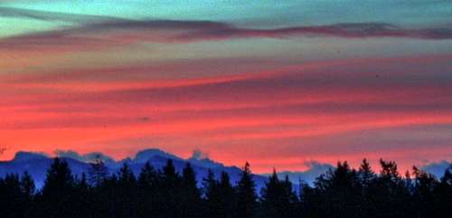
![Sunrise from Highway 2]()
View along the Way to Palmer
From Everett: Pretty much the Same Directions As above except for access to Monroe which you would go right onto Highway 2 and then follow directions after Monroe.
From Leavenworth: Drive West along Highway 2 over Stevens Pass, after passing though the city of Skykomish hold out your suspicions. Fortunately finding the turn off onto the NE Old Cascade Highway is easy to find which you'll see a sign that says "Money Creek Camp Ground" which will be on your left. Also just before the turn off you pass under a tunnel which makes it even more obvious. Then after the bridge take a right onto fs 6030 which eventually turns into fs 6031 which you go as far as you can.
View along the Way to Palmer
Route Information
So the beginning may be "the crux" of the trip or not depending on how much water flow there is in the creek. When I went through it was a simple leap while other times it can be tricky crossing. After crossing the creek continue following the road which soon curves around the hill. Soon you reach a fork in the road which you take a left. Very soon after this you take a left into the woods which catches the ridge. The ridge starts out wide making it not seem much like a ridge, but eventually becomes more ridge like as you go higher.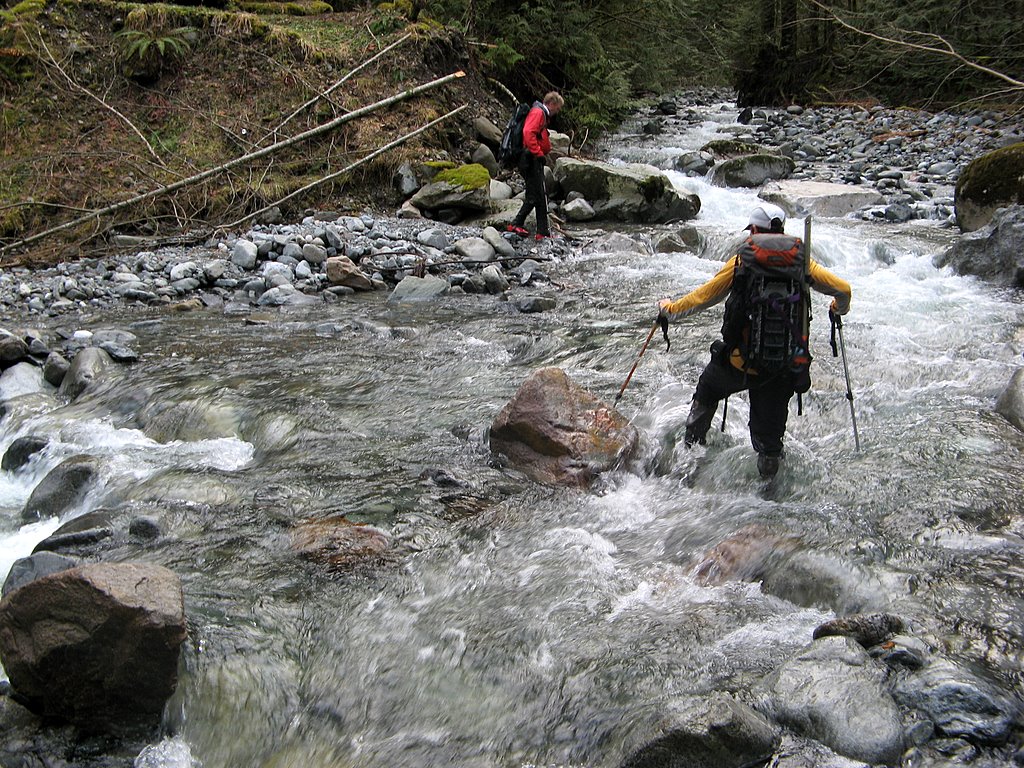
The Creek Crossing
Grotto Mountain View
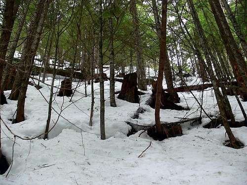
The Trees on the Way Up
Gunn Peak with a Gloomy Atmosphere
The ridge may have some fallen over trees and is tree covered although does offer some views if you take a look behind you. In winter time the woods were not bad for traveling, with little brush. As you go up the ridge you'll encounter a road which you should ignore and continue going up. Way later on up the ridge you encounter a part called "The Quarry" which is a large Gap in the Mountain. For a few seconds you should be on the road which be sure to take a right, I made the mistake of taking a left which ended up on a steep ridge off route. At the end of the road you reach an area where it looks like it's going to get steep if you proceed, be sure to take a left here which goes onto the ridge. From here getting to the summit becomes less complicated although with a few spots that I had to stay alert on. When reaching a clearing section be sure to take a left which stays on the ridge, I was tempted to go right off the ridge which would have been off the route.
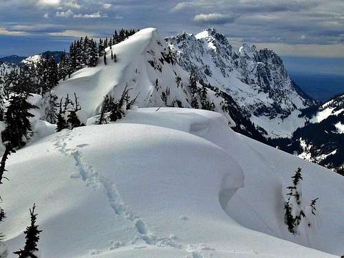
From here it is "pure ridge walking", it gets wider on some spots but easy to follow. Once you get to about 4,000 feet that is when the views really start breaking out. As you go higher, there becomes less trees and more photo opportunities. As you get near the top, don't be fooled by the false summit which you end up traversing around it.
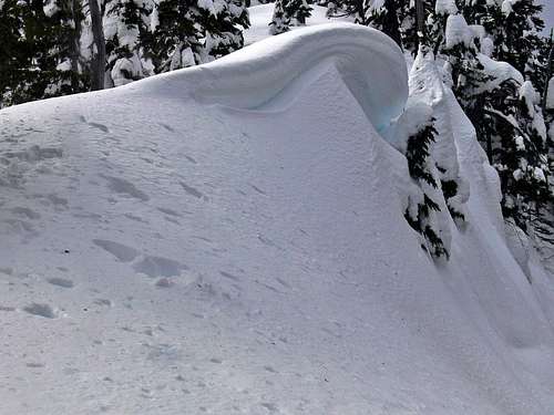
The Cornice Section
The False Summit
I know the summit looks like it's right there at this point, but you still have to go around the summit block by traversing the South Side of the top. Then on the SW side you go a little ways down into the gully section. The gully can sometimes get icy from what I hear so be prepared, when I was in it there were some pieces of ice coming down. So ascend the gully, from here the summit is on your right which is an easy walk for about a few hundred feet. On the summit your rewarded with great views of Mount Index, Baring, Crosby, Lennox, and many more! Also be careful, cornices do form on this summit which although I was able to look over the summit, I did not actually touch it due to the danger.
Looking Towards Mount Index
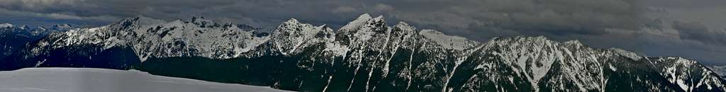
Wild Sky Wilderness Panorama from the Summit
 The River Below |  Cornice over the Gully |  Shifting Sky |  Looking Towards Index |
 To the Summit |  Water Ice Along the Cliffs |  The Cliffs Above |  Cornice on the Ridge |
The Sun Attempting to Make an Appearance
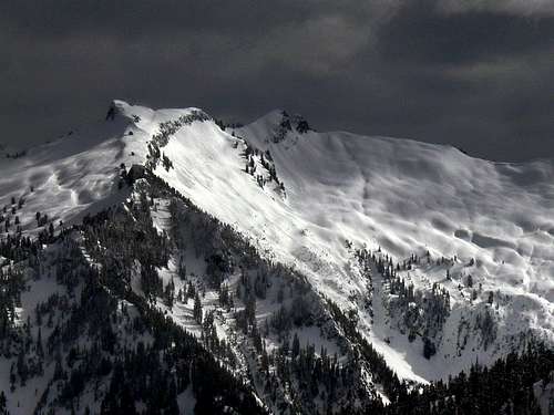
Lennox Mountain Panorama
Red Tape
A Northwest Forest Pass is not required at the "parking lot" because there is no trail head that says anything about parking passes, but may be recommended so that your car does not appear abandoned.
There are no rules or restrictions to climb Palmer Mountain, nor are there permits needing to be filled out like most Cascade Peaks.
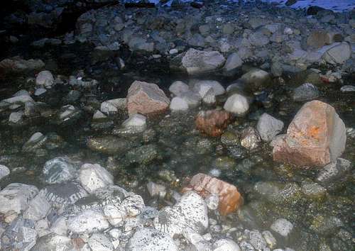
As for filtering water, at Lowe Creek is one ideal location as well as a few other minor creeks on the mountain. But besides that I did not find many spots for filtering water.
There are no rules or restrictions to climb Palmer Mountain, nor are there permits needing to be filled out like most Cascade Peaks.
As for filtering water, at Lowe Creek is one ideal location as well as a few other minor creeks on the mountain. But besides that I did not find many spots for filtering water.
Camping
Although this mountain is most of the time done in a single day there are some nice places you could camp. One being the Query which is on the last section of road, there are also some other areas along the road you could camp on.
Perhaps the best place to camp would be near the summit around 4,300 feet or so where the slopes on the route get a bit smoother and have a nicer view.
Perhaps the best place to camp would be near the summit around 4,300 feet or so where the slopes on the route get a bit smoother and have a nicer view.
Mountain Conditions for Palmer Mountain
For Weather information check in with the Noaa Forecast.
For Avalanche forecast's check in with the North West Avalanche Center.
Click here for the road conditions to the trail head.
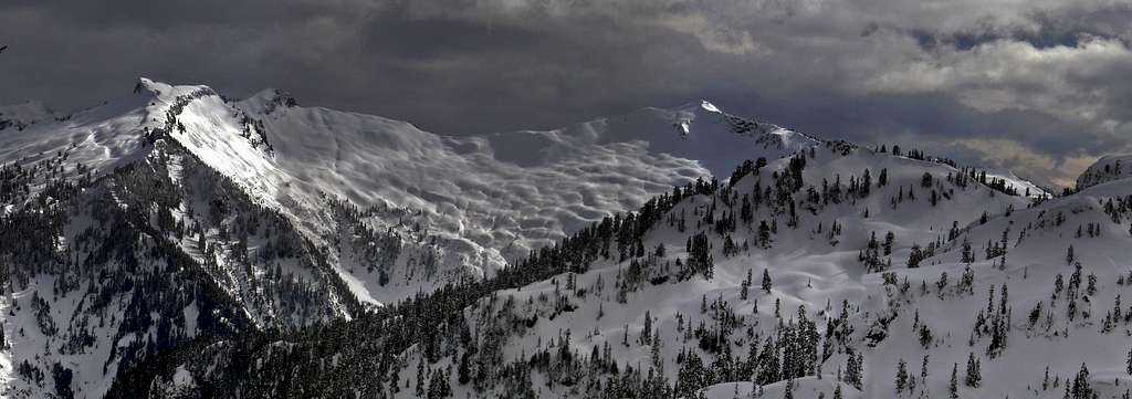
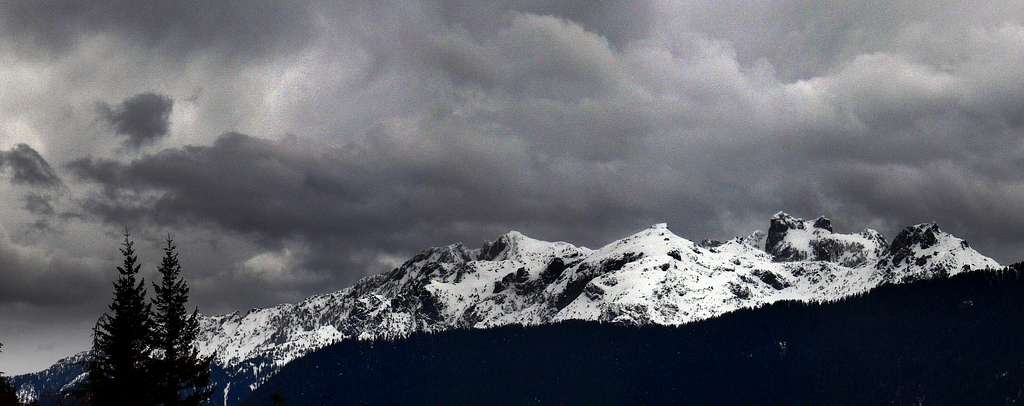
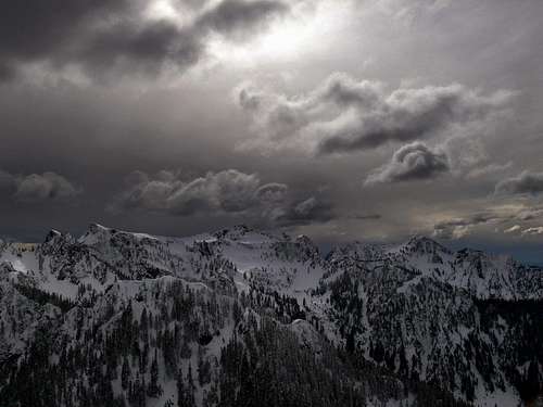
![Lennox Peak with Dark Clouds]()
View of Dark Clouds from Palmer Mountain
For Avalanche forecast's check in with the North West Avalanche Center.
Click here for the road conditions to the trail head.
View of Dark Clouds from Palmer Mountain
Topographic Maps
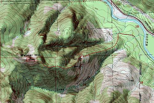
Topographic Map of the Route
External Trip Reports
- Matt's 2011 Trip Report
A Modern Trip Report on this Peak Posted on Nwhikers - Beave's Trip Report
Informational with Plenty of Photos - Mike Collin's Trip Report
A Short Write Up of a Trip during December 29, 2000