
|
|
Route |
|---|---|
|
|
5.20000°N / 60.77°W |
|
|
Scramble |
|
|
A few days |
|
|
Class 4 |
|
|
Approach
To reach the trailhead, you must make your way to San Francisco de Yurani. San Francisco can be reached by bus. Most people ride the bus all the way there from Caracas, Ciudad Boliviar, or Ciudad Guyana. Others fly to Santa Elena which is only a few hours south of San Francisco de Yurani, and take the bus up from there. There are some rather grubby hotels in San Francisco de Yurani, and a few restaurants. We were allowed to camp in the futbol (thats soccer for gringos!) field. There is a small selection of food in some stores, but I would recommend bringing most items from a larger city.The actual trailhead is in Paratepui, which is 22kms (14 miles) east of San Francisco de Yurani. Most hire a vehicle in SF de Y, but it can be walked in a day for those who wish to save a few bucks (not recommended). A vehicle cost $100 in 1996 and can hold 6 people with gear.
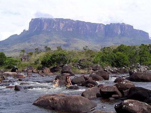 Kukenan from the Kukenan River.
Route Description
From Paratepui, follow the old un-used road east. There are several shortcut trails that bypass some long detours of the old road. You will see the peak ahead for most of the route. The peak on the left is Kukenan; Roraima is the peak to the right. There are a few river crossings, which you must do on foot (no bridges). The Rio Tex crossing can be problematic after rains. The trek out to the base of the peak can be hot, sunny, and shade-less across the Gran Sabana. Rio Tex is the first major river crossing on the main trail. It is here that you leave the main trail (the main trail leads to Roraima).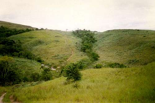 The section of the trail near Rio Tex.
Shortly after crossing Rio Tex, look for a lesser use trail branching off the main track to the left. This is the trail to Kukenan Tepui. If you're lucky enough to have clear weather, your objective will be visible in front of you the entire way. The route to the summit climbs and incredibly steep gully to the left of the highly visible Kukenan Falls (Salto Kukenan). The route is straight forward, but not easy. Mud makes the trail to the summit extremely difficult. The gully has over 5,000 feet (1500 meters) of very steep elevation gain and is very slippery. In technical difficulty, the most difficult sections are only class 4, but the route is very slippery, wet, and long, with some exposure, which makes it seem more difficult. Conditions were not ideal when we visited, and we didn't get a chance to reach the summit plateau, so a little luck with the weather is needed. See Trip Report. A rope is needed for packs, especially while descending. Get a very early pre-dawn start on the climb to assure that you don't get caught out in the dark! The Rio Tex has a nice campsite, but it is recommended that you hike further in order to shorten the second day. If you're not at the base of the steep gully by dawn, forget about attempting the summit! What ever you do, try to arrive on the summit early in the afternoon to look for a campsite among the swamps and boulders (this may take several hours).
The summit plateau is very misty, foggy, and rainy almost all of the time, and there is a maze of rock formations on top. It is extremely hard to navigate on top, so take care not to get too lost! It is recommended that you camp on top a few nights and spend at least one full day on top. There is much to see and explore.
Other routes other then the one described are very seldom attempted. Rock climbers can find several "first" all over the sides of this peak.
 Kukenan Tepui.