
|
|
Mountain/Rock |
|---|---|
|
|
48.93332°N / 117.1519°W |
|
|
Pend Oreille |
|
|
Hiking, Mountaineering |
|
|
Summer, Fall |
|
|
7177 ft / 2188 m |
|
|
Overview
Peak 7177, by virtue of not having an official name, can be a deceiving peakbagging destination. The mountain is one of many peaks located within tiny yet very mountainous Pend Oreille County, in the northeastern side of Washington. Peak 7177 has enough prominence (417'+) to be considered a true mountain, despite being found only a short distance from the highest point in the county, Gypsy Peak. In fact, Peak 7177 is the third-highest mountain in the county, behind only Gypsy Peak and Hooknose Mountain.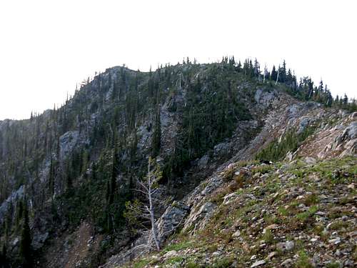
Peak 7177 is located along the standard ridge approach for Gypsy Peak. The only highpoint/bump that separates the two peaks is Point 7033, which does not have enough prominence to qualify as a true mountain. Centrally located along the off-trail section of the standard approach for Gypsy Peak, Peak 7177 is a good turnaround destination in the event of sudden inclement and/or hazardous weather. Peak 7177 is also the first mountain from which to get a great view of Gypsy Peak and Watch Lake, both located north of the mountain. Many outdoor enthusiasts traverse down to Watch Lake, a popular camping location, from the saddle on Peak 7177's northwest side. Great views can be had in all directions from the open summit.
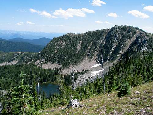
Watch Lake and North Side Of Peak 7177
Getting There
Per Paul Klenke, on the SummitPost page for Gypsy Peak:
1) To get to the trailhead, the easiest way is to take Sullivan Lake Road from Metaline Falls.
2) At the lake, continue east on FR-22 in the valley bottom or FR-2212 on the southeast slope of Crowell Ridge--the latter goes past the junction for the road up to Sullivan Mountain.
3) If taking FR-22, go about 4 miles to the junction with FR-2200 (FR-22 turns right).
4) Continue on FR-2200 for about six miles to the east-end junction with FR-2212, taking it up the hill a couple of miles to the FR-200 junction. Take FR-200 northeastward for several miles until reaching the trailhead.
NOTE: FR-200 has a gate that is closed from August 15 through November 30 to help preserve wildlife habitat. FR-2212 is closed from December through May for the same reason.
HIKING INSTRUCTIONS:
1) Hike the Sullivan Mountain Trail for approximately one mile, until the trail reaches its highest point below Point 6617.
2) Begin hiking off-trail steeply uphill, heading north, to Point 6617.
3) Continue hiking along the ridgetop, traversing over or around Point 6853, until reaching Peak 7177.
ROUNDTRIP HIKING DISTANCE: Four miles with ~1600'-2000' elevation gain (depending upon whether Point 6853 is side-traversed or ascended/descended).

South Slope of Peak 7177
Red Tape
There are no fees or permits required to visit Peak 7177. However, there is a trail register/sign-in at the trailhead.FR-200 is recommended for high-clearance vehicles only. The other roads used for the standard approach are passable for a passenger vehicle.