
Comments
No comments posted yet.
|
|
Article |
|---|---|
|
|
Hiking, Mountaineering, Trad Climbing, Ice Climbing, Big Wall, Mixed, Scrambling |
Previous facts
Peru, the "land of the Incas", the latest in chronological order and the most powerful among the various ancient civilizations, such as the Wari, the Chavìn and the Moche, who thrived for centuries on the territory of this fascinating country. Regarding these ancient civilizations, it remains a cospicuous testimony in the archaeological remains throughout Peru. A country of lively colors, strong contrasts and surprising geographical and landscaping differences: the coast of the Pacific Ocean, the Nazca desert with its enigmatic lines, the lush Amazonian forests, the high lands around Lake Titicaca, the perennial snows of the mountain ranges are just some of the many aspects.
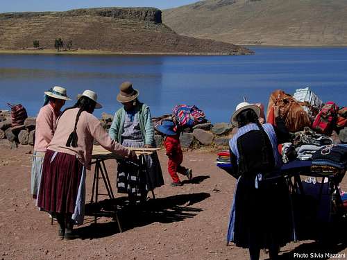
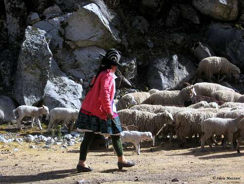
The attentive traveler will also be impressed by the great variety of ethnicities and cultures and by the deep social differences, which the explosive development of the last twenty years has not been able to defeat. There are numerous native animal species, but the condor is the undisputed lord of these ethereal spaces and its sudden appearances have surprised, enchanted, sometimes even threatened ... Crossing the skies with its majestic flight, it accompanies the adventures of mountaineers on the peaks. The high lands, the snows of the Cordilleras, the crevassed tropical glaciers, the colorful local markets, the ruins of the ancient Inca cities lost in the mountains are an important aspect in the life of the country.
The images of the Peruvian Andes had lived for years in my imagination through the dream born during an exciting trip, spent between an improvised "Inca Trail", long train rides through the mountains, the suggestions of the Andean music, the crowd bath at Cuzco during the event called “Inti Raymi”. A journey during which the peaks appeared as a mysterious and evanescent background and for this very reason extremely attractive. Sooner or later I would have to return, to get a little closer to the beauty of the transparent Andean skies and try to touch those glittering ridges admired from afar.
The Andes
In the aspect of a cordon crossing the South American continent for about 7500 kilometers lengthwise, from Venezuela to Tierra del Fuego, the Andes are the longest mountain range on the planet. In their run from Norte to Sur they cross different states, assuming very different characteristics from region to region, and are divided into nine main sectors: Venezuelan, Colombian, Ecuadorian, Peruvian, Bolivian Andes, Atacama region, Chilean-Argentine Andes, with the culminating peak, Aconcagua 6959 m, Patagonian Andes and Tierra del Fuego.
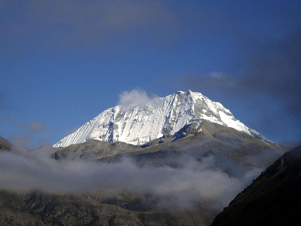
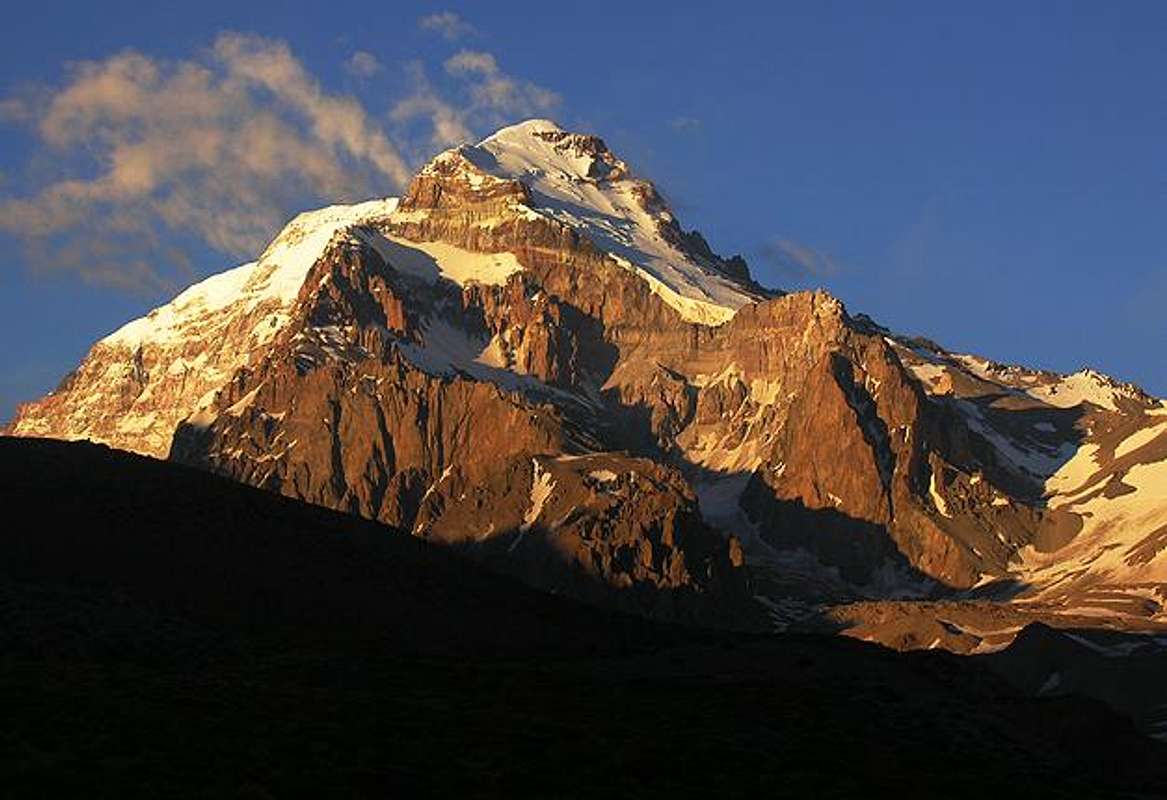
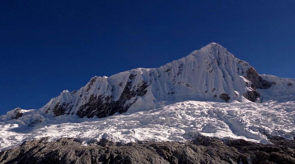
In the Peru territory there are 24 Cordilleras, located between the 6th and 18th parallel South. Neglecting the small Central chain, the Cordilleras are basically organized in two parallel chains: the Oriental and the Occidental. In the Oriental we find some attractive mountain groups, quite well known and explored, such as the Cordillera Vilcanota and the Cordillera Apolobamba, but the greater proximity to the Amazon rainforest makes the climate rather unstable. It is in the Occidental where we meet the most scenic Cordilleras and the most impressive mountains; the most admired are undoubtedly the Cordillera Blanca with the Nevado Huascaràn 6768 m, the highest peak in Peru and the fourth on the continent, and the nearby Cordillera Huayhuash with Nevado Yerupaja 6634 m the second mountain of the Peruvian Andes.
Cordillera Blanca and Huascaràn National Park (PNH)
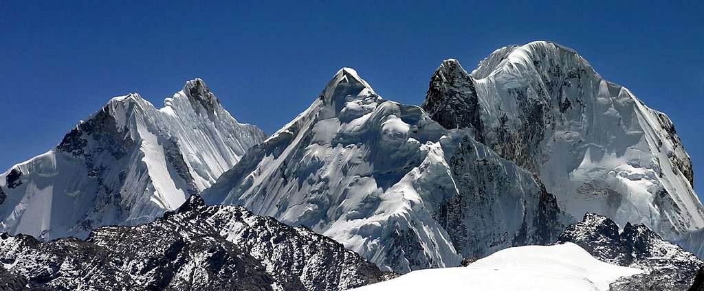
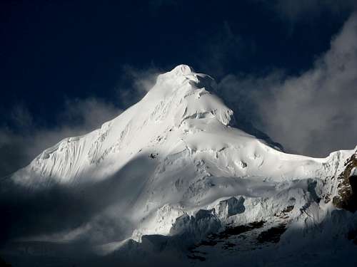
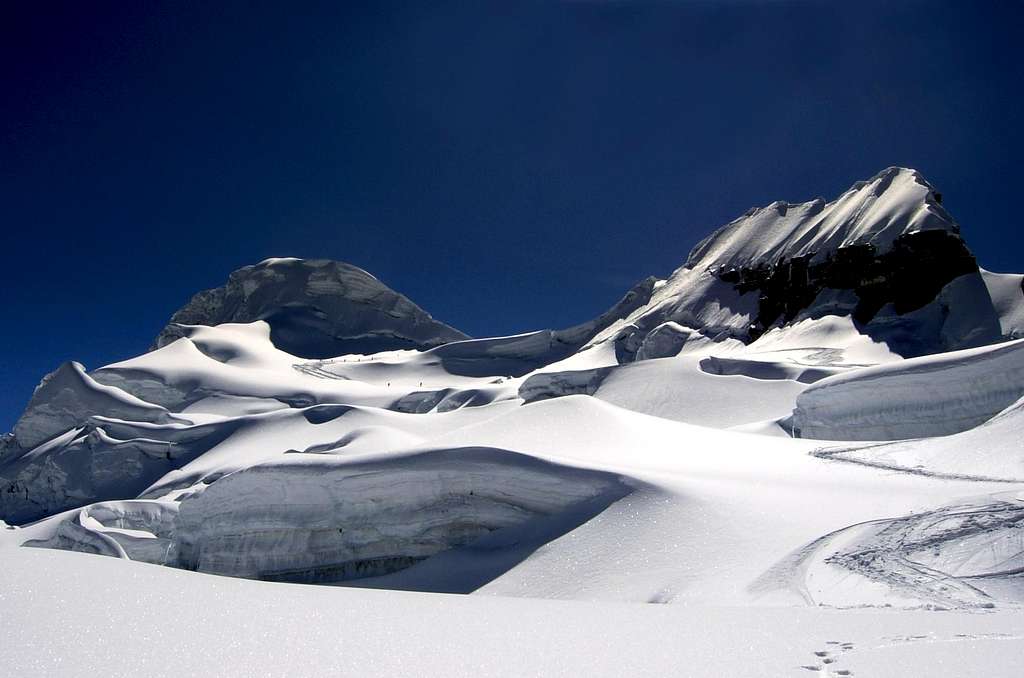
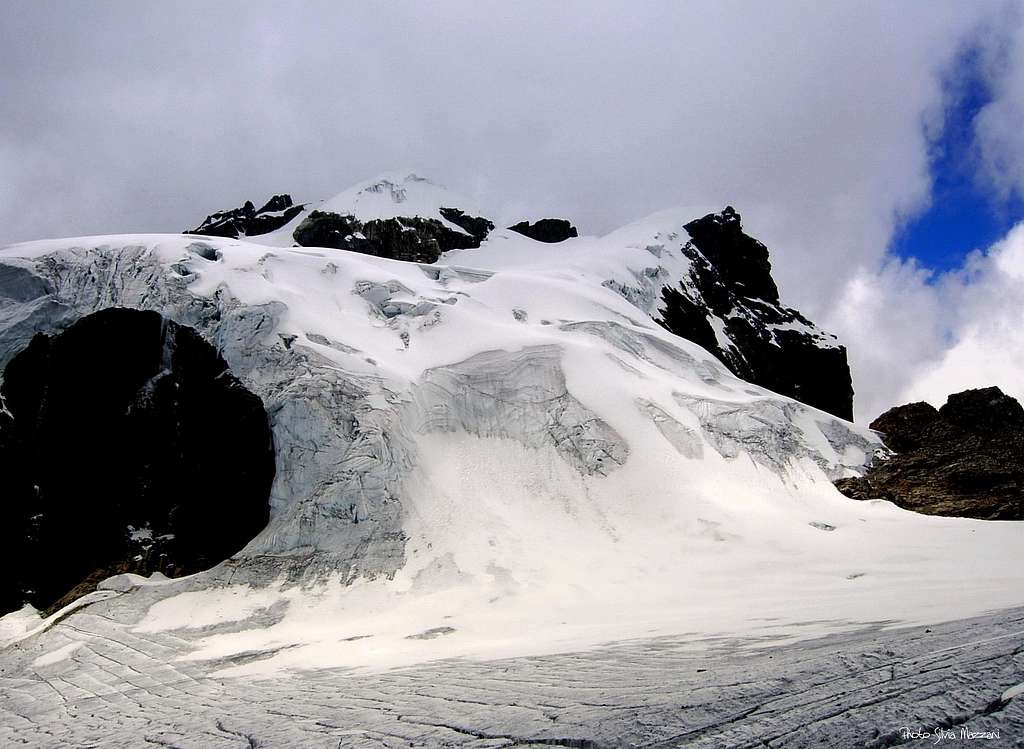
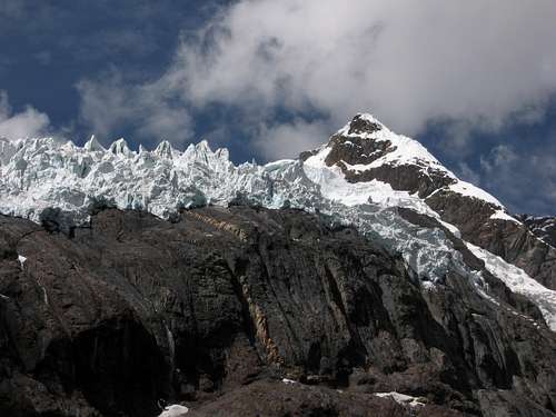
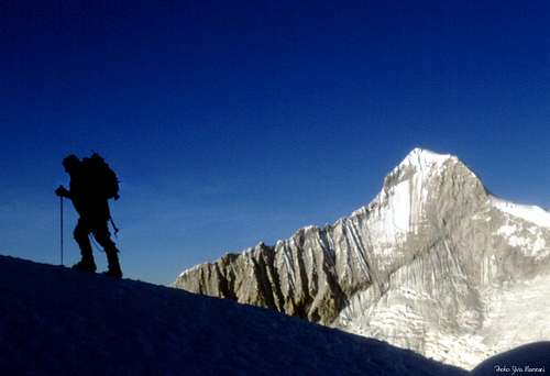
Peaks embroidered with ice, very white crests edged with frames, luminous walls with organ pipes, "quebradas" dotted with turquoise lagoons, daring, unforgettable mountains, which stand out brightly in the sublime transparency of the skies: the Cordillera Blanca fascinates and offers itself as a wonderful playground for climbs of any difficulty.
"The mountains become great through the presence of mountaineers who look at them with admiration, and try to climb them, and through the events of the peoples who inhabit them": this is particularly true of the mountains of the Cordillera Blanca, an extremely lively territory, throbbing with humanity.
The Cordillera Blanca is located 9 degrees South of the equatorial line; it is 180 km long and runs in the NNW-SSE direction parallel to the Pacific coast, which is only 100 km away, and to the great valley of the Callejòn de Huaylas, at the southern end of which is the city of Huaràz. From the Callejòn the various “quebradas” branch off perpendicularly, these one are the valleys that penetrate towards the mountains, some of which can be connected to each other by organizing imaginative acclimatization treks… Seeing is believing!
The Cordillera Blanca has climatic and environmental characteristics that place it halfway between the Alps and the Himalayas and is covered by numerous and majestic glaciers, today unfortunately in a marked reduction phase due to the "global warming", whose effects on the surfaces ice are particularly evident at these latitudes.
The dry season coincides with the local "invierno" (wintertime) - from June to September - during which generally there are more or less lasting periods of good weather, especially in the initial part; the climate is never extreme, although temperatures undergo considerable variations from day to night, as do the conditions of the slopes and ridges, which change enormously depending on the exposure. Consider that being in the Southern hemisphere, the exposure to sunlight of the walls is exactly the opposite of the Alps: the North walls are the sunniest, while the poorly lit South walls are the last to come into condition.
Most of the Cordillera Blanca is located within the Huascaràn National Park (PNH), established in 1975 on the initiative of the North American mountaineers Curry Slaymaker and Michael Rourke, the climber Cesar Morales Arnao and the administrator Augusto Guzmàn and inserted in full title in 1985 in the list of natural sites recognized by the UNESCO. Initially the Huascaràn National Park had the objective of protecting the area around Nevado Huascaràn, but was subsequently extended to currently cover a total area of 3400 sq km.
Nevado Chachani, the discreet charm of Arequipa's volcanoes
Yes, Cordillera Blanca, but the Cordillereas present in the area are even 24... After several ascents the time has come for a different experience. In the surroundings of Arequipa "la blanca", an ancient pre-Inca city in Southern Peru, subsequently re-founded by the Spanish, there are several volcanoes, some of which exceed six thousand meters of altitude: Ampato, Corupuna, Misti, Hualca-Hualca, Chachani. The mountains emerge with their white peaks from the boundless high altitude desert, populated by numerous specimens of alpacas and vicuñas and furrowed by the deep Colca Canyon.
The ascent to the lunar Nevado Chachani 6075 m along the Ruta Norte or Azufrera does not pose any technical difficulties. There are no crevasses and it is not necessary to proceed as a roped party, but it should not be underestimated: the altitude is particularly felt, due to the cold and extremely dry climate, characterized by a very strong temperature range. However, the ascent reserves a very interesting experience, particularly if carried out in the months of June or July, at the beginning of the dry season, when the weather is stable and the mountain is still covered by ice with its suggestive "penitentes", thin and close together blades of hardened ice, oriented towards the direction of the sun. The name derives from the resemblance to a crowd of people in prayer.
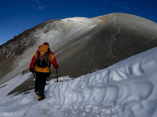
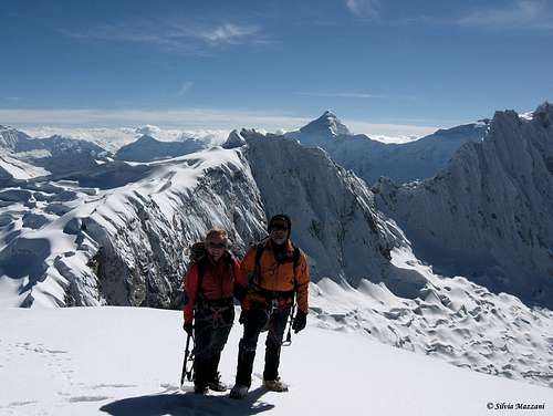
I propose some classic selected itineraries which, in addition to climbing different peaks, allow you to travel and discover five different "quebradas" among the many in the Cordillera Blanca. The base for all ascents is the well-known town of Huaraz 3060 m.
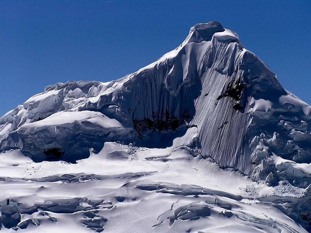
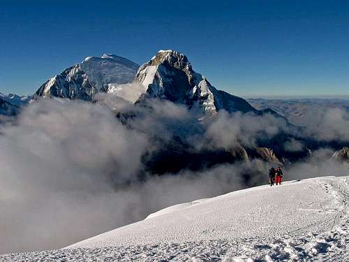
Tocclaraju is certainly the most fascinating mountain among those ones located at the head of the Quebrada Ishinca and one of the most beautiful in the whole of Blanca. Its perfect ice pyramid, clearly visible from Base Camp, takes on a magical light at sunset and irresistibly attracts the gaze of the mountaineer intent on observing the beauty of the valley. It is a fairly challenging Seimila, but not too much, the climb of which involves a moderate path on the glacier, a more technical final stretch with the summit mushroom and an aerial ridge towards a perfect summit. What more could you want? Some problems in overcoming the bergschrund located at the beginning of the steep final slope can arise in particularly dry years.
Location: Huascaràn National Park - Cordillera Blanca, Chinchey Massif, Quebrada Ishinca
Coordinates: 9.35547° S - 77.40129° W
Difficulty: D-, difficulties concentrated in the summit pyramid
Characteristics of the route: long route on a moderately sloping glacier, final technical climb on ice
Difference in altitude: 1030 m from the Advanced Camp, 1630 m from the Base Camp
Time required: 2 days round trip from the CB, 5-6 hours from the Advanced Camp to the summit
Support points: Refuge Ishinca Refuge at the head of the homonymous quebrada
Access to Quebrada Ishinca: from Huaràz to the Collòn pueblo and to a group of houses with the PNH checkpoint 2 km away from Collòn, where it begins the approach trekking. The path climbs along the hydrographic right bank of the stream, first in the forest, then coming out into the open ground. After a flat stretch and a steep final stretch, the route reaches a large plateau, closed upstream by a gigantic moraine, located at the head of the Quebrada Ishinca, where the BC is installed.
Access to the Advanced Camp: from the BC reach the left end of the plateau and go up a small valley between the large morainic crease on the right and the left side of the main valley. Going up the steep slope, traverse to the right along an area of large boulders towards an obvious snowy ramp that reaches the flat surface of the glacier. The first useful place to prepare the camp is a sheltered small basin at 5100 meters above sea level between the glacier and a rocky emergence.
Climb: go up the glacier for a long time in the direction of the NW edge, reach the bergschrund, enter an icy chimney, reaching the edge that you go up until you come in sight of the "hongo cimero", the icy summit mushroom. You cross the wide bergschrund, with more or less difficulty depending on the conditions, to reach the frozen mushroom, which you overcome with a 50-meter pitch, reaching a stop in an ice niche with taproots. For the summit ridge to the summit.
Descent: along the same ascent itinerary with 1 long abseil, possibly divisible, to descend the summit mushroom.
Bicuspid peak that directly dominates the city of Huaràz and the Callejon de Huaylash and can be climbed along two different normal routes, the North Ridge and the South-West slopes. He comes
here described the second itinerary, which offers a magnificent ascent on the glacier and a panoramic final ridge. Being located in the Quebrada Llaca, one of the three valleys closest to the city, it is an easily accessible peak from Huaràz.
Location: Huascaràn National Park - Cordillera Blanca, Chinchey Massif, Quebrada Llaca
Coordinates: 9.00975° S - 77.63259° W
Difficulty: PD-
Characteristics of the route: walk up on a moderately sloping glacier, steeper final ridge with cornices
Difference in altitude: 880 m from Campo Morena, 1380 m from Campo Base
Time required: 2 days round trip from the CB, 3-5 hours from the Advanced Camp to the summit
Access: from Huaràz, take the Quebrada Llaca to its end, reaching a grassy plateau at 4300m. with the “Guias de Montana del Peru” Refuge, where the camp can be set up.
Access to Campo Morena: from the CB you go back along the road for a few hundred meters to take the obvious path that leads to Campo Morena at about 4800 meters (about 2 hours from the CB).
Climb: granite slabs lead to the glacier, which alternates slightly sloping sections with steeper sections and climbs in view of both mountain peaks, the South peak on the right and the North, the highest, on the left. From the collar between the two peaks, go up to the main peak following a magnificent crest fringed with cornices on the left.
Descent: reversing the same route
Located in the scenic head of the Quebrada Cayesh, the Maparaju, whose name means "colored mountain" is not very popular, but for the beauty of the environment and the moderate difficulties it is perfect both as a final destination after trekking, and for acclimatization in view of more demanding or higher climbs.
Location: Huascaràn National Park - Cordillera Blanca, Chinchey Massif, Quebradas Quilcayhuanca and Cayesh
Difficulty: F / PD depending on the conditions of the initial glacier
Characteristics of the route: glacier route, final ridge
Difference in altitude: 1020 m from the Base Camp
Time required: 4-5 hours from CB to the summit
Access to Quebrada Cayesh: from Huaràz to the Pitec locality, gate (PNH check point), where the path that climbs the Quebrada Quilcayhuanca begins. At the fork, after about 2 hours of walking, keep to the right, entering the Quebrada Cayesh, which ends in a plateau under a beautiful serac, where the CB is located at an altitude of 4300 m.
Climb: go up the slopes on the right of the CB for a long time, reaching the front of the glacier with characteristic “penitentes”. Cross the glacier slightly downhill to reach the base in a steep ice slope. Go up it, skirt a large rocky triangle and move on to the upper slopes that climb up to the summit ridge and the summit.
Descent: along the same route
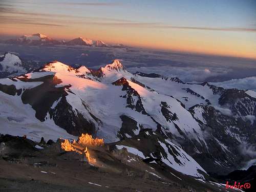
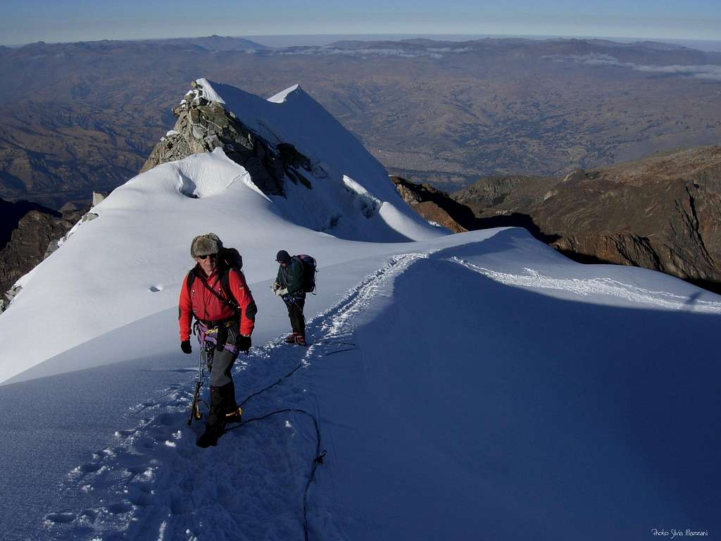
Known to the Andinists by the only name of Pisco, the Pisco Oeste is actually the Westernmost of the two Piscos. The SW Crest is a popular itinerary for its beauty and moderate difficulty. While the summit of Pisco Este is rarely visited, the Pisco Oeste is suitable both for experienced climbers in the acclimatization phase, and as a first ascent in Cordillera Blanca, with the caveat that, although it is not a technical route, it is certainly not to be taken. lightly, as well as not being the right place to learn the progression on a glacier ... very crevassed! From the summit, the 360 degree view of the Cordillera Blanca is truly a "must": in addition to the Huandoys, the imposing Chacraraju to the east, Pyramid of Garcilaso, Artesonraju and Alpamayo to the north, Huascaràn to the south.
A curiosity: the mountain owes its name to the typical Peruvian liqueur, called "Pisco" from the city of the same name, abundantly consumed to celebrate the success of the first ascension.
Location: Huascaràn National Park - Cordillera Blanca, Huandoy Massif, Quebrada Llanganuco
Coordinates: 9.00975° S - 77.63259° W
Difficulty: PD+
Characteristics of the route: long route on a moderately sloping glacier, a very short wall of ice just before the summit
Difference in altitude: 850 m from Campo Morena, 1150 m from Campo Base
Time required: 2 days round trip from the CB, 3-5 hours from the Advanced Camp to the summit
Support points: Refuge Peru
Access to the Quebrada Llanganuco: from Huaràz to the town of Yungay and then to the Quebrada Llanganuco, where there are two large lagoons. The starting point for the ascent to the Pisco is located beyond the second lagoon, in the place called “La Curva” or “Cebollapampa”.
Ascent to Base Camp and Advanced Camp: from Cebollapampa go down to cross the stream on a bridge and head NW for a good path that climbs to the wide grassland of the Base Camp (2 to 3 hours from Cebollapampa). Take the path that leads to the steep moraine and reach its edge, descend along the steep opposite slope, cross the glacier covered with large boulders and go up the moraine on the opposite side, following the itinerary for Colle Huandoy-Pisco. After a first glacial lake, reach a second smaller lake, often dry, where the Advanced Camp is located (2 to 3 hours from Base Camp).
Climb: follow the route to Colle Huandoy Este - Pisco Oeste along the moraine on the right of the camp (cairns), reaching the glacier at an altitude of 5150 m. Cross the first very crevassed area, heading West and reaching the hill at 5300 m. Turn sharply to the NE and climb the SW ridge overcoming some crevasses and a short but steep icy wall that gives access to the summit ridge and the summit.
Descent: reversing the same route