Most of Edwards' photos are more of this nature, cityscapes and industrial detail:


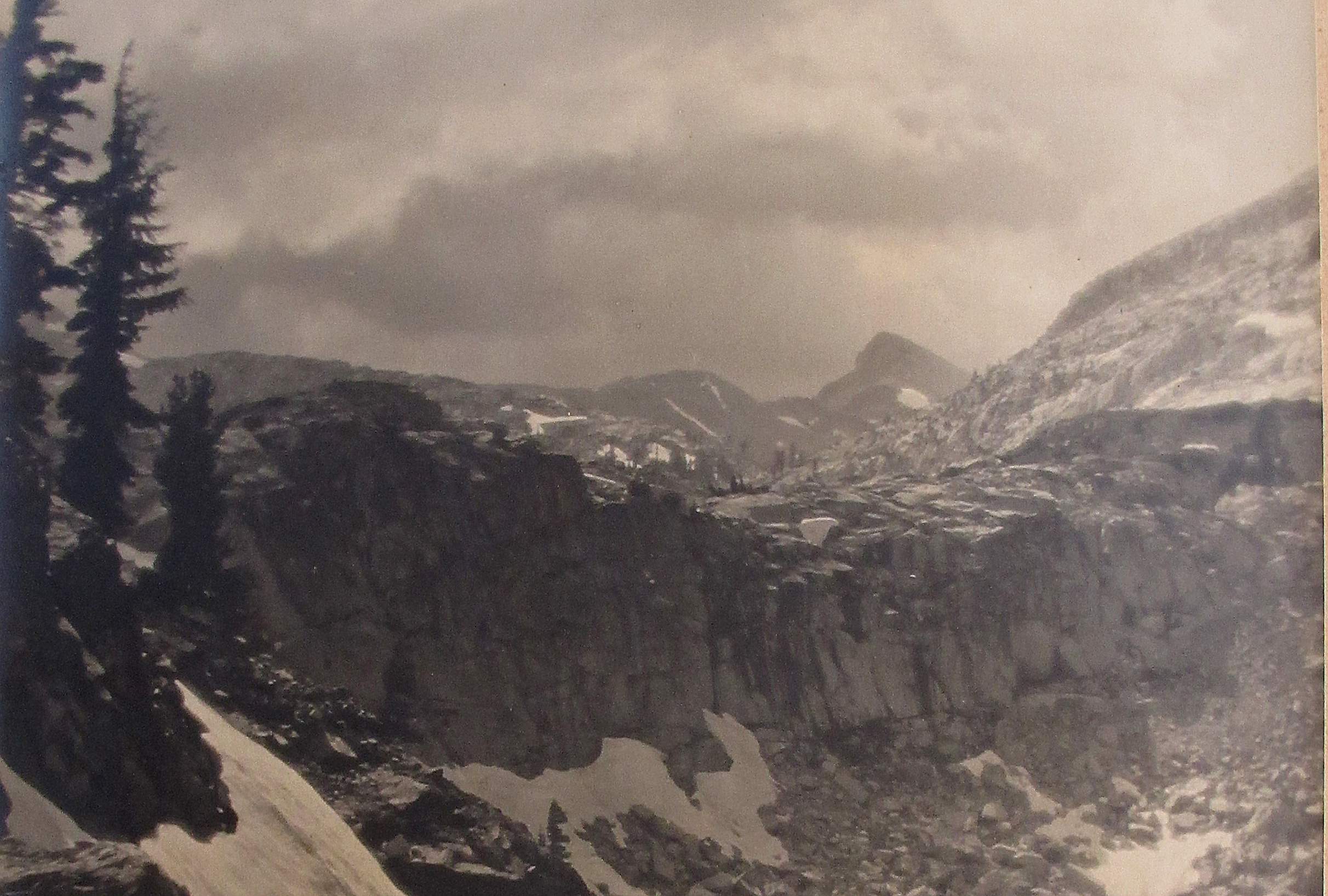
Damn Gordon! Now you've really thrown a monkey wrench into this! It's not Florence, I checked some shots from Glacier Point. Could be the high point to the left is the summit of the Dana Plateau. If the peak isn't Dana then we're possibly in deep water with no oars here!boyblue wrote:Here's a picture of Dana I took from the vicinity of Shell Lake and Bennettville:
Here's another from the lower SE slopes of Conness- about a mile west of the Saddlebag dam:
I admit that they seem to very closely match bearflag's image.
I hope it's okay, but I took the liberty to zoom in and crop his image:
Make sure you click it and expand it all the way. See how the upper face is twisted or skewed more toward the photographer? Compare that with Dana. Try to use Google Earth to change the viewpoint to achieve the same effect with Mount Dana. You'll see that it can't be done without changing the shape of the whole mountain.
Also, look very closely and you'll see that the peak to the left is deep in the background beyond a barely perceptible ridge (revealed by a very slight color difference along a line where the two snow chutes begin and end). There's nothing like that if you look at the real Mt. Dana from this angle. To me, it looks almost like Mt Tom peeking up beyond some of the ridges in the vicinity of upper Pine Creek.
Fact is, this mystery peak has a classic shape that is common throughout the Sierra. University, Red Slate, Hooper, Florence and countless others. It may not even look very prominent from most other directions and it might not even be named.
...or I might be completely full of s**t. I don't care. I've been having a lot of fun with this.

Noondueler wrote:Damn Gordon! Now you've really thrown a monkey wrench into this! It's not Florence, I checked some shots from Glacier Point. Could be the high point to the left is the summit of the Dana Plateau. If the peak isn't Dana then we're possibly in deep water with no oars here!
bearflag wrote:And still thinking near major road or trail c.1920.
bearflag wrote:


boyblue wrote:Noondueler wrote:Damn Gordon! Now you've really thrown a monkey wrench into this! It's not Florence, I checked some shots from Glacier Point. Could be the high point to the left is the summit of the Dana Plateau. If the peak isn't Dana then we're possibly in deep water with no oars here!
Sorry about the monkey wrench, Windsor!As you know, the saddle between the high point of Dana Plateau and Mt. Dana is very shallow and it is at the head of a very obvious cirque. Compare the right skyline of the 'real' DP highpoint in the previous photos with the right skyline in bearflag's photo. It's close, but I don't see a match. I guess we're not going to be satisfied until we find the exact location of where the photo was taken.
There's probably one thing we can all agree on: Whatever or wherever it is, it's very likely that Bob has already day-hiked it.


bearflag wrote:Taking a good look at the trees:
I'm thinking these are probably mountain hemlock and only range up to a bit over 9000 ft.
Foxtail pine range higher but I'm pretty sure these ain't.
And still thinking near major road or trail c.1920.

Users browsing this forum: No registered users and 0 guests
