Rabbit Peak (Santa Rosas) - From the Coachella Valley?
-

KathyW - Posts: 1656
- Joined: Wed Jun 25, 2003 7:07 am
- Thanked: 53 times in 39 posts
Rabbit Peak (Santa Rosas) - From the Coachella Valley?
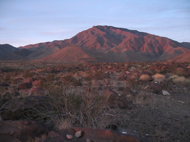
I've been to Rabbit Peak from S22 (over Villager), but I'm thinking about starting down in the Coachella Valley in the Oasis area to do it my second time. Has anyone done it this route? If so, did you just leave your vehicle parked along the side of the road on Filmore Street near where Avenue 79 would be and head toward Rabbit as the Sierra Club's Desert Peak's Guide suggests? Any advice or tips on the route to Rabbit Peak from the Coachella Valley will be appreciated.

-
KathyW - Posts: 1656
- Joined: Wed Jun 25, 2003 7:07 am
- Thanked: 53 times in 39 posts
Doug: Thanks for the info. I'm not sure if I'll do it as a day hike or an overnighter. I might carry a lightweight sleeping bag and pad - just 3 extra pounds and I'll have a choice if I get tired.
Ze: I'm also of the understanding that's a voluntary closure - the Skyline Trail also has a sign on it about the closure.
Ze: I'm also of the understanding that's a voluntary closure - the Skyline Trail also has a sign on it about the closure.
-
KathyW - Posts: 1656
- Joined: Wed Jun 25, 2003 7:07 am
- Thanked: 53 times in 39 posts
Dougb wrote:Kathy, I added my pirate treasure map of Rabbit (I sketched it after the last time I did it 5 yrs ago) to my profile page. It may be too little too late unless you have one of those blackberry thingies since you maybe already there, but I dug it out today and took a photo of it and put it on SP. Now I gotta figure out how to add it to the Rabbit Pk page. Anyhow, it is a very accurate map of the route, it may look crude, but it's spot on.
Doug: Thank you for all of the great information and the map - I'll be using it all. I'm looking at giving it a try in two weeks.
When I work out in the Coachella Valley, I often find myself down in the Oasis area looking up at up at Rabbit but I've never been completely clear on what's the best way up from the Valley.
I think it'll be okay to park down on Filmore Street. There aren't a lot of people living out in that area and those who do are mostly good people who work on the farms, so I think it's pretty safe.
I'm not a fast hiker, so I'll probably go ahead and carry the sleeping bag and pad - I'd love to camp on top of Rabbit but not sure I'll end up doing that. The other time I did Rabbit, I went from S-22 to Villager, on to Rabbit, and then back to Villager the first day. Then it was an easy trek back out to S-22 the next morning. Anyway, I'll just look at my first trip as an exploratory trip to scope out the route and if I make it all the way up and back down that will be an added bonus.
Kathy
-

bajaandy - Posts: 247
- Joined: Tue Feb 08, 2005 11:03 am
- Thanked: 5 times in 5 posts
Rabbit peak still holds fascination for me as well. In the late 80's two friends and I hiked from Toro Peak along the Santa Rosa crest across Peak 6582 (Lorenzen's), Rabbit and Villager. I recall that trip as being one of the more remote and difficult hikes I've ever done. We spent three nights along the ridge, carried two gallons of water each. Lot's of bush whacking, tics, etc. On our last night we camped in the saddle below Villager. A storm came up and it rained and rained and rained. We descended to S22 in howling wind and rain. By the time we got back on the road to go back up to Santa Rosa to get my truck, it had snowed so much we couldn't get there. My truck was parked up there for six weeks until I finally got the dude (Rocky) that drove a snow cat to the peak to do maintenance work for the MCI tower to help me pull it out through the drifts. What a hoot that trip was!
And the thing is, I've always wanted to go back and do it again. Actually, I'd like to try to do Rabbit from the East or West one of these days.
Good luck Kathy. Can't wait to hear your TR when you get done!
And the thing is, I've always wanted to go back and do it again. Actually, I'd like to try to do Rabbit from the East or West one of these days.
Good luck Kathy. Can't wait to hear your TR when you get done!
-
KathyW - Posts: 1656
- Joined: Wed Jun 25, 2003 7:07 am
- Thanked: 53 times in 39 posts
Full Moon on January 30th - that sounds good to me for the "Big Bunny."
We followed those white rocks back to Villager from Rabbit - they were a great help because we were losing the daylight fast and they seemed to glow.
We followed those white rocks back to Villager from Rabbit - they were a great help because we were losing the daylight fast and they seemed to glow.

-

Michael Graupe - Posts: 153
- Joined: Thu Apr 24, 2003 10:55 am
- Thanked: 9 times in 8 posts
Re:
Deleted User wrote:mungeclimber wrote:I wonder if those are Brutus and brothers trail ducks?
I do not know who ducked those three miles from the citrus tree groves to the beginning of the trail, but whoever it was, they deserve a pat on the back. It's so cool, once you start finding them, and look for the next one and so on, it really makes those three miles go by fast. They are not down in the main wash, they are on the alluvial fan. Also, they are mainly comprised of white rocks, because whoever did it was well aware that the sun will be low in the sky when you are stumbling out!
In case anyone is interested, the white ducks are still in place. I didn't pay much attention to find the start of the route from the citrus groves and just aimed at the bottom of Rabbit's E-ridge, but came across the ducks fairly quickly. A big thanks to whoever put them up. They do "glow" and are a great time saver.
This was my New Year's Eve hike: East - west traverse of the Santa Rosas, up the E-ridge of Rabbit, then on to Villager and down the S-ridge to S-22 where my wife picked me up again. Took less than 10 hours and the views were totally awesome all the way.
-

MoapaPk - Posts: 7780
- Joined: Fri May 13, 2005 7:42 pm
- Thanked: 787 times in 519 posts
Re: Rabbit Peak (Santa Rosas) - From the Coachella Valley?
I was totally unaware that dougb was deleted. I much appreciated his insight. Gawd, I'll never understand...
-
- Related topics
- Replies
- Views
- Last post
-
- Burnett Peak/Santa Lucia Range - Any Beta?
by Jesus Malverde » Sun Jan 22, 2012 7:28 pm - 2 Replies
- 2115 Views
- Last post by dabart

Sat Feb 18, 2012 1:49 pm
- Burnett Peak/Santa Lucia Range - Any Beta?
-
- Santa Rosa Mountain/Toro Peak Road Condition
by harryquach » Fri May 07, 2010 5:45 pm - 0 Replies
- 1280 Views
- Last post by harryquach
Fri May 07, 2010 5:45 pm
- Santa Rosa Mountain/Toro Peak Road Condition
-
- Waterhouse Peak/Hope Valley
by Superhero » Fri Apr 06, 2012 8:07 pm - 3 Replies
- 1183 Views
- Last post by Palisades79
Sat Apr 07, 2012 3:52 pm
- Waterhouse Peak/Hope Valley
-
- Telescope Peak, Death Valley, California
by pmgraehlmd » Wed Oct 23, 2019 1:58 am - 2 Replies
- 3649 Views
- Last post by Malbert33
Thu Jan 30, 2020 8:35 pm
- Telescope Peak, Death Valley, California
-
- Climbing in the Santa Clarita area
by Steve Larson » Mon Dec 13, 2010 3:10 am - 5 Replies
- 5416 Views
- Last post by goldenhopper
Tue Dec 14, 2010 3:58 pm
- Climbing in the Santa Clarita area
Who is online
Users browsing this forum: No registered users and 0 guests