
-
 4293 Hits
-
 88.19% Score
-
 26 Votes
|
|
Route |
|---|---|
|
|
46.95120°N / 12.02196°E |
|
|
Hiking |
|
|
Summer, Fall |
|
|
Most of a day |
|
|
F/F+ |
|
|
Overview
Picco Palù Normal route from Acereto
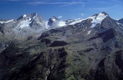
Picco Palù 3059 m - Grosser Moostock in the original name - is a fine mountain overcoming the 3000 meters of altitude, located in the Rieserferner Group (Vedrette di Ries). This mountain dominates the Valle di Tures and the village of Acereto, the birthplace of Hans Kammerlander, one of the best known mountaineers in the world and climber of Eight Thousanders. Picco Palù is a famous summit belonging to the Monti di Cima Dura subgroup, with a stunning panorama. In a sunny day the view from the summit is absolutely fantastic, due to the situation of the mountain, just in the middle of a mountains circle.
There are a few easy routes to summit Picco Palù, but the true standard route is the itinerary starting from the locality Gasteiger, above Acereto, and climbing the SW-ridge.
The route doesn't oppose particular difficulties and runs in a really beautiful environment. Few iron ropes in the middle part of the route and the ridge tackled by an easy scrambling add an "extra" to this itinerary and makes it - already very interesting - even more satisfying. However the difference in level of about 1500 m and just the “extra” do not allow to underestimate the mountain.
Approach
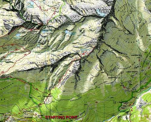
The starting point is the village of Acereto/Ahornach 1334 m.
From the Brennero Motorway A22 exit Bressanone and take the SS49 Val Pusteria road. In Brunico turn to left onto the S621 Valle Aurina road. In Campo Tures take the right road to Riva di Tures - Rein in Taufers. Drive on this road and leave it after some kilometers taking a road on the left at the signpost to Acereto/Ahornach 1334 m. This road reachs the village after about 8 km. Passed the village, the road continues for about 3 km more. Park the car in a little parking lot near the Maso Gasteiger at about 1570 m. Here there is a signpost to Picco Palù/Grosser Moosstock (path 10B).

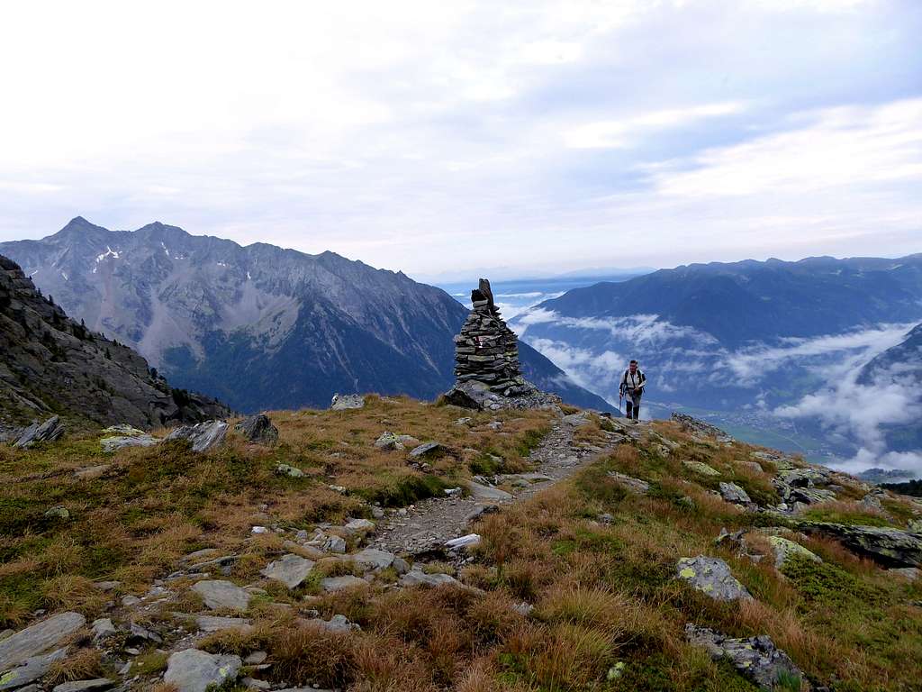
On the route

Towards the moraine
Route Description
Picco Palù Normal route from Maso Gasteiger (Acereto)
Summit altitude: 3059 mDifficulty: F
Difference in level: 1495 m from Gasteiger
Exposure: SW
Starting point: Parking lot near Maso Gasteiger
A truly beautiful climb in the wild, with beautiful views of the surrounding mountains belonging to the Vedrette di Ries and the Aurine Alps. The route is signposted by white-red marks and by several cairns.
Take the paved road at the bend to the left of the parking lot, following the signpost n 10B. Continue briefly along the road, then take a path in the fine coniferous forest (signpost Picco Palù and Schlafhauser). After about half an hour we cross a fence and arrive near an alm; the trail continues in the midst of a slope with vegetation on a sparse forest of "cirmoli" up to the Schlafhauser Alm 2010 m, a wooden shelter with stove. It is placed in a wonderful position at the junction of our itinerary and the trails to Riva di Tures (Vegetation Weg) and to Poja Valley (Durreck Hohenweg). The alm is unguarded. At the crossroad near the alm, continue directly on the path 10B (signposted "Moosstock") in the sparse forest of "cirmoli" pines, then on open pastures, reaching a steep slope.
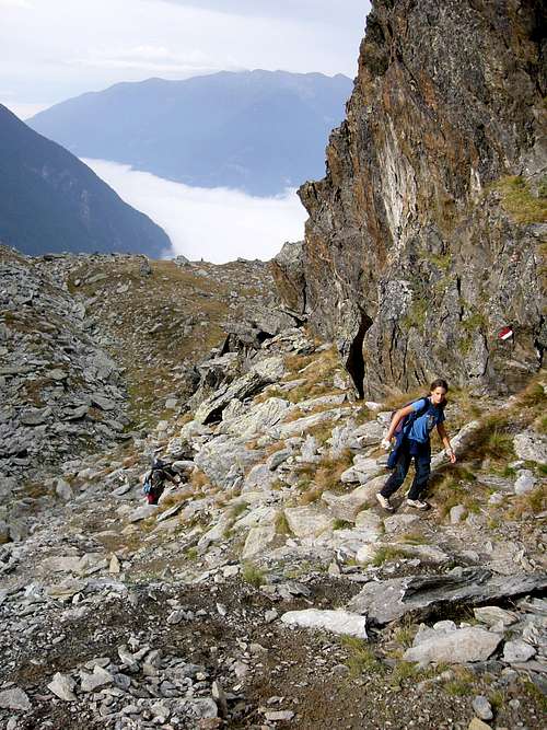
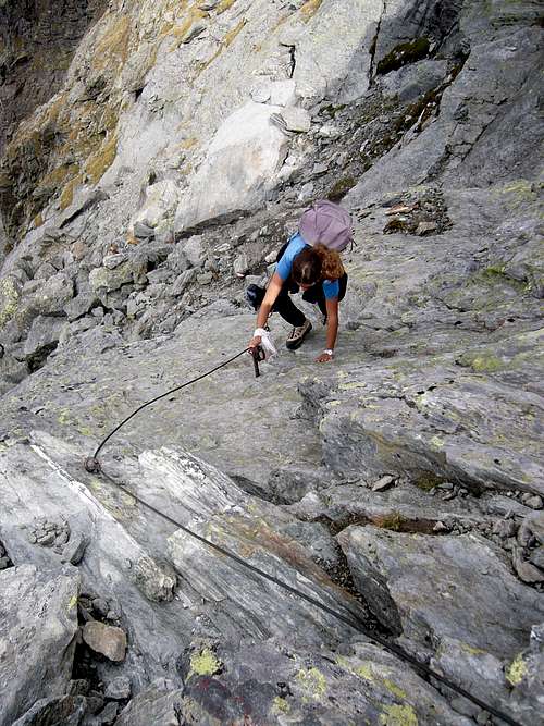
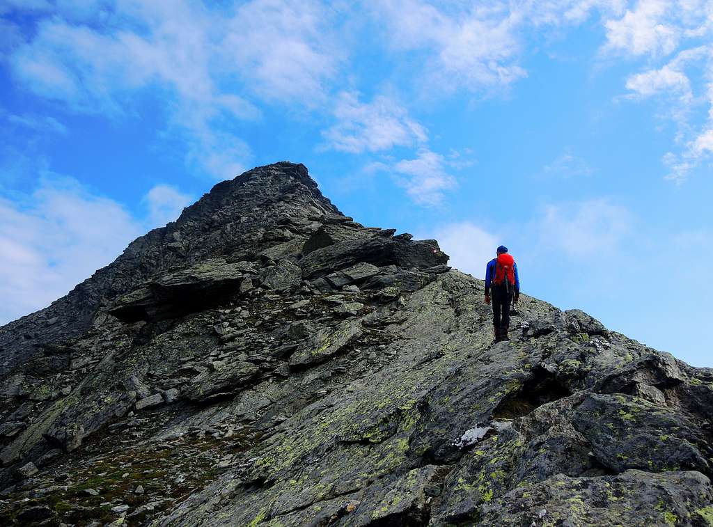
After an easy and short rocky passage, the route crosses slanting left up to the base of a rocky stretch, equipped with a metal cable to facilitate the overcoming of a small overhang (easy). Always on rocky ground and a chaotic slope of boulders (cairns) the route reachs the summit of the wall and a marked shoulder at about 2700 m, from which it appears Picco Palù.
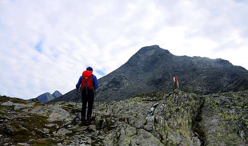
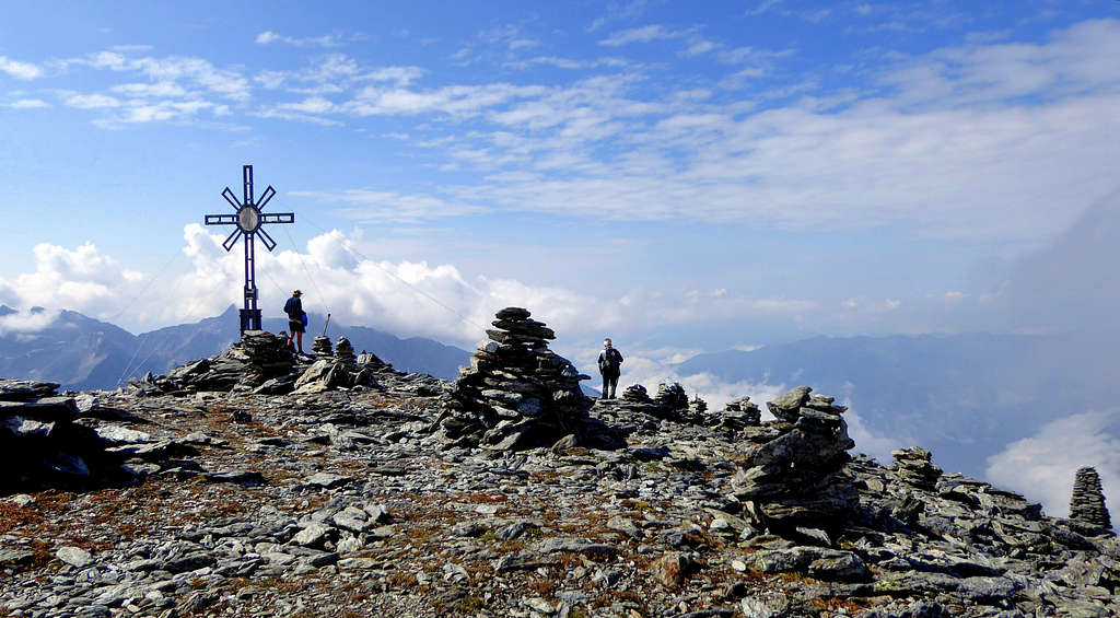
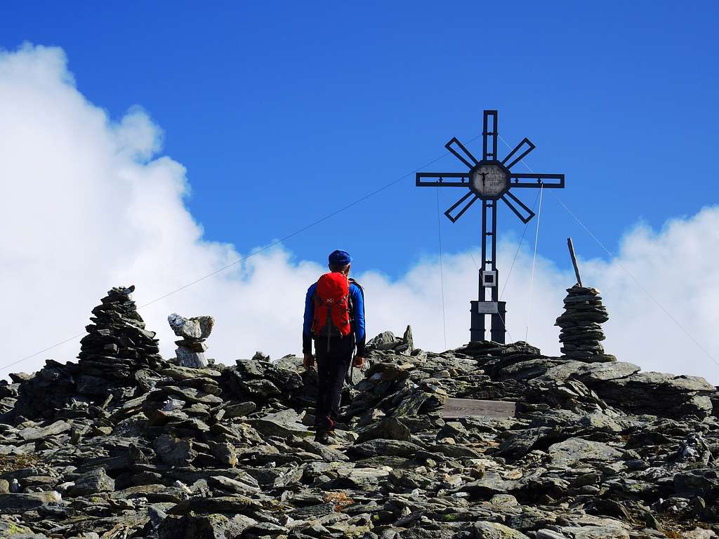
Lower left, you can see what it remains of the small Mosstocksee lake. From the saddle the SW-ridge is on the right, so the route now head to the right to get the start of the rocky ridge. Climb up directly the ridge with some easy moves on rock of good quality, the alternative path on the scree to the left of the ridge is easier, but on on unstable ground. The wide flat summit is wonderful and the panorama is exciting!
Descent: reversing the same route
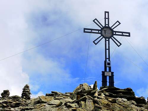
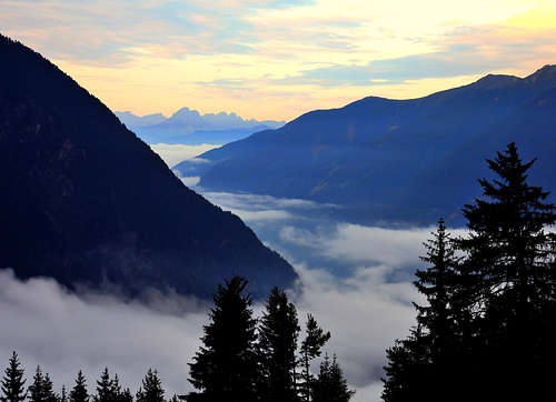
Panoramic view
 From the summit
Essential Gear
Good shoes and high mountain equipment to protect in case of bad weather.
Red Tape
No fees no permits required. Picco Palù is situated inside a protected natural area established in 1988, the Parco Naturale Vedrette di Ries-Aurina, bordering directly with the Parco Nazionale Alti Tauri and comprising an area of 31,320 hectares. The Vedrette di Ries-Aurina Nature Park includes the largest number of glaciers in the South Tyrolean nature parks and includes the following municipalities: Campo Tures, Valle Aurina, Predoi, Gais, Perca and Rasun-Anterselva, To the east it is bounded by the Passo Stalle and the state border with Austria, while the border to the south-east is the Valle di Anterselva and to the south the Val Pusteria. Characteristic in the Vedrette di Ries-Aurina Nature Park is its richness of water. There are also different varieties of animals such as the golden eagle, the marmot of the Alps, the alpine chamois, the roe deer and the red deer. The flora is also widely represented, with the Arnica montana, the Cinquefoglia fior d'oro,
When to climb
Summer and early Fall are the good season to climb. It is advisable to carry out the ascent in good weather, as the route is long and with a noticeable difference in level and without any possibility of shelter after the Schlafhauser Alm at 2010 m of altitude.
Accomodation
Different kind of accomodation in Campo Tures, Riva di Tures and Acereto.
Meteo
METEO PROVINCIA BOLZANO ALTO ADIGE
Guidebooks and maps
"Alpi Pusteresi - Vedrette di Ries" - F. Cammelli, W. Beikircher - Collana Guide dei Monti d'Italia CAI/TCI
"Prestigiosi 3000 del Sud Tirolo"- Hanspaul Menara Athesia, Bolzano
Map: I monti della Valle Aurina - sheet 16 - Mapgraphica Bolzano 1:25000