
|
|
Mountain/Rock |
|---|---|
|
|
36.57652°N / 118.47219°W |
|
|
Tulare |
|
|
Hiking |
|
|
Spring, Summer, Fall, Winter |
|
|
12302 ft / 3750 m |
|
|
Overview
Picket Guard anchors the south ridge that flanks the short but beautiful Kern Kaweah river valley. Like its slightly bigger brother Kern Point across this valley, Picket Guard looms almost 4000 feet over the upper reaches of the main Kern River canyon. Unlike Kern Point, Picket Guard makes up for its slightly lower stature with more imposing features and superior scrambling. Picket Guard is one of the 248 list peaks designated by the Sierra Peaks Section of the Sierra Club Angeles Chapter. One of the more remote peaks in the High Sierra, the mountain is relatively easy to climb but only after a long approach from any direction. However, the views over the canyon to the Sierra Crest are well worth it. From the Sierra Crest, the peak is much easier to spot than Kern Point but it still blends into the higher profile Great Western Divide / Kaweah mountains.Picket Guard was named by William R. Dudley, an esteemed Stanford University professor, botanist, and pioneering Sierra Club officer. According to Francis P. Farquhar in his book Place Names of the High Sierra (1926), Dudley stated “there is a fine pyramidal peak at the eastern end of the third range, which was always in the background of the view as we entered and ascended the narrow cleft of the Kern-Kaweah. This was named the Picket Guard.” This is likely a reference to the term picket guard associated with soldier sentries. A Climber’s Guide to the High Sierra (1954), edited by Hervey H. Voge, credits the first ascent on 1 Aug 1936, by C. Dohlman, H. Manheim and B. Breeding.
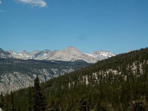
 Picket Guard ‘s north face from Kern Point’s south slope(Jul 10)
Getting There
Due to its remote location, Picket Guard can be approached from a number of different directions depending on the itinerary. It’s debatable on what the best approach is but the closest trailhead approach is from Mineral King over Glacier Pass and Hands & Knees use pass to the Big Arroyo. For those who have the time, the easiest route is available to those hiking the Colby Pass Trail or the High Sierra Trail. Entry into this region is also available from the west, though a bit longer. As a remote but centrally located peak, the possibility of approaches is dictated only by the particular taste and agenda of the peakbagger. Picket Guard has been day hiked (20+ hours) from both the Whitney Portal and the Glacier Pass (Mineral King) Trailhead.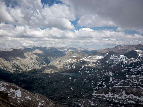 Picket Guard looms over the Kern river canyon (Jul 10)
Routes
There are a number of interesting scrambling routes up Picket Guard and probably some other undocumented routes that are possible. The north face looks to promise interesting climbing on certain parts of its face although dragging climbing equipment the requisite distance may not be worth it.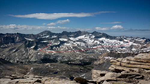 |
Northern route to the west ridge: The low spot at the end of the west ridge can be reached by either climbing up from Gallats Lake (Colby Pass trail) or traversing the long ridge slope at approximately the 11200 foot elevation level from Pants Pass. Class 2. |
| Picket Guard traverse from Pants Pass (Jul 10) | |
 |
Southern route to the west ridge: The low spot at the end of the west ridge can be reached from the Picket Guard creek basin. The basin itself makes for very easy traveling but one must either climb the slabs and cliffs up from the Kern River or cross the Lawson-Queen Kaweah saddle. Variation: descending Kaweah Queen’s north slope (dangerously loose!) or Lawson Peak’s northeast ridge will also work. Class 2. |
| Picket Guard from Kaweah Queen's summit (Jul 10) | |
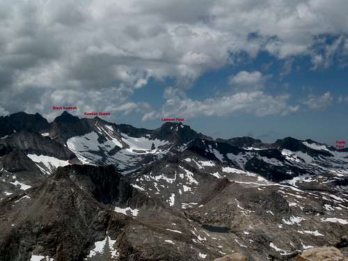 |
The northeast ridge is an attractive scramble option to the west ridge. After climbing or traversing to the lake below the west ridge’s low point, climb the ridgeline that drops in front of the north face. Variations on the north face are also available although reportedly loose. Easy Class 3 |
| Picket Guard’s north face from Kern Point (Jul 10) | |
 |
The east face appears to be a faster option if ascending directly from the Kern River Canyon. While the east face itself is Class 2, the route up from the canyon itself promises to be a bit stiffer. |
| East face from the PCT (Jul 10) |
Red Tape , Camping, and Conditions
Everything you need to know about permits, regulations, and driving directions can be found on the Eastern Sierra - Logistical Center page. The parent SEKI page to this page is also filled with great information on the Park’s rules. While overnight hikes require a wilderness permit, day hikes can be done without red tape with the exception of entry from the Whitney Portal.Climbing can be done in almost any season but May through October are the most popular times. In heavy snow years, the chutes and slopes may hold residual snow. This is also true for any of the routes over the Sierra Crest. Check for current weather.
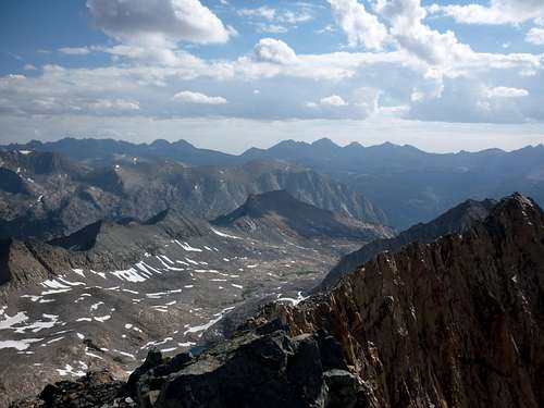
 Looking east towards Mt Whitney from the summit block
External Links
Trip Reports:Climber.org reports
Bob Burd’s day hike
Pictures:
My pics & summary
Matthew Holliman’s day hike
Rick Kent’s day hike with Bob