Intro/Stats
Cascade Mtn (9387')
Pikes Pk (14115')
"Little Pikes" (13363')
"Devil's Playground Pk" (13070')
June 18-19, 2010
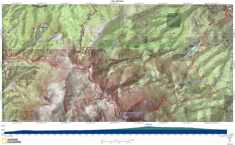
Via Heizer Trail/Trail 638/Barr Trail/NE Ridge/Crags Descent
18 miles RT, 8100' gain
Participants: PJ, Jim, Josh, & Kevin
Slideshow
I have a goal of climbing Pikes in every month of the year via a variety of routes. I've had my sights set on climbing the mysterious northeast ridge for a long time. Dave "Hoot" Gibson came up with an idea of doing it from the town of Cascade near the beginning of the Pikes Peak Highway. I was hoping to knock this off in Sept or Oct, but it didn't work out. I still needed a June checkmark for Pikes though and the ridge would likely be free of snow by then. A date was set, but Hoot wouldn't be able to make it.
I had virtually zero beta on this ridge. Not even the caretakers at Barr Camp knew anything about it. It looks impressive from some angles, but from other vantage points it looks fairly benign. It turned out to give us more than we bargained for, but it was a great adventure! Jim Ohl has a similar Pikes goal and would be joined by his friend Josh. PJ Horn, a friend from church, would join me as well. This would be PJ's first 14er! I just hoped I could make the experience enjoyable enough for him to want to do another one!
The Approach Plus Cascade Mtn
7.5 miles, 3800' gain
Stewart Green and Susan Paul would join us for the first 2 miles of the day on the Heizer Trail with the objective being soft ranked technical 9er Cascade. I had done Cascade back in 2006 and wanted to return. There are 3 summit candidates up there, and I wanted to make sure I got the right one. We set out at around 2pm, taking advantage of no late afternoon storms. The Heizer trail is a steep grunt to the ridge, but there are plenty of switchbacks to make the hike enjoyable.
Stewart explored the summit options and agreed that the 15 foot boulder that I climbed the first time as indeed the highpoint. It is the middle of the 3 summits. The western summit would be the toughest and the eastern one is a class 2 scramble.
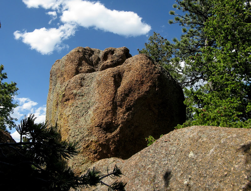
Cascade summit block:
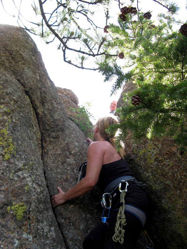
Stewart led the short crack climb next to a tree on the east side of the summit block. He placed one large nut for pro and belayed all of us up. The summit is pretty small, enough room for three!
Susan on the crux:
PJ was game and had no problem getting up, his first technical summit! We rapped down and then took a break before parting ways.
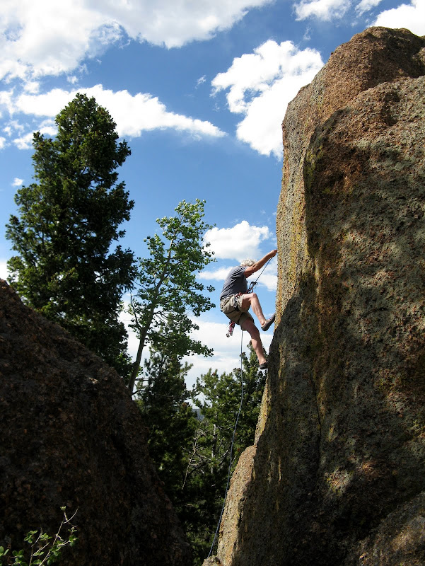
Stewart raps from the summit:
PJ and I continued south on the Heizer trail as it met up with trail 638. This trail eventually gets you to Barr Trail after about 2.5 miles with lots of ups and downs along the way. It is not near as direct as the USGS map indicates. See my GPS track for the circuitous route that it takes. The trail met up with Barr Trail about 1.6 miles east of Barr Camp. We were both getting very hungry and were happy to arrive at 8pm so we could down our Subway sandwiches that we hauled up here!
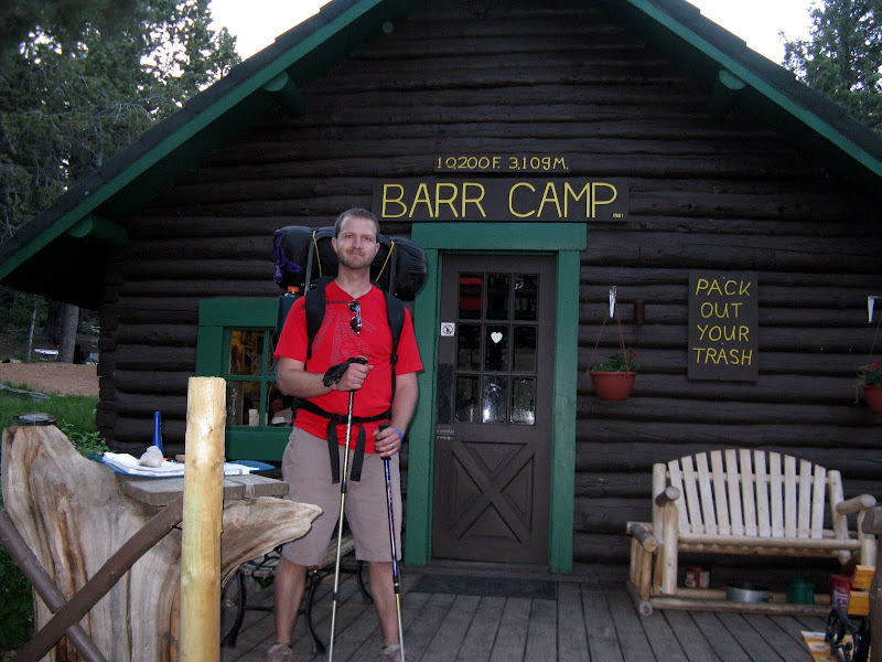
PJ's first visit to Barr Camp:
We visited with the caretakers Neil and Teresa for a bit before hitting the sack in our spacious lean to shelter. The bad thing about a lean to is it is an open air shelter on one side, so we got hit by some mosquitoes. We both didn't get a whole lot of sleep, but at least we didn't have to get up real early. Jim and Josh were not able to do the approach on Friday evening, so they had to start their hike from the Barr TH at 4am! They arrived at camp early enough to rest a bit and have some breakfast.
The Northeast Ridge
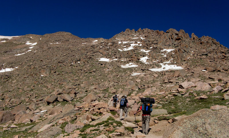
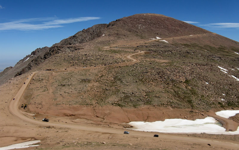
We set out at 7:30am so that PJ and I could enjoy the pancakes that are served for breakfast. We weren't worried about storms much since it was forecasted to be a bluebird day. I went with shorts all the way to the summit, probably the first time I've worn shorts on the summit of a 14er in June! We followed Barr Trail all the way up to near around 12700 feet where it gets very close to the northeast ridge. From there, it would be about .8 mile and 1300 feet to the summit. That 1300 feet would take us nearly 3 hours!
The northeast ridge looms above Barr Trail:
Josh elected to take the trail the rest of the way and he would beat us to the summit by about 2 hours. We hit the ridge at a prominent notch and quickly discovered that we weren't going to be able to climb over the first tower.
We skirted around it, but on the west side it looked like there was an easier line. I decided to explore it and found an exposed 4th class weakness to the top, a nice warmup for things to come!
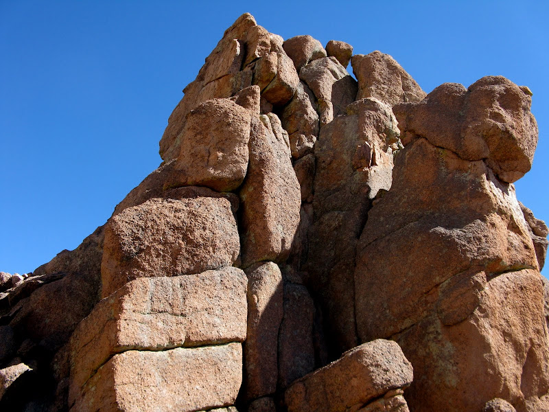
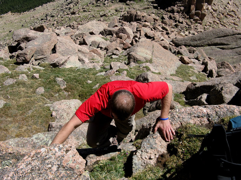
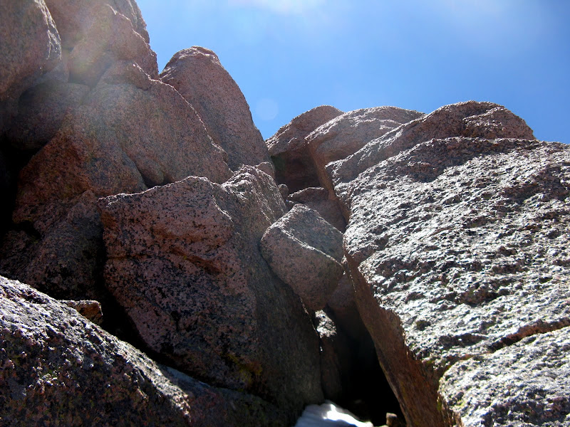
Enough messing around. This ridge turned out to be tougher than I expected as staying on the crest of the ridge was impossible without a rope. There was a wide array of boulders and slabs to climb up and around, so the routefinding was tedious. We stuck to conservative lines for the most part since this was PJ's first experience at scrambling, but there were a few 4th class moves here and there that we did where the exposure wasn't bad. I tried to get on the ridge crest where feasible, but kept in mind that anything I climbed I might have to reverse my tracks and downclimb! The possibility of getting cliffed out was there.
Jim enjoying some Pikes Peak granite:
PJ soaking up some scrambling on the ridge:
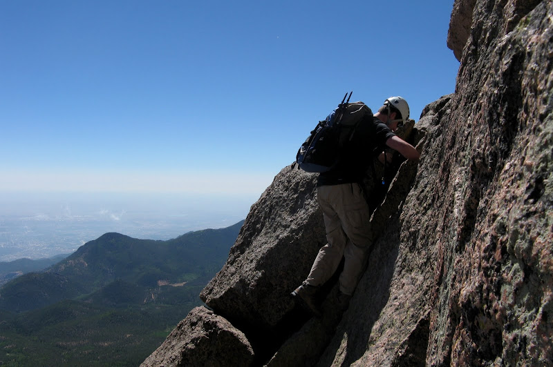
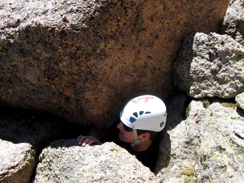
Jim decided to go underneath a boulder to avoid an exposed spot. I was impressed that he was able to pull himself through this tight spot!
The ridge seemed to go on and on and progress was slow. I finally was able to get back on the ridge crest after skirting below for awhile and it didn't take long before a 10 foot drop shut me out. I backtracked and went down the north side. Some newly acquired canyoneering downclimbing techniques served me well on this steep downclimb!
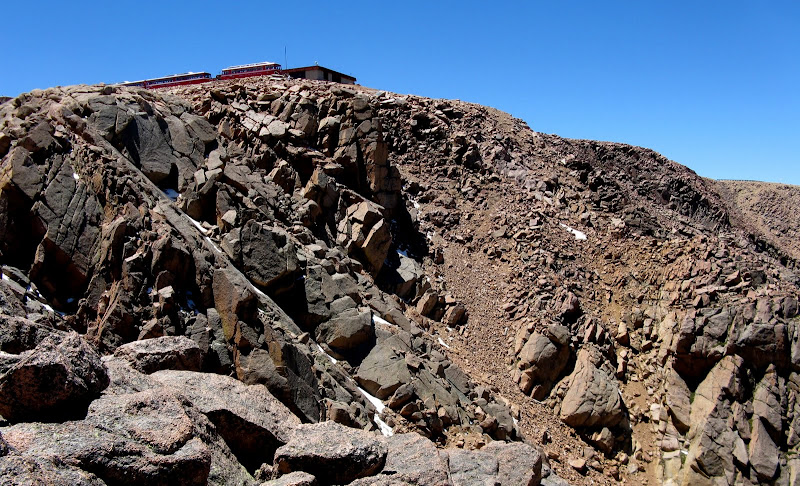
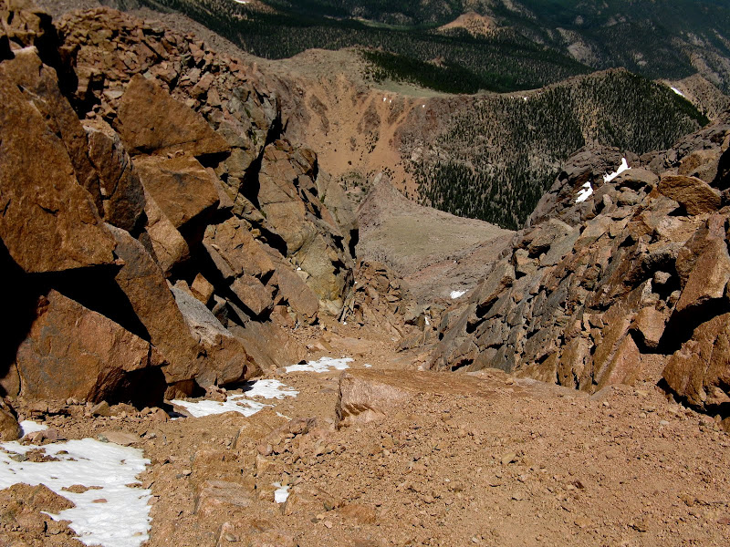
The difficulties finally come to an end about 300 feet from the summit. We could now see the summit house and the train and had a nice view down the Railroad couloir, which is now melted out.
Looking down the Railroad couloir:
We strolled over to the true summit in the parking lot, topping out at 1pm. We found Josh in the summit house and I got a cheeseburger and a donut to refuel, bummed that there was no peperoni pizza ready! We headed down to the Crags trail on the northwest side as Jim's wife Karen graciously saved PJ and I many miles of hot hiking with a car shuttle. Little Pikes and Devil's Playground don't require much additional vertical, so I decided to escape the dusty trail and go over those on the way out. We made it down at around 5pm and PJ didn't enjoy the knee busting descent much, but he said he'll probably climb another 14er someday!
Pikes from the summit of Little Pikes:
GPS track:


Comments
Post a Comment