
-
 18450 Hits
-
 88.19% Score
-
 26 Votes
|
|
Mountain/Rock |
|---|---|
|
|
50.19500°N / 126.93°W |
|
|
Hiking, Mountaineering |
|
|
5059 ft / 1542 m |
|
|
Overview
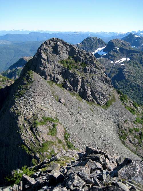
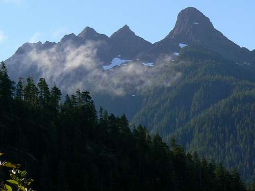 Pinder Peak NE aspect from Atluck Lake Pinder Peak NE aspect from Atluck Lake |
Pinder is the only officially named summit in the massif. The generally accepted first ascent, as is so often the case with Island mountains, is ascribed to the original survey party of 1931 led by A.J.Campbell.
North Island summits are well and truly off the beaten path and Pinder and its cohorts are no exception. Access to the alpine can often be eased by the use of decommissioned logging roads but this situation is becoming ever more fluid and complex. Because of liability issues, the companies are not just pulling the culverts and leaving cross ditches. Some cross ditches are now being made that are impossible to cross, bridges are being removed and roads blocked with logs or other barriers. The standard route up Pinder for years was via a spur road known as Apollo Road. The guidebooks, in fact, make it sound like a major access route. It’s still there if you look hard enough but is essentially unusable.
The following describes an approach that works but don’t expect to find trail, cairns, flags or any other sign of human passage until right on the summit – other than the half dozen pieces of flagging that we left. Expect instead steep, tangled huckleberry and “krumholtz” bush that resists your every attempt at forcing passage. Expect to navigate by dead reckoning with map and compass and/or GPS. Expect also some nice old growth that offers pleasant progress and some fine scrambling to the summit from an airy col. Above all, expect superlative views of the north Island, south to the impressive Haihte Range and east and west to both coasts. The Province Range is so far north that the distinctive shapes of Victoria and Warden peaks are just specks on the horizon and that the biggest summits on the Island in the north of Strathcona Park are just a thin line of white in the far distance.
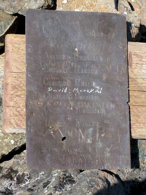 Summit plate |
Getting There
Vancouver Island can be reached by air from Toronto, Vancouver, Seattle, Calgary and Edmonton to Victoria, Nanaimo, Comox or Campbell River and by ferry from Port Angeles to Victoria on The Coho and on BC Ferries from Vancouver to Victoria or Nanaimo. Public transport on the Island is notoriously poor and anyone arriving by air would be advised to rent a car.Access in this case involves steep, rough, de-built logging roads with deep water bars. A 4WD vehicle with high clearance is essential in order to reach the very top of the road that gives access to the mountain. Chains may also be required if the roads are still under snow. This can occur well into May.
From any point on southern Vancouver Island, drive north on the Island Highway 19 to Campbell River and beyond towards Port Hardy, the last community of any significant size in the north Island.
Proceed through Sayward Junction and the turn-off for the village of Woss. Approximately 10 minutes past Woss turn left at the sign for Zeballos. The road becomes gravel almost immediately.
Approach
About 7 km from highway 19 turn right at a signpost for Atluck Lake. You are now on Atluck Main. Follow this road to and then around the lake. Pinder Peak dominates the view at the west end of the lake. Once around the lake, watch for a road turning off left and signed Artlish Main. Set your trip meter to 0 here and take this road.Drive exactly 4.4km from here to the logging spur you want. A few hundred metres before reaching your turn, a road labelled “AR0600” breaks off left. This may also give access to Pinder but I don’t believe it goes too high. There is no label at your turn but – as of September 2007 – plenty of pink flagging wrapped around a wooden post. Your main guide should be the distance traveled from the Atluck/Artlish junction. If you haven’t already done so, engage 4WD here.
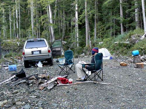 Hunters' camp |
Altitude at this point is approximately 600 metres.
Update provided by Tawney Lem, August 23, 2009. The access spur off Artlish described above has been fully deactivated. You now have to walk the 2.8 km to the "hunters camp".
Route
Walk out of the hunters’ camp, across two river crossings where the bridges have been removed and up to the end of the de-built road in about 30 minutes. Map reference at this point is: 9U 0647265/5561153 (NAD27) and the altitude 775 metres.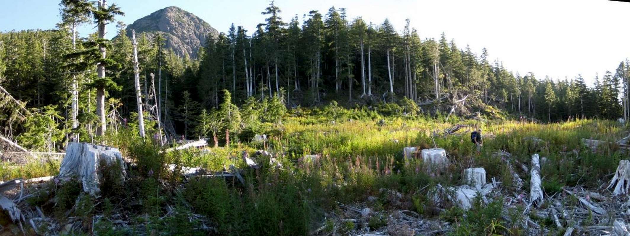  |
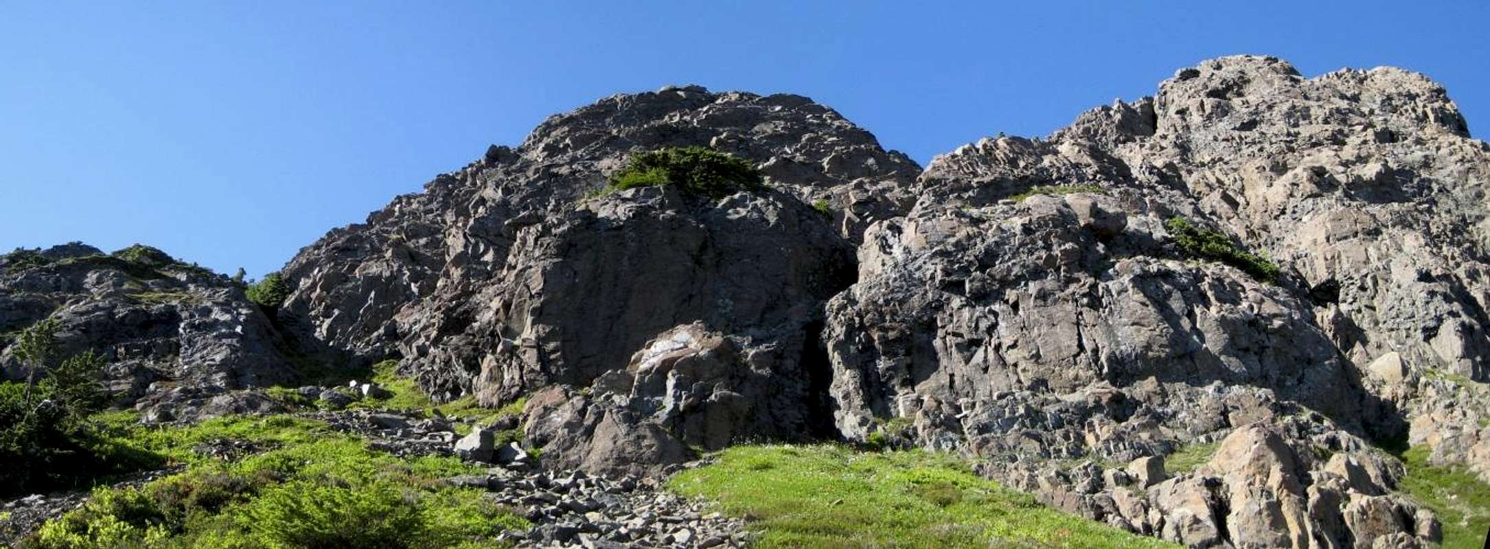
Refer to the wide-angle photo above. Ahead of you is a creek bed exiting the forest. This creek flows out of the basin below and between Pinder and its satellite “The Horn” and is roughly the route that will be followed. First, though, cross the logging slash at the end of the road to the old growth beyond using animal trails. The easiest course (and the game does know best) leads slightly east of the ideal northeast direction and puts you in the forest at a slightly lower point than the creek exit in 15-20 minutes from the road end.
Once in the old growth, trend northwest back towards the creek and then upwards following the course of the creek but not in the creek bed itself. Stay on the true left (climber's right) side. Bush here is moderately thick in places but, if you’ve chosen well, with one passage through open forest with clear going. You may encounter one or more of the half dozen orange flags we placed in this phase of the route.
After 1-1.5 hours of steady climbing in a northeasterly direction, you will emerge from the trees at the bottom of the steep ravine made by the creek on its journey down the mountain side.
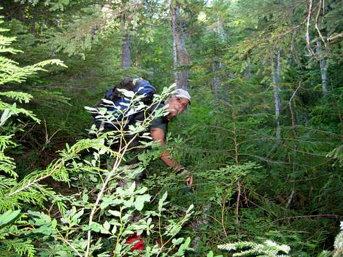 Pinder Peak; Bushwhack approach | 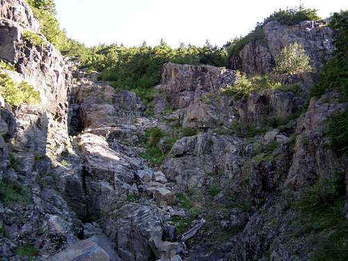 The Ravine | 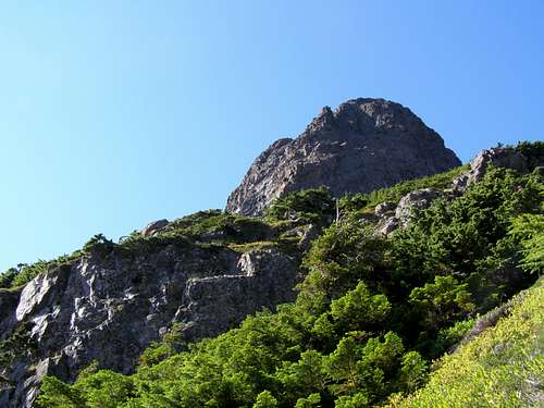 Summit above the ravine | 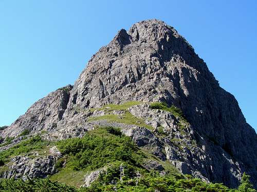 Pinder Peak Summit Block |
Prepare for some serious bush at this point as you fight your way up towards the alpine. Keep the same northeasterly course and try to be patient. It’s going to take an hour or so until you finally find a way through and step out onto a boulder field that leads to the small southwest facing bowl under Pinder and the Horn. There is generally snow available here to top up water bottles.
From the bottom of the bowl climb scree and heather slopes to the northwest aiming for a saddle to the left of the main summit. Both the gully and the face to its left “go” at Class 3 but with some loose rock in the gully.
 |
Once in the saddle turn right (NE) and walk over the sub-summit ahead and up to the main summit from there. It’s about 20-30 minutes from the bottom of the bowl to the summit.
Alternately, climb up beyond the bowl and right into the saddle between Pinder and the Horn. Turn left and approach Pinder’s steep SE ridge up a heather ramp. I’m told that this ridge can be climbed “with no technical difficulty”. But take this with a pinch of salt and decide yourself. If you decide that this is not for you, traverse down and left (SW) and intersect the route above at any convenient point.
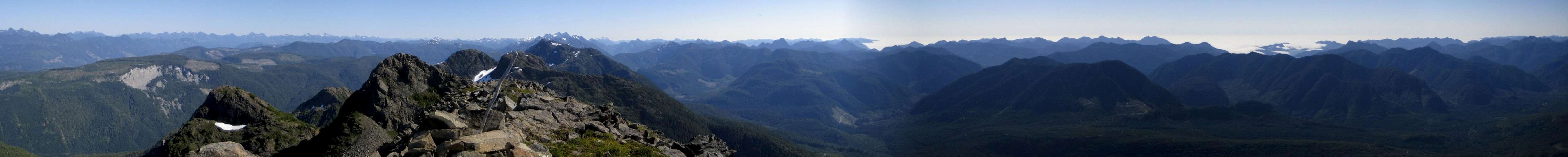
Once on the summit enjoy the 360° views of the north Island as far in all directions as the atmospheric conditions of the moment allow. As impressive as the mountain vistas are, perhaps the most impressive aspect of the views offered from the summit of Pinder is the ability to see right across the Island from the east coast (and the mountains on the mainland beyond) to the open Pacific in the west.
Descend by retracing the upward route. Beware of straying too far to skier’s right when descending below the bowl i.e. in the direction of the ravine formed by the creek. This way lie hidden bluffs, thick vertical bush and, of course, the ravine itself. I speak from experience!
 The Horn | 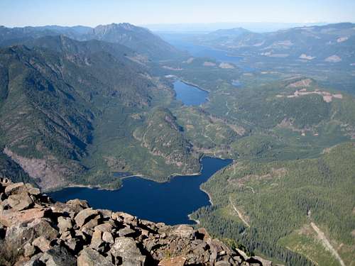 Summit view NW | 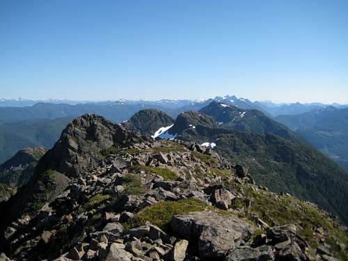 Summit view S |
Red tape
Absolutely none.There’s nothing resembling a trailhead and an intentions system simply doesn’t exist in this neck of the woods. Make sure, therefore, that you have left a detailed trip plan with someone responsible. The RCMP and the appropriate SAR agency will respond in an emergency but it is up to you to have the mechanism in place that will initiate the call-out process if it becomes necessary.
Camping
At the top of the approach spur road in the comfort of your vehicle or anywhere you care to pitch your tent. Fires are nominally prohibited and you should pack a stove. However, this is at your discretion. There’s not going to be anyone around to enforce any rules.Bear and cougar frequent the mountains and forests of Vancouver Island. Big animal scat and tracks are everywhere you look in this area. Proper back country methods – hanging food bags out of reach, cleaning up all cooking scraps, good toilet practice etc – are absolutely essential. Giardia is well documented throughout the Island, so boil or treat all water.
Weather
Nearest point current conditions and forecast.West
East
Additional Information
The map for this trip is the government 1:50 000 topographical map sheet 92L/, “Port Hardy”. Advance copies can be ordered on-line at the BC Government open-maps site. Copies are usually readily available in good bookstores and outdoor stores throughout the Island.Suggested Reading
Island Alpine – A Guide to The Mountains of Strathcona Park and Vancouver Island, Philip Stone, Wild Isle Publications, 2003, ISBN 0-9680766-5-3 and/or visit Island Alpine Climbing GuideHiking Trails III is a general guide to the mountains and forests of northern Vancouver Island.
Both these accepted publications describe access to and the route up Pinder Peak via “Apollo Road”. By all means read what they have to say but be alert to missing or erroneous information. For instance, "Island Alpine" shows the correct route to the summit but describes it as the “SE Ridge” when the feature is clearly southwest facing. Use all the information at your disposal not just one source.
An excellent guide to the back roads of Vancouver Island is Backroad Mapbook. Volume III: Vancouver Island
Summit Panorama
 |