
|
|
Mountain/Rock |
|---|---|
|
|
34.33640°N / 112.4009°W |
|
|
Yavapai |
|
|
Hiking |
|
|
Spring, Fall |
|
|
6780 ft / 2067 m |
|
|
Overview
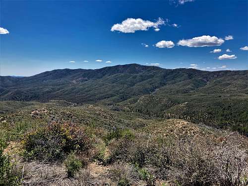
Pine Mountain is kind of a hidden gem located 5 ½ miles south of Mount Union 7,979' in Prescott National Forest. Pine Mountain has a trail to the summit and prominence of about 560’. However, it is rarely hiked and not well known. This is probably due to the dirt roads that lead to the starting point; and folks are drawn to more popular destinations in Prescott National Forest such as Mount Union and Spruce Mountain.
Forest Road 67 leads towards the peak from Mayer, AZ and it is well graded. This makes the mountain closer to most metro-Phoenix communities than Prescott. From the 101/I-17 junction in North Phoenix, it is less than 90 minutes to the trailhead.
Because there is a trail to the summit, it can be hiked during most of the year, absent fire restriction closures and winter snow. Summer really isn’t recommended. The best times to hike here are March-May, and October-November.
Getting There
Pine Mountain is located along the Yankee Doodle Trail. It is accessed from Senator Highway south of Mount Union. The easiest way to get there is to drive to Mayer, AZ. Mayer is accessed from AZ-69. It is 60 miles north of downtown Phoenix on I-17 to AZ-69. Once on AZ-69 it is about 6.5 miles to Mayer. Turn left on Main Street and wind through town towards Jefferson Street as it turns to dirt and go past the Old Mayer Cemetery. The road becomes Forest Road 67. Continue on this road past Milepost 11. There is a trailhead on the left at the junction of Forest Road 67 and Senator Highway.
While one can drive further up Senator Highway, there was a creek crossing at the junction on April 23, 2023 that may or may not be there during dry conditions. Therefore, if wanting a good starting point for 2WD vehicles, this is the best spot. There are a few creek crossings along Forest Road 67 during wet years that may be complicated for vehicles without high clearance.
Route
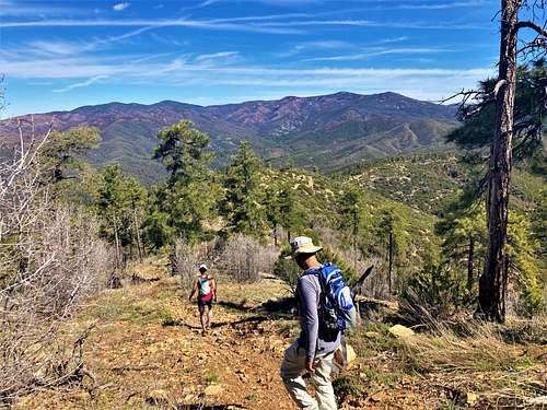
From the starting point, head north on Senator Highway for about a mile. On the left, there is a path going up the hillside to the top of the ridge. This is a connector trail that is relatively wide. It isn't marked, but it is generally easy to follow.

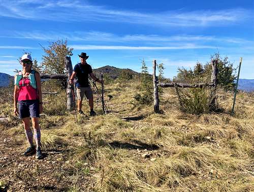
After a little over ½ mile, the top of the ridge is reached and Pine Mountain comes into view. The summit is 1 ¾ miles further up the ridge to the south. It is less than 3.5 miles and a little over 1,500’ to the summit.
It is easy to do a longer loop by continuing north on the Yankee Doodle Trail past the junction with the connector trail. The trail eventually descends back down to Senator Highway. That allows for about a 10-mile loop.
There are additional summits in the vicinity. Longfellow Ridge 6,620’ is above the trail to the north before descending back down to Senator Highway. It requires a little off-trail bushwhacking.
Peak 6149 is located at a pass about ½ a mile east of the trailhead on Forest Road 67. Peak 6149 can be hiked in less than 1 ½ miles round trip via a relatively easy off-trail effort.
Red Tape
There is no red tape for Pine Mountain. Please note that during winter there may be snow along Forest Road 67. During summer, fire danger may lead to preventative road closures.