-
 5524 Hits
-
 77.48% Score
-
 8 Votes
|
|
Route |
|---|---|
|
|
36.74598°N / 118.41363°W |
|
|
Scrambling |
|
|
Class 3 |
|
|
Overview
Of the Kearsarge Pinnacles, #9 is certainly one of the most spectacular and is probably the easiest to climb since the route is mostly Class 2 with a little Class 3 here and there and because the peak is one of the closest to the trail.Getting There
From the town of Independence in Owens Valley, head west into the mountains at the signed turnoff for Onion Valley and drive 13 miles to the road's end, where there is a large parking lot (this is a popular area for day hikes and for beginning and ending backpacking excursions).Route Description

Climbing this peak means about 15 miles round-trip with almost 4500' of climbing (this includes 800' or so gained on the return hike).
The trailhead is at 9200'. Hike 5.5 miles to Kearsarge Pass, which is on the boundary of Inyo National Forest and Kings Canyon National Park, gaining about 2600', and then descend about a mile and 800' to Kearsage Lakes. There are use trails around the lakes. To approach the Kearsarge Pinnacles, stay on the east side of the lakes. If you stay on the west side, you will find that what the map makes look like the outlet of the lake closest to the peaks is too wide to cross easily. It looks shallow enough to cross, or did in July 2012 from above, but that is no guarantee, and you will still have to get wet. Using the east side is a little longer but keeps you dry.
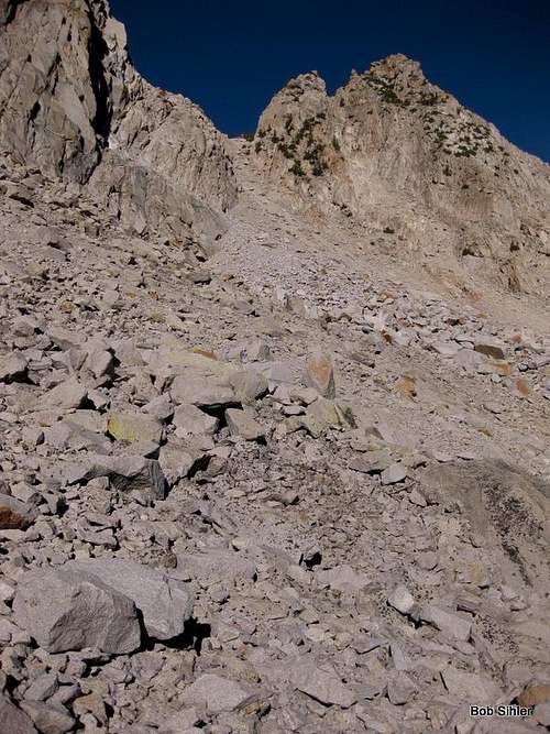
As long as you have looked at the pictures on this page and the main page, you will have no trouble spotting Pinnacles 9 and 10. Head up a steep, obvious chute to the 11,650' saddle between the two peaks. Expect a lot of scree and a lot of boulder-hopping. You'll do yourself a favor by staying on the larger rocks as much as possible, especially higher up, where it gets much steeper and the scree is looser.
From the saddle, climb east up the ridge abut 300 vertical feet to the summit. Mostly, this is Class 2 and 2+, but you'll probably encounter some spots of Class 3. If it ever gets more difficult than that and that's not good, retreat and look for something easier; it's there.
From the lake's edge to the summit, it's about half a mile, with around 1000' of elevation gain.
My GPS device gave me an elevation of 11,937'.