Foreword
Following a Summer of harrowing ridge traverses and various endurance hikes and climbs across the state, I have been honoring the age old tradition of being lazy in the Fall. Out with the 15-25 mile days and in with the 6-10. 7500 feet of vert? Let's cut that down to 3000 feet. Climbing Mount Arkansas was but a continuation of this trend. Conservative estimates of round trip length and elevation gain were only 6 miles and 3300 feet of vertical, falling perfectly into my scheme of "sitting on my butt." At this point, you may be yawning and asking yourself, "Where's the excitement? Why are you boring us with this monotony?" There is one final detail. The 1.5 mile, Class 4 North East Ridge of Mount Arkansas had no known ascents, and we were going to climb it in Winter conditions.
In preparation for the climb Abe and I scoured the internet for beta photos and accounts of previous ascents. We found a few photos, mostly from the Fremont Pass vantage, but no information on the ridge itself. The best clue we found about the nature of the ridge was a comment on Summitpost's climber's log for Mount Arkansas. It said, "We originally intended the NE ridge, but that looked like it might need a rope!" We literally cracked up laughing when we found this and it spurred us on to take on the challenge. Not really knowing what was in store for us, we brought along a 30m rope, stoppers and cams to 1 inch, webbing for rappels, dual ice axes, and crampons. We wanted to be ready for whatever it would throw at us.
Approach
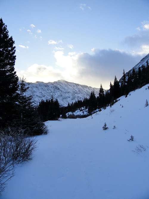
The day of the climb came, and with it the first day of daylight savings time. The drive in was slow going due to icy roads from a storm the day before so we didn't exactly get an alpine start. Although, at 6 miles round trip who needs one?
![Arkansas Sunrise]() Arkansas Sunrise
Arkansas Sunrise![Colorado Sunrise]() Colorado Sunrise
Colorado Sunrise
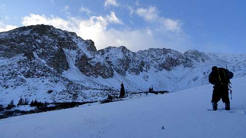
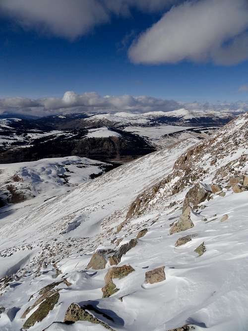
Hiking from half way up the road, we got our first taste of the temperature and snow conditions we would have for the day. Several new inches of fresh and 10-20 degrees F. We hiked south east into the basin between the two ridges of Arkansas and upon inspection of a nasty gendarme decided to bypass PT 12923 and head straight for the ridge.
![Hiking the Road]() Hiking the Road
Hiking the Road![Arkansas NE Ridge]() Arkansas NE Ridge
Arkansas NE Ridge
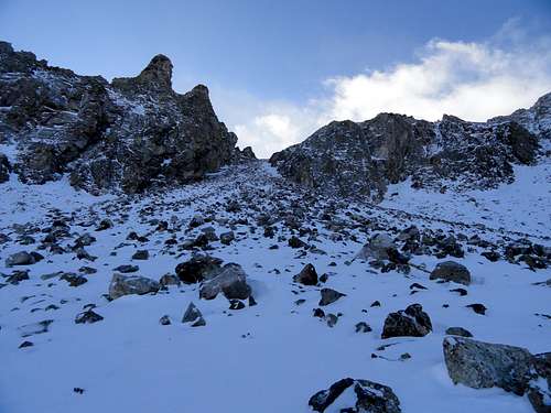
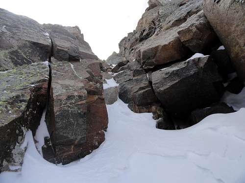
We initially used a loose gully to access the saddle below PT 12923, but eventually decided to exit the gully due to deteriorating snow conditions near the top. At one point we sent down a small 3-4 inch hard slab that was resting on 8-10 inches of sugar snow.
![Ascent Gully]() Ascent Gully
Ascent Gully![Slab Action]() Slab Action
Slab Action
Forced onto the steeper face we ascended separate routes, mine following a narrow couloir that eventually choked off into a couple short vertical rock steps. I would consider this part to be the crux of the day, although ultimately unnecessary. Once atop the ridge the views opened up and we encountered variable wind from 15-25 mph.
![Rock Step]() Rock Step
Rock Step![PT 12943]() PT 12943
PT 12943The Ridge and Descent
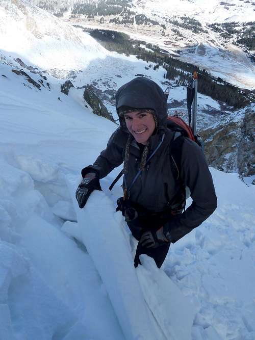
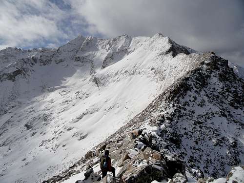
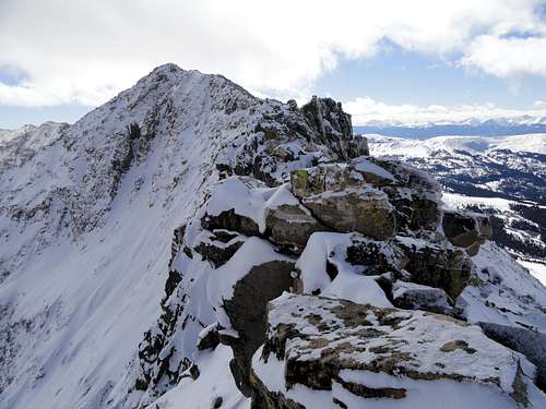
The ridge from this point to the junction with the North Ridge was tricky in a few spots and the exposure was constant. Fortunately, the sections that we thought would cause major difficulties did not and we soon joined in with the North Ridge. Staying true to the ridge crest we encountered some gnar and decided to pitch out about 50 feet of exposed traversing above the east face. After this section we endured a slippery downclimb and a few false summits before topping out at 12:40 PM.
![Mount Arkansas North East Ridge]() Arkansas North East Ridge
Arkansas North East Ridge![Sketchy Ledges]() Sketchy Ledges
Sketchy Ledges![Narrow Ridge]() Narrow Ridge
Narrow Ridge![Narrow Ridge]() Narrow Ridge
Narrow Ridge![Sun and Shadows]() Sun and Shadows
Sun and Shadows![On Belay]() On Belay
On Belay![Gendarme Downclimb]() Gendarme Downclimb
Gendarme Downclimb![Arkansas Summit]() Arkansas Summit
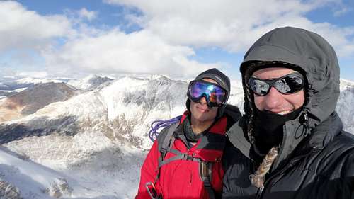
Arkansas Summit
After the obligatory high fives and summit revelry we walked off the summit to the north west and dropped a few hundred feet below a few rock buttresses to bypass all of the ridge crest scrambling. We side hilled along this slope for a while and eventually joined back in with the North Ridge aka "powdery-talus-ankle-twisting-misery." The bowl east of the ridge is already setting up nicely and some cornices are beginning to form.
![Walk Off]() Walk Off
Walk Off![Crux Gendarme]() Crux Gendarme
Crux Gendarme![North Ridge Bowl]() North Ridge Bowl
North Ridge Bowl
A quick stroll down the ridge brought us to the end where we weren't really sure where we should go. We descended west down a mellow slope and post holed through calf deep breakable crust back to treeline. Back in the trees I got us lost and Abe used his gps to find the truck. The thing I find most remarkable about this day is the incongruencies in time spent on the mountain and actual mileage and elevation gain covered. Our car to car time was in the 9-10 hour range, yet we only traveled 4.5 miles and gained 3200 feet of elevation. Anyway, it was a great adventure and yet another fine day in the Tenmile.
![NW Slopes]() NW Slopes
NW Slopes![Climax Mine]() Climax Mine
Climax Mine![GPS Data]() GPS Data
GPS Data


Comments
Post a Comment