
|
|
Route |
|---|---|
|
|
43.70890°N / 71.7236°W |
|
|
Hike |
|
|
Half a day |
|
|
Class 1 with simple scrambles |
|
|
Approach

VIA PLYMOUTH MOUNTAIN TRAIL: Take NH 25 west from Plymouth. Go around the rotary and head south on NH 3A towards Bristol. Head over the height of land and roughly five miles from the rotary make a left at a dirt road called Pike Hill. (this road is opposite the road towards Hebron and Groton). Head up the dirt road (not maintained in winter) roughly 1.3 miles to a turnaround and a small parking space just before the "do noit enter sign. The Plymouth Mountain Trail will be on your right.
Route Description
Plymouth Mountain Trail
3.5 miles roundtrip
Elevation Gain: 900 ft.
Plymouth Mountain Trail is an easy to moderate class 1 trail to the summit. The trail is poorly marked but is can be easily followed due to the fact that the trail has been recently maintained. The maintainance factor wasn't always the case as four years ago this trail was often hard to follow.
The trail begins from the small parking area just before the "DO NOT ENTER" sign and begins on a some jeep path. Roughly 0.2 miles there is a trail sign showing the Plymouth Mountain Trail. This section goes through a shrub field (a possible small former clearcut) before entering a forest. About 0.6 miles from the base the trail steepens to a moderate pitch as it begins to rise through the forest. An partial grown overlook comes up to your right roughly 0.8 miles from the starting point.
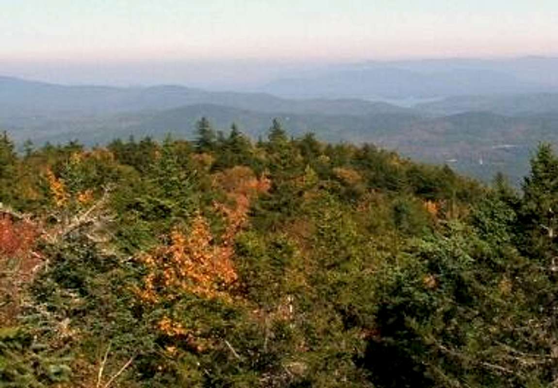
After the overlook the trail then become gradual again as it slowly rise to the summit. The hits a false summit that used to be know for views but has become completely overgrown at 1.3 miles. The true summit is down the ledge and into a col. The trail then goes up a simple scramble and rises to the summit where a sign and a cairn mark the summit. There is sign pointing to the classic beautiful out look 100 yards from the summit.
Essential Gear
This trail is only recommend for spring through fall because the road is a dirt road and is not maintained in winter. I read that there is parking at the base of 3A but I did not see anywhere to park.Only essential gear is nessesary in spring through fall.
Libertynh - May 1, 2011 11:59 am - Voted 6/10
ParkingOn 5/1/11 we found the parking area and turn around to be almost incorporated into a driveway across the road from the trail and the jeep trail that continued past the trail was an open class 6 road which we mistook as the road to the trailhead. We ended up hiking the road after it turned into a path/trail which was nice but without views. There is a small pull over on 3A just north of the intersection that is sometimes used for parking. We will try the actual trail another day.
Libertynh - Apr 11, 2013 9:08 pm - Voted 6/10
Found It!Found the trail. Had to go a bit further up the class VI road. Drove as far as possible then walked on road. Trail marking on the right. Good description. Parking is pretty much none but could get a small vehicle out of the road.
EastKing - Apr 12, 2013 6:56 am - Hasn't voted
Re: Found It!I remember that road being quiet narrow and that the only way to park anywhere was at the side of the road. I hope you enjoyed Plymouth Mountain. That peak had some good views.