
-
 15962 Hits
-
 78.27% Score
-
 9 Votes
|
|
Mountain/Rock |
|---|---|
|
|
39.10100°N / 106.653°W |
|
|
10460 ft / 3188 m |
|
|
Overview
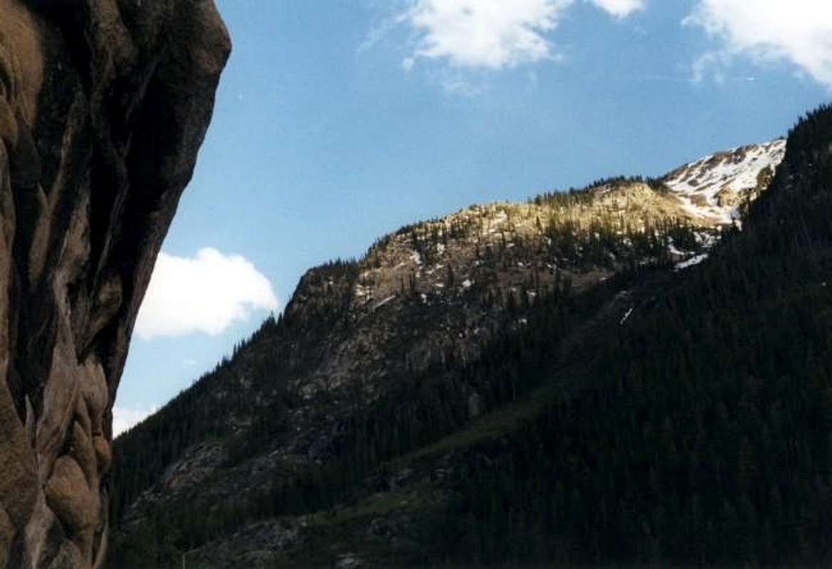
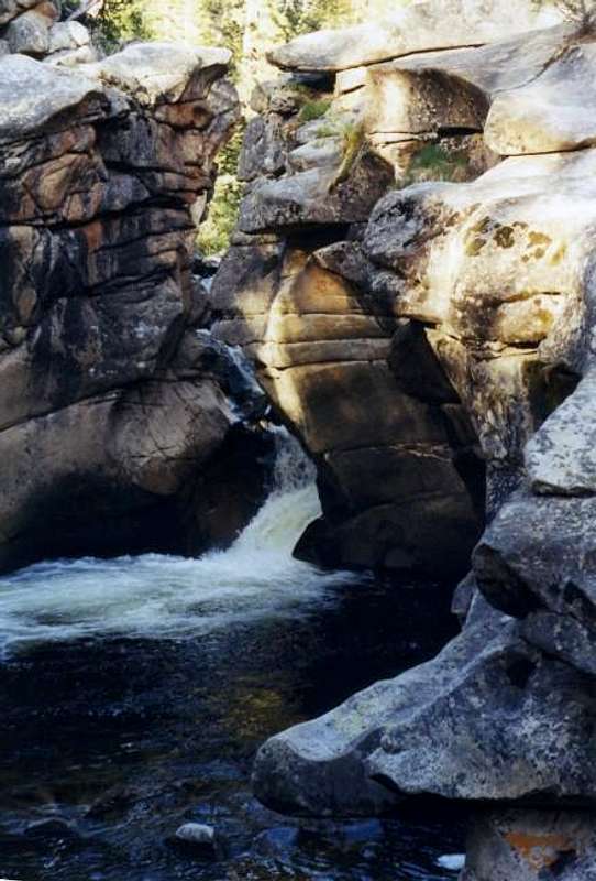
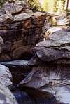
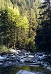
Point 10,460 is the shoulder of an un-named twelve thousand foot peak on the western side of Independence Pass. The area in which this point is a part is known for its' extensive collection of technical climbing routes. As you drive the part of Highway 82 from Independence Pass to Aspen you'll understand why it has its' reputation. There are a large number of huge cliffs all along the valley from the pass to Aspen. Point 10,460 is actually the top of one of these climbing mechas. For those of us who are vertically challenged, there is a trail that heads up around the cliffs on its' east side. The trail is very steep though and provides quite a challenge, if not going up, then coming down. The cliffs that make up Point 10,460 are quite impressive and are made up of very good rock for technical climbers as I've been told by climbers from the area. Other than the many technical routes on this hundred foot spire, the views from the top are beautiful in all directions and if it's solitude you're looking for than this is the place for you. The whole valley west of Independence Pass is crawling with geologic wonders. Just below the trail for Point 10,460, on the other side of highway 82, there is a parking lot with a trail that leads down to the Roaring Fork River. You'll be surprised with a beautiful cascade that is about fifty feet high and almost from a storybook. The many rock formations are impressive to see and can be easily combined with Point 10,460. There is actually a parking area across the road from the trailhead for Point 10,460. This is on the south side and this is also where the trail heads down to the Roaring Fork River to view the cascade. This is just one of the many little features of this beautiful valley which is well worth visiting.
ANY INFORMATION ON TECHNICAL CLIMBING ROUTES IS WELCOMED!
Getting There
There are two ways of getting to Point 10,460 via highway 82.
From Vail:
• From I-70 get onto highway 24 south to Leadville. Drive nearly 30 miles to Leadville and continue through town to where it meets up with highway 82 to the east of Twin Lakes and Mt. Elbert. Get onto highway 82 for Independence Pass and continue over the pass. From the top of the pass it is about three miles to the trailhead. The trailhead parking lot will be the first one on the left coming from Independence Pass once you’re past the historic mining town of Independence. The trail starts across the road (north side) and you’ll be able to see the cliffs. You’ll also see the trail for the cascade heading down below the parking lot.
From Aspen:
• Head out of town on highway 82 east. Continue for about ten to fifteen miles until you reach the winter closure gate. From here the trailhead and parking lot is only another three quarters of a mile up the road on your right. The trail starts across the road (north side) and you’ll be able to see the cliffs. You’ll also see the trail for the cascade heading down below the parking lot.
 |  |  |
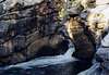
The Devil's Punchbowl
Below the parking lot, across from the trailhead for Point 10,460, a trail leads down to the Roaring Fork River which drains out of Independence Pass as it heads towards Aspen. Here there is a beautiful cascade called and tunneled out little canyon, called "The Devil's Punchbowl", that looks as if it should be out of a fairytail. It isn't hard to find a beautiful picture here.
 |  |  |  |
Red Tape
The surrounding lands are part of the Collegiate Peaks Wilderness and the Hunter/Fryingpan Wilderness. The location of Point 10,460 is between these two wilderness areas but all rules should apply. There are no permits or parking fees for the parking area. For conservation purposes for future generations, follow the "Leave No Trace" program and the natural areas will be there for years to come as they exist now.
When To Climb
This area is climbable all times of the year but the route is considered technical in winter conditions. Treat any climb out of season as a technical climb!
Camping
There are two campgrounds in the area at Lincoln Gulch and at Weller Lake. For information at the Lincoln Gulch site, contact the White River National Forest district office. For wilderness camping on backpacking trips, also use the White River National Forest district office.
Mountain Conditions
For weather conditions use:
weather.com
Type in Aspen for the place name.