
|
|
Route |
|---|---|
|
|
39.90611°N / 105.94806°W |
|
|
Hiking, Skiing |
|
|
Summer, Fall |
|
|
Half a day |
|
|
Class 2 |
|
|
Overview
This is the most scenic route up Ptarmigan Peak. The first half of the trail is good, but then is more faded as you approach Bottle Pass. After Bottle Pass, there is no trail, but cross country travel is easy. Approaching the summit of Ptarmigan Peak.
Getting There
East of Parshall (not far east of Kremmling) and on Highway 40 between mile post 197 and 198, turn south onto Country Road 3. Follow County Road 3 until you reach County Road 32 (FR-139), mile 12 (formerly between mile markers 15 and 16?) on County Road 3. Follow County Road 32 for 4.7 miles and turn right on FR-136 on the road marked for Lake Evelyn and Bottle Pass Trail. The small parking area at the trailhead is reached after another 3.9 miles. The last road is sometimes rather rough in places, but if you drive slowly, most vehicles can make it.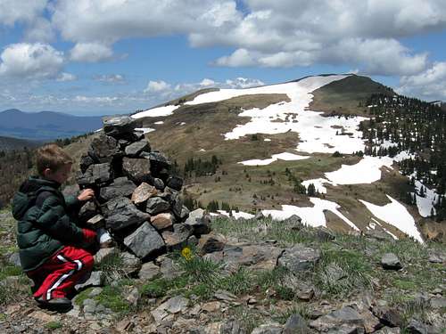 This is Ptarmigan Peak as viewed from the summit of Bottle Peak.
Route Description
From the trailhead, follow the marked trail (an old logging road) for Bottle Pass on the left side of the parking lot. The trail heads south up the Keyser Creek Valley. You will pass a trail junction, with a trail marked for Bottle Pass.Leave the old logging road here and take the less used trail to the left that is marked for Bottle Pass. The first half of the trail to Bottle Pass is good, but it gradually fades away. If you pay close attention you can still follow the trail by looking for old markers on trees and for cairns. We briefly lost the trail once on the way up and once on the way down, but I marked the strategic place with a cairn making it easier to find. If you look for the markers you should be able to stay on route. Bottle Pass is reached 2.25 miles from the trailhead and has some nice views.
Ptarmigan Peak is on the left. To climb Ptarmigan Peak, just head up the hillside towards the peak. There are no trails, but stay on the slopes to the left to avoid some of the swampy areas.
There are fine views from the summit, including the best views of Bills and Byers Peak and all the other surrounding mountains and valleys.
The round trip distance to climb Ptarmigan Peak from Keyser Creek is 5.4 miles round trip with 1800 feet elevation gain. If you climb Bottle and Ptarmigan Peaks in the same trip, the round trip distance is 6.2 miles round trip.
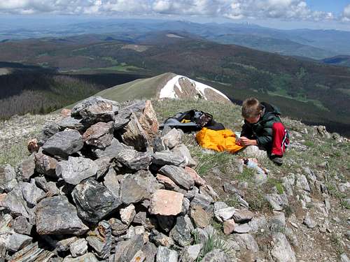 This is the summit of Ptarmigan Peak looking north.