
-
 2468 Hits
-
 84.27% Score
-
 18 Votes
|
|
Route |
|---|---|
|
|
46.56229°N / 10.71699°E |
|
|
Hiking, Mountaineering |
|
|
Spring, Summer, Fall, Winter |
|
|
Most of a day |
|
|
Alpine F |
|
|
Overview
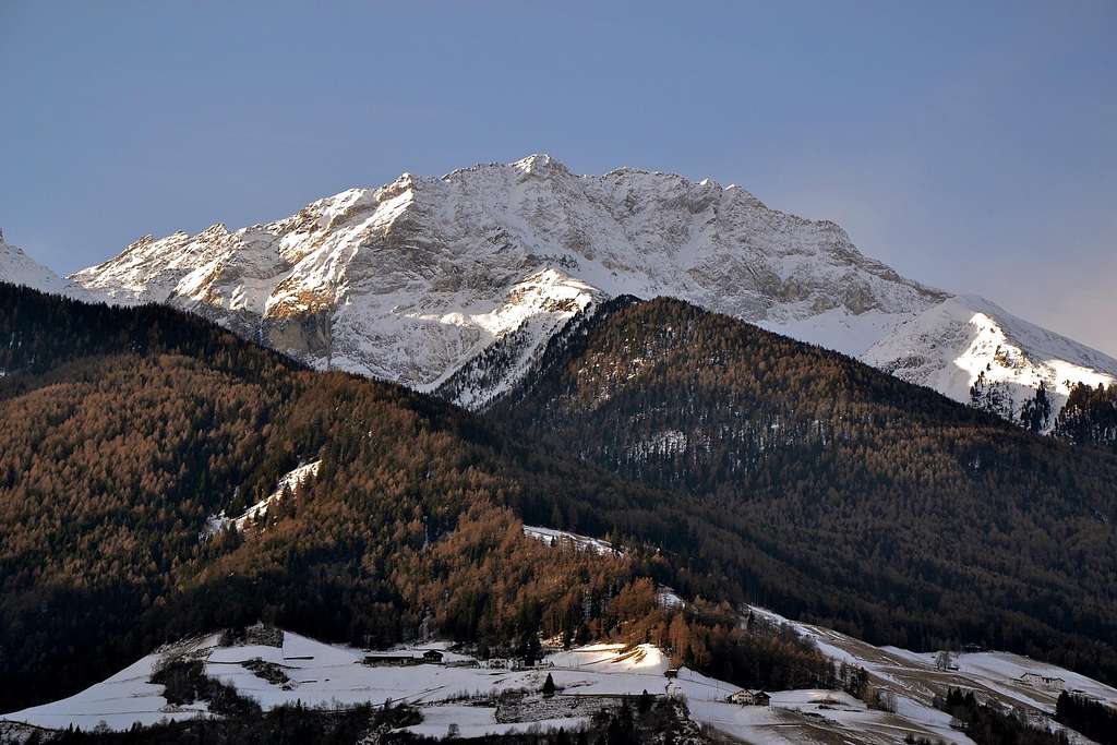
Punta Lasa or Laaser Spitze or Orgelspitze Normal route from South (Val Martello)
Surrounded by Lasa, Venosta and Martello valleys, Punta di Lasa 3305 m belongs to the Ortles-Cevedale Group and overlooks the little village of Lasa in Valle Venosta. From this latter the mountain is well seen watching towards South. It’s the most important summit belonging to the Lasa Subgroup and it shows four ridges and a small glacier. This remarkable peak has three name: Punta di Lasa is the official Italian name, while the local names are Laaser Spitze for the inhabitants of Venosta Valley and Orgelspitze for the inhabitants of Martello Valley. This latter name seems to originate from the german word “Orgg”, in reason of the ancient legend concerning an ogre who had lived on the mountain. According to another interpretation, the name would do reference to the term "Arge Spitze", meaning Menacing Peak, as the first signs of the onset of bad weather would appear on the top of this mountain.
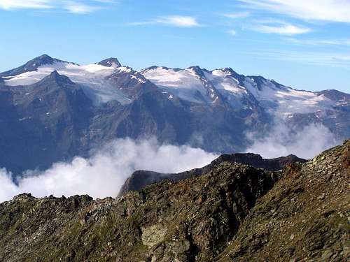
Being a primary panoramic point, the mountain is often climbed along its interesting Normal Route starting from Maso Stallwies located in Val Martello side. From the summit the mountaineer can enjoy an incredible contrasting view between Ortles-Cevedale white summits and Val Venosta green meadows.
Getting There
The road approach is from Bolzano.
- from the Autobrennero exit Bolzano and follow the road to Merano and Valle Venosta, reaching Coldrano – Goldrain. Here leave the main Val Venosta and turn to left, taking the road to Val Martello, getting to the village of Ganda - Gand. In Ganda turn to right (signposts)and follow the winding and narrow road to Maso Stallwies m. 1931. Parking.

Route report
Route Description
Summit altitude: 3305 m
Difficulty: the route is long and steep, but essentialy a walk in the first section, then an easy scramble when climbed in summer condition May be graded Alpine F in last spring or early summer, when it becomes a bit more difficult, requiring the use of crampons and axe to climb up the summit
Difference in level: 1373 m. from Maso Stallwies m. 1931
Exposure: South
Time required: 4 hours for the ascent, about 3 hours for the descent


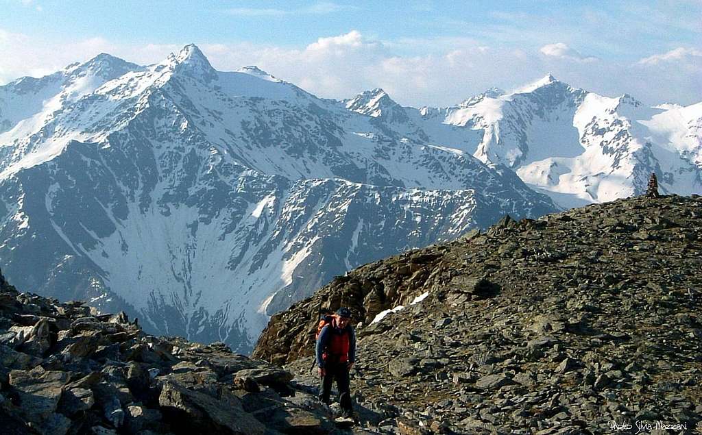
From Maso Stallwies m. 1931 take the path n. 5 rising inside a wonderful pines and larchs wood and skirting a stream, then crossing the stream. Ignore on the right side at first the path n. 23 (Marteller Hohenweg), then the path n. 23a (Schlichtbergsteig) and head to North West, always following the path n. 5; the route rises along a steep valloon on grassy and scree slopes, leading to a shoulder and a nice small lake, called Laghetto Sassobuco or Steinmanngasseloch at the altitude of 2935.
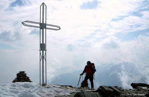
Now the steep summit pyramid of the mountain is visible. Head to North and climb the steep face on stones or snow slopes in early season, gaining the South East ridge, then the summit cross (summit book) and the huge cairns built on the top. Superb view on the Alpi Venoste and Ortles-Cevedale Group.

Descent: reversing the same route.
Essential Gear
High mountain gear. In presence of snow and ice, possible in early season, crampons and an axe are required to climb the summit pyramid.
Red Tape

No fees no permits required. Punta di Lasa is situated inside Parco Nazionale dello Stelvio, one of the hystorical national parks in Italy, belonging to the provinces of Trento, Bolzano and Sondrio. Free camping is not allowed and fires are forbidden. The whole fauna and flora are protected.
When to climb
Mountaineering: from the end of May to middle October
Ski mountaineering: from March to the end of April
Accomodation
Maso Stallwies has some rooms. Otherwise different possibilities of accomodation in Martello Valley

Guidewbooks and maps
Guidebooks


“Prestigiosi Tremila del Sud Tirolo” by Hanspaul Menara – Ed. Athesia
“Ortles-Cevedale – Parco Nazionale dello Stelvio” by Gino Buscaini – Collana CAI-TCI Guide dei Monti d’Italia
“Alto Adige Occidentale” Guida alpinistica escursionistica by Achille Gadler – Panorama ed.
Maps
“Ortles-Cevedale”, sheet 72 - Kompass 1:50.000 "Val Venosta", sheet 52 - Kompass 1:50.000 "Laces-Martello-Silandro", sheet 045 - Tabacco
Meteo
METEO PROVINCIA BOLZANO ALTO-ADIGE