
-
 1689 Hits
-
 81.84% Score
-
 14 Votes
|
|
Route |
|---|---|
|
|
45.48270°N / 7.16843°E |
|
|
Mountaineering, Scrambling |
|
|
Summer, Fall |
|
|
EE, F |
|
|
Overview
Punta Violetta Normal route from Piani di Nivolet
The pretty Punta Violetta 3031 m, also named Punta del Nivolè, not an important peak, offers an absolutely pleasant ascent from Piani del Nivolet, moreover it's quite advisable due to the wide and beautiful panorama visible.
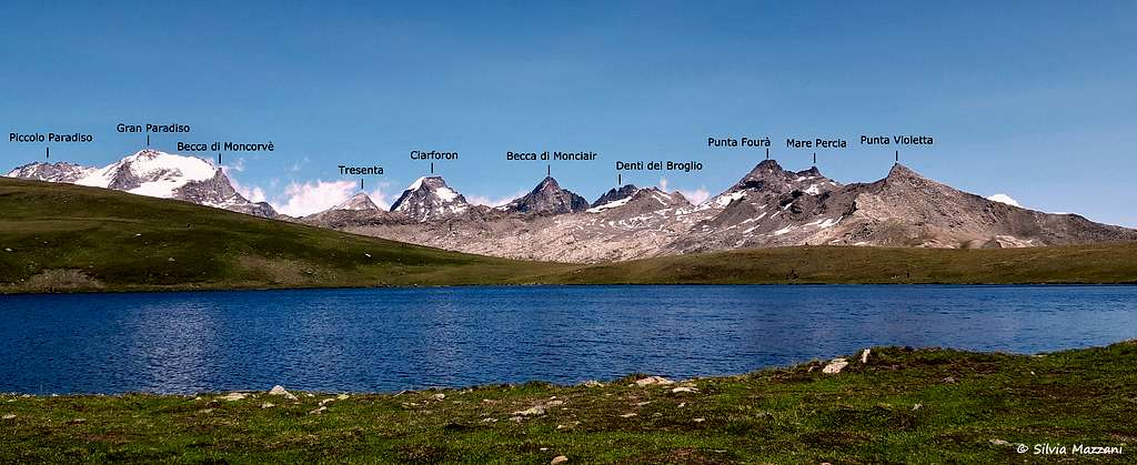
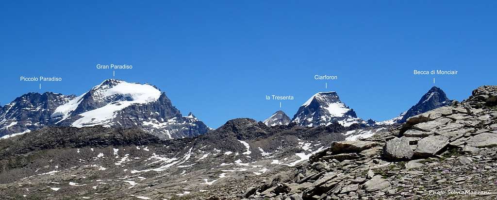
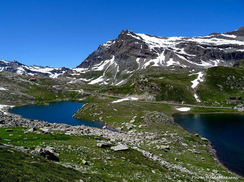
The views range widely in the direction of the Levanne group, the Gran Sassiere and the peaks of Vanoise towards SE, the group of Galisia-Basei to the SW, Mont Blanc to the West and a vast sector of the Gran Paradiso with the parade of peaks from Grivola to Punta Fourà with the main summit of Gran Paradiso in the middle and the magnificent water mirrors of Nivolet. The Normal route follows the West ridge of the mountain in its high part.
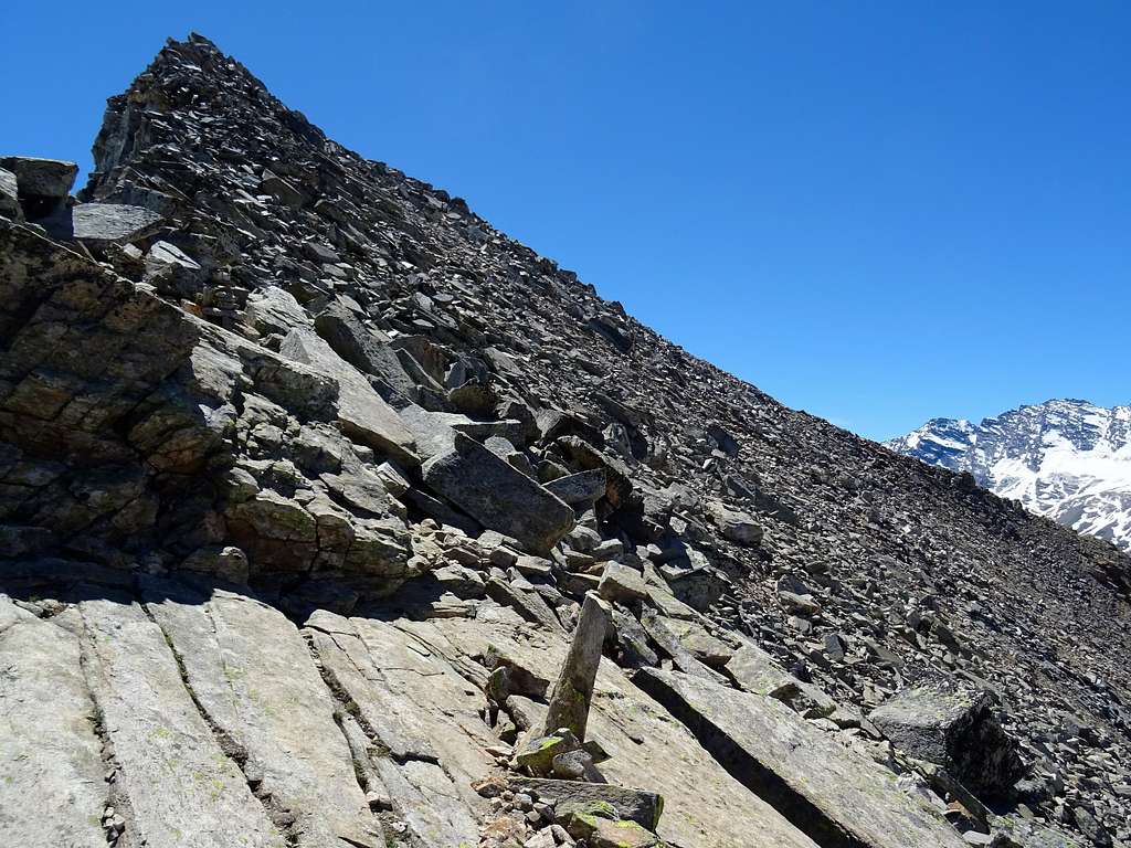
The ascent is short and very varied, starting in a small valley, then following a morainic hill and finishing with an easy scrambling finish on blocks of solid granite.
Getting There
The closest inhabited center is Ceresole Reale (km. 35 from Pont Canavese), in the high Valle dell'Orco, m. 1613, a nice village lying near the great artificial lake of Ceresole.
Road access
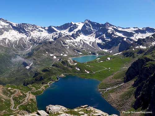
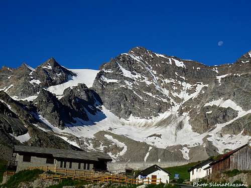
- From Torino (Caselle international airport) to Ivrea (motorway A5) and then Courgnè and Pont Canavese m. 461; from here follow the road entering Valle dell’Orco, reaching Locana, Rosone, Noasca. In Noasca drive up to reach Ceresole Reale, here continue to Colle del Nivolet, passing through Lago Serrù, crossing the dam of Lago Agnel and reaching the pass 2612 m. The Colle del Nivolet is a pass between the regions of Piedmont and Valle d'Aosta included in the Gran Paradiso National Park with a wonderful panorama of frozen peaks and numerous alpine lakes. From the pass descend briefly to reach the flat Piani del Nivolet with the Nivolet lakes, right near the Rifugio Savoia 2532 m. Small parking lots along the road and a large one at the refuge.
- From Aosta take the Aosta-Torino motorway, exit Ivrea. From Ivrea follow the road towards Ciriè, reaching Pont Canavese. From here same access as the previous one.
Route Description
Punta Violetta Normal route
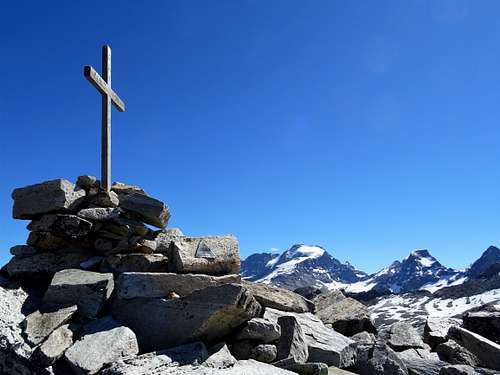
Summit quote: 3031 m
Difficulty: EE
Difference in level: 500 m
Starting point: Piani del Nivolet
From the Rifugio Savoia 2532 m walk briefly along the road in the direction of the col (South) to take a path branching off to the left and crossing an isthmus between the two lakes of the Nivolet.
After the lakes, the path begins to climb the grass and stony slope towards the Costa di Menta, an elevation of little importance between the Rocce del Nivolé and Punta Violetta. Continue along the wide ridge of grass and stones obliquely to the left in the direction of some visible electric pylons, then head directly until you will reach a big stone-cairn with prayer flags. Right in front you can see the slender and inviting rocky pyramid of Punta Violetta and on the left you have a beautiful view to the Gran Paradiso group. Start to follow the West ridge (cairns) at first wide and flat then increasingly narrow and in the form of blocks of solid rock. Once you have reached the altitude of 2926 m, descend slightly to the underlying saddle and return to climb up along the ridge becoming narrow and gradually steeper, not far from the edge of the same. Gained the base of the summit triangle, progressively move to the right (Valle dell'Orco side) to avoid a stretch of wall and continue on steep blocks until you reach the summit cross.

Descent: reversing the same itinerary
Essential Gear
High mountain clothes and mountain shoes
Red Tape
No permits, no fees and no particulary restrictions in climbing. The mountain is located inside Parco Nazionale del Gran Paradiso, established in 1922, one of most important National Parks in Italy. You should take care of nature as usual within the boundaries of all the natural parks. Free camping is not allowed and fires are strictly forbidden. The whole fauna and flora are protected. Don’t disturb fauna and other mountaineers’ peacefulness with every kind of noise.
Pay attention to the periods of opening of the road to the Colle del Nivolet, in the height of summer the road is not passable by private vehicles, but it is possible to take advantage of a shuttle service.
Where to stay
Different possibilities of accomodation in Comune di Ceresole Reale:
Near Colle del Nivolet there two huts:
- Rifugio Savoia
- Rifugio Città di Chivasso
When to climb
The best period goes from mid June to mid October
Meteo
Meteo Regione Piemonte
Meteo Alpi
Guidebooks and maps


Gran Paradiso - E.Andreis, R. Chabod, M. Santi - Collana Guide Monti d'Italia CAI-TCI
IGC Parco Nazionale del Gran Paradiso sheet n. 3 1:50.000
External Links
