
|
|
Route |
|---|---|
|
|
43.99311°N / 115.10346°W |
|
|
Hiking, Aid Climbing, Scrambling |
|
|
Summer |
|
|
A few days |
|
|
Class 4 |
|
|
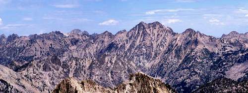
Queens River / Little Queens River Approach to the Rakers
Although the most common approach to the Rakers is to start at the Grandjean Trailhead and follow the South Fork of the Payette past Elk Lake before scrambling cross country to the base of the Rakers, the Queens River loop affords many more peak bagging opportunities along the way. I would suggest this route if you'd like to accomplish more than just summiting the Rakers as there are plenty more opportunities for fun in the mountains along this approach as opposed to the standard northern approach. You will have many opportunities to summit other peaks such as Plummer Peak, Mount Everly, Blacknose Peak, Browns Peak, Flat Top Mountain, and Nahneke Mountain.DISCLAIMER: This route is best suited for experienced hikers and climbers. The location is remote and cross country travel (no trails) is required over class 2-4 terrain.
Getting There
Take Idaho Highway 21 north of Idaho City about 18 miles and turn east at the sign for Edna Creek Campground onto FR 384. From here, follow signs to Atlanta. At 13.7 miles turn left (east) onto the North Fork of the Boise River road (FSR 327). At 26.6 miles turn left at a 4 way stop onto the Middle Fork of the Boise River road (FSR 268). At 36.5 miles turn left onto the Queens River road (FSR 206) and drive another 2.5 miles to the trailhead at 39 miles.Route Description
From the trailhead you have two options. You can hike up along the Queens River or you can go up the Little Queens River. Your destination is the high point of the trail at 9200+ feet just above Arrowhead Lake. This is where the cross country portion starts. From here head north toward the saddle below the east ridge of Blacknose Peak. There is a small knob topping out around 9680 feet. Head to the right (east) side of the knob to reach the saddle.If you head left (west) instead you can reach the summit of Blacknose Peak. I originally attempted this but ran into some cliffs and decided it would be best to drop down into the boulder field north of Blacknose. It may be possible to summit Blacknose and continue on around the ridge system that leads to the Rakers and if you're feeling adventurous I would imagine it would be fun. I ran into cliffs however and decided to discontinue that plan.
From the saddle it's a fairly easy class 2-3 descent into the boulder field to the north of Blacknose peak. You will lose up to 1000 feet of elevation, less if you traverse high across the boulders, but cross the boulder field and head up the other side toward peak 9722. Once you gain the peak, follow the ridge to the "South Raker" (as listed on the USGS quad, not the "real" South Raker). Dip down the "South Raker's" north ridge and angle left around the west side of the rakers. The terrain from here is boulders / talus. Continue on to the saddle between the North Raker and the South Raker. There is supposed to be a summit register somewhere in the saddle, but I could not find it for the life of me.
 Routes are hand drawn. As always, exercise caution with route finding and decision making.
South Raker Summit
From the saddle between the North Raker and the South Raker, begin the scramble up the northwest ridge of the South Raker. The final summit block is only a couple hundred feet, but is highly exposed, particularly to the north. There are a couple moves I would consider class 4. At some point you will run into a smooth vertical wall approximately 4 1/2 to 5 feet high. I wasn't able to find any footholds on the wall and had to do some mantling (think getting out of a swimming pool without a ladder) to get to the next move. The final summit block for the South Raker
There is another shorter wall just below the summit which also poses some difficulty although not nearly as much. The actual summit is about the size of a large coffee table with a good amount of exposure on all sides. If you can make it to this point, you can count yourself among the small number of people who have done so.
 A view from the saddle between the Rakers