Reinhart Knob - Richland Balsam Loop

Reinhart Knob - Richland Balsam Loop

Page Type Page Type: Trip Report
Date Date Climbed/Hiked: Jun 6, 2012
Activities Activities: Hiking
Seasons Season: Spring

One of the Easiest, One of the Hardest...

Reinhart Knob (6,106') and Richland Balsam (6,410') are, as the Carolina Mountian Club describes it, one of the easiest and hardest South Beyond 6K'ers on the list. This primarily has to due with the fact that Reinhart Knob has no trails to it's summit and there are no connector trails between the two peaks. Thankfully, they are relatively easy to get to. Located astride the Blue Ridge Parkway south of Waynesville, the peaks sit within a couple miles of each other making for a relatively quick hike barring any off-trail wrong turns.

My hike began at the Beartrail Ridge Gap on the Blue Ridge Parkway. From there I walked a few hundred yards south where I turned right and dove into the forest. The route up and over Reinhart Knob is a bushwhack, and a tough one at that, with a thick understory of mixed thorny plants. The descent down the back side was steep and rocky. Once at the Mountains to Sea Trail I turned north paralleling the ridge above for about 2 miles until I was roughly below the Richland Balsam Overlook. At that point it was a short (but steep!) bushwhack back up to the parkway which I arrived at only a quarter mile or so below Richland Balsam. After a quick scramble up the rocks across from the overlook I quickly picked up the trail over the top of Richland Balsam at which point I simply followed the Parkway back to my car. All told it was a 5-6 mile hike and, despite the beauty of it, one I hope not to repeat anytime soon...

Photo Journal...

Reinhart KnobReinhart Knob

Reinhart Knob, rising to 6,106', would be my first objective. There are no trails to the summit so I would have to do something somewhat unfamiliar to me...bushwhack to a summit. The planned route would involve a 260' climb/bushwhack from the parkway to the summit and then a steep 600'+, half-mile bushwhack descent down its south face to the Mountains-to-Sea Trail...


Beartrap Ridge OverlookBeartrap Ridge Gap

My route started from Beartrail Ridge Overlook (elev. 5,812). From here I headed a short distance east along the parkway before striking out into the forest for Reinhart Knob's summit. Across from Beartrail Ridge Overlook there was a BEAUTIFUL view of the Middle Prong Wilderness down Sugar Cove...Cold Mountain (6,040') rose majestically in the distance...


Diving In...Bushwhack Begins

A few hundred yards north along the parkway from Beartrap Ridge Gap I picked a random gap in the trees and, GPS in hand, struck out for the summit...


Reinhart Knob BushwhackPickerbush Hell

I'm not going to sugar-coat it, the short bushwhack up was BRUTAL. Most of the undergrowth you see here has some kind of thorn attached to it. My choice of long sleeves and long pants was wise. Mercifully, the bushwhack to the top is quite short.....


Reinhart Knob SummitReinhart Knob Summit

Before long, if you're on the right track, you leave the pickerbushes behind and enter a spruce/fir forest typical of 6,000 foot peaks around here. The summit area is obvious, though the exact high point is less so. To make sure I hit the top I did a bit of wandering around...


Reaching the MST...Downhill Was Worse

After reaching the top, my next objective was to reach the Mountains-to-Sea Trail south of the summit some 600 vertical feet below me. To reach it involved a half mile bushwhack that was both steep, rocky, and wet. The drainage I followed on the way down widened out and housed numerous small, hidden streams that made the descent uncomfortable at times, to say the least. I was quite elated when I finally reached the MST...


Mountains-to-Sea TrailThe MST

The MST, at least the portion I hiked, followed an old logging road along the ridge. There was very little elevation change and it was quite overgrown with grass testifying to the fact that this was a seldom-visited area...just how I like it...


Rare MST View...Just A Peek

The MST was very well-cloaked in trees so when a view, however small, opened up it was a cause for an enjoyable break...


Waterfall Crossing on the MSTEphemeral Falls

Every so often the MST would be crossed by a small streams whose existence was owed to the rains of the previous evening. They were never too large not to hop across and every so often, like this one, they would display some nice cascades...


Mountains-to-Sea...Simply Walking

Between bushwhacks I followed the MST for about 2 miles. For much of its length it pretty much looked the same, a grassy trail surrounded by trees. Not the most visually exciting trail but, as it was bookended on this hike by bushwhacks, a welcome reprieve from physical exertion...


Richland Balsam BushwhackOne More Bushwhack

I was following my Carolina Mountian Club supplied map to the best of my ability but as I reached the supposed end of my stretch on the MST it was disagreeing somewhat with my GPS. Eventually, I figured it was simply in my best interest to strike out for the Blue Ridge Parkway, somewhere above, and go from there. As with the previous bushwhacks it was short and steep but this one was mercifully devoid of any pickerbushes...


Parkway @ Richland BalsamInternal Compass Working Fine

As I was essentially guessing where I was heading (I wasn't trusting my GPS entirely at this point)I was quite impressed to discover that my internal compass had dumped me out on the parkway less than a quarter mile south of the Richland Balsam Overlook...

Richland Balsam Panorama

From the Richland Balsam Overlook, one has to make a quick scramble up the small cliff across from the parking area to get to the summit loop. The panorama from the top is one that could literally knock you off your feet...and if you visit in late July or August you can enjoy some wild blueberries here at the same time, how perfect is that?!


Richland Balsam TrailRichland Balsam Loop

After all the bushwhacking and route-finding it was nice to be on an established trail, even one as well-traveled and (let's admit it) mediocre as the Richland Balsam Loop...


Richland Balsam ViewRichland Balsam View

As the Richland Balsam Trail looped around the west side of the summit a nice, small opening in the trees offered me a beautiful view of the countless rolling hills and ridges stretching away to the distant Smoky Mountains...


Richland Balsam SummitRichland Balsam Summit

Now, I'm not going to come right out and say that the summit of Richland Balsam is a disappointment. Ecologically, it's an amazing place that is home to one of the thickest stands of fir anywhere in the mountains and the various, more northerly, creatures which call this unique environment home. However, it's 6,400 freaking feet high...and there's no view (the glimpse through the trees hardly counts)!!! I've climbed this peak dozens of times and a small part of me is always disappointed (OK, I did say it). I have a feeling more swearing goes on at this summit than any other peak in the southern Appalachians...


Richland Summit ViewThe 'Not-a-View'

In my previous tirade I mentioned that the fleeting glimpse through the trees below the top of Richland Balsam hardly counts as a view...I'll let you be the judge...


Richland Balsam ForestHigh Elevation Forest

The summit of Richland Balsam is a thick tangle of firs, ferns, and fallen trees. As I meandered down from the summit I found my self appreciating the fact that I didn't have to bushwhack this one!


Future ViewFuture View?

Not far below the summit of Richland Balsam, a couple deceased firs almost give another glimpse of the surrounding terrain. I certainly don't enjoy the death of venerable old trees but if a couple more went...well, I'm just saying...


Richland Balsam TrailConcrete Jungle

All semblance of wildness on this hike disappeared when the Richland Balsam Loop, just short of the parking area, turned to concrete...just looking at the picture makes my feet sore...


Catawba RhododendronSerenade of Color

The flower season has been all screwed up this spring and the rhododendrons haven't been immune. Aside from one's like these, above 6,000 feet, all the Catawba Rhododendron's have long since come and gone. Finding a nice, healthy grove along the trail is always an uplifting experience...even more so this year...


Haywood-Jackson Panorama

The Richland Balsam Loop spat me back out onto the parkway at the Haywood-Jackson Overlook. This is one of my favorite spots on the parkway. The massive Shining Rock Ridge, much of it above 6,000', rises across from the Middle Prong Wilderness. The view also provided me with my first look back at Reinhart Knob. Funny, I thought, the two peaks don't seem as far away when you have a road to walk between them rather than three bushwhacks...


Haywood-Jackson OverlookCold Mountain

Visible from the Haywood-Jackson Overlook also was the 6,040' bulk of Cold Mountain and a cloud-wrapped 5,722' Mt. Pisgah...


A Nice Road Walk...The Parkway

The route back to the car from Richland Balsam simply involves a mile and a half walk along the Blue Ridge Parkway. Normally, I detest road walks on my hikes but how can you be upset with walking along this road?


Richland BalsamRichland Balsam

As I made my way downhill, a look back over my shoulder revealed a fleeting glimpse of Richland Balsam sticking above the ridge...


Cowee Mountain Overlook

About halfway back to the car from Richland Balsam is the Cowee Mountain Overlook. The rains from the previous night had really done a good job of scouring the moisture out of the atmosphere and the immense panorama stretched away to the South Carolina piedmont...


Reinhart Knob Panorama

Finishing up the Reinhart Knob-Richland Balsam Loop I was treated to this amazing panorama of the southern slopes of Reinhart Knob...may I never have to climb it again!

Beta...

Reinhart Knob - Richland Balsam Route MapThe Approximate Route


Mileage Hiked: ~5.5 miles
Trailhead Temp: 52'F
Min. Elevation: 5,400'
Max Elevation: 6,410'
SB6K Peaks Bagged: 2 (Reinhart Knob-6,106', Richland Balsam-6,410')


Comments

Post a Comment
Viewing: 1-5 of 5
MarkDidier

MarkDidier - Jun 12, 2012 5:50 pm - Voted 10/10

I see that...

...it didn't take you long to get out hiking now that you are back home!

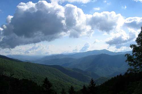
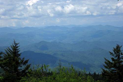
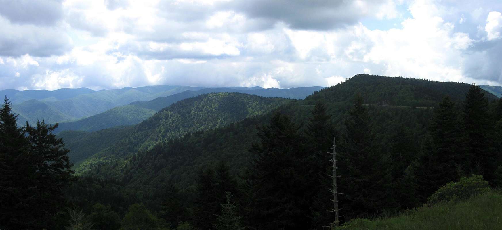
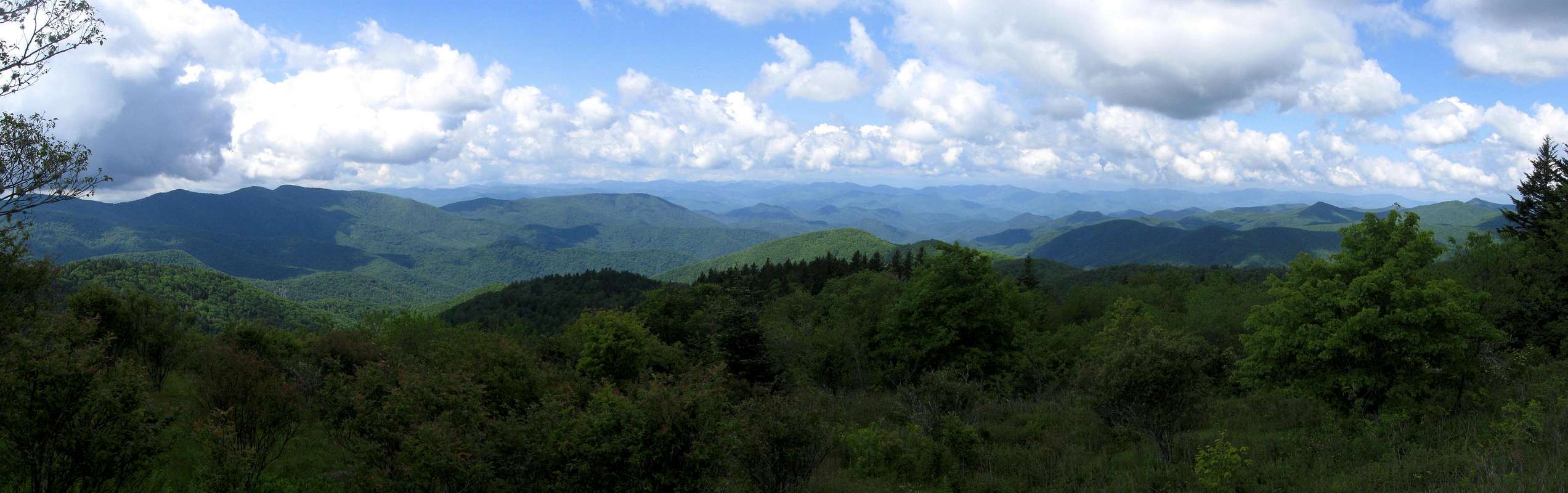
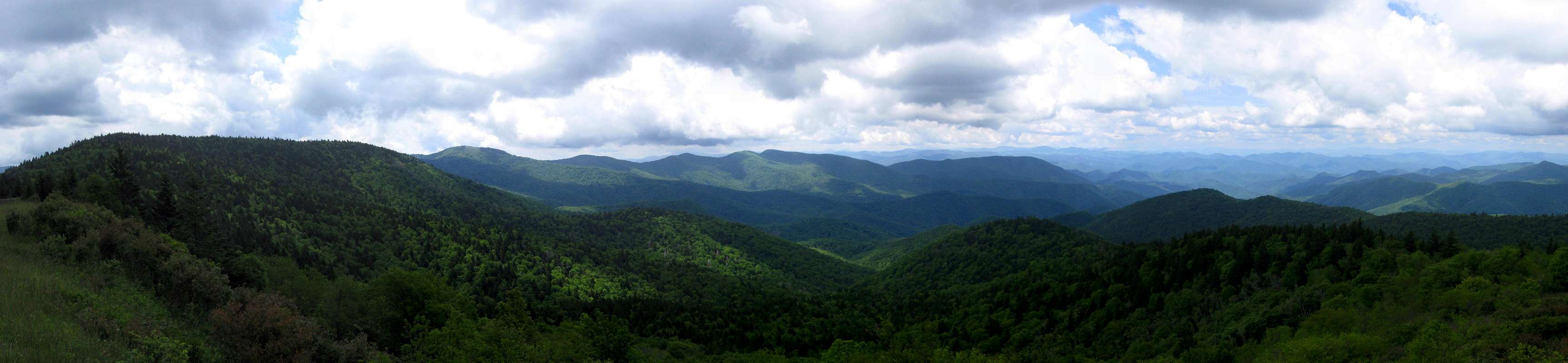
Classic southern Appalachian summit - work so hard for nothing but a view of the trees! Still sounds like it was a great day. Some great pics in here. Good to see a new post from you.

Happy Trails,
Mark

dwhike

dwhike - Jun 12, 2012 9:49 pm - Hasn't voted

Re: I see that...

I was long, long overdue...it feels great to be back in the high peaks! I'm scouring my maps for some new mountains to add and have a couple in mind. Can't wait! Thanks for the nice comments!

johnmnichols

johnmnichols - Jun 13, 2012 7:58 am - Voted 10/10
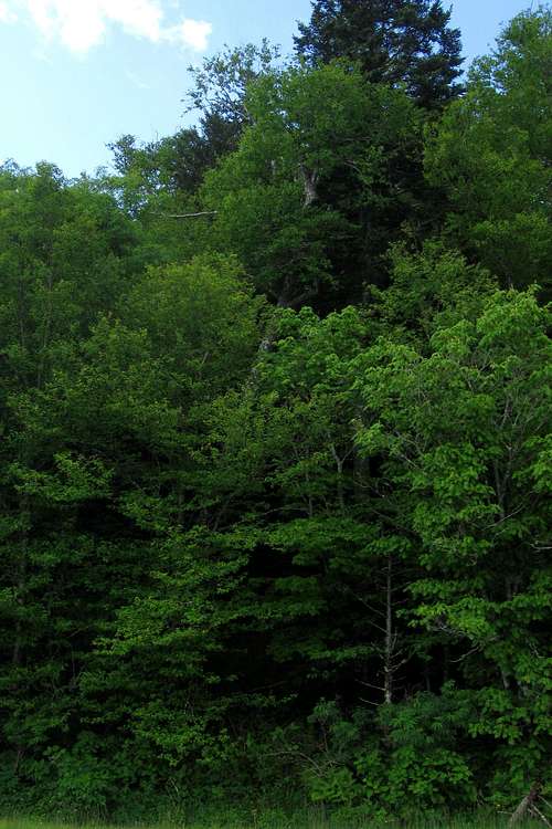
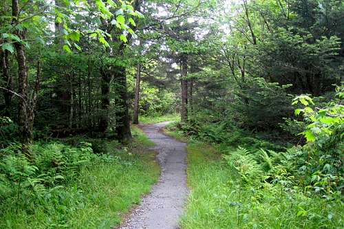
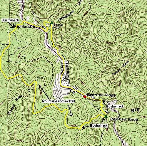
Very nice

I love to hear stories of non-winter southern Appalachian bushwacks...when the undergrowth is super thick. Glad you didn't get stuck in rhododendron hell. Nice write-up.

dwhike

dwhike - Jun 22, 2012 9:23 am - Hasn't voted

Re: Very nice

Thanks, it was quite an experience and one that it looks like I'll have to get used to if I'm going to complete the SB6K list!

wmbii8204

wmbii8204 - Jul 22, 2013 11:14 pm - Hasn't voted

bushwhack

Did Reinhart Knob today. Brutal bushwhack! Whacked thru yards and yards of 8' high blackberry and other thorny brambles near the summit. Quite an experience, especially in July. If I ever repeat it, it will be immediately after the Parkway reopens.

Viewing: 1-5 of 5

Parents 

Parents

Parents refers to a larger category under which an object falls. For example, theAconcagua mountain page has the 'Aconcagua Group' and the 'Seven Summits' asparents and is a parent itself to many routes, photos, and Trip Reports.

Richland BalsamTrip Reports
 
Reinhart KnobTrip Reports