
-
 3442 Hits
-
 77.48% Score
-
 8 Votes
|
|
Route |
|---|---|
|
|
39.53970°N / 105.6043°W |
|
|
Download GPX » View Route on Map |
|
|
Hiking |
|
|
Spring, Summer, Fall, Winter |
|
|
Most of a day |
|
|
Overview
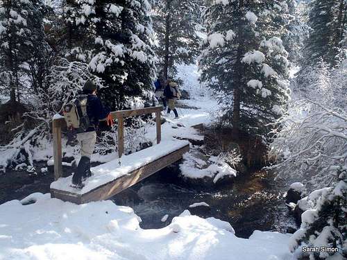 Tanglewood Trail Stream Crossing
This great circuit route breaks out of the “out and back” rut and takes in some dynamite scenery, providing a great tour of Bandit Peak. Roughly one-third of this route is off-trail, so bring your sharp navigation skills with you. While no scrambling is involved, be ready to negotiate sometimes loose boulders and talus. The views above timberline on Bandit Peak are fantastic. Enjoy!
Roundtrip Distance: 9 miles
Elevation Gain: 3200 feet
YDS Class: 2
This route was shown to me by Rico, one strong son-a-gun who loves exploring off-trail and sharing his love of the mountains with others.
Getting There
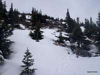 |  |  |  |
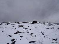
 Upper slopes of Bandit Peak
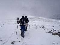 Nearing the summit
Follow Hwy 285 west from Denver for 28 miles. At a stop light, turn northwest (right, if coming from Denver) onto Park County Road 43. Follow CR 43 for 6.8 miles to a fork in the road. Bear left at this fork and continue an additional 2 miles (past the campground) to the Deer Creek Trailhead.
4x4 is not required to reach this trailhead unless there is deep snow present. In dry summer conditions, a sedan or motor cycle could reach this trailhead, if desired.
Route Description
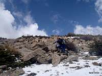
 Summit cairn in view!
 Beginning descent
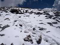 Northwest slopes
 Descending to southwest
 Back into the trees
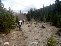 Lower western slopes
Ascent
• From the parking lot, head first westward on the Tanglewood Trail to the junction with the “Old Rosalie” trail.
• From here, travel roughly 2.1 miles north on the Tanglewood Trail to the point where the trail heads east across a creek. This is a good point to begin your off-trail ascent of Bandit Peak.
• Begin hiking cross-country through sometimes dense timber on often steep ground, westbound. After roughly ½ mile, you will emerge from the trees.
• Continue the remaining ¾ of a mile or so up boulders, rocks and talus to the summit of Bandit Peak.
Descent
Resist the temptation to drop immediately west down the western slopes of Bandit Peak. These slopes are steep and loose. There is a better way!
• Head northwest off of the summit of Bandit Peak toward the saddle with Rosalie Peak.
• From here, it is roughly 1.25 miles back to a trail.
• Trend first southwest down talus, then south through light timber and willows, then south southwest again through timber to reach the trail.
• Gain the Deer Creek Trail down in the drainage and follow this southeast for about a mile to a junction. Here you have the choice between heading uphill and following the “newer” Rosalie Trail, or remaining downhill to follow the old, decommissioned trail.“newer” Rosalie Trail, or remaining downhill to follow the old, decommissioned trail. The old trail follows the drainage, provides solitude and serves up great scenery in the form of streambed outcrops.
• Regain the Tanglewood Trail very near the trailhead and complete the stomp back to your vehicle.
Essential Gear
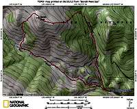 Circuit Map
 Stream crossing on old trail
• Trails Illustrated #104: Idaho Springs | Georgetown | Loveland Pass
• Outerwear appropriate to the season
• Flotation (snowshoes or skis) in snow season