
-
 6766 Hits
-
 71.06% Score
-
 1 Votes
|
|
Route |
|---|---|
|
|
51.32230°N / 116.1306°W |
|
|
Mountaineering |
|
|
Summer |
|
|
Most of a day |
|
|
Difficult Scramble |
|
|
Approach
This is a 3500’+/- ascent day. If you are just ascending the ridge and returning, this is an easy scramble. If you are traversing the ridge from north to south, it is a difficult scramble, however, is the route I recommend. Park at Moraine Lake. Take the Consolation Lakes trail 2.5kms to it's terminus at Lower Consolation Lake. |  |  |  | 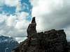 |
Route Description
Cross the lower Consolation Lake outlet using boulders, logs, etc. I advise just wading through. I tried to connect the dots to no avail. My just reward was having to wring out my socks and boots on the other side. Proceed straight up an avalanche gully to the north peak of Panorama Ridge. This is a several thousand foot plod on firm ground. If anything, stay climbers right up the slopes. Eventually you hit a large boulder field. These large block boulders make up the entire ridge, unique compared to most ridges I have experienced in the region. This peak has a cairn at about 9200'. Take in the views of the east side of Mount Temple along with other prominent peaks of the Larch Valley. During this entire journey, you will be treated to two of the more interesting glaciated mountains, Mount Quadra and the black sheep of the family, Bident Mountain to the southwest.Proceed along the ridge to the obvious high point to the south, the second to last peak on the ridge before Taylor Pass. This part of the trip involves expert hands on scrambling and route finding. The most conspicuous aspect to this climbing is that none of this rock is sound, meaning no solid walls, just a bunch of blocks sitting precariously on top of each other. The crux is featured in a photo on this route page, but there are several challenges.
Once at the summit, you have great views over Mount Bell and beyond to Mount Ball, Isabelle Peak and Mount Stanley. You can make a quick and pleasant descent straight down and to the left (one of the quickest scree descents you will ever experience). You will eventually find the softer scree, put on the gaiters and lose 2000' in a matter of minutes. Continue straight west (down) and then bushwhack your way back north to the Mount Quadra moraine and find a trail marked on its second rib. To the south you will be looking straight up at some of the most leaning ice (Mount Quadra’s north glacier) in the area. Proceed north to the upper lake and CROSS OVER TO THE WEST SHORE, unless you have some secret weapon against billions of mosquitoes. I was led to believe there was a trail along the east side of the lake, however, there is not. As I was bushwhacking, this was the worst I have ever been attacked by the creatures. When I got to the center of the two lakes, rest assured I jumped west onto the large boulder field with glee and returned to the north end via the west shore of the lower Consolation Lake. Return via Consolation Lakes Trail.
I recommend this one, as it is pleasurable ground for ascent and descent, grants good views and provides a challenge.