Toggle navigation
Mountains
Routes
Images
Trip Reports
Forum
What's New
People
Areas & Ranges
Articles
Trailheads
Canyons
Huts & Campgrounds
Albums
Logistical Centers
Fact Sheets
Lists
Custom Objects
Gear
Plans & Partners
WELCOME TO SUMMITPOST
SIGN IN
REGISTER
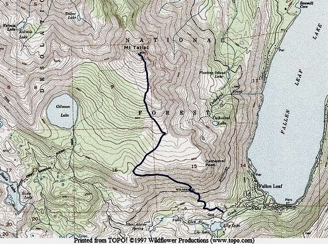
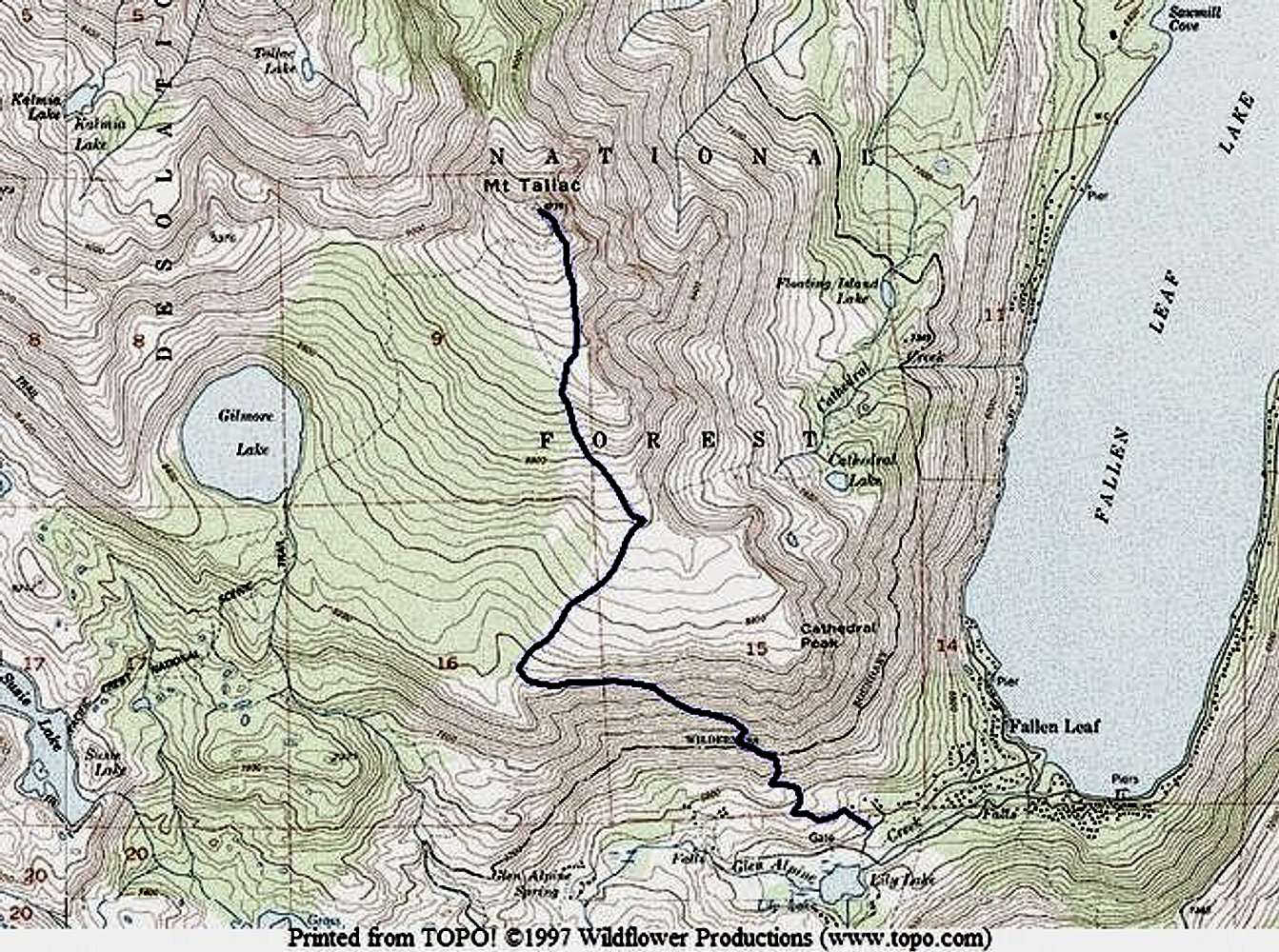
Mid Tallac Trail
Additional Parents
Image
Rough outline of Mid Tallac...
View High-Resolution Image
Rough outline of Mid Tallac...
Rough outline of Mid Tallac Trail. Once you find it from the parking lot it will be easy to follow.
« PREV
NEXT »
mountainvoodoo
on
Oct 21, 2004 8:00 pm
Comments & voting
Other parents
Lat/Lon:
38.90610°N / 120.0978°W
Image ID:
74926
5876 Hits
72.08
% Score
2
Votes
Log in to vote
Comments
No comments posted yet.
to post!
Don't have an account?
Mid Tallac Trail
(Route)
« PREV
Viewing
#3 of 3
GALLERY
You are at
the Last
Image
mountainvoodoo's Image Gallery
« PREV
Viewing
#27 of 33
GALLERY
NEXT »
Mount Tallac
(Mountain/Rock)
Loading....
×
You need to login in order to vote!
User Name
Password
Remember me
Forgot your password?
Log me out when I close my browser.
Keep me logged in all the time.
sign in as a user
Don't have an account?
Register now for FREE
Rating available
Suggested routes for you
People who climb the same things as you
Comments Available
Create Albums
Register Here


