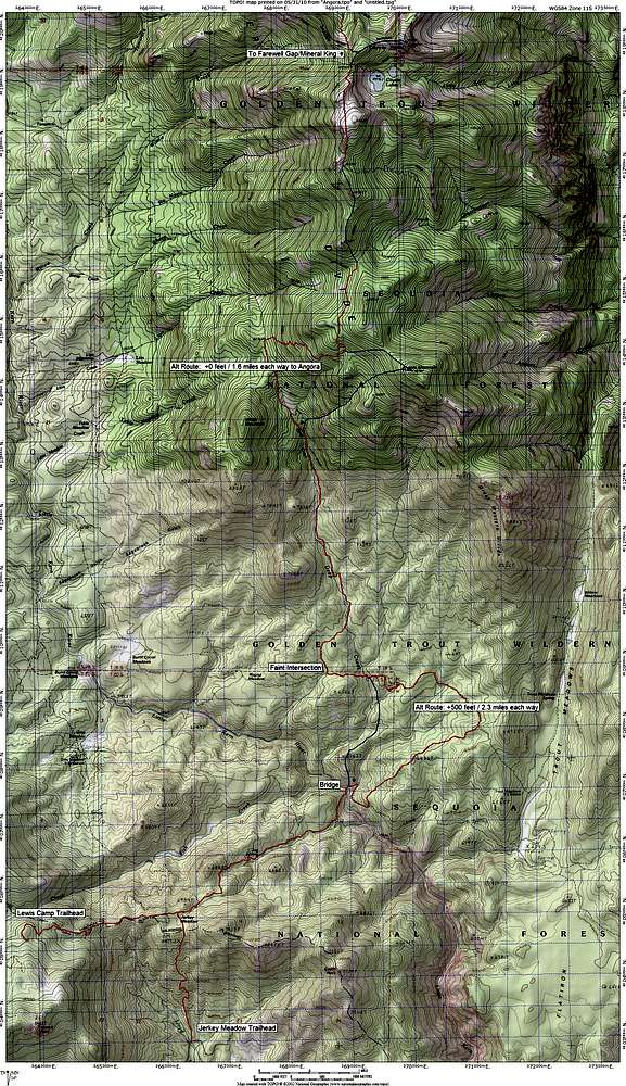
Route from Jerkey Meadow and Lewis Camp Trailheads to Angora Mountain and Coyote Peaks
Cross-country portions are shown in blue, and alternate routes are noted with mileage differences
Map prints best on legal sized paper
Click here for the route map from Mineral King


