
|
|
Route |
|---|---|
|
|
15.49293°S / 72.1°W |
|
|
Hiking, Mountaineering, Trad Climbing, Ice Climbing, Mixed, Scrambling |
|
|
Spring, Fall, Winter |
|
|
A few days |
|
|
Overview
I would highly recommend using this one way route route and going up one route and down the other. If you are already acclimatized, the route from the west and Andagua would be easiest. If you are not acclimatized, the route from the south and Cabanaconde or Puente Colgado is the best route.Five or more days is recommended if you plan on summitting the peak.
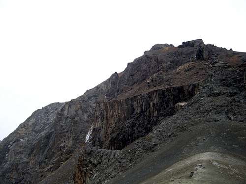
 Cerro Cerani is to the right and in the clouds. This is as viewed from 4550 meters at the Quebrada Cerani.
Getting There
Regardless of your route, your first destination will be the large city of Arequipa. The city is served by several buses and flights every day of the year.Via Cabanaconde
As of November 2007, several bus lines and tourist buses are visiting Cabanaconde. For the public bus, several (3-4) buses a day leave from Terminal Terreste. Buses leave anywhere from the middle of the night to early afternoon. As of 2007, the bus company names are Transportes Reyna, Transportes Andalucia, and Turismo Milagros. All buses stop in Chivay along the way. Expect to take 5-6 hours from Arequipa.
From Cabanaconde there are several options to get to the Puente Colgado (bridge) on the Rio Colca. The first option is to walk the entire section (see the route page). About every other day a supply truck heads from Cabanaconde to the “Change of Slope to Llanca” about half way to the bridge. Enquire in Cabanaconde for the supply truck which leaves from the main square in the morning.
 Besides foot travel, this supply truck is currently the only transport to Llanca "change of slope". There are no buses and the supply truck only goes a few days a week.
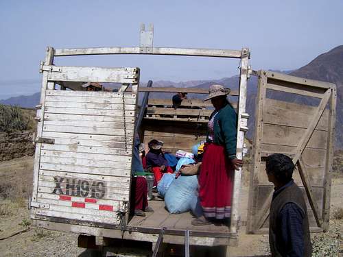
The chances of getting a ride to the Puente Colgado are slim, but we got a ride with the army. They were mighty curious and amused as to what this five year old gringo and his dad were doing out in the middle of nowhere in a remote corner of Peru and they gave us a ride down to Puente Colgado!
 We were out in the middle of the desert when the Peruvian Army came by. They were mighty curious what a five year old "gringo" was doing out in the middle of no where in a remote corner of Peru. They were quite amused by Kessler and gave us a ride down to the Colca River, which saved us a long dusty part of the trek. They even gave Kessler some of their candy rations.
Via Andagua
Theoretically there are two buses a day reaching Andagua, but there was only one when we were there. Transportes Reyna and Turismo Milagros supposedly each make the trip once a day, but as we found out, this is not always the case. It’s a long 10 hour bumpy and dusty bus ride. Return buses always ridge throughout the night. Dress warm because the bus reaches 5500 meters/18000 feet! If the elevation figures are correct this must be one of the highest bus rides in the world.
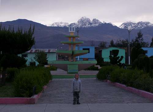 This is the trailhead at Andagua. It's a nice, but off the beaten track village. If you climb Cerro Cerani you will likely either begin or end the trip here. Cerani is in the group of peaks to the right.
Cabanaconde to Choco
From Cabanaconde, where you begin walking depends on if you get a ride part way down (see the Getting There section). The route has changed in recent years, but the road scar is obvious from Cabanaconde and heads west. Just follow the road all the way to the bottom of the canyon (there are some campsites in the area if you wish to camp). If you are on foot, there are several shortcuts on the trail that you can take. If in doubt, ask for the trail to Choco as there are several houses along the first part of the route.After reaching the river (1900 meters), you will cross a rickety bridge before climbing the long and dusty trail left to Choco (the trail to the right heads to Llauar). The trail contours quite a bit west with some fantastic views of the deepest part of the Colca before contouring around to the Rio Cusco. The walls of the Cusco Canyon are more confined than the open Colca giving the canyon a much different feel and a change of scenery. Notice all the ancient terracing in the area that pre-dates the Incas. It must have been a lot of work to build all these terraces. The trail then makes the steady climb to the village of Choco (2473 meters). You can camp in the village (inquire locally) and there is a basic shop that sales some basic food items.
 This scene is just below Choco.
 Choco to Miña
The river divides at Choco. You will follow the right branch which is known as the Rio Chalza. The route crosses the river (small and easy crossings unless you are there during or after recent rains). The trail goes through a really impressive gorge before opening out. The trail climbs steeply in a few places before reaching the village of Miña at 3600 meters. Inquire locally to camp in the village. Like Choco there is a basic shop here that sells some food items. You can also hire a donkey here to carry your gear for the long day ahead. This is Kessler in the Rio Chalza Gorge.
Miña to Paso Cerani
From Miña the trail climbs west far above the valley. There are some fantastic views as you climb higher and higher and out of the confines of the valley. Ampato, Sabancaya and Hualca Hualca are the snow-capped mountains in the distance. We saw several condors in the area. The trail climbs to a pass at 4600 meters before dropping down to the Rio Achacota. The Rio Achacota makes a fine campsite. From the river, the trail climbs north than west through some interesting volcanic scenery before reaching the jagged granite mountains around Cerani. Notice the curious Yareta plants in the area. Climb the steep trail to the pass at 5300 meters.Assuming the weather is good, you will have some fine views of Coropuna, the highest mountain in Southern Peru from the pass.
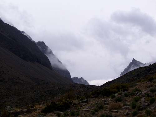
 Bad weather just east of Cerani.
Routes up Cerro Cerani
There are several routes up Cerro Cerani of various degrees of difficulty. The route up the peak directly from the pass requires a rock climb or climbing a frozen waterfall (when present) just to the west. There are other scrambling/non technical routes you can climb by contouring on either side of the pass, but they involve scree and some traversing, plus much loss in elevation. If you have the right equipment the shorter technical routes would be more fun. The views from the top will be very spectacular.After climbing the peak, return to the area of Paso Cerani and drop down the steep trail to the west. There are some great views before reaching the ideal campsite of the Quebrada Cerani. There are usually many llamas grazing the area, so take extra care to purify your water.
 This is Cerro Cerani as viewed in bad weather right from Paso Cerani. One route up the peak is up the gully on the left right where the snow is.
Quebrada Cerani to Andagua
From the Quebrada Cerani, you will follow a seldom used road for much of the time. Follow the road west and then north and cross a river. The village of Chachas should be visible for much of the way. There are several shortcut trails that cut much distance from walking the entire road, so use the trail (which predates the road) whenever possible. You will pass through some nice wildflowers before dropping down into the cactus again.Eventually you will reach the village of Chachas. There is a minibus that leaves Chachas (at least two restaurants) for Andagua daily at around 1 PM. Assuming you arrive in Chachas in time, you can ride the bus through the valley of the volcanoes to Andagua. The only buses that leave for Andagua leave at night, so if you don’t want to hop on the bus and ride all night after completing a long trek and climb, consider spending the day in Andagua and climbing Cerro Yanamauras or other volcanoes and seeing other sites before heading back to Arequipa.
 View from the Quebrada Cerani. Cerro Casiri is on the left.