-
 10612 Hits
-
 73.5% Score
-
 4 Votes
|
|
Route |
|---|---|
|
|
36.13176°N / 115.49254°W |
|
|
Hiking |
|
|
Spring, Fall, Winter |
|
|
Most of a day |
|
|
Class 3 |
|
|
Overview
Most text in this page's overview and route description sections is by the original author, who has been inactive for a long time now. I have made some edits for clarity and have tried to do a little more with the picture display.
Getting There
From Summerlin, follow Charleston Boulevard (SR 159) west to the entrance to the Scenic Loop through Red Rock Canyon National Conservation Area ($7 per vehicle entry fee as of Summer 2013). Drive 10-11 miles to the large, signed parking area for Pine Creek Canyon.
159 is also accessible from the west via SR 160.
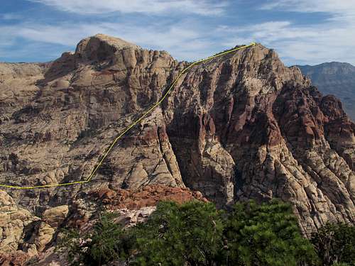
Route Description
Follow the Pine Creek Trail into the north fork of Pine Creek Canyon, where the trail drops into a wash (about 1.5 miles from the TH). The north fork of the canyon is locally known as Fern Canyon. The wash heads SW and is a mixture of Class 1-3. Continue through the wash to a seasonal waterfall. Ascend the brushy chute to the right of the waterfall.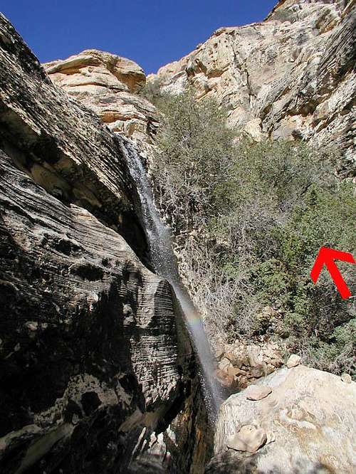
Waterfall and chute
Once up the chute, hike on the sandstone; don’t descend back into the wash. Make your way up the canyon to a dryfall distinguished by white salt deposits. It’s only about 150 yards from the top of the chute you ascended.
Once up, hike 25 yards north toward the mouth of the canyon on sandstone to a path. Follow the path 30 yards east, and then head north (left) to a small wall. Once up the wall (class 3), head east (right) along a wide ledge. As you continue east, the dropoff to the south (right) increases. Soon the ledge gives way and you have to climb/traverse (class 2/3) up to the next level. Cairns may mark this spot. Head east on the sandstone, avoiding brush. Continue east, paralleling a 100-foot wall to the north. Follow it as it bends to the NE (left), where the terrain opens up.
From here you will scramble to the start of a gully. Numerous cairns help keep you on route. The easiest route is no harder than Class 3, with most of the route being Class 2.

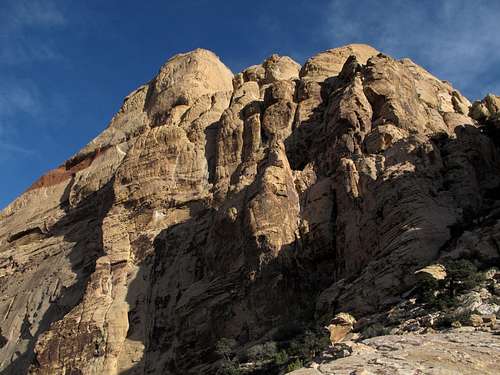
Above Fern Canyon
A little before the gully, a path leads through vegetation to the gully. Once in the gully, veer to the right when an outcrop divides the gully. (The outcrop is noticeable from the bottom of the gully but seems to disappear once you’re in the heart of the gully.) It’s a strenuous Class 2 trek to the top. Near the top of the gully, there’s an interesting ponderosa pine growing sideways out of the sandstone. At the top of the gully, notice the dark red ground. This is a major landmark on your descent.
Bridge Mountain from high in the gully
Head NE about a quarter of a mile over Class 2 terrain to the summit. A cairn marks the summit, along with a register.