Toggle navigation
Mountains
Routes
Images
Trip Reports
Forum
What's New
People
Areas & Ranges
Articles
Trailheads
Canyons
Huts & Campgrounds
Albums
Logistical Centers
Fact Sheets
Lists
Custom Objects
Gear
Plans & Partners
WELCOME TO SUMMITPOST
SIGN IN
REGISTER
From north east
Additional Parents
Image
Route
View High-Resolution Image
Route
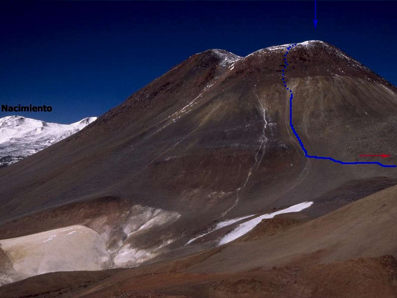
The blue line - the route I took. The red arrow - about 4 km to BC. The Blue arrow - the summit is hidden behind the ridge, but is in this direction. For an easier ascent - go for the left hand side ridge.
« PREV
NEXT »
Corax
on
May 3, 2006 12:26 am
Comments & voting
Other parents
Image Type(s):
Alpine Climbing
Image ID:
191741
2068 Hits
74.01
% Score
4
Votes
Log in to vote
Comments
No comments posted yet.
to post!
Don't have an account?
From north east
(Route)
You are at
the First
Image
Viewing
#1 of 3
GALLERY
NEXT »
Corax's Image Gallery
« PREV
Viewing
#623 of 683
GALLERY
NEXT »
×
You need to login in order to vote!
User Name
Password
Remember me
Forgot your password?
Log me out when I close my browser.
Keep me logged in all the time.
sign in as a user
Don't have an account?
Register now for FREE
Rating available
Suggested routes for you
People who climb the same things as you
Comments Available
Create Albums
Register Here


