
|
|
Route |
|---|---|
|
|
43.08600°N / 72.926°W |
|
|
Hiking |
|
|
Spring, Summer, Fall, Winter |
|
|
Half a day |
|
|
Easy with some deep mud. |
|
|
Mileage & gain:
From the trailhead to Stratton Pond, (entire Trail):9.5 miles 2000 feet elevation gain (one way)
From trailhead to Stratton Mtn. via LBT/LT/AT:
13 miles 3200 feet elevation gain (one way)
Overview:
Trail marker color: BLUEThis trail travels through the remote and seldom used Lye Brook Wilderness, passing by the Lye Brook Falls, one of Vermonts tallest, into an area frequented by moose and two stellar ponds. There are many shorter ways to Stratton Mountain but if you like solitude, this is a good spot. The trail begins near the once quaint now commercialized town of Manchester and ends at Stratton Pond and the Long Trail/Appalachian Trail which can be taken to reach the summit of Stratton Mountain, The birthplace of the Long Trail and Appalachian trail.
Route Description
From the Trailhead, (750 Ft.), the trail begins upward at an easy moderate grade gaining 1800 Ft. in 4 miles. ( at the 2 mile mark is the .4 mile side trail to Lye Brook Falls)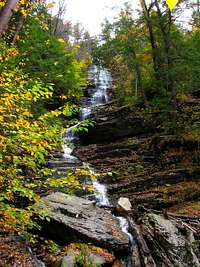 Lye Brook Falls
After 4 miles the land is mostly flat with gradual, short ups and downs, traveling through areas of Pines hardwoods and large White Birch. It was in this area that I saw many fresh moose tracks, although thay eluded me on my entire 26 mile backpack. This area is full of sporadic mud pits, some of them very deep, taking some extra time for the hike, especially with a heavy pack. Also there are several stream crossings, which, i could tell after a big rain could be very difficult to cross.
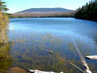
At 7 miles and 1950 ft. gain, is the junction with the Branch pond Trail and the Bourn Pond Area.
 Bourn Pond
From here, the trail is still mostly flat with some more boggy areas and a large blowdown section caused by a thunderstorm wind shear event.
 Large Blowdown area
At 9 miles Stratton Pond will be reached, bearing left, the trail passes the Stratton Pond camping area on the left and finally ends at the junction with the LT/AT
 Stratton Mtn. from Stratton Pond
Essential Gear
Bring the appropriate gear for the season.On this trail, I would strongly reccomend Gore Tex type boots and some good gaitors or long pants as the trail has some low brush as it is not a high use trail.
Red Tape
Although at the time of my hike the trail was well marked and markers were often. I had absolutley no trouble navigating but this trail is primitively maintained and seldom traveled. Conditions such as downed trees, deep mud and swollen streams provide a good challenge for any hiker and may not be tended to for some time.The gmc (green mountain club)closes many of the popular hikes in the greens and strongly encourages hikers to avoid higher elevation trails from april 15 to memorial day because of trail erosion due to the wet conditions of spring so check with thier website for more info. Green Mountain Club
Some images from this area
 some lichen and moss
 a shroom and some moss
 Some interesting features growing on this tree
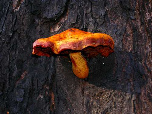 a Vermont Shroom!
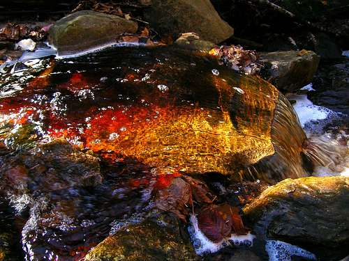 a colorful stream enriched by the sun