Toggle navigation
Mountains
Routes
Images
Trip Reports
Forum
What's New
People
Areas & Ranges
Articles
Trailheads
Canyons
Huts & Campgrounds
Albums
Logistical Centers
Fact Sheets
Lists
Custom Objects
Gear
Plans & Partners
WELCOME TO SUMMITPOST
SIGN IN
REGISTER
Las Trampas Lakes
Additional Parents
Image
Route
View High-Resolution Image
Route
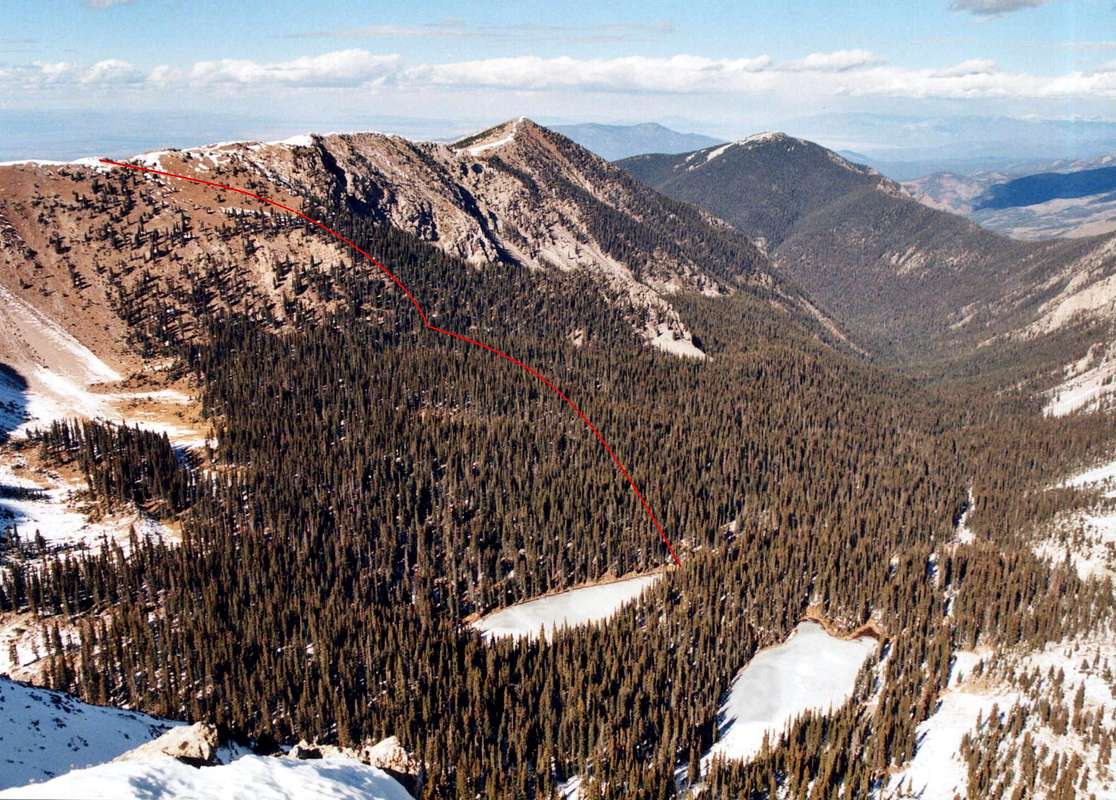
My approximate route (in red) from Trampas Lakes to Sheepshead's north ridge. Jicarilla Peak (12,494') and Trampas Peak (12,170') are visible flanking the canyon.
« PREV
NEXT »
jfrishmanIII
on
Nov 20, 2006 5:14 am
Comments & voting
Other parents
Lat/Lon:
35.99170°N / 105.6459°W
Image ID:
245393
3276 Hits
74.01
% Score
4
Votes
Log in to vote
Comments
No comments posted yet.
to post!
Don't have an account?
Las Trampas Lakes
(Route)
« PREV
Viewing
#8 of 9
GALLERY
NEXT »
jfrishmanIII's Image Gallery
« PREV
Viewing
#92 of 166
GALLERY
NEXT »
"Sheepshead Peak" & UN 12,900
(Mountain/Rock)
Loading....
×
You need to login in order to vote!
User Name
Password
Remember me
Forgot your password?
Log me out when I close my browser.
Keep me logged in all the time.
sign in as a user
Don't have an account?
Register now for FREE
Rating available
Suggested routes for you
People who climb the same things as you
Comments Available
Create Albums
Register Here


