
-
 17979 Hits
-
 79.04% Score
-
 10 Votes
|
|
Route |
|---|---|
|
|
35.99170°N / 105.6459°W |
|
|
Hiking |
|
|
Spring, Summer, Fall |
|
|
A long day |
|
|
Walk-Up |
|
|
Overview
Distance: Approximately 14-15 miles round-trip.
Elevation Gain: Approximately 4,000 feet.
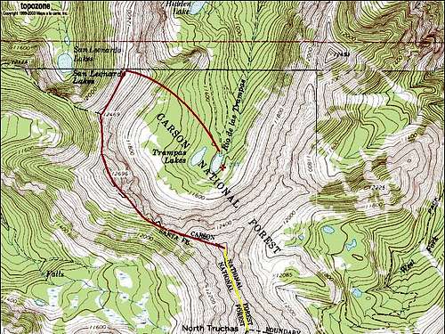
RED-Walk-Up to UN 12,900 YELLOW-Class III Ridge to N. Truchas
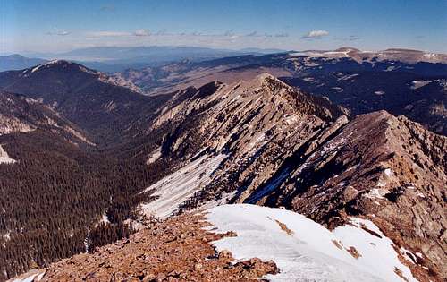
Las Trampas Canyon provides one of the easiest means of access to the Truchas Peaks area, the highest mountains of the Pecos Wilderness. An approach hike through lush spruce forest leads to a spectacular ridge walk above some of New Mexico's finest alpine basins. From the summit of UN 12,900, a fun Class III ridge scramble leads to North Truchas Peak. Doable as a long dayhike, this route is possibly the only reasonable way for mere mortals to climb one of the Truchas Peaks in a day. An overnight or three-day backpack would provide more time to explore, and could facilitate a trip to the other three Truchas Peaks.
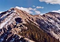
 Las Trampas Canyon from UN 12,900
Getting There
See the main page for details.
Approach
Hike the 5 miles to Trampas Lakes. See Approaches on the main page for details.
Route Description
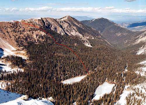
From the right (i.e. west) Trampas lake, strike out northwest through the trees. Try and stay at about the same elevation; if you're going downhill, you're off course. You're aiming for a spur that protrudes from Sheepshead's north ridge. The face of the ridge here is steep, but not cliffy and reasonably cohesive. Pick a line and head up! I did this by headlamp before dawn and had no trouble stumbling into a good line.

Once you top out on the ridge, your route is obvious. Head south on the ridgetop and straight up to the top of Sheepshead, on nice firm ground all the way. If for some reason you want to skip Sheepshead and go to UN 12,900 as fast as possible, there is an obvious game trail that countours around the peak's south side. Unfortunately this trail, so obvious on the way out, is much harder to find from the other direction. Sheepshead's southwest flanks are very loose and unpleasant in the absence of a trail.
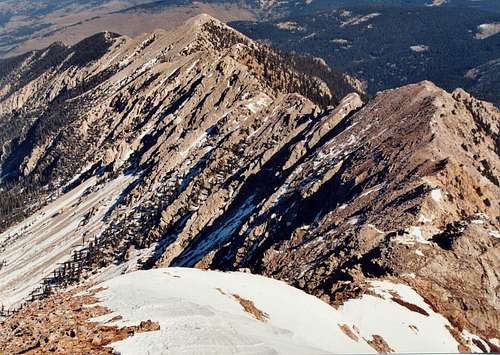
From Sheepshead to UN 12,900, you will continue to stay more or less right on the ridge crest. Down near the saddle between the peaks, there's a series of dramatic gendarme-wannabes, little stone teeth with sheer north faces and moderate slopes in back. Skirt these to the right, or poke your head over the top occasionally to look down some lovely couloirs.
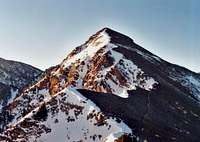
Up towards UN 12,900
Continue up the ridge toward UN 12,900. There is only one short section of loose scree and protruding stone that will require hands for some.
Enjoy your time on top and soak up one of the best views in New Mexico. From here you can head south across the ridge to North Truchas, head back down to the saddle and descend south to explore Rio Quemado Basin, or return the way you came.
Resist any temptation to descend via UN 12,900's northeast ridge. It is cliffy, loose, fraught with gendarmes and near-vertical gullies. I explored down as far as I could get, had a rather unpleasant time of it, and when I finally thought I might be through the crux, I was cut off very decisively and forced to return the way I came. Not recommended.
Not recommended.
Essential Gear
Standard hiking gear should be sufficient. Gaiters might be nice in spring and fall.