

-
 15313 Hits
-
 81.84% Score
-
 14 Votes
|
|
Route |
|---|---|
|
|
42.44280°N / 19.81230°E |
|
|
Hiking, Mountaineering, Scrambling |
|
|
Spring, Summer, Fall, Winter |
|
|
Most of a day |
|
|
Long walk-up, scramble (I UIAA) |
|
|
 |
Introduction
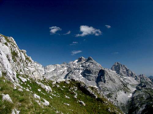
Description of the route starts from Qafe Pejë a high mountain pass (1,690 m) on traditional old trade and shepherds' Pejë road (Slavic: Pecki put) on its section from Thethi valley (Photo 1.) in Albania to the town of Gusinje in Montenegro. Actually, Pejës road is just a trail and also the most difficult of four main traverses over Prokletije mountain range.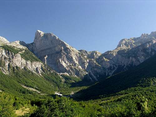  Northern part of Thethi valley. Left is huge Maja Harapit peak, in the distance on the right side of the photo is Qatat e Verlla peak and between them is Pejë pass |
Route Description
When you reach the pass from Thethi you will notice the continuation of Pejës trail in northern direction, descending first, in just 5-10 minutes, to Gropa Pejës depression with small green-colored glacial Pejës lake (Albanian: Liqeni Pejës) and continuing further to Montenegro. But our route will take us sharp right from the pass, around the large wooden cross and following clearly visible eastward path. (Photo 2.)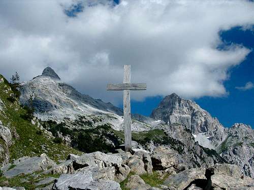 Pejës pass with a view to Maja Popluks (left, 2,569 m) and Maja e Alis (right, 2,471 m) |
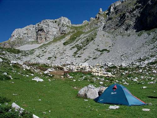
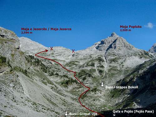
This path, that has been used by shepherds for generation, takes you at first in eastern direction along shelves hanging over the northern edge of Thethi valley offering very nice views, then it turns to the north entering more rugged area. After 30-40 minutes you should reach a small field with Buni i Gropaet (also Gropat) Ujit katun (katun is a shepherds' summer settlement). Ujit means water in Albanian, and its name comes after a fresh water source at the bottom of the field. This katun is situated just to the south of the Qatat e Verlla/Maja e Stierra ridge. This katun (actually only two very modest cottages) is the most popular starting point for southern Maja Jezerce approach from the albanian side (technically easier than the northern approach, but without orientation marks thus orientationally more complicated). Also Maja Popluks is the most easily accessible from there (Photo 3).
 Buni i Gropaet (also Gropat) Ujit |
From Buni i Gropaet the first part of the route is common with the Maja Jezerce southern approach. You should continue eastward following the natural direction of the valley and in 10 minutes time you should reach another larger field with Buni i Gropes Bokoll katun (meaning a shepherds settlement with good grass) (as seen from Photo 4)
 Buni i Gropes Bokoll |
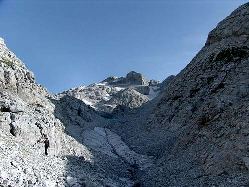
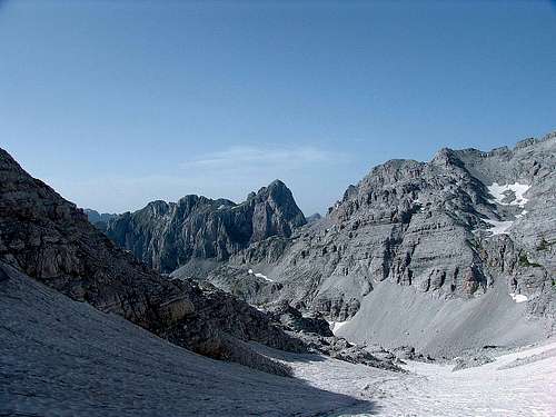
Head to the north-eastern side of this field and start to climb up by the most obvious way (sometimes there is a trace of a path), generally keeping to the northern (left hand) side of a large basin between Maja Popluks, Maja Jezerce and Maja e Stierra ridges (Photo 5), until you are directly below the south face of Maja Kolacit (2490 m) and the characteristic col with two sharp rocky towers ('vampire's fangs') - about 1 hour from Buni i Gropaet. (Photo 6)
 Large basin between Maja Popluks, Maja Jezerce and Maja e Stierra ridges |
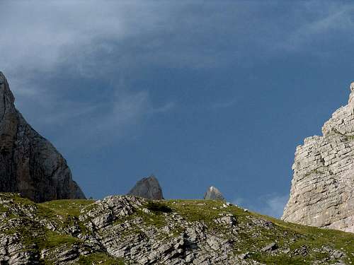 Maja Kolacit (2490 m) and the characteristic col with two sharp rocky towers ('vampire's fangs') |
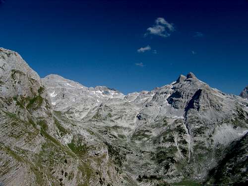
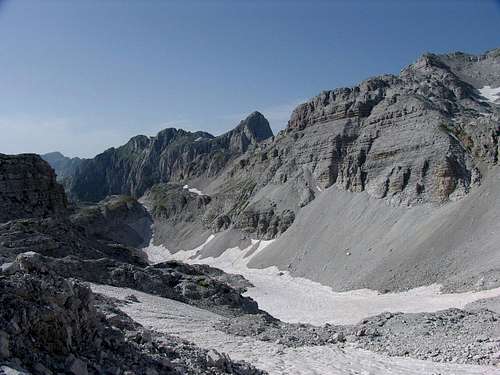
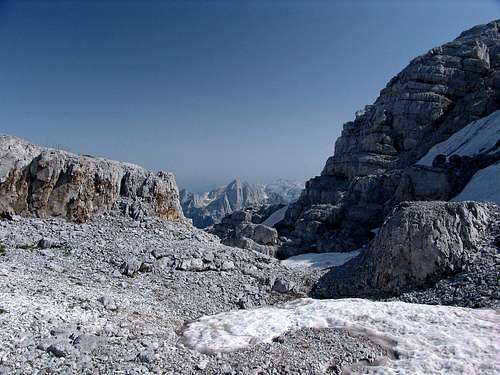
Then traverse to your right using the best passages towards the deepest cut in the valley threshold (Qafa Jezerces - Jezerce pass). You can walk along its nothern grassy side and not losing too much in height, or you can follow the bottom of the cauldron closed from all sides by the walls of Maja Jezerce (left, north) and Maja Popluks (right, south). (Photo 7)
 The cauldron closed from all sides by the walls of Maja Jezerce (left, north) and Maja Popluks (right, south) |
After you reach very close to the end of this cauldron turn right in Maja Popluks direction (for Maja Jezerce you should go left) and enter more smaller canyon-like rifts. (Photo 8)
 |
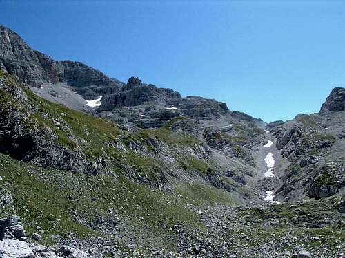
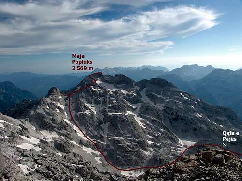
Soon you should find yourself in a large open area, just below the main slopes of Maja Popluks. Although the summit of Maja Popluks will be right in the front of you, looking very close, for the best summit climb you should continue (slightly left) in north-eastern direction first to reach a huge, long and deep valley that separates Maja Jezerce and Maja Popluks (Photo 9) and then the largest couloir (situated on north-eastern part of Popluks) that is perfectly visible from the slopes of Maja Jezerce but now is hidden from you. (see Photo 10)
 Huge, long and deep valley that separates Maja Jezerce and Maja Popluks |
 The largest couloir at left (situated on north-eastern part of Maja Popluks) that is perfectly visible from the slopes of Maja Jezerce |
Traverse this valley along its bottom almost to its end and then turn sharply to the right (southwards) up the largest (north-eastern part of Popluks) couloir that goes up to the col between Maja Popluks main summit (right) and the dark triangular rocky tower (left). (Photo 11.)
 Up to the col between Maja Popluks main summit (right) and the dark triangular rocky tower |
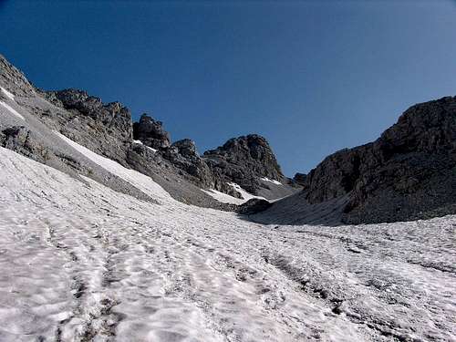
This couloir is usually filled with lots of snow all year-round and is not more than 30 degrees steep. Usually you do not need any extra equipment to climb it but a pair of telescopic poles may be helpful. But bewarned - the snow conditions may change! (Photo 12.)
 The couloir leading to the summit of Maja Popluks. The slopes of Maja Jezerce are on the right side of this photo and the spire of Maja Kolacit (2490 m) is in the background |
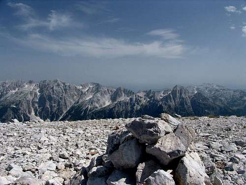
After reaching the col, find the most convenient way to the top of Maja Popluks to your right - there are many possibilities. Our approximate route is marked on the photo-scheme. We went up the scree, rocks and some small snow fields and ended up at the right hand side of the peak (Photo 13). From there we scrambled some rocks for about 50 m (about I UIAA) until we were on the huge, scree-covered summit plateau. From Buni i Gropaet it takes about 3 hours to the peak (Photo 14).
 |
 |
Remarks
The shepherds from Buni i Gropaet said it is easy to reach the top when you turn right up Maja Popluks northern slopes earlier from the bottom of the cauldron. We also heard about that possibility from a friend who went there in June 2006 but we have not tried it ourselves this time.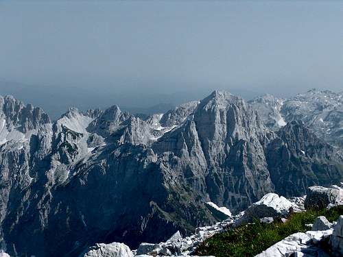 |
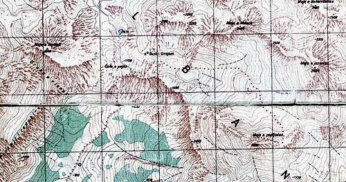
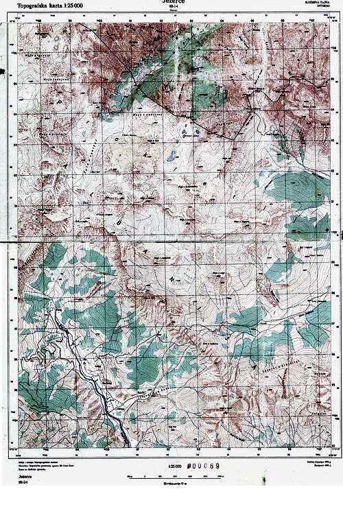
Maps and schemes of the described route
 |
 |
 |
 |