Overview
The approaches from north and south to the area of Qafa e Pejës and Buni i Gropaet are described at the
Qatat e Verlla main page. The summit route description starts at the Buni i Gropaet
katun (summer settlement of shepherds), which consists of just two modest, stone-built huts. They are thatched only for summer when the shepherds live there (usually July-September). This
katun has its own water spring, hence its full name Buni i Gropaet Ujit (
ujit – water in Albanian). It is the most popular starting point for the
southern route to
Maja Jezerce (2694 m). Also from there it is most convenient to climb
Maja Popluks (2569 m). The shepherds are more than happy to let you camp on the meadow nearby and use water from the spring. When going to Qatat e Verlla, there is no more water above Buni i Gropaet.
![]()
Buni i Gropaet Ujit |
| ![]()
View from Buni i Gropaet |
| ![]()
Qatat e Verlla |
| ![]()
Qatat e Verlla
and Maja e Stierra |
|
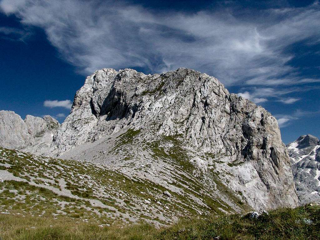
As far as we know, this route is the only relatively easier way to reach the top of Qatat e Verlla, and the only one that has been climbed so far. Because of language problems we did not understand if the shepherds have been at the summit or just in its neighbourhood. Our ascent may have been the first confirmed one.
![]()
Qatat e Verlla's north-west face, with visible ascent route starting from the large saddle.
Maja Popluks (2569 m) to the right, in the distance. |
Route description
From Buni i Gropaet go up the very steep grassy slope (up to 45 degrees) towards the well visible, free standing white gendarme. You may have to cross some fields of steep scree. Just below the ridge, instead of going up to its crest, it is most convenient to start traversing below it to the right, behind the gendarme. There are many possibilities so look for the best passages. Soon you will see the steep silhouette of Qatat e Verlla. Go on parallelly to the ridge until you reach a great saddle covered with grass and scree.
![buni i gropaet]()
![ascent QV]()
![view down]()
![gendarme]()
![saddle]()
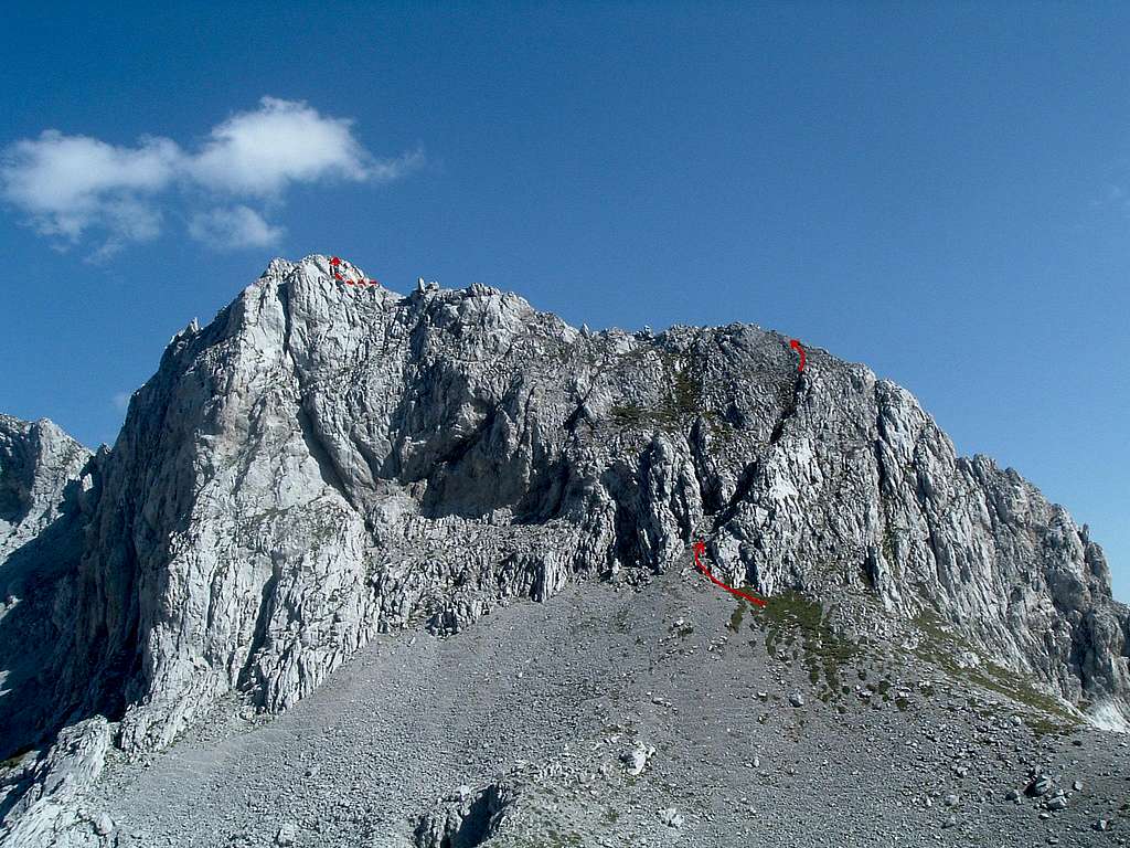
Stand on the saddle and admire the beauty of the mountain in front of you. Don’t chicken out but take a good look for the easiest way up the wall. Use the gully that climbs at a rightward angle. It is better visible if you go a bit left from the saddle.
![]()
Take the diagonal gully to the false summit. Scramble the summit ridge to the top.
In the final section bypass the yellow slab from the left, using the easier niche. |
The gully is 45-50 degrees steep, with grass and scree. Most of it is not that difficult, just really rotten. It is the last 15 metres where things get really nasty. The gully ends there and you enter a steep open face (60 degrees or more), covered with grass mixed with very loose rock. Perhaps I-II UIAA, if we can use the UIAA grading for a pile of choss that hardly holds together. Especially watch out on the way down!
![gully1]()
![gully2]()
![Gord climb]()
![Azra climb]()
Climb to the summit ridge and follow it a few metres to the left to the false summit (70-80 m above the base of the gully). The true summit is only several metres higher but to reach it you have to climb another 70-80 m of a knife-edge ridge that drops almost vertically to both sides. Its hardest places are about II+ UIAA but the difficulties are more psychological than technical. The rock is loose in places, so be careful what you are putting your hands and feet on. Just below the summit
do not go straight up the yellow slab (very loose rock) but bypass it from the left instead, using an easier niche.
![Od višine se zvrti]()
![ridge1]()
![ridge2]()
![ridge2]()
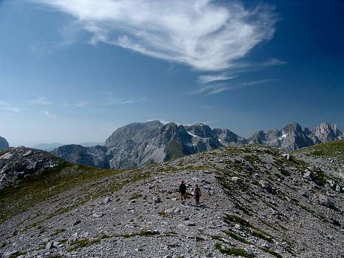
From Buni e Gropaet it takes about 3 hours to the top and about 2 hours back. But it is well worth to take your time and wander around for great views on Prokletije.
![ridge2]()
![Maja Malisores]()
![The Young Man And The Mountains]()
![Liqeni Pejes]()
Essential Gear
Good hiking boots and standard hiking equipment.
Rope and some protection (a few long slings and carabiners/quick-draws) are highly recommended if you have only little rock climbing experience, especially if you do not have a good head for heights.
In winter/spring you're surely gonna need crampons, ice axe and full winter gear.
![]()
Descent from Qatat e Verlla,
Maja Shnikut and Maja Shkurts in the distance |
Maps
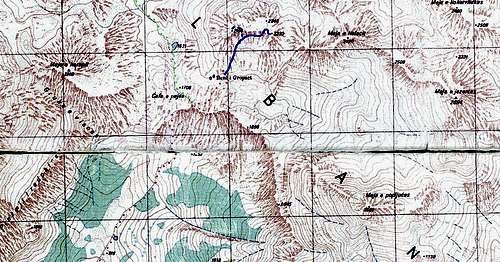
![]()
The route from Buni i Gropaet to Qatat e Verlla |
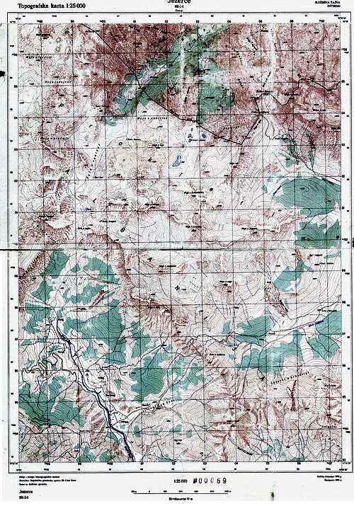
![]()
Central-western Prokletije |


 8196 Hits
 81.84% Score
 14 Votes