


-
 14029 Hits
-
 89.77% Score
-
 30 Votes
|
|
Mountain/Rock |
|---|---|
|
|
42.44920°N / 19.78770°E |
|
|
Mountaineering |
|
|
7654 ft / 2333 m |
|
|
Overview
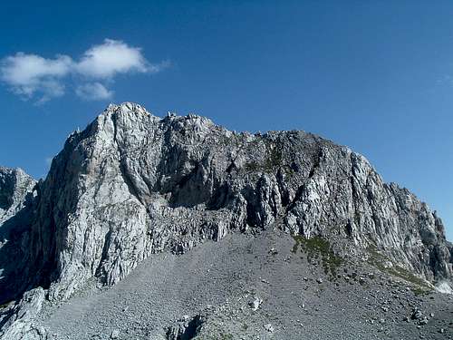
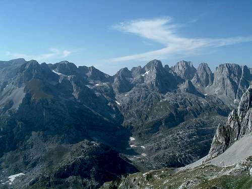
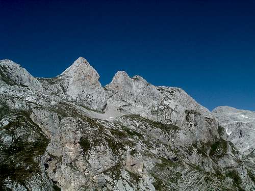
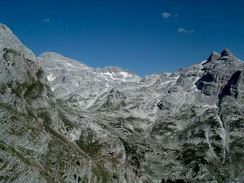
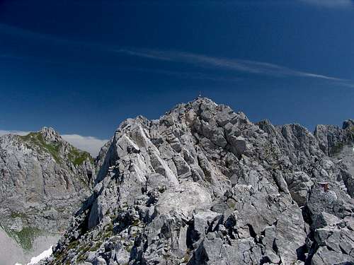
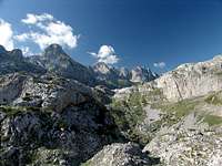
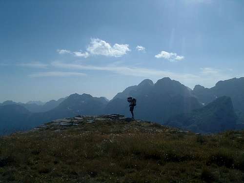
Qatat e Verlla (2333 m, name uncertain, see below) is the first really prominent peak in the ridge that starts with the 2198 m culmination rising directly east of Liqeni e Pejes lake (see map). Qatat e Verlla drops steeply to all sides. To its east, also rising sharply from the deep col between them, stands another peak in the ridge. From it, via one more culmination, the now milder, grassy section leads to Maja Kolacit (2490 m). Going eastwards, each peak is higher. On Maja Kolacit the ridge meets another one that comes from north-west, called Maja Malisores (Maja Kolacit is actually the highest point of the Maja Malisores group). Further east the ridge steeply drops to the characteristic col with two sharp rocky towers, only to rise steeply again and, via the 2509 m culmination, lead to Maja Jezerce (2694 m), the highest peak of Prokletije.
|
|
|
|
|
|


|
|
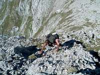
Because of language problems we did not understand if the shepherds have been at the summit or just in its neighbourhood. Even the easiest route is not trivial. Our ascent may have been the first confirmed one.
  |
Getting There
By plane:JAT (Serbian Airlines)
Montenegro Airlines
The websites should have an English version but feel free to drop the page maintainers a line if you need translation of any travel details from Serbian to English.
Albanian Airlines
Some other European airlines also have scheduled flights to Belgrade, Podgorica, Sarajevo, Dubrovnik and Tirana – check out the airports close to you.
By train:
Železnice Srbije (Serbian Railways)
There are direct trains from Belgrade to Bijelo Polje (Montenegro).
By bus/coach:
Coach timetables from Beograd (Belgrade)
For connections with Montenegro - in the ‘Timetable’ section look at ‘Interstate transport’ and not ‘International transport’ – the page is not up to date with the new political situation yet.
Access from the north (Montenegrin side):
Coach Beograd-Nikšić – get off at Bijelo Polje.
Coach Beograd-Berane.
Local bus connections from Bijelo Polje and Berane to Plav and Gusinje.
Access from the south (Albanian side):
Coach Beograd-Nikšić – get off at Podgorica.
Podgorica-Koplik (Albania) – for the time being only by taxi or hitchhiking.
Ulcinj–Shkodra (Albania) – there are scheduled minibuses.
By car:
From the north:
Beograd (Serbia) - Čačak – Užice – Bijelo Polje (Montenegro) – Berane – Gusinje
Sarajevo (Bosnia&Herzegovina) – Priboj (Serbia) - Bijelo Polje (Montenegro) - Berane – Gusinje
Dubrovnik (Croatia) – Nikšić (Montenegro) – Podgorica – Berane – Gusinje
(good, asphalted roads all the way)
From the south:
Podgorica (Montenegro) – Koplik (Albania)
Tirana (Albania) – Koplik
(asphalted roads)
Koplik – Ducaj (asphalted road) – Boge – Thethi (over 30 km of a very bad gravel road, recommended only for 4x4’s and trucks). Not for ordinary passenger cars, unless you are a bunch of desperados like us. It is recommended to leave the car at Boge and try hitchhiking to Thethi, prices are negotiable.
|
|
|
|


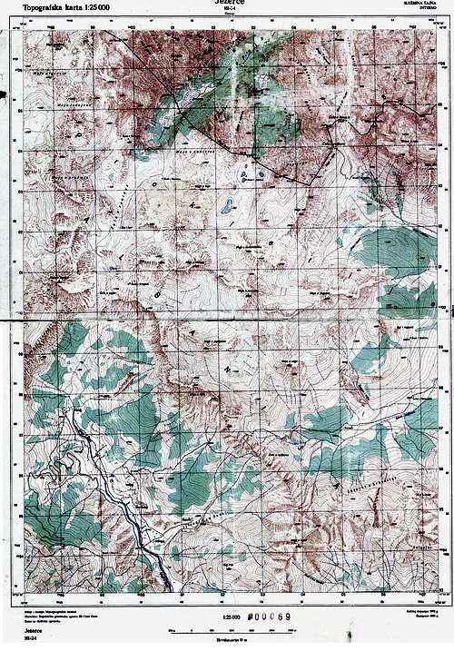
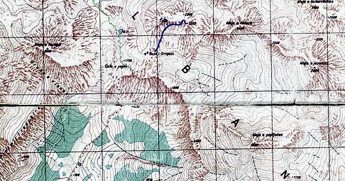
Route overview
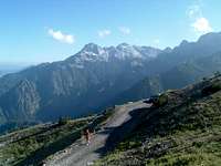
The only relatively easier route, and probably the only one that has been climbed so far, is described here and the map is here. You would most likely climb Qatat e Verlla during a few days’ stay in central Prokletije, camping in the area of upper Ropojana valley, Qafa e Pejës pass or the Buni i Gropaet katun (summer settlement of shepherds). The approaches from the south (Albania) and the north (Montenegro) are shortly described below.
|
|
|
|


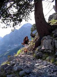
| From Montenegro: The convenient starting point is the village of Vusanje, 5 km south of Gusinje by asphalt road. You can also stay overnight in the Zastan hut (or camp near it) a bit further up, to the east of the bottom of the valley. Spring water is available there. From there, go all the way up the Ropojana valley, across the Montenegrin-Albanian border (you need a permit from local police – see Red Tape section), past the Buni i Runices katun, up the valley threshold and past the small glacial Pejës lake (Liqeni Pejës in Albanian, 1621 m), up to the Qafa e Pejës pass (1708 m). It can take 4-5 hours from Vusanje with a heavy backpack. The route follows a very old shepherds’ trail that has for ages been one of the traditional connections between northern and southern side of Prokletije. |
|

| From Albania: The southern approach uses the same shepherds’ trail. The starting point is the village of Thethi. The path takes you past the spring in the flat part of the valley (last water before Qafa e Pejës) and up the steep threshold, to the right of the majestic wall of Maja Harapit. To get to the Buni i Gropaet katun you can go all the way to Qafa e Pejës and turn right steeply up the meadows, or more conveniently use the path that turns right by the wooden cross, a few minutes below the pass. It takes 2-3 hours from Thethi to Qafa e Pejës with a heavy backpack, and another 30-40 min. to Buni i Gropaet. |
|

Red Tape
To enter Prokletije from Albania you do not need any permit. From the Montenegrin side, to be on the right side of the law, you need to obtain a permit at the police station at Gusinje and then register at the watchtower at Vusanje. The situation tends to change quite often, apparently in 2005 it was very difficult to get the permit, while in 2006 it posed no problem. It is quite unclear if you would be officially allowed to stay for several days.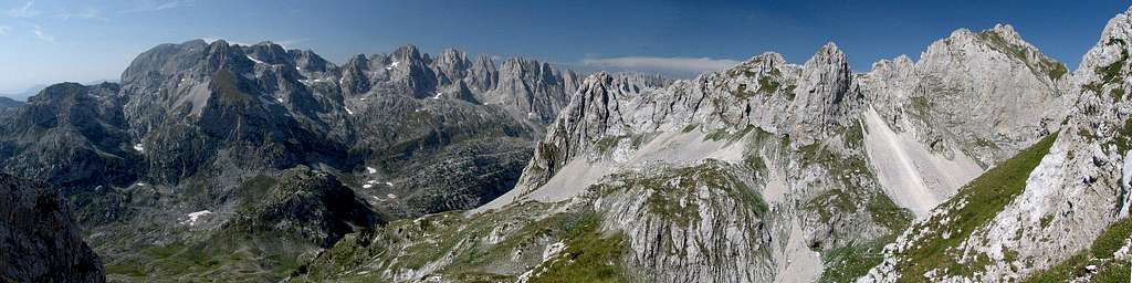 |
Camping
You can camp freely in Albanian Prokletije. The local shepherds are very hospitable and will be more than happy to let you camp near their summer settlements, use their water and invite you to try their cheese, milk and homemade plum vodka/slivovitz (rakija in Serbian, raki in Albanian). Of course, like anywhere in the great wide open, protect the nature and leave the place the way you'd like to find it.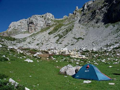 |
Weather/When to climb
Weather forecast for Prokletije (Plav town in Montenegrin part). Thanks to vvujisic for the link.The best time to visit Prokletije is July-September. Earlier there may still be too much snow, later it becomes colder and the days are shorter.
 |
Maps
 |
 |