
|
|
Route |
|---|---|
|
|
46.63060°N / 12.31530°E |
|
|
Hiking, Mountaineering, Scrambling, Via Ferrata |
|
|
Summer, Fall |
|
|
Most of a day |
|
|
Easy via ferrata |
|
|
Getting There
 Handdrawn map of the Paternkofel / Monte Paterno Group.
The route starts at pass Paternsattel/Forcella Lavaredo, 2454m (between Paternkofel and Drei Zinnen). It is approachable from the hut Rif. Auronzo, 2320m in about 30 minutes below the south faces of Drei Zinnen.
Route Description
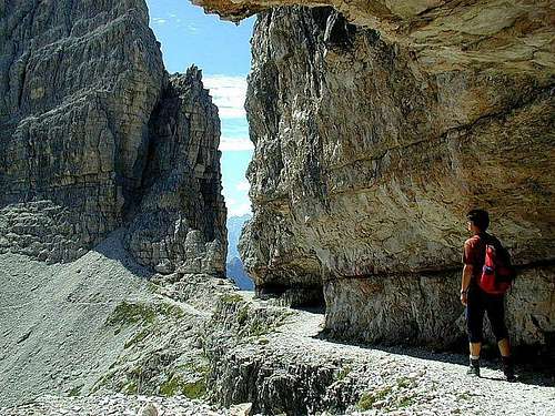 On the ledges of Paternkofel's south ridge.
From the pass Paternsattel/Forcella Lavaredo, 2454m you follow the signposts for Paternkofel in the NE direction over the rocky ridge to the start of the tunnel. The first tunnel is very narrow. You have to creep by knees also. When you come out from the tunnel you walk over the airy shelves secured with iron cables all the way to the notch Passportenscharte/Forcella Passaporto, 2379m.
From here you cross the east face of Paternkofel over the nice shelves cuted in stone. This was made during the First World War. After the crossing you have to reach the notch Gamsscharte where other routes also come. From here you have to climb some 15 meters high vertical rock, which is well protected by iron cables. After this climbing you have only some easy climbing to the summit.
You descend by the same route or combine any other possibility.