
|
|
Route |
|---|---|
|
|
52.69678°N / 3.90066°W |
|
|
Trad Climbing, Scrambling |
|
|
Spring, Summer, Fall, Winter |
|
|
Half a day |
|
|
Diff (USA 5.2-5.3) |
|
|
4 |
|
|
Overview
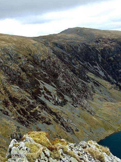
From Cwm Cau, Tapia Llwydion is probably the most direct route to the summit of Cadair Idris, it is also one of its least used. It takes a long and intermittently vegetated line out of the deep recesses of the Cwm in which Llyn Cau sits, and out onto the broad summit plateau a short distance east of the mountain's summit. The 260 meter climb is graded as Diff, with most of the technical climbing confined to the lower 100 meters or so (4 pitches), and the upper sections more akin to Grade 2/3 scrambling than true rock climbing. The route is probably at the lower end of the grade, and most experienced climbers will have little difficulty in completing it, and may in fact, not feel the need to pitch the climb at all. All in all, although the route isn't of the highest quality, it is quite fun, and takes one up a less trodden face of Cadair Idris. What's more, the confines of Cwm Cau, will not only offer you shelter from the worst the weather can throw at you, but also offer a spectacular backdrop to your endeavour. |
Getting There
The approach begins at the main carpark (SH 732 115), and the start of the Minffordd Path on the southern side of Cadair Idris. The carpark is situated a few metres along the B4405 near the junction with the A487T. If coming from the north you will need to gain the A487T at the Cross Foxes Inn Junction (SH 766 167) on the A470T. If coming from the south you will need to travel north along the A487T from Machynlleth (SH 745 008). Cross the Afon Dyfi just to the north of the town (SH 744 019). Immediately after the bridge the road turns right very sharply, follow the road around along the winding and wooded pas through the villages of Corris and Corris Uchaf. As you exit the pass Cadair Idris will rear up in front of you and the junction off the main road will soon be signposted. The carpark is also serviced by a public bus which runs between Aberystwyth (SN 583 815) and Dolgellau (SH 728 177). Be aware though the bus drivers will drop you off but don't always pick you up afterwards. In these situations you may be forced to hitch, as the next bus will be a long time coming. |


Route Description
Approach The approach takes the Minffordd Path from the main carpark (SH 732 115>/font>) on the south side of the mountain to Llyn Cau (SH 715 123). Start by leaving the carpark through the kissing gate at the far right hand (if your facing north) corner of the carpark, just behind the toilet block. Follow the broad gravel path north crossing a small concrete bridge, after around 100m you will reach another gate. Go through the gate and carry on following the gravel path past the CCW run visitors centre on the right, past a ruined farmstead on the left, until you reach another gate (SH 728 115). Go through the gate and begin the steep walk through the oak woodland up into Cwm Cau. From here on the stream that flows from Llyn Cau will always be to your right hand side. The path is generally good, and where erosion is at its worst, wooden steps and gangways have been constructed. After passing through a gate in a stone wall you will exit the woods, although the carry on a little further on the other side of the stream, and the path will take you in an ark into Cwm Cau proper. From here the path is of a more gradual nature, and should be obvious in all but the worst weather conditions. Stay on the path, ignoring the junction that bears left onto Craig Cwm Amarch, and make your way gradually to Llyn Cau (SH 715 123), which is dammed by an obvious moraine. Follow the moraine and the lake shore north, and cross the stream that exits the lake. From here the slabs of Tapia Llwydion (SH 716 126) should be obvious, so leave the path and walk a short distance across the rough grass to their base. The Route: Climbing  Photo topo of Tapia Llwydion (Photo by Nanuls) Photo topo of Tapia Llwydion (Photo by Nanuls)Start just to the right of the bottom of the left hand lobe of the slabs, about 2m higher than the lowest point. Pitch 1 (38m): The route begins steeply, climb a shallow groove up the centre of the lobe, holds are plentiful and the gradient should provide no great obstacle. Soon the climb eases into a more gently sloping ledge, climb this to a parallel sided groove full of grass and heather. Climb straight up an obvious dome a couple of metres to the right of the groove, which will open out onto a broad and gently sloping slab, walk across this to a small patch of grass and heather where you will be able to place protection and set up a belay. Pitch 2 (50m): The guidebook 'Scrambles & Easy Climbs in Snowdonia' recommends using a full 50m rope for this pitch, however it is possible to split the pitch half-way, and climbers who are both comfortable and confident about climbing at this grade may wish to dispense of the rope altogether (Note: I'm not recommending that you do this). Climb up a clean slab to another heathery ledge above which the rock becomes steeper. Climb the rock directly just to the right of a heather-choked crack. From here the angle eases and you will be able to walk across the slabs that greet you. Cross the slabs to gain a series of sloping ledges just to the right of a steeper dome like buttress. Belay from here from the right-facing flank of the buttress.  The start of the route (Photo by Nanuls) The start of the route (Photo by Nanuls) Pitch 2 of the route (Photo by Nanuls) Pitch 2 of the route (Photo by Nanuls)Pitch 3 (12m): Climb the dome like buttress, which quickly eases and you will be able to walk up a section of grass and heather to the next outcrop of rock. To the right is is a steep smooth buttress bounded on its right by a wide cleft. The buttress is probably the hardest part of the climb so you can either climb it directly (probably harder than the Diff grade this route holds); or climb the narrower knobbly pillar just to the right. Both these options eventually terminate onto an easy slabby rib. Climb the rib to a heathery shoulder, walk across the slab and then climb a broad easy-angled slab, to steeper ground. Running across the base of the steep rock is an indistinct path, cross the path and belay from the base of the rock. Pitch 4 (18m): Climb two short slabs to reach a flat ledge on the left edge of the buttress, overlooking a stream filled gully. Climb a triangular slab to the right of a bulbous rocky dome, and emerge onto a near-horizontal spine of rock. Follow the spine until it descend slightly into a shallow grassy saddle. From here you have the choice of heading straight for the summit of Penygadair (SH 710 130) via easy scrambling over broken rock, or by traversing rightwards onto more serious ground which offers Grade 2/3 scrambling and short pitches of V. Diff rock climbing for those who seek it. Either way, this is probably the end of roped climbing for most parties. Generally speaking all the harder obstacles are avoidable by skirting around them over heather and grass. The Route: Scrambling  Scrambling on the upper part of the route (Photo by Nanuls) Scrambling on the upper part of the route (Photo by Nanuls) Lower reaches of the Minffordd Path (Photo by Nanuls) Lower reaches of the Minffordd Path (Photo by Nanuls)Route finding from here is really up to you, however I will briefly describe the route normally taken by those continuing the climb along the grade 2/3 scramble. From the shallow saddle where your climb ended, descend to the right for about 8m, around the base of some steep and often wet rock to reach the start of a grassy ledge running almost horizontally to the right. Follow the ledge until it terminates at an ill defined gully, and make a step down into a subsidiary gully before traversing across it. Scramble up a little col behind a prominent spike on a ridge dividing the upper reaches of the gully. From here the ridge becomes steeper, move right for around 10m and up about 3m to gain the ridge just below where it gets steep. Above is a horrible composition of loose rock and heather, keep to the right of it by going diagonally right up on a grassy ramp with a small indistinct path on it. Follow the ramp to a small overhang, continue to the right of it up a short rib, which ends in a grassy slope, Head left to reach a terrace with several large upstanding rocks. Just above the rocks is a triangular rock plinth below a large boulder. Go up the plinth until it steepens, step right across grass to the next buttress. Climb the buttress heading for a prominent triangle if overhanging rock. Head for the overhanging bearing left to top out onto an arête a few metres above it. Continue up the obvious slabs above it to the top of the buttress. From here there is nothing but scattered crags and boulders, stop for a spot of light scrambling and bouldering before heading up the main ridge to the summit of Penygadair (SH 710 130). Descents From the summit there are a number of possible ascents the most obvious being the Minffordd Path, either heading south-west for Craig Cwm Amarch (SH 710 121) or east for Mynydd Moel (SH 727 136). A shorter alternative is to head south-west along the Minffordd Path to the col at Craig Cau (SH 708 125). Here you can make a steep descent via quickly broadening gully straight to Llyn Cau and your starting point at the base of Tapia Llwydion. The third alternative, and only for those skilled at technical down-climbing, is to descend via the Cyfrwy Arête (SH 703 134). This option however, leaves you with the obvious logistical problem of getting back to your car. |
Essential Gear
A single rope will be fine, a moderate rack of nuts and hexes, and a few slings and screwgates. The route can be done in mountain boots or rock shoes, although boots are probably more advantageous considering the broken nature of the climb. Naturally you will also need all the other paraphernalia normally associated with hill walking in Wales: full waterproofs, fleece, hat, gloves and of course some lunch. |
Maps
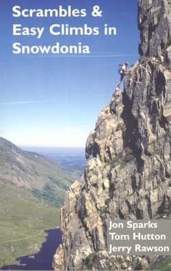
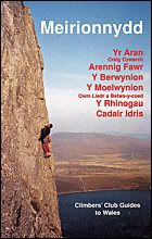
Guidebooks
|

External Links
 Tapia Llwydion from Craig Cwm Amarch (Photo by JoeHarris) Tapia Llwydion from Craig Cwm Amarch (Photo by JoeHarris)Government Bodies and Official Organisations Snowdonia National Park Authority Association of National Park Authorities Royal Commission on Ancient & Historical Monuments in Wales Hiking, Climbing and Mountaineering Organisations and Companies British Mountaineering Council Plas y Brenin National Mountain Centre Weather Tourist Information North Wales Tourism Partnership Local Information from Gwynedd.com Local Information from Snowdonia Wales Net Travel Welsh Public Transport Information Accommodation Youth Hostel Association in Wales Maps and Guidebooks Cordee Travel and Adventure Sports Bookshop Wildlife and Conservation |