Overview
Our expedition up Rupal Peak was a scientific partnership with the University of Venice and Adventurers and Scientists for Conservation to collect ice samples from high altitude crevasses for climate change research. We were a two man American team, and, according to the locals, the first climbing team in the valley this year. This was our first time in Pakistan, and our first time in the Himalayas. Overall, Pakistan is much safer than the media makes it out to be, and the logistics of getting around are also not that hard. The approach is beautiful and easy, the climb is not hard. Weather is a major factor. August is the recommended time to climb and skies are generally more clear. We climbed in July, and early morning clouds and snow proved an obstacle in route finding. We got our visas through Hunza Adventure Tours. They proved to be extremely helpful throughout our trip, very professional and easy going, I would highly recommend them.
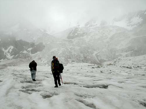
![Unnamed Image]()
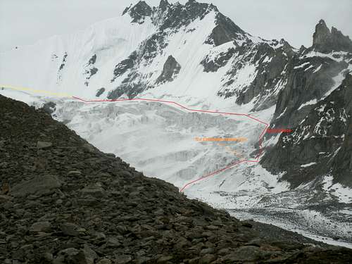
Approaching the ice fall
Cultural Notes
Pakistan is not a uniform, homogenous country. In the northern areas in particular, there are many distinct cultures with different languages, histories, beliefs, and customs. Many of these people identify more closely with their region than Pakistan. Hunza was ruled by a Mir (prince) until 1974, and other former Kashmir areas were also independently ruled during the Raj, so these people are not fully integrated into Pakistani culture. You will not likely see foreigners, either expats or tourists, anywhere in the North except
maybe Hunza. In Gilgit and Tarashing, they speak Shina, a Persian dialect, but also some Urdu. Every once in a while, you will run into somebody who speaks English, but don’t count on it. It helps to have a local guide. If you go up to middle Hunza, they speak Brusheski, and a little further north, they speak Wakhi. In this region, there is a mix of many ethnicities. Over the centuries, greek descendants, huns, Tibetans, Indians, Kafirs, and many other cultures have interbred. You will see people who look northern European, who look Tibetan, and who look Pakistani all intermingled in the different villages. People generally wear off white Shalwar Kameez, and if it is cold, a waistcoat. Younger people often wear jeans and button down shirts. Older men generally have longish beards with the moustache shaved (Abe Lincoln style), younger men are
clean shaven, have short beards, or moustaches (except in Sunni areas, where beards are expected for anyone who can grow one). In Tarashing, the women avert their faces and cover their heads when men approach, you will not speak to any women. They wear long (body length) beautiful shawls and contrasting brightly colored dresses or shalwar kameez. While negotiating prices is customary, the negotiators will often appear offended, as they expect foreigners to have lots of money to throw around and think that you are greedy for trying to get a good deal. Food is generally eaten with the hands. A typical breakfast is an omelet with prata (layered butter fried chappati) and milk tea (with salt in Hunza, with sugar in Tarashing). Dinners are some kind of curry of chicken or mutton, curried vegetables, and chappati. The most valued gift that you can bring to
the villages is medicine, anti-fever and painkilling pills in particular, but I think that anything would be appreciated. Shoes and socks are also nice gifts.
Some Shina Language Basics
Mish-tee: Good
Bo-day Mish-tee: Very Good
Katchu: Bad
Awa: Yes
Naya: No
Ju: Thank You (people generally don’t say thank you, or goodbye)
Mel: Lassi (yogurt drink commonly made from goat milk and frequently consumed and offered
by the local sheperds)
A salam aleikum (Waliekum Asalam): Formal hello (response)
Salam: informal hello
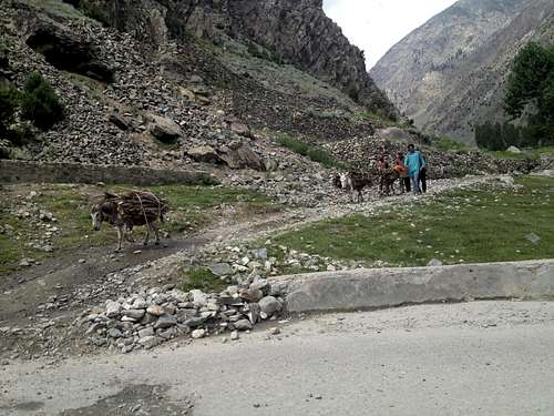
![Unnamed Image]()
Villager carries firewood home on his donkeys
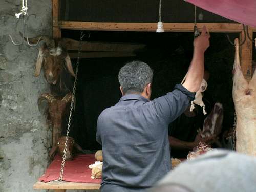
Getting our mutton
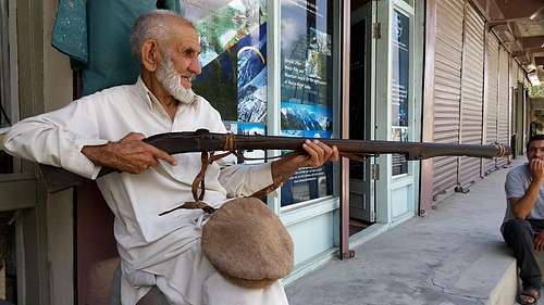
![Unnamed Image]()
This 92 year old man showed us how he used an matchlock rifle to hunt ibex
Security
There is little to no danger of hostility in Gilgit or Tarashing. Your only danger is in areas that support the Taliban, which are the conservative Sunni areas. The only high risk area in the North is Waziristan, which will not be on your route. Astore, and the surrounding villages on the Diamir/Fairy Meadows side of Nanga Parbat are also conservative Sunnis, with at least some Taliban sympathizers (thus the 2013 massacre was on that side rather than the exclusively Shia Rupal face side). Taliban sympathizers may also be found in Chilas and the surrounding villages. If you stay out of Waziristan, take a private car, and don’t linger or make a scene in these other areas, you will be fine. Also, the government has a strong vested interest in keeping you safe. There are checkpoints all along the way where you stop, give your passport information, and they usually send an armed guard with you to keep you safe. I found the police to be kind, helpful, and genuinely interested in keeping you safe. Wearing shalwar kameez helps you keep a low
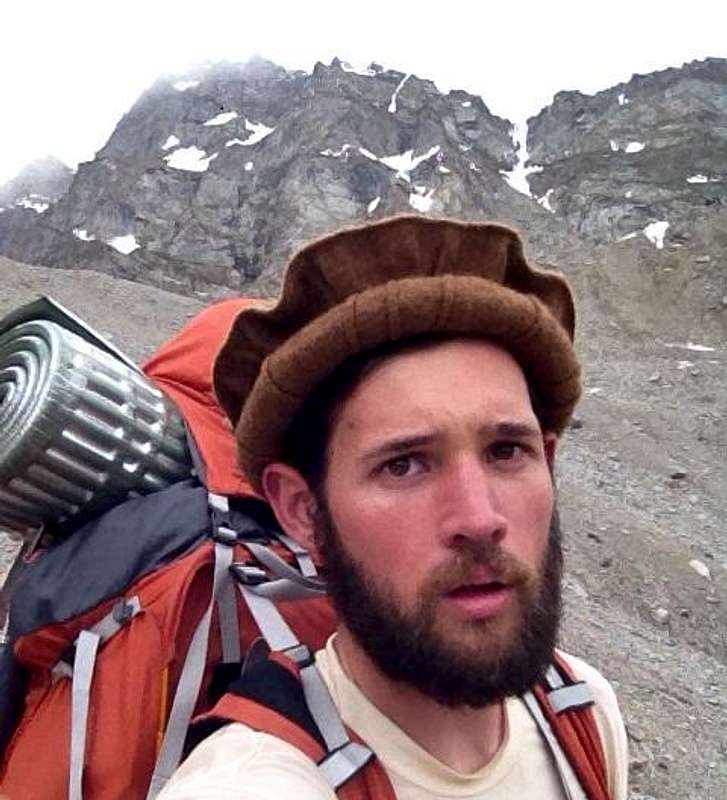
profile. Wear a flat cap if you have light hair. If you have a dark complexion, a moustache or short beard help.
![Unnamed Image]()
With the beard and flat cap, everybody thought I was Chilasi
Getting There
From Islamabad, you have two options to get to Gilgit, fly on a PIA flight that only actually flies about 50% of the time, or drive for 16 hours up the gorgeous by painfully slow and rough Karakoram highway. If you fly, just buying a ticket does not get you a flight (the ticket itself is about $110). You have to get the ticket “confirmed,” which basically means to have to pay somebody off at PIA (another $20 or so). Book your ticket through a travel agent, because they know how to pay off the right people to get the ticket
confirmed. Also, prepare for the possibility that the plane may not leave, and you will have to get reconfirmed for another flight. A private car up to Gilgit is about $160. It is best if you do not linger in Chilas, as it is a very conservative Sunni area with a significant portion of Taliban supporters. Nonetheless, the police at checkpoint along the way are friendly, and are excited to meet Americans, and to see foreign tourists generally. In Gilgit, we stayed at the Riveria hotel, which was nice (big room, hot shower, good cheap food) for $20 per night. We then booked a Jeep to Tarashing, which was about $90. Here, we stayed at a hotel on the entrance road on the left. Accomodations were decent (Asian style toilet, hot water upon request, foam mattress), the price was a bit high (we spent $98 over two days for two rooms plus food and tea for 3), but the people were friendly and the food was delicious. The hotel is owned by 5 brothers, the youngest, Abbas, speaks very good English and is an experienced high altitude porter. Another, Jam Sheed, volunteered to be our porter (despite Ramadan, and the fact that he was fasting). We paid him $100 for him plus a donkey for our journey, and he also climbed the mountain with us, and it proved to be a worthwhile investment. He was strong, humble, good humored, and helpful. At one point, he smelled our hand sanitizer and thought we were drinking, which put him off until we cleared things up.
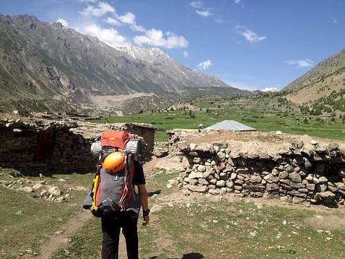
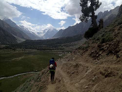
The Approach
Take thesouthern bank. The trail is nicer, more flat (no glaciers or moraines to cross), and has less traffic. Follow along the houses on the cliff at Rupal village. Between two houses, there is a little path which goes down to a bridge over the river. There are plenty of places to camp along the way, and plenty of wood for fires. We actually approached on the North side. There is a nice grassy lunch spot at the Polish camp on the east side of Bazhin glacier. After that, you climb the high moraine wall, cross the glacier, climb the other wall, then descend down to the Herligkoffer base camp of Nanga Parbat (a large grassy field, filled with yaks, cows, and sheep). It was still early, so we continued on to the Latoba (SP?) shepherds camp. Here, an elderly man (who said he was also a policeman), impressed us with his rock climbing skills on a large boulder (we also did some bouldering). The people here live in crude stone huts, and live the same simple lifestyles they have for a thousand years. The next morning, we hiked another hour to cross the bridge near the Shaigiri shepherds camp. A visiting policeman in Latoba accompanied us on this section with his MP5. Once across the river, we hiked up the moraine, and turned left at the first creek that we encountered. The donkey struggled, so we made a nice path for it. By midafternoon, we were up at the high camp, which sits on the left side of the valley, beneath a large rock face. It is quite flat, despite the surrounding talus, and we built a nice kitchen area and a stone corral for the donkey. From the high camp, you can see the ice face, and weather coming up from below.
On our return, after the climb, we took the route on the south side of the river, and made it from high camp to Tarashing in 7 hours. Our porters were reluctant to do the trip in one day, as they said that nobody does the trip in one day, but it was largely downhill and was not bad at all.
![Unnamed Image]() Rupal Village
Rupal Village![Unnamed Image]()
Above Herligkoffer Base Camp
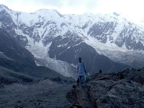
![Unnamed Image]() Bashir (our guide) in front of Nanga Parbat
Bashir (our guide) in front of Nanga ParbatThe Climb
This climb should begin at 2 or 3 am, will take 5-5.5 hours to summit, then 3 hours back, getting you to high camp about 10 or 11 am. It is important to leave early primarily because there is a lot of falling rock and ice on the ice fall once it starts to warm up. Also, frozen snow is obviously more firm than melting snow. The ice fall, which is the
only real technical part of this climb, is constantly changing, and has undergone some major changes in the past year or two. The traditional route, up the chute of the
middle of the ice fall had recently been hammered by a lot of falling ice, and the route was broken by several sections of precariously balanced vertical ice. As such, we opted for the route on the right side of the mountain, against the rock face. After one long 40 degree bulge from the flat section, you go to the right under the ice fall to an upward sloping bit that leads to a 30 foot section of easy glacial ice 3 climbing (our porter did it with just an old meter long ice axe), leading up to another steepish section,
from which you can see a rock slide chute against the cliff. Get here early as the rocks start falling with vigour once it warms up. We went high to the right of the rock chute, then entered the chute. It is about 75 meters up the chute, then you get to a ledge which leads up to the main long trudge to the summit.
![Our Route]() Route
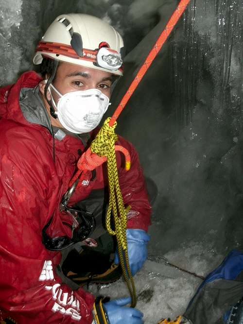
RouteWe made a side diversion to collect ice sample from a crevasse for our climate change research. From the bottom of the chute, we went left up a series of short (20-30 ft) vertical ice steps. These ended at a high ice face, which we were able to traverse under to the left along a narrow (2 ft) flake of ice between 2 crevasses. This led to a small ledge beneath a breathtaking and enormous ice bridge. We set some screws and rappelled into the uphill crevasses and extracted 10 liters of ice from various depths. It
was really a lovely spot. Notably, our trekking guide, Bashir, who was not even planning to do the actual climb, managed to climb all of the way up here, un-roped, without crampons, without gloves, and with a huge ice axe from the ‘70s while wearing his cotton shalwar kameez in the driving snow. He chopped steps and climb up the vertical ice like it was rock. A brave and impressive man indeed.
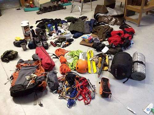
Gear
We definitely had more gear than was needed for summiting (largely due to our ice collection). At no point on the summit climb did I feel the need to place ice pro (though it wouldn’t have hurt). I had a mountaineering axe and a climbing tool, plus crampons. The tool was a nice to have, but I would probably sacrifice the convenience for the weight, given that the ice was not too technical. I had 5 screws, 3 would have been more than enough. I had 3 stakes, probably 1 more the middle team member on the rope would be fine, just in case of a very unlikely crevasse fall. We didn’t encounter any hidden crevasses, everything was pretty apparent. Definitely need to rope up though (I think one 40m is plenty), and have a helmet (lots of rock and ice fall).
Bring everything that you need with you, or ship it to Pakistan beforehand. The very few items available in Gilgit are well used wal mart quality items from the 90s; even these are just camp gear, there is no mountaineering gear available. Was able to get some old, used, rusty propane/butane fuel canisters from the one shop that had them in the bazaar for an outrages $10 each (only ended up using 2, I left the other 6 at the Riveria hotel to distribute to whoever needed them). As far as food, we got pooridge, biscuits, apricot nuts, dried apricots, and dried mulberries in the bazzar. I probably wouldn't get the dried fruit, it was filled with sand and bacteria (I got seriously ill on the mountain, lost 20+ pounds). In Karimabad, a couple of hours north, you have a better selection of gear, including newer cheaper fuel canisters, mountaineering boots, packs, sleeping bags, crampons, etc. The axes, screws, and crampons are old and dull. Most of the gear is leftover stuff from expeditions.
![Unnamed Image]()
Gear for the trip

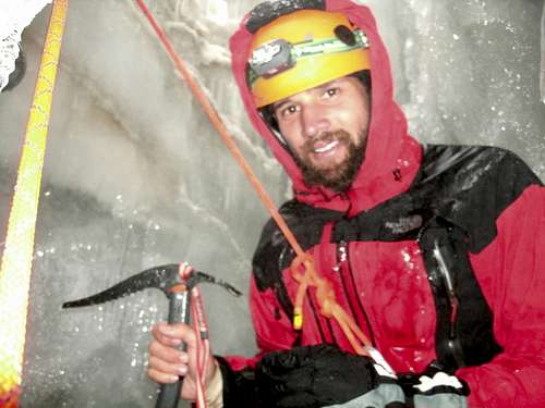
 Pericles collecting ice
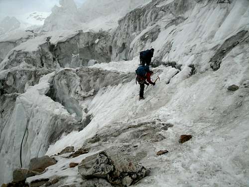

Comments
Post a Comment