
|
|
Mountain/Rock |
|---|---|
|
|
34.73498°N / 119.64609°W |
|
|
Santa Barbara |
|
|
Hiking |
|
|
Spring, Summer, Fall, Winter |
|
|
6227 ft / 1898 m |
|
|
Overview
Samon Peak is a subsidiary peak located in the Los Padres National Forest and the Sierra Madre transverse mountain range. The peak stands off the main ridge and thus towers over Sisquoc River Valley with commanding views. Samon is on the Sierra Club Angeles Chapter’s Hundred Peaks Section (HPS) List and therefore is visited by a fair number of hikers. In more recent times, the mountain has become part of a grueling 45 mile day hike with 9500 feet elevation gain known as the Santa Barbara HPS Big 4. According to the HPS website, the peak is named after USFS Ranger Judell M. Samon, who held a number of positions including Assistant Supervisor in the Los Padres National Forest from 1929 to 1933.The peak and the surrounding area were devastated during the 2007 Zaca fire, often described as the second largest wildfire in the State of California. While much of the area is recovering, burnt remains of trees can be found everywhere and can easily become obstacles on the many roads and trails in the area. Side trails and old forest roads abound in the area so intentionally or not intentionally, there are many areas to explore or campsites to spend the night at. Water is limited but is available from Chokecherry Springs.
 Samon Peak at sunrise (8 May 10)
Getting There
The shortest “standard route” is a 20+mile roundtrip affair either by foot or mountain bike. A few of the possible routes are described here but with the myriad of forest roads and trails abounding in this wilderness, there are countless variations on the exact approach.Santa Barbara Canyon offers the shortest approach and two distinct routes to Samon via road or trail. To get to Santa Barbara Canyon, take CA 33 south 2.7 miles south from the junction with CA 166 or north 36 miles from Ojai from the junction with CA 126. Turn right or left onto Foothill Road, crossing the river, and then left onto Santa Barbara Canyon after 2.1 miles. Santa Barbara Canyon Road is 12.6 miles of paved, poorly paved, and finally good dirt road to the locked gate on Big Pine - Buckhorn Road at the end. A mile below the lock gate is the trailhead for reaching Samon via the Santa Barbara Canyon. More specific instructions can be found on the HPS website.
Sierra Madre Road provides access from the northwest end of the mountains. Continue past the junction with CA 33 as described above and then an additional 12.8 miles past New Cuyama to Cottonwood Canyon Road (11N01). Turn left and follow the road 12.7 miles to the junction with Sierra Madre Road again turning left. It is unclear how far one can drive up this road but contact the Santa Lucia Ranger Station for more information. More specific directions can be found on the HPS website.
 Samon Peak spur ridge from West Big Pine Mtn (8 May 10)
Routes
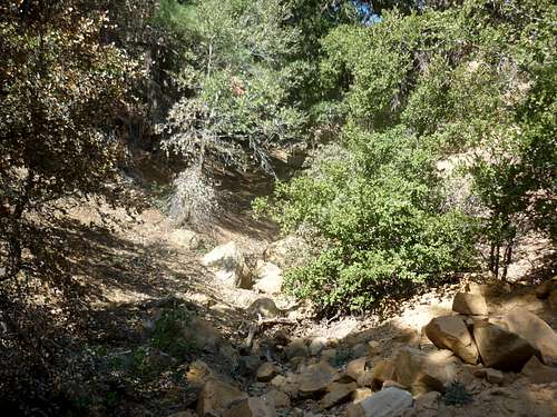
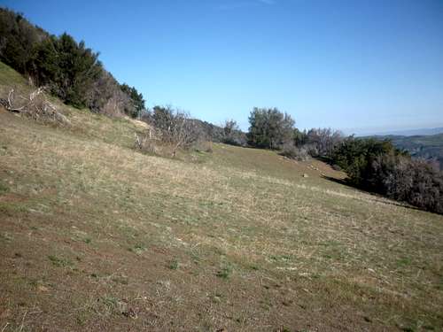
The normal use trail starts at a steep east facing gully marked by a cairn off the Big Pine – Buckhorn Road. Head up the gully until the ridge is gained at which time you briefly hike along the top of the ridge until a meadow is observed northwest of your location. Drop down into the meadow and head for the northwest corner where you will work your way around to the west side of the ridge. Pay careful attention to where you pop back out on the ridge as it’s easy to miss this spot (by following abandoned use trails) forcing you to descend the much more difficult Chokecherry Springs gully. Continue along the ridge following cairns and a use trail, alternating between climbing or bypassing on the right the intermediate bumps along the way to Samon.To get to the beginning of the gully approach, you have multiple possibilities with the two most popular described below:
Santa Barbara Canyon trail via Santa Barbara Canyon road winds its way south until reaching Madulce Guard Station (~8 miles) at which point the correct route heads west to join the Madulce Peak trail (10 miles) and finally joins the Big Pine - Buckhorn Road (11 miles). Head north, passing Chokecherry Springs (an alternate and more difficult approach) to the steep gully (12.5 miles).
Big Pine - Buckhorn Road via Santa Barbara Canyon Road heads west switchbacking up the Sierra Madre range before hitting the junction (4.5 miles) with the Sierra Madre Road (an alternative entry point). Continuing south on the main road leads you to the steep gully described above just before Chokecherry Spring (9 miles).
Red Tape , Camping, and Conditions
You'll need the Adventure Pass, which is $5/day or $30/year (as of 2010). These can be bought at any of the Ranger Stations and most sporting goods outlets in Southern California. Current information on conditions, permits, or closures can be obtained by calling the ranger station.Campgrounds or campsites abound in this area. The interior ones are primitive with usually just a table. There is no campsite at the end of Santa Barbara Canyon Road but there are sufficient spots to do primitive tent or car camping near both trailheads. Plenty of campsites are available along the trail and road including Madulce Campsite and flat spots along the Big Pine – Buckhorn Road.
Hiking can be done in almost any season but April through December (avoiding the hottest months) are the most popular times. In heavy snow years, the north facing roads and trails may hold residual snow into late spring. Check for current weather
 First light hits Samon Peak while along the ridge (8 May 10)
External Links
HPS Page for Samon PeakBob Burd’s Trip Report of the HPS Big 4
Rick Kent’s Trip Report of the HPS Big 4
David Stillman’s Trip Report of a winter hike.
My photos from the HPS Big 4