
-
 14748 Hits
-
 87.76% Score
-
 25 Votes
|
|
Mountain/Rock |
|---|---|
|
|
37.68470°N / 119.06528°W |
|
|
Mono |
|
|
Hiking, Skiing |
|
|
Spring, Summer, Fall, Winter |
|
|
10242 ft / 3122 m |
|
|
Overview
Ritter Range from San Joaquin Ridge
The ridge is also a skiing and mountain bike area.
The portion of the ridge featured on this page is the 10,242' high point just south of Deadman Pass.
Getting There
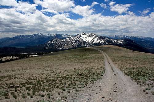
Road to the top
Red Tape
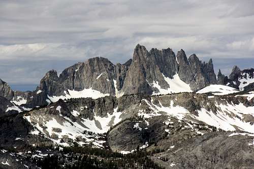
The Minarets from San Joaquin Ridge
Camping
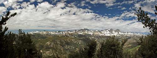
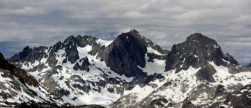
Ritter Range panorama
Agnew Meadows: (8,300' el.) Go 2.75 miles past Minaret Summit on Hwy. 203 to the hairpin turn going left. Take the road at the hairpin northwest .6 miles to the campground.
Agnew Meadows group campground: Go .4 miles further beyond Agnew Meadows campground on the same road.
Soda Springs campground: (7,700' el.) Go 2.3 miles past the hairpin turn further down 203 and turn left on a dirt road and go .3 miles.
There are several more campgrounds in Pumice Flat (7,600' el.) .5 miles on the right past the turn to Soda Springs campground as well as the Minaret Falls campground (7,600' el.) and another campground (7,600') at Soda Springs further along in Pumice Flat at the end of Hwy. 203 right before Devils Postpile.
Weather forecast for Mammoth Lakes
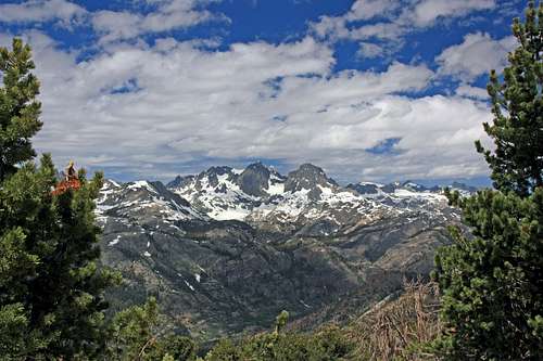
Mt. Ritter and Banner Peak
Noondueler - Jul 17, 2010 12:08 pm - Hasn't voted
Re: Not the SherwinsThanks Clydascope.